
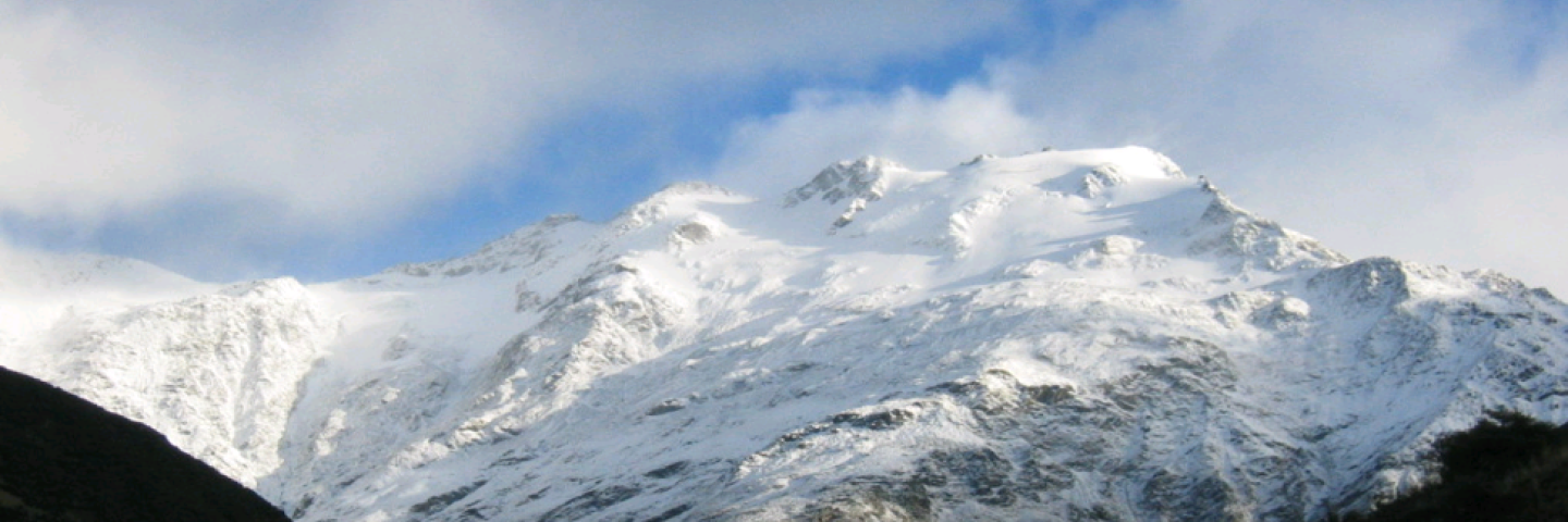
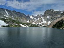
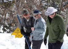
NRCS hydrologists manage a comprehensive network of manually-measured snow courses and automated Snow Telemetry (SNOTEL) monitoring sites throughout the West, manage the data collection process, and estimate the runoff that will occur when it melts.
Data, Tools, and Reports Available to the Public
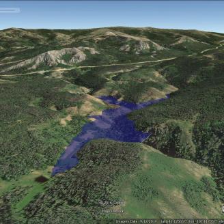
Snow and Water Interactive Map
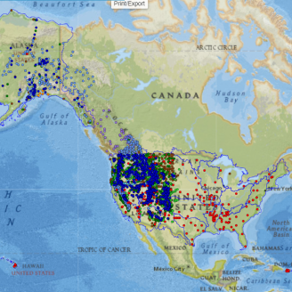
Snow and Water Interactive Map
Learn more about the Interactive Map
The Snow and Water Interactive Map displays both current and historic hydrometeorological data in an easy-to-use, visual interface. The information on the map comes from many sources. Natural Resources Conservation Service snowpack and precipitation data are derived from manually-collected snow courses and automated Snow Telemetry (SNOTEL) and Soil Climate Analysis Network (SCAN) stations. Other data sources include precipitation, streamflow, and reservoir data from the U.S. Bureau of Reclamation (BoR), the Applied Climate Information System (ACIS), the U.S. Geological Survey (USGS), and other hydrometeorological monitoring entities.
Snow and Precipitation Update Report
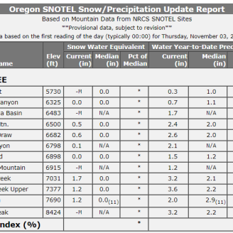
Snow and Precipitation Update Report
Open the User Assistance Guide
Open list of predefined reports for Snow and Climate Monitoring
The National Water and Climate Center SNOTEL Update Report is an analysis utility that produces reports with daily Snow Telemetry (SNOTEL) snow water equivalent (SWE) and precipitation values for 24 different geographic areas. You can request reports in seven different display formats, allowing comparisons of the daily data against either the daily 30-Year Median or Average, the current or historical month-to-date values, the median/average monthly or annual totals, or against data from a different year. You can also select any date for a report.
Report Generator
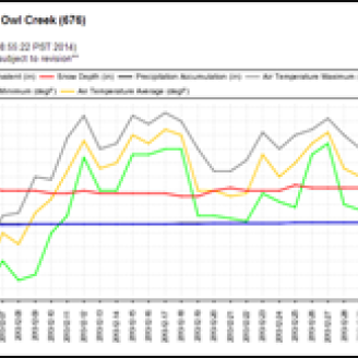
Report Generator
Open Report Generator to create custom reports from multiple data sources.
Read the User Guide for assistance.
Report Generator uses long-term snowpack, precipitation, reservoir, streamflow, and soils data from a variety of quality-controlled sources to create reports.
Users can choose from predefined templates or build custom reports.
Data from tabular reports may be exported to different formats, including comma-separated value (CSV) files. Charts can be saved to graphics formats, such as JPG and PNG.
Water Supply Forecasting

Water Supply Forecasting
Open the NWCC Seasonal Volume Forecast Plots
Learn more about Water Supply Forecasting at NRCS
Access Predefined Report links for the Water Supply Forecast tool
Open the Water Supply Forecast Charts User Guide
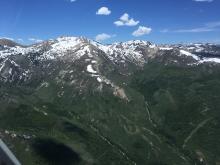
Most of the western United States has a dry climate, where agriculture depends on irrigation. The water supply for irrigation largely comes from rivers and creeks, whose streamflow originates from the springtime melting of winter snow.
The NRCS uses statistical models to produce water supply forecasts. These are equations that express a fitted mathematical relationship (usually linear) between several predictor variables and the target seasonal streamflow volume. Predictor variables are primarily snow water equivalent at selected measurement sites but can also include precipitation, antecedent streamflow, and a few other miscellaneous quantities.
AWDB Web Service Tools

AWDB Web Service Tools
Open the AWDB RESTful Webservice Test Tool
Open the AWDB SOAP Webservice Test Tool
Access the AWDB Web Service User Guide
The National Water and Climate Center maintains a large database of soil, water, and climate data known as AWDB (air and water database). This database includes data from NWCC’s extensive automated data collection system of snowpack and related climate data called SNOTEL (for SNOw TELemetry), its Soil Climate Analysis Network (SCAN) stations, as well as data from snow courses, streamflow stations, reservoirs, climate indices, National Weather Service COOP stations, 30-year normals, water supply forecasts, and more. All of this data can be accessed publicly through the AWDB Web Service.
The AWDB SOAP Webservice Test Tool lets users run any methods of the Web Service, set SOAP requests, SOAP responses, and the actual data returned. This is a powerful tool that allows users to look at data to test the Web Service to ensure it returns what is wanted before implementing the calls in code.
The AWDB RESTful Webservice Test Tool gives users access to machine-readable data from AWDB using a REST protocol.
Reservoir Storage Reports and Tools
Reservoir Storage Reports and Tools
Reports
- Monthly Reservoir Update Report
- Basin Data Reports - Select "Reservoir" as report type
- California Current Reservoir Storage Summary - California Dept. of Water Resources
Maps
Graphs
Western U.S. Reservoir Storage Bar Graph and Data Reports (Preliminary posted on 5th working day, final on 10th working day each month)
30-Year Medians and Averages
- Reservoir 30-Year Medians and Averages (1991-2020) Effective Oct. 1, 2021
Snow and Climate Monitoring Predefined Reports and Maps
Snow and Climate Monitoring Predefined Reports and Maps
Snow Program Organization
States in the West collect mountain snowpack and precipitation data in their areas, and offer regular reports on those areas utilizing the national database. Individuals, organizations, and state and federal agencies use the information provided for decisions relating to agricultural production, fish and wildlife management, municipal and industrial water supply, urban development, flood control, recreation, power generation, and water quality management.
Organizationally, the SSWSF Program is composed of two major operations:
- A network of Data Collection Offices (DCOs) located in key areas of the western U.S., including Alaska. Each of these states has a team of snow surveyors, water supply specialists, hydrologists, and technicians who gather, analyze, and disseminate snowpack and climate data for their respective regions.
- A centralized National Water and Climate Center (NWCC) administers the information systems and other aspects of the program. The hydrologic data collected by each of the DCOs are analyzed by a team of forecast hydrologists at the National Water and Climate Center. During the January-June snowpack season, NWCC staff produce detailed water supply and streamflow forecasts for the 13 western states. Each state uses these data to produce monthly Water Supply Outlook Reports.
State Snow Survey Programs

Data and Reports
California Snow Survey
The NRCS Snow Survey Program provides mountain snowpack data and streamflow forecasts for the western United States. Common applications of snow survey products include water supply management, flood control, climate modeling, recreation, and conservation planning.
Colorado Snow Survey
Colorado Snow Survey Data Collection Office
Montana Snow Survey
Montana Snow Survey Data Collection Office
New Mexico Snow Survey
NRCS's Snow Survey and Water Forecasting program monitors seasonal snowpack and annual mountain precipitation and uses the data collected to provide streamflow forecasts. These forecasts help water managers make informed management decisions and curtail water supply issues before they occur.
Utah Snow Survey Program
Utah’s Snow Survey Program Team works to provide mountain snowpack data and streamflow forecasts from across the state. This information can be a valuable tool for conservation planning, water supply management, flood control, drought and avalanche prediction, and recreation.
Washington | Snow Survey & Water Supply Program
The NRCS Snow Survey Program provides mountain snowpack data and streamflow forecasts for the western United States. Common applications of snow survey products include water supply management, flood control, climate modeling, recreation, and conservation planning.

Wyoming Snow Survey and Water Supply Forecasting
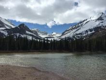
NRCS hydrologists manage a comprehensive network of manually-measured snow courses and automated Snow Telemetry (SNOTEL) monitoring sites throughout the West, manage the data collection process, and estimate the runoff that will occur when it melts.

Nevada Snow Survey
Nevada’s NRCS Snow Survey Program provides mountain snowpack data and streamflow forecasts across the state and the Eastern Sierra. This information is valuable for conservation planning, water supply management, flood control, drought assessment, avalanche forecasting, modeling, and recreation.
Ready to get started?
Contact your local service center to start your application.


