
These training materials are intended for use by partners, Soil and Water Conservation District staff, Tribal Conservation District staff, NRCS employees who are pursuing a conservation planner certification. They are also useful educational resources for the public.
Self-Guided vs. Instructor-Led Courses
Some courses are self-guided, allowing the student to read through the material on their own at their convenience. Other courses are instructor-led and will require the student to schedule time with an instructor to complete the training. Students are asked to be considerate of the instructor’s time and other work responsibilities, and to schedule training appointments far in advance of when they wish to complete their certification.
Some instructor-led courses will require field time, and thus must take place during the summer field season. Instructor-led courses that do not require field time are best conducted during winter. Students are encouraged to read the course descriptions on each of the courses to plan ahead for scheduling purposes.
NRCS Point of Contact
For questions about the Alaska Curricula, contact Tracy.Robillard@usda.gov.
Agronomy

Growing Degree Days, Frost-Free Days and Plant Hardiness Zones
Growing degree days (GDD) are a measure of heat accumulation used by horticulturists, gardeners, and farmers to predict plant and animal development rates such as the date that a flower will bloom, an insect will emerge from dormancy, or a crop will reach maturity. There are concerns with using GDD as a planning tool, particularly in Alaska where production data is lacking and day length varies greatly from week to week. This course will discuss the concept of GDD and its limitations as a planning tool in Alaska.
Frost-free days (FFD) refers to the number of days without frost available in an area. Given Alaska’s brief growing season, generally Mid-May to Mid-September, knowing the behavior of frost may be more useful than a generic ‘frost-free days’ value.
Plant hardiness zone designations represent the average annual extreme minimum temperatures at a given location during a particular time period relevant to plant growth and survival. They do not reflect the coldest it has ever been or ever will be at a specific location, but simply the average lowest winter temperature for the location over a specified time.
Low temperature during the winter is a crucial factor in the survival of plants at specific locations, so knowing the hardiness zone helps producers understand which plants can survive their region’s climate.
This course will discuss how planners should consider temperature and season when working with crop producers.
The student must review the following training materials then contact the State Agronomist upon completion.
Type: Self-guided
Format: Video (41:16)
NRCS Point of Contact: NRCS State Agronomist David Ianson, David.Ianson@usda.gov
Training Materials:
High Tunnels
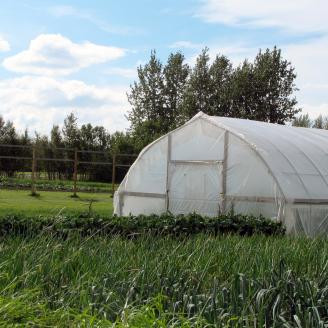
A high tunnel is a plastic-covered structure that allows growers to increase production of certain crops, grow some crops that could not otherwise be grown in their area, and extend the length of time that the crops may be grown. High tunnels have become popular across Alaska in recent years, because they allow many crops to be grown that would otherwise not survive or thrive under natural conditions.
This course material covers the basics of high tunnels, planning considerations when working with producers using high tunnels, as well as some crops that are typically grown inside high tunnels in Alaska.
The student must review the following training materials. Once completed, contact the State Agronomist.
Type: Self-guided
Format: Slide Presentation and Fact Sheet
NRCS Point of Contact: NRCS State Agronomist David Ianson, David.Ianson@usda.gov
Training Materials
Fertilizer and Lime Availability in Alaska
Synthetic nutrients are not as readily available in Alaska as they are in agricultural districts of the Lower 48 states. When they are available, they often come in limited formulations, or are only available in limited locations around the state.
This course will discuss the use and availability of fertilizer and lime in Alaska, as well as things to consider when providing nutrient management technical assistance to crop producers.
The student must review the following training materials then contact the State Agronomist upon completion.
Type: Self-guided
Format: Video (23:38)
NRCS Point of Contact: NRCS State Agronomist David Ianson, david.ianson@usda.gov
Training Materials:
Alaska Native Tribes and Tribal Entities

ANCSA and Native Entity Organizations
The Alaska Native Claims Settlement Act was signed into law by President Richard Nixon on December 18, 1971, constituting at the time the largest land claims settlement in United States history. ANCSA was intended to resolve long-standing issues surrounding aboriginal land claims in Alaska, as well as to stimulate economic development throughout Alaska.
This course is an overview of the indigenous peoples of Alaska, the history of United States administration in the state, and the present-day organization and structure of the Alaska Native - United States relationship.
This is an instructor-led course. The student must contact the NRCS Tribal Liaison to schedule a time to review the course materials together.
Type: Instructor-led
Format: Web-based graphic presentation
Training Materials:
-
AK Curricula - AK Natives - ANCSA (7.29 MB)

Alaska Native Corporations
The Alaska Native Claims Settlement Act of 1971 created twelve Alaska Native Regional Corporations (ANCs). This course introduces background on the structure of the Corporations, details of each Corporation individually, and the importance of the Corporations to modern-day Alaska Natives.
This is an instructor-led course. The student must contact the NRCS Tribal Liaison to schedule a time to review the course materials together.
Type: Instructor-led
Format: Web-based graphic presentation
Training Materials:
-
AK Curricula - AK Natives - Corporations (3.98 MB)
Working Effectively with Alaska Natives
The “Working Effectively with Alaska Natives” (WEWAN) course is an established training within the USDA AgLearn curricula. The course is required to achieve level 2, 3 or 4 of Certified Planner status; however, the course is only offered once every four or five years.
This course is a review of the concepts and recommendations covered in the full WEWAN training. This course does not satisfy the WEWAN criteria for Level 2, 3 or 4 certification, but it provides enough information for a new conservation planner to being working with Alaska Native customers with oversight provided by a Level 3 or 4 Certified Planner.
This is an instructor-led course. The student must contact the NRCS Tribal Liaison to schedule a time to review the course materials together.
Type: Instructor-led
Format: Web-based graphic presentation
Training Materials:

Subsistence as Agriculture
Agriculture is the science or practice of farming, including growing crops and raising animals for the production of food, fiber, fuel and other products. For purposes of participation in USDA conservation programs, the NRCS considers customary and traditional subsistence harvest of plants and animals as agriculture.
This course explores both the history of subsistence within Alaska’s Native community as well as present day subsistence statistics. It also discusses the importance of subsistence activities to modern indigenous communities and the cultural, spiritual, and practical considerations that a conservation planner must take into account when providing conservation technical assistance to Alaska Natives.
This is an instructor-led course. The student must contact the NRCS Tribal Liaison to schedule a time to review the course materials together.
Type: Instructor-led
Format: Web-based graphic presentation
Training Materials:
Biology
Stream Visual Assessment Protocol for Alaska
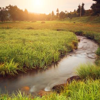
The Stream Visual Assessment Protocol 2 (SVAP2) is a national protocol that provides an initial evaluation of the overall condition of wadeable streams, their riparian zones, and their instream habitats. The AK-SVAP2 document has been customized for use in Alaska.
The student should review the following training materials then contact the NRCS State Biologist to schedule a time to review and discuss these SVAP2 materials.
Type: Self-guided, followed by review with NRCS State Biologist
Format: Slide Presentation, Technical Note, SVAP Protocol
NRCS Point of Contact: Dean Houchen, State Biologist, dean.houchen@usda.gov
Training Materials:
-
AK Curricula - Biology - SVAP slides (3.67 MB)
-
AK Curricula - Biology - SVAP Handbook (1.31 MB)
-
AK Curricula - Biology - SVAP Summary Sheet (354.26 KB)
Alaska Wildlife Habitat Evaluation and Planning Tools
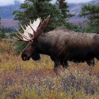
NRCS utilizes a variety of technical information to plan and implement effective conservation on wildlife habitat, and to consider the needs of wildlife when planning conservation practices on agricultural lands.
This course covers how to: identify wildlife habitat projects; NRCS conservation practices that may create, enhance or restore wildlife habitat; biology planning and inventory field tools; and effective documentation of the biology planning process.
The student should review the following training materials then contact the NRCS State Biologist to schedule a time to receive training in wildlife habitat planning.
Type: Instructor-led
Format: Review written technical materials the State Biologist
NRCS Point of Contact: Dean Houchen, State Biologist, dean.houchen@usda.gov
Training Materials:
- State of Alaska Wildlife Action Plan
-
AK Curricula - Biology - Wildlife - Tech Note (1016.63 KB)
-
AK Curricula - Biology - Wildlife - syllabus (122.44 KB)

Endangered Species Section 7 in Alaska
The Endangered Species Act of 1973 is the primary law in the United States for protecting imperiled species. The law requires federal agencies, including NRCS, in consultation with the US Fish and Wildlife Service and National Oceanic and Atmospheric Administration, to ensure that actions they authorize, fund, or carry out are not likely to jeopardize the continued existence of any listed species OR result in the destruction or adverse modification of designated critical habitat of such species.
This course will cover the basics of the ESA and NRCS’ responsibilities under the law, including planning considerations and consultation with the authoritative agencies.
The student must review the following training materials then inform the NRCS State Biologist.
Type: Self-guided
Format: Slide Presentation
NRCS Point of Contact: Dean Houchen, State Biologist, dean.houchen@usda.gov
Training Materials:
Compliance
National Food Security Act
This course will provide an introduction to the National Food Security Act (NFSA or just FSA). It will cover NRCS’ responsibilities under the law as the responsible federal agency, as well as the compliance requirements for land owners seeking to participate in USDA programs. The course will also introduce the concepts of ‘highly erodible land’ (HEL) and ‘wetland compliance’ (WC).
Making official HEL or WC determinations are inherently governmental activities that are the sole responsibility of NRCS personnel; however, any properly-trained certified planner may perform HEL calculations or make a wetland determination.
This course will cover the differences between a delineation and a determination.
This is a self-guided course. The student must review the training materials and complete the review examination. Upon completion, the student must contact the State Resource Conservationist.
Type: Self-guided
Format: Slide Presentation
NRCS Point of Contact: NRCS State Resource Conservationist
Training Materials:
CPA-52 Environmental Evaluation Worksheet
This course will provide an overview of the Environmental Evaluation (EE) process to comply with the National Environmental Policy Act (NEPA). The student will be introduced to the EE process and directed on how to perform a thorough and comprehensive evaluation. Guidance will also be provided on how to properly complete the CPA-52 Environmental Evaluation form.
The CPA-52 is an inherently-governmental activity, and is not typically performed by non-NRCS personnel; however, all conservation planners providing technical assistance for NRCS customers or doing planning for USDA programs must be aware of the EE process and agency responsibilities.
This is a self-guided training; however, the student must not attempt to perform an EE or complete the CPA-52 without the guidance of a Level e or 4 Certified Conservation Planner. The student must review the following training materials. Upon completion, the student must contact the State Resource Conservationist.
Type: Self-guided
Format: Slide Presentation
NRCS Point of Contact: NRCS State Resource Conservationist
Training Materials:
Conservation Practices and Tech Notes
Field Office Technical Guide
The FOTG is the primary technical reference for the Natural Resource Conservation Service (NRCS). The FOTG contains technical information about conservation of soil, water, air, plant, animal, and energy resources with human considerations (SWAPAE+H). The FOTG also contains guidance to assist planners with treating resource concerns using both ecological science and engineering practices.
This course provides an overview of the FOTG and documents in it that are specific to conservation planning and implementation in Alaska.
The student must review the below training materials and contact the State Resource Conservationist upon completion.
Type: Self-guided
Format: Slide Presentation
NRCS Point of Contact: NRCS State Resource Conservationist
Training Materials:
-
AK Curricula - FOTG Presentation (2.79 MB)
Conservation Practice Standards
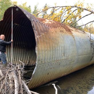
NRCS conservation practices are used to improve natural resources with respect to soil, water, air, plants, animals, and energy, with human considerations as a factor in every decision. A Conservation Practice Standard (CPS) establishes the minimum acceptable level of quality required to plan, design, install, operate, and maintain a conservation practice.
This self-guided course provides instruction on conservation practice standards and how to apply them to site-specific situations in order to provide timely and effective conservation technical assistance to treat unique natural resource concerns.
The student must review the below training materials and contact the State Resource Conservationist upon completion.
Type: Self-guided
Format: Slide Presentation
NRCS Point of Contact: NRCS State Resource Conservationist
Training Materials:
Implementation Requirements
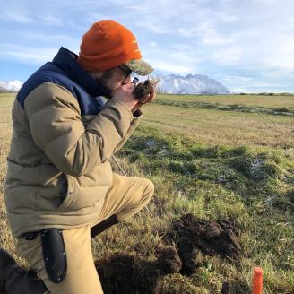
Conservation practice implementation includes the design, layout, construction, inspection and certification. Many practices also have operation and maintenance requirements. Implementation Requirements (IR) are site-specific information and instructions necessary to install or implement a conservation practice according to the conservation practice standard (CPS) and practice specifications (PS).
The student must review the below training materials and contact the State Resource Conservationist upon completion.
Type: Self-guided
Format: Slide Presentation
NRCS Point of Contact: NRCS State Resource Conservationist
Training Materials:
Cultural Resources
Alaska Cultural Resources Modules 7 & 8
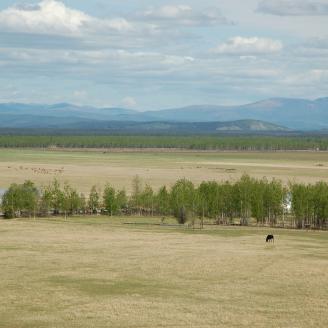
The National Historic Preservation Act of 1966 as amended requires federal agencies to protect and preserve historic buildings and infrastructure and prehistoric and historic resources of the United States in cooperation with other nations and in partnership with the States, local governments, Indian tribes, and private organizations and individuals.
The NRCS provides a series of training modules on cultural resources through AgLearn, the official agency training division’s online training system. Modules 1 through 6 are self-guided modules that may be taken online. Modules 7 and 8 are instructor-led and require time in the classroom and in the field.
To complete modules 7 and 8, the student must contact the NRCS Tribal Liaison to schedule a time to review the course materials together.
A portion of this course requires time in the field. Because fair weather is required, the student must plan in advance in order to schedule time with the Tribal Liaison during the spring-summer field season. Appropriate field dress will be required, including water-proof boots, brush-resistant clothing, and bug protection.
Type: Instructor-led
Format: AgLearn web-based learning followed by classroom and field portion for modules 7 - 8.
Training Materials:
Erosion (coming soon)
Water Erosion Process
Content Coming Soon
More Information Coming Soon On the Following Erosion Topics:
- Water Erosion Process and USLE
- Wind Erosion Process and WEQ
- AGNPS
- RUSLE2
- WEPS
- WinPST
Farming History & Agricultural Development in Alaska
Alaska Agriculture and USDA Programs
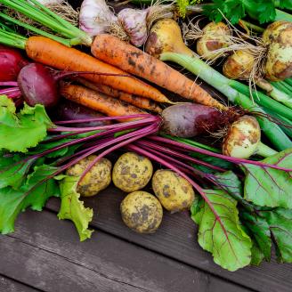
Although agriculture is not one of the top industries in Alaska, agricultural operations in the state are fairly diverse. Farm and ranch sizes range from small “backyard gardens” to thousand-acre barley farms. There are also extensive free-range caribou herds and vast tracts of managed forest land.
This course provides a general overview of production agriculture in Alaska, including farm and ranch and forest statistics. It also provides details on the various USDA conservation assistance programs available to Alaska land owners.
The student must review the training materials below and upon completion, notify the State Resource Conservationist.
Type: Self Guided
Format: Slide Presentation
NRCS Point of Contact: NRCS State Resource Conservationist
Training Materials:
Alaska Farming History
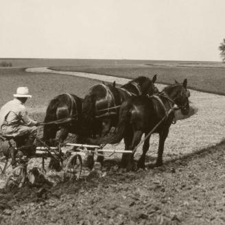
The agriculture industry in Alaska has a troubled and problematic history. While indigenous people engaged in sustainable subsistence in the land that would become the state of Alaska for thousands of years, the first crop and livestock producers were Russian settlers. In 1935, a US government project transplanted 903 men, women and children from Midwestern states to the Palmer area for the purpose of establishing a farm colony. Plagued by insufficient planning, over-confident officials, and bureaucratic ineptitude, the Colony venture largely failed, although descendants of the hardy few who persevered despite the enormous challenges still live, and some still farm, in the Matanuska Valley today. Another government-backed agriculture venture was put forth in the 70s and 80s this time pushed by the State, and sought to develop a dairy and barley industry. It also largely failed, although a few of the original farmers have managed to hold on and are using creative business and farming practices to keep their operations viable.
This course provides access to non-NRCS history documents. The NRCS does not endorse the opinions expressed by the authors, nor can the agency confirm the names, dates or events depicted. The material is simply meant to give the student a starting point for their own study of the history of agriculture in Alaska.
The student must review the training materials below and notify the State Resource Conservationist upon completion.
Type: Self-guided
Format: PDF Articles
NRCS Point of Contact: NRCS State Resource Conservationist
Training Materials:
-
AK Curricula - Farming in Alaska History (801.94 KB)
Common Crops in Alaska
Learn more about common agronomic crops produced in Alaska.
The student must review the training materials below and notify the State Resource Conservationist upon completion.
Type: Self-guided
Format: Two Videos
NRCS Point of Contact: NRCS State Resource Conservationist
Training Materials:
Forestry
Basic Forest Ecology and Management Concepts
This training covers the basic ecology of Alaska forests including management concepts for conservation planners to assist landowners with enhancing forest health, improving the quality and quantity of timber harvests, increasing and improving wildlife habitat, and preventing damage from wildfires.
The student should review the following training materials.
Type: Self-guided.
Format: Slide Presentation.
NRCS Point of Contact: Chris Tcimpidis, NRCS State Forester, christopher.tcimpidis@usda.gov.
Training Materials:
More Forestry Topics Coming Soon
Curricula Under Development...more information coming soon on the following topics:
- Tree and Shrub Identification: Native and Introduced
- Tree Planting
- Forest Evaluation Field Tools
- Commercial and Traditional Uses of Alaska Tree Species
- NRCS Forest and Wildlife Management Practices and Tech Notes
- Common Forest Diseases and Pests in Alaska Harvesting Methods, Timber Access and Water Quality Considerations
Land Clearing
Land Clearing Techniques and Equipment
Land clearing activities, regardless of the purpose, should be conducted with careful consideration for the health of the underlying soil, prevention of soil erosion into adjacent lakes, streams and wetlands, and the conservation of native plants and wildlife. Therefore, proper land clearing involves considerably more effort than simply moving a bulldozer across the land.
This course discusses some sustainable land clearing methods and techniques. This instruction is intended for familiarization only and is not sufficient to enable the student to perform land clearing planning on their own without oversight from a Level 3 or 4 Certified Conservation Planner.
The student must review the training materials below and notify the State Resource Conservationist upon completion.
Type: Self-guided
Format: PDF documents
NRCS Point of Contact: NRCS State Resource Conservationist
Training Materials:
-
AK Curricula - Ag Land Burning (55.82 KB)
-
AK Curricula - Ag Land Clearing (56.79 KB)
Land Ownership and Agriculture in Alaska
Land Ownership in Alaska
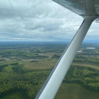
Alaska is the largest state in the nation, but the majority landowner is the Federal government. Many millions of acres of formally Federal land have been conveyed to Native entities through the Alaska Native Claims Settlement Act. Understanding land ownership and control is important information for conservation technical professionals.
This course will provide an overview of land ownership in Alaska including reference maps.
The student must review the training materials below and notify the State Resource Conservationist upon completion.
Type: Self-guided
Format: PDF documents
NRCS Point of Contact: NRCS State Resource Conservationist
Training Materials:
-
AK Curricula - AK Land Transfer Map (304.12 KB)
-
AK Curricula - Who Owns Alaska Map (275.36 KB)
-
AK Curricula - Land Ownership in AK Fact Sheet (134.89 KB)
State and Borough Farm Plan Requirements
The State of Alaska requires certain guidelines be followed when a land owner seeks to develop land for agriculture. A State Farm Conservation Plan is a document unique to any given state agricultural parcel and its purchaser(s) that helps the State ensure that appropriate site‐specific soil and water conservation planning occurs prior to the purchaser taking control of the land. The borough may also have farm plan requirements.
This course is designed to make the student aware of State and borough farm plan requirements. An NRCS conservation plan may help a land owner comply with the State or borough requirements. It is important for a planner to understand State requirements in order to provide customers with appropriate technical assistance.
The student must review the training materials below and notify the State Resource Conservationist upon completion.
Type: Self-guided
Format: PDF documents
NRCS Point of Contact: NRCS State Resource Conservationist
-
AK Curricula - State Conservation Plan Forms (212.74 KB)
- Note: This is a record of the Mat-Su Borough's farm plan requirements. Other boroughs may have different farm plan requirements or no requirements at all.
Alaska Ag Parcel Land Sales
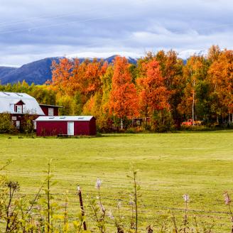
The State of Alaska has an active homesteading program and State government encourages agricultural development and expansion. Clearing and developing wild lands for residential and production purposes requires careful consideration and planning in order to prevent the degradation of both the land being developed as well as adjacent lands and waters.
The State of Alaska provides guidance on appropriate land development. This course provides those documents for the student’s review and consideration. This instruction is intended for familiarization only and is not sufficient to enable the student to perform land development planning on their own without oversight from a Level 3 or 4 Certified Conservation Planner.
The student must review the training materials below and notify the State Resource Conservationist upon completion.
Type: Self-guided
Format: PDF documents
NRCS Point of Contact: NRCS State Resource Conservationist
Training Materials:
-
AK Curricula - Ag Land Development (148.87 KB)
-
AK Curricula - Mat-Su Borough Ag Sales Brochure (355.91 KB)
Note: Other boroughs may have different ag land sales programs or none at all.
Other Assessment Tools
GIS Basics
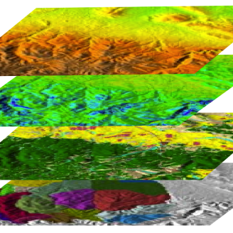
The purpose of this course is to introduce the concept of Geographic Information Science and gain a basic understanding of Geographic Information Systems. GIS technology has become integrated into nearly every aspect of modern life, from daily travel to online shopping. GIS is also an important tool in land use planning and conservation planning.
This is an instructor-led course that requires the student to conduct some pre-study on their own before meeting with the GIS Specialist. The student must review the training materials below and enroll in the Esri courses online as instructed. Then watch the one hour video “Introducing Coordinate Systems and Map Projects” at the provided link.
Note: The student must have access to the ArcGIS application in order to complete these prerequisites. Contact the NRCS GIS Specialist for assistance.
Type: Instructor-led
Format: Prerequisite study and videos prior to meeting with the instructor
NRCS Point of Contact: Denise Miller, NRCS State GIS Specialist, denise.miller@usda.gov
Training Materials:
GPS Field Use
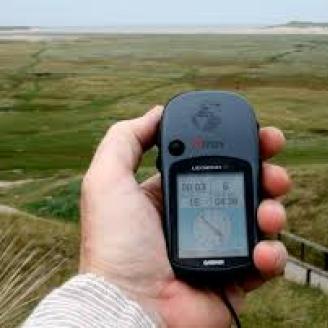
This course explains how to collect GPS data, maintain data quality, and integrate GPS data into NRCS GIS applications.
This is an instructor-led course that will take place both in the classroom and in the field using GPS devices. The student review the following training materials which includes reading sections from The Nature of Geographic Information online course module from Penn State’s College of Earth and Mineral Science, and watching an online webinar called “Use of GPS for NRCS Conservation Planning: Collecting, Managing, and Entering Data."
Upon completion of these pre-requisites, the student must contact the State GIS Specialist.
Type: Instructor-led
Format: Pre-requisite study and videos prior to meeting with the instructor
NRCS Point of Contact: Denise Miller, NRCS State GIS Specialist, denise.miller@usda.gov
Training Materials:
-
AK Curricula - GIS and GPS Pre-requisite study (114.33 KB)
Hydrology EFH2
EFH2 is a computer program that NRCS uses to predict runoff volume and peak discharge from small, single-subarea watersheds. Peak discharge calculations are used for designing a number of NRCS conservation practices, such as grassed waterways, stream crossings, and drainage ways.
This course is only intended to make the student aware of the EFH2 and its purpose. It will not give the student enough information to use the program independently.
This is an instructor-led course. The student must contact the Planning Specialist to schedule time together to review the EFH2 User Manual.
Type: Instructor-led
Format: Review the EFH2 User Manual with the instructor
NRCS Point of Contact: Phil Naegele, NRCS Planning Specialist, phil.naegele@usda.gov
Hydraulics and Waterway EFT
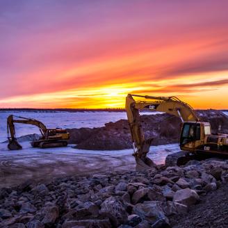
Hydraulic Formulas Tool (HFT) is a collection of formulas based on procedures defined in the NRCS National Engineering Handbook Part 650 (NEH 650). The formulas provide solutions to the hydraulic equations that are frequently encountered in soil and water conservation planning and design activities.
This course is only intended to make the student aware of the various engineering field tools (EFT) used for hydraulic engineering practices. It will not give the student enough information to use the formulas and tools independently.
This is an instructor-led course. The student must contact the Planning Specialist to schedule time together to review the EFH2 User Manual.
Type: Instructor-led
Format: Review the EFH2 User Manual with the instructor
NRCS Point of Contact: Phil Naegele, NRCS Planning Specialist, phil.naegele@usda.gov
Level Surveying
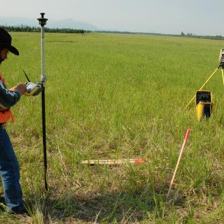
Level Surveying - Baseline, Waterways, Topographic
Type: Instructor-led
Format: Review the EFH2 User Manual with the instructor
NRCS Point of Contact: Phil Naegele, NRCS Planning Specialist, phil.naegele@usda.gov
Hand Level and Clinometer
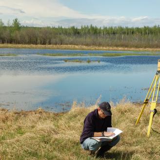
A hand level (also called a sight level or hand sight level) is a spirit level inside of a small telescope that is used for estimating slope of land surfaces. NRCS uses hand levels for a variety of conservation planning activities including erosion calculations, determining the direction of water flow, and preliminary engineering design.
A clinometer or inclinometer is an instrument used for measuring angles of slope (or tilt), elevation, or depression of an object with respect to gravity's direction. Clinometers measure both inclines (positive slopes, as seen by an observer looking upwards) and declines (negative slopes, as seen by an observer looking downward).
This is a self-guided course consisting of You Tube videos and self-paced exercises. Please review the links and instructions in the document posted below. If you have any questions about using these tools while going through the training document, please contact Phil Naegele.
Type: Self-Guided
Format: Review training document (includes watching You Tube videos and performing your own self-paced exercises)
NRCS Point of Contact: Phil Naegele, NRCS Planning Specialist, phil.naegele@usda.gov
Training Materials:
-
AK Curricula - Hand Levels and Clinometers (187.94 KB)
Delineating a Watershed
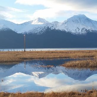
A watershed is an area of land that drains to a single point. A watershed channels rainfall and snowmelt to creeks, streams, and rivers, and eventually to outflow points such as reservoirs, bays, and the ocean. Delineating a watershed entails tracing out the ridges and slopes on a topographic map to determine the size of the area that is drained and in which direction the water flows. Knowing the size of the watershed and the location of the drainage point(s) is important information for conservation planning and engineering design.
This is an instructor-led course and will take place in the classroom. The student must contact the Planning Specialist to schedule time for the instruction.
Type: Instructor-led
Format: Review the EFH2 User Manual with the instructor
NRCS Point of Contact: Phil Naegele, NRCS Planning Specialist, phil.naegele@usda.gov
Alaska Phosphorous Index
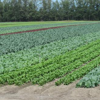
Eutrophication is the growth of undesirable aquatic plant resulting from additions of phosphorus to the water. The purpose of the Phosphorus Index is to provide conservation planners with a tool to assess the various landforms and management practices for potential risk of phosphorus movement to water bodies. The ranking of Phosphorus Index identifies sites where the risk of phosphorus movement may be relatively higher than that of other sites.
This is an instructor-led course and will take place in the classroom. The student must contact the Planning Specialist to schedule time for the instruction. The course will cover “The Phosphorus Index Tech Note” and the “AK-CPA-7 Phosphorus Index” worksheet.
Type: Instructor-led
Format: Review the EFH2 User Manual with the instructor
NRCS Point of Contact: Phil Naegele, NRCS Planning Specialist, phil.naegele@usda.gov
Pasture and Rangeland
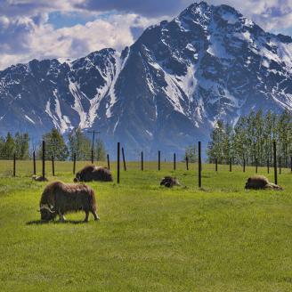
Range Assessment in Alaska
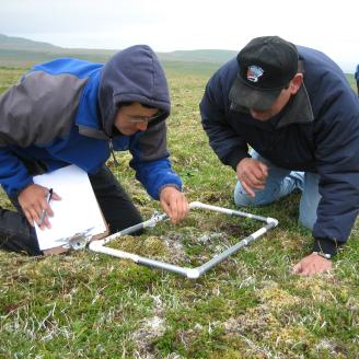
Rangeland is grasslands, shrublands, woodlands and other areas of native plants that are used for grazing. Range in Alaska is often not fenced and the grazing areas are typically much larger than pastureland.
This course gives instruction on how to inventory, evaluate, and monitor range condition to ensure that the plants and habitat the land supports are utilized in a sustainable manner.
This is an instructor-led course. The student should view the training materials below, then contact the Rangeland Specialist to schedule time for in-person review of the materials and further instruction.
Type: Instructor-led
Format: Review the course material with the instructor
NRCS Point of Contact: Karin Sonnen, NRCS Rangeland Specialist, karin.sonnen@usda.gov
Training Materials:
Pastureland Assessment in Alaska
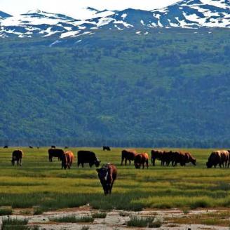
Pasture are areas covered with grass or other plants that are used for grazing livestock. Pastureland is planted to improved species or select types of native plants, primarily grasses, and is managed more intensely than rangeland.
This course gives instruction on how to inventory, evaluate, and monitor pasture condition to ensure that desirable plants maintain health and vigor and a sufficient level of nutrition for the intended grazing livestock.
This is an instructor-led course. The student should view the following training materials, then contact the Rangeland Specialist to schedule time for in-person review of the materials and further instruction.
Type: Instructor-led
Format: Review the course material with the instructor
NRCS Point of Contact: Karin Sonnen, NRCS Rangeland Specialist, karin.sonnen@usda.gov
Training Materials:
Grazing Planning Tools and Computations
There are a variety of tools and methods used to manage grazing land, estimate available forage, determine carrying capacity (number of animals that can sustainably use a grazed area), evaluate livestock condition, and monitor changes in pasture and range trends over time.
This is a bundle of courses that provide general instruction and familiarity for multiple planning tools used by NRCS and other industry professionals.
This is an instructor-led course. The student should view each of following presentations. Once all items have been explored, contact the Rangeland Specialist to schedule time for in-person review of the materials and further instruction.
Type: Instructor-led
Format: Review the course material with the instructor
NRCS Point of Contact: Karin Sonnen, NRCS Rangeland Specialist, karin.sonnen@usda.gov
Training Materials:
-
AK Curricula - Body Condition Scoring Beef Cows (791.68 KB)
Plants

Alaska Ecological Sites - Coming Soon
Ecological Sites provide a consistent framework for classifying and describing rangeland and forestland soils and vegetation; thereby delineating land units that share similar capabilities to respond to management activities or disturbance. Ecological Site Descriptions (ESDs) are reports that provide detailed information about a particular kind of land - a distinctive Ecological Site. ESDs provide the information needed for evaluating the land as to suitability for various land-uses, capability to respond to different management activities or disturbance processes, and ability to sustain productivity over the long term.
This is an instructor-led course. The student should view the “Ecological Site Descriptions” presentation, then contact the Rangeland Specialist to schedule time for in-person review of the materials and further instruction.
Type: Instructor-led
Format: Review of Ecological Site Descriptions in Alaska
NRCS Point of Contact: Karin Sonnen, NRCS Rangeland Specialist, karin.sonnen@usda.gov
Training Materials:
- Ecological Site Descriptions Presentation (coming soon)

Plant Identification
It is critical for conservation planners providing technical assistance to be able to identify the plants commonly found in their service area. Effective plant identification begins with an understanding of plant types and forms.
This course is designed to introduce the student to the concept of plant identification. It also introduces several technical references to aid the student in plant identification.
This is an instructor-led course. The student should view the following presentation then contact the Rangeland Specialist to schedule time for in-person review of the materials and further instruction.
Type: Instructor-led
Format: Review the course material with the instructor
NRCS Point of Contact: Karin Sonnen, NRCS Rangeland Specialist, karin.sonnen@usda.gov
Training Materials:
-
AK Curricula - Plant Identification (2.44 MB)
Common Plants in Your Service Area
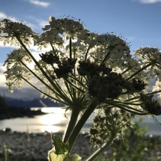
This course introduces the student to important plants commonly found in their service area. This includes plants with conservation benefit, species used for livestock and wildlife forage, and noxious and invasive weeds that may cause chemical or mechanical harm to livestock or people.
This is an instructor-led course. The student must contact the NRCS State Rangeland Specialist to schedule in-person training in the field. Because plants must be alive and active for proper identification, the student must plan in advance in order to schedule time with the Rangeland Specialist during the spring-summer field season. Appropriate field dress will be required, including water-proof boots, brush-resistant clothing, and bug protection.
Type: Instructor-led
Format: Field work
NRCS Point of Contact: Karin Sonnen, NRCS Rangeland Specialist, karin.sonnen@usda.gov
Training Materials:
-
AK Curricula - Plant List Central (115.36 KB)
-
AK Curricula - Plant List Southeast (122 KB)
-
AK Curricula - Plant List North (155.96 KB)
-
AK Curricula - Plant List West (116.52 KB)

Wetland Plant Identification
This training will give the student a basic overview of the types of plants endemic to their specific service area that are typically found growing in wetlands. It is not designed to make the student a plant identification expert, but rather to give the student an understanding of the differences between upland and wetland species, establish the habitat of considering plant types during the inventory and evaluation step of the planning process, and provide an introduction to some of the key wetlands species that the student may encounter in their location.
This is an instructor-led course. The student must contact the NRCS State Rangeland Specialist to schedule in-person training in the field. Because plants must be alive and active for proper identification, the student must plan in advance in order to schedule time with the Rangeland Specialist during the spring-summer field season. Appropriate field dress will be required, including water-proof boots, brush-resistant clothing, and bug protection.
Type: Instructor-led
Format: Field work
NRCS Point of Contact: Karin Sonnen, NRCS Rangeland Specialist, karin.sonnen@usda.gov
Training Materials:
-
AK Curricula - Wetland Plants Presentation (732.31 KB)
Soils
Web Soil Survey
The Web Soil Survey (WSS) provides soil data and information produced by the National Cooperative Soil Survey. It is operated by the NRCS and provides access to the largest natural resource information system in the world. The site is updated and maintained online as the single authoritative source of soil survey information. Soil surveys can be used for general farm, local, and wider area planning.
The goal of this course is to introduce students to several common soil properties and interpretations, the basics of map unit composition, and Web Soil Survey, the official source of soils data. This course will also give students the opportunity to practice applying your soils knowledge within the context of the conservation planning process.
Type: Self-Paced virtual course on Ag Learn
Format: Ag Learn. Students should log into their Ag Learn accounts and search for the following course title and course ID to sign up and take the training:
- Name: Using Basic Soil Survey Information in Conservation Planning
- Course ID Number: NRCS-NEDC-000416
- Course Category: NRCS-NEDC-ONLINE
- Contact Hours: 4
In addition to taking the Ag Learn training, the State Soil Scientist will provide more instruction on Alaska-specific Web Soil Survey interpretations during the other in-person soils curricula.
NRCS Point of Contact: Cory Cole, NRCS State Soil Scientist, cory.cole@usda.gov

Hydric Soils
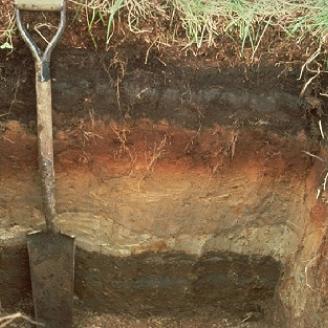
A hydric soil is a soil that formed under conditions of saturation, flooding, or ponding long enough during the growing season to develop anaerobic conditions in the upper part. Hydric soils are important indicators of wetlands.
This course provides more instruction than just hydric soils. It also gives a general overview of soil formation, soil structure, soil description, and soil diagnostic methods.
This is an instructor-led course. The student must schedule time with the Resource Soil Scientist to receive in-person instruction.
Type: Instructor-led
Format: Classroom instruction on the computer
NRCS Point of Contact: Dennis Mulligan, NRCS Resource Soil Scientist, dennis.mulligan@usda.gov
Training Materials:
-
AK Curricula - Hydric Soils presentation (8.93 MB)
Basic Soils Training
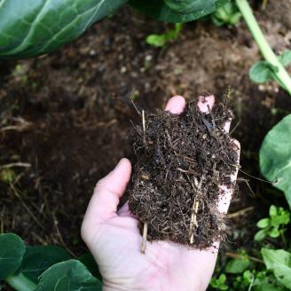
Soil is the naturally occurring unconsolidated material on the earth’s surface that has been influenced by parent material, climate, organisms and topography acting over time.
This course goes into greater detail on soils formation, soil structure, soil description, and soil diagnostic methods, as well as soil survey. This course also includes a field component where the student will become familiar with field investigation of soils including how to dig a test hole, how to texture soil, and how to evaluate soil health.
This is an instructor-led course. The student must schedule time with the State Soil Scientist to receive in-person instruction.
Type: Instructor-led
Format: Classroom instruction on the computer
NRCS Point of Contact: Cory Cole, NRCS State Soil Scientist, cory.cole@usda.gov
Training Materials:
-
AK Curricula - Basic Soils presentation (6.42 MB)


