
Through the National Cooperative Soil Survey, NRCS details the make-up of soils across Rhode Island so that farmers, woodland owners, oyster growers, livestock producers, and others can make informed land use decisions.
Focus Areas
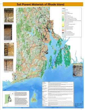
- Soil Survey
- Soil Interpretations
- Soil Health
- Conservation Compliance
- Wetlands Determinations
- National Resources Inventory
Projects
We fund cutting-edge projects like:
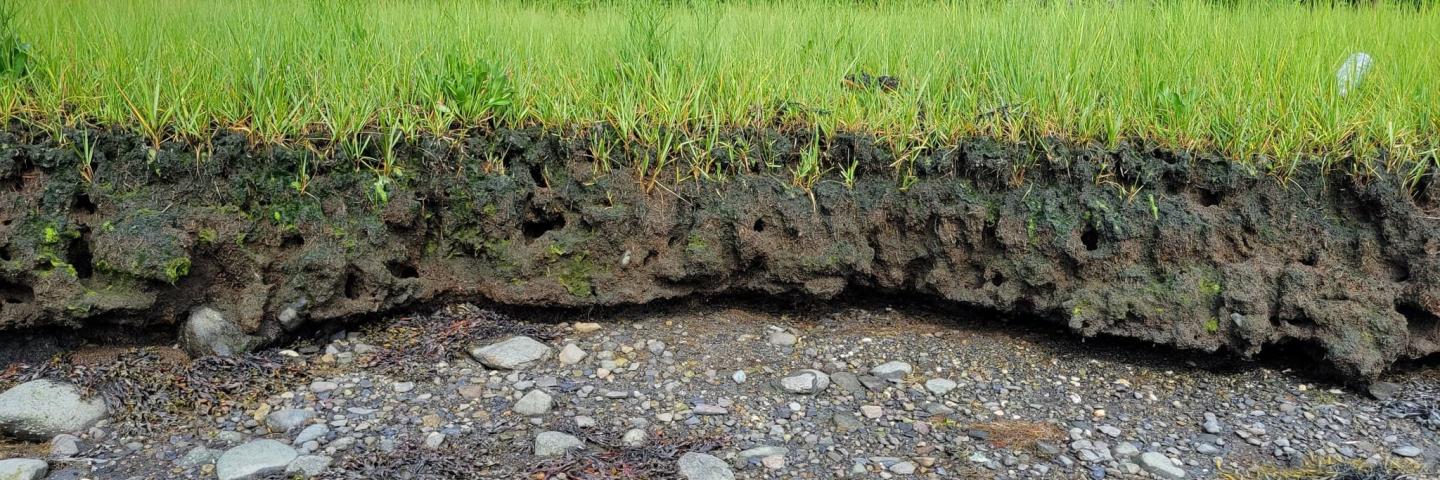
- Coastal Zone Soil Survey
- Ecological Site Descriptions
- RI State Soil
- Soil Climate Analysis Network (SCAN) Station
- Soil Mapping
- Subaqueous Soils
Who We Are
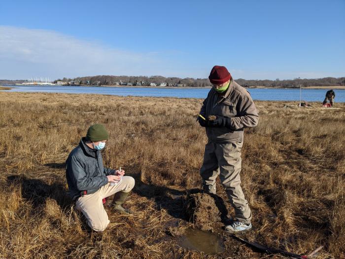
The Rhode Island Soils Division provides Technical Soil Services (TSS) – Information and assistance on the appropriate use and application of soil information – to customers in Rhode Island and Southern New England. TSS includes wetlands and HEL (highly erodible land) determinations for regulatory compliance, onsite conservation planning assistance, training and soil education activities, promotion of Soil Health Systems, and helping the public obtain and use soils data available through the Web Soil Survey, eFOTG and other web applications.
We are part of the National Cooperative Soil Survey (NCSS) program, a nationwide partnership of federal, regional, state, and local agencies and institutions. This partnership works together to cooperatively investigate, inventory, document, classify, and interpret soils and to disseminate, publish, and promote the use of information about the soils of the United States and its trust territories.
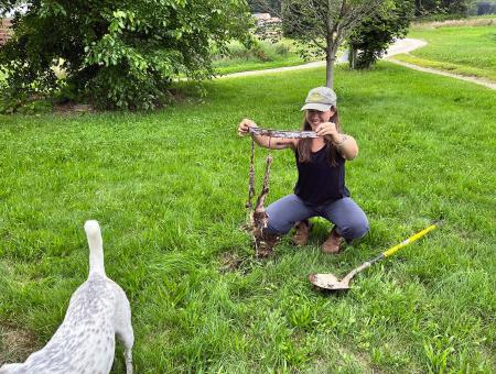
Take the 'Soil Your Undies' Soil Health Challenge!
Have you ever wondered how healthy your soil is?
Just bury a pair of cotton underwear around May-June and dig it back up after at least 60 days. It’s the quick and dirty way to test the microbial activity in your soil. The more the underwear is deteriorated, the healthier your soil!
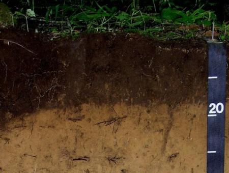
Rhode Island State Soil - Narragansett
Narragansett soils occur on approximately 12,000 acres in Rhode Island and also occur in the adjacent states of Connecticut and Massachusetts. They are productive agricultural soils supporting principal crops of silage corn, hay and vegetables.
Digital Data & Online Mapping
- Web Soil Survey - official USDA-NRCS Soils data
- Rhode Island GIS
- Google Soil Maps
- Google Earth Soils
- Soil Web App
- Coastal Zone Soil Survey Data
Additional Documents
Additional Information
Soil Science
NRCS delivers science-based soil information to help farmers, ranchers, foresters, and other land managers effectively manage, conserve, and appraise their most valuable investment — the soil.
Learn MoreSoil Survey
NRCS soil surveys provide critical information about soil characteristics and properties and their limitations and potentials. Soil surveys are intended for many different users. Learn how soil surveys can help you better understand your soil and manage your land.
Learn MoreSoil Health Fact Sheets
Download fact sheets about soil health. Available in English, Arabic, Chinese, Spanish, Hmong, Korean, and Vietnamese.
Learn More

