
Guides and Instructions
Water Harvesting Catchment (No.) (636) Conservation Practice Standard
Download the national conservation practice standard document and supporting documents for Water Harvesting Catchment (No.) (636).
Official websites use .gov
A .gov website belongs to an official government organization in the United States.
Secure .gov websites use HTTPS
A lock (
) or https:// means you’ve safely connected to the .gov website. Share sensitive information only on official, secure websites.
Download the national conservation practice standard document and supporting documents for Water Harvesting Catchment (No.) (636).
Predefined links for a variety of water supply forecast reports.
Download the national conservation practice standard document and supporting documents for Water Well (No.) (642).
Download the national conservation practice standard document and supporting documents for Watering Facility (No.) (614).
Download the national conservation practice standard document and supporting documents for Waterspreading (Ac.) (640).
Web Soil Survey (WSS) provides soil data and information produced by the National Cooperative Soil Survey.
Download the national conservation practice standard document and supporting documents for Well Decommissioning (No.) (351).

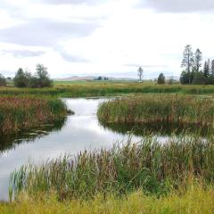
Download the national conservation practice standard document and supporting documents for Wetland Creation (Ac.) (658).
Download the national conservation practice standard document and supporting documents for Wetland Enhancement (Ac.) (659).
Download the national conservation practice standard document and supporting documents for Wetland Restoration (Ac.) (657).
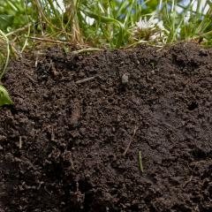
Soils perform vital functions to sustain plant and animal life, regulate water flow, filter and buffer pollutants, cycle nutrients, and provide physical stability and sort.
The Whobuddies are six unique owl cartoon characters who really care about the environment. Each Whobuddy specializes on a particular resource. The natural resources include: soil, water, air, animals, plants, and energy.

Information from NRCS Montana on the topic of wildlife and wildlife habitat.
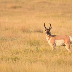
Download the national conservation practice standard document and supporting documents for Upland Wildlife Habitat Management (Ac.) (645).
Download the national conservation practice standard document and supporting documents for Wildlife Habitat Planting (Ac.) (420).
Wind Erosion Prediction System (WEPS) predicts many forms of soil erosion by wind such as saltation-creep and suspension including PM-10 using a process-based, continuous, daily time-step model that simulates weather, field conditions, crop growth, and hydrology.
WinDAM C Software
Estimating Erosion of Earthen Embankments and Auxiliary Spillways of Dams
