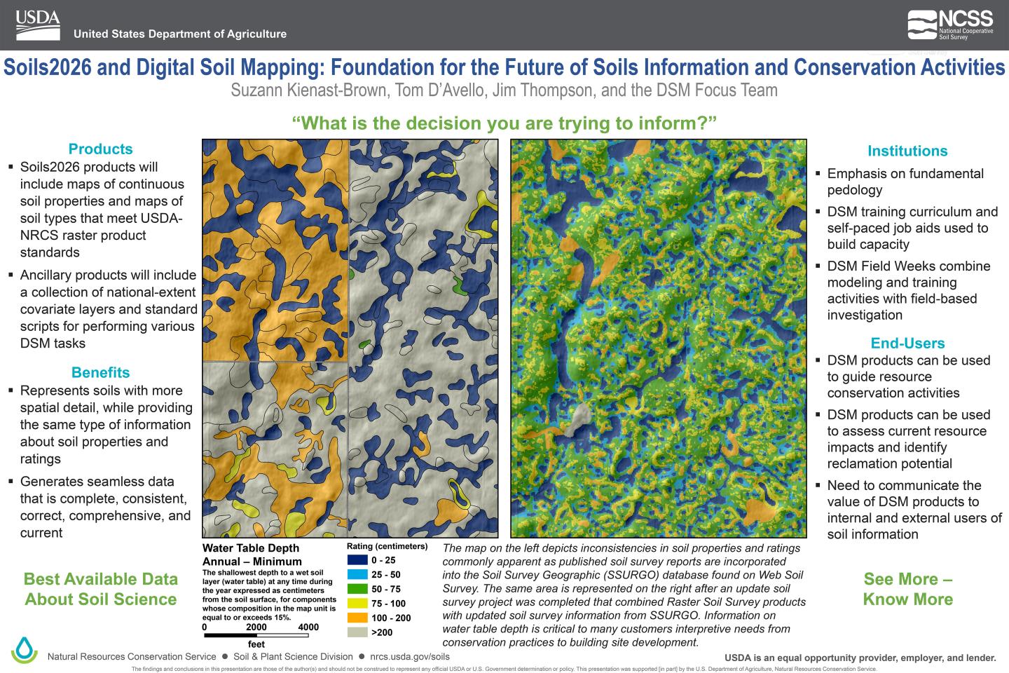
Charges, activities, and contact information for the Digital Soil Mapping Focus Team.
Sign up for email updates on Digital Soil Mapping and Raster Products
Overview
Digital Soil Mapping: The generation of geographically referenced soil databases based on quantitative relationships between spatially explicit environmental data and measurements made in the field and laboratory (McBratney et al., 2003); the spatial prediction of soil classes or properties from point data and environmental raster data using a statistical algorithm.
Charges
1 - Coordinate DSM activities across the Soil and Plant Science Division
2 - Identify training needs
3 - Identify needs to update standards and propose solutions
NSSH Part 648 – Digital Soil Mapping – Raster Products
4 - Initiate annual field weeks to investigate soil-landscape relationships in selected DSM project areas
5 - Assemble existing data
6 - Identify gaps
7 - Produce raster-based soil data and information
Soil Landscapes of the United States (SOLUS) website
Team Structure

Sub-Teams
Pixelation Station
DSM Practitioner Discussions – Join monthly conversations exploring all things DSM with a different topic each month. Open to all. Please contact Jessica Philippe or Suzann Kienast-Brown to receive monthly invites.
DSM Project Mentoring – The DSM Focus Team project mentoring program can provide technical support and guidance to eligible Soil Survey Offices conducting DSM projects. See request form below for more information.
DSM Field Weeks – DSM Field Weeks provide a cross-training opportunity between local soil scientists and those with DSM expertise while helping deliver soil survey products. The field week activities focus on a local mapping project and capacity building. Each DSM Field Week will be tailored to meet the needs of the specific project and provide support for DSM project activities in the months following the field week. Field week participants must meet the minimum requirement of the Introduction to Digital Soil Mapping training course or equivalent and have a project planned that will utilize DSM methods. Use the link below to apply to host a DSM Field Week for your project!
DSM Papers of Interest (links to CloudVault)
Other Resources
- Raster Mastery Newsletter
- Check us out on Github at https://github.com/ncss-tech/dsm-focus
- Job Aids – GIS and Digital Mapping for Soil Survey
- Soil Survey Manual – see Chapter 5. Digital Soil Mapping
Webinars
- Digital Soil Mapping Focus Team
- Comparison of Spline Depth Interval and Point-Depth Approaches for Predicting Soil Properties
- Webinar - InteRpretations: Soil Interpretations Outside of NASIS (3/2021)
- NRCS Contributions to the GSP and Global Soil Property Maps
- Digital Soil Mapping in the the Western U.S.
- Machine Learning and Knowledge Based Soil Inference Classification – Jessica Philippe details the current methodology for initial soil survey in the White Mountain National forest. Existing pedon data was used to train random forest models in R, the results of which were refined using case-based reasoning in ArcSIE. This process includes objectively narrowing the number of environmental covariates utilized in the models and incorporating those covariates into a conditioned-Latin hypercube sampling design that will provide data for model refinements in the remainder of the survey area.
- MLRA 90A - Mille Lacs Uplands Coarse-Loamy Basal Till – Betsy Schug gives a detailed overview of the processes taken to produce a seamless and high-resolution soil survey product using Digital Soil Mapping (DSM) techniques in an initial and update project setting.
- Raster Soil Survey: Project Development, Correlation, Standards, & Export – Joe Brennan and Chad Ferguson focus on general project management considerations, soil survey standards, and product development/delivery for raster soil surveys.
- Utilizing DSM in a Complex Environment – Tiffany Smith, Soil Survey Office Leader in Waynesville, TN, highlights the evaluation of predictions developed using machine learning in the Great Smoky Mountains National Park Digital Soil Mapping (DSM) project. Also covered are the lessons learned and knowledge gained during field work, training data preparation, and validation in order to assist anyone interested in using DSM in their future field projects.
- Applied Digital Soil Mapping: Using pedology to understand, map, model, and manage landscapes – Dr. Nauman explores how predictive statistical techniques in soil science can inform land management planning and decision making. Example applications include planning forest restoration, refining ecological sites, evaluating restoration of oil and gas drilling sites, determining dust sources, identifying salinity mitigation sites, mapping ecological states, and assessing landslide risk.
- Digital Soil Mapping Focus Team – An introduction to the focus team, current activities, and vision for digital soil mapping within the SSD.
- Digital Soil Mapping Primer – An introduction to the basic process and methods under the umbrella of digital soil mapping.
- SDJR is Over, Now What? – An update project using digital soil mapping methods in North Dakota.
- Digital Soil Mapping in Practice: Essex County, VT – An initial mapping project using digital soil mapping methods in Vermont.
- Soil Survey of the Boundary Waters Canoe Area Wilderness – An initial mapping project using digital soil mapping methods in Minnesota.
- Exploring the Application of Machine Learning to Soil Datasets – Dr. Ramcharan provides an introduction to the methods and datasets used to produce the SoilGrids100 dataset.
Accomplishments
Contacts


