
Properties Sub-Team
Sub-team of the Digital Soil Mapping Team.
Soil and Plant Science Division has launched Soils2026, an ambitious initiative to provide a new inventory of soils and provisional ecological sites for all areas of the U.S. by 2026. Soils2026 aims to provide basic soil and ecological site information that will be useful to land managers, ecologists, modelers, conservationists, and other natural resource professionals. This effort will rely heavily on digital soil mapping to produce the next generation of soil information products that will provide a flexible raster-based product for interpretation of soil physical, chemical, and biological properties across the U.S.
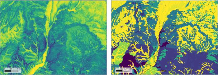
The properties sub-team was initiated to focus on the development of a complete, consistent, correct, comprehensive, and current inventory of the soil resources of the United States. Nationwide gridded continuous soil property products meet this goal and not only support the Soils2026 effort but also lay the groundwork for the future direction of soil survey and soil information products for the United States. These continuous soil property products, Soil Landscapes of the United States (SOLUS), are meant to be flexible and relevant to meet a variety of expanding user needs.
The objective of the sub-team is to produce this next generation SOLUS product with full National Cooperative Soil Survey and Soil and Plant Science Division involvement and support. The sub-team will be applying the latest digital soil mapping methods combined with collective pedologic knowledge to produce continuous soil properties predictions and estimates of uncertainty for all areas of the United States. SOLUS100, the initial 100-m resolution product, includes predictions for 20 key soil properties at 7 depths. Future versions of SOLUS will be 30-m resolution maps (SOLUS30) with the option to expand properties, add class predictions, or implement time-space modeling methods for dynamic soil properties as user needs demonstrate. Ultimately, SOLUS maps will be used to generate interpretations for use and management to support conservation planning, land managers, and decision makers.
Fundamental pedology and communication of soil knowledge will be the primary focus of this effort, yielding a framework for delivery of seamless raster-based soils data for all areas of the U.S. on yearly cycles. This framework will foster an environment of continuous improvement and support a complete, consistent, correct, comprehensive, and current inventory of the soil resources of the U.S. The aim is to provide the SOLUS product to the user community via download and as a web service, with accompanying interpretations for management and use.
This effort was partially supported by the Soils2026 Property Maps Initiative with collaboration between NRCS SPSD, West Virginia University, and New Mexico State University.
Recent Work
Soil Landscapes of the United States (SOLUS) website
SOLUS paper citation: Nauman, T. W., Kienast-Brown, S., Roecker, S. M., Brungard, C., White, D., Philippe, J., & Thompson, J. A. (2024). Soil landscapes of the United States (SOLUS): developing predictive soil property maps of the conterminous United States using hybrid training sets. Soil Science Society of America Journal, 1–20. https://doi.org/10.1002/saj2.20769
Team Lead
Stephen Roecker, Soil Scientist & GIS Specialist, St. Paul, Minnesota
Team Members
Colby Brungard, New Mexico State University
Travis Nauman, USGS
Jim Thompson, West Virginia University
Dave White, NRCS