Raster Soil Surveys (RSS)
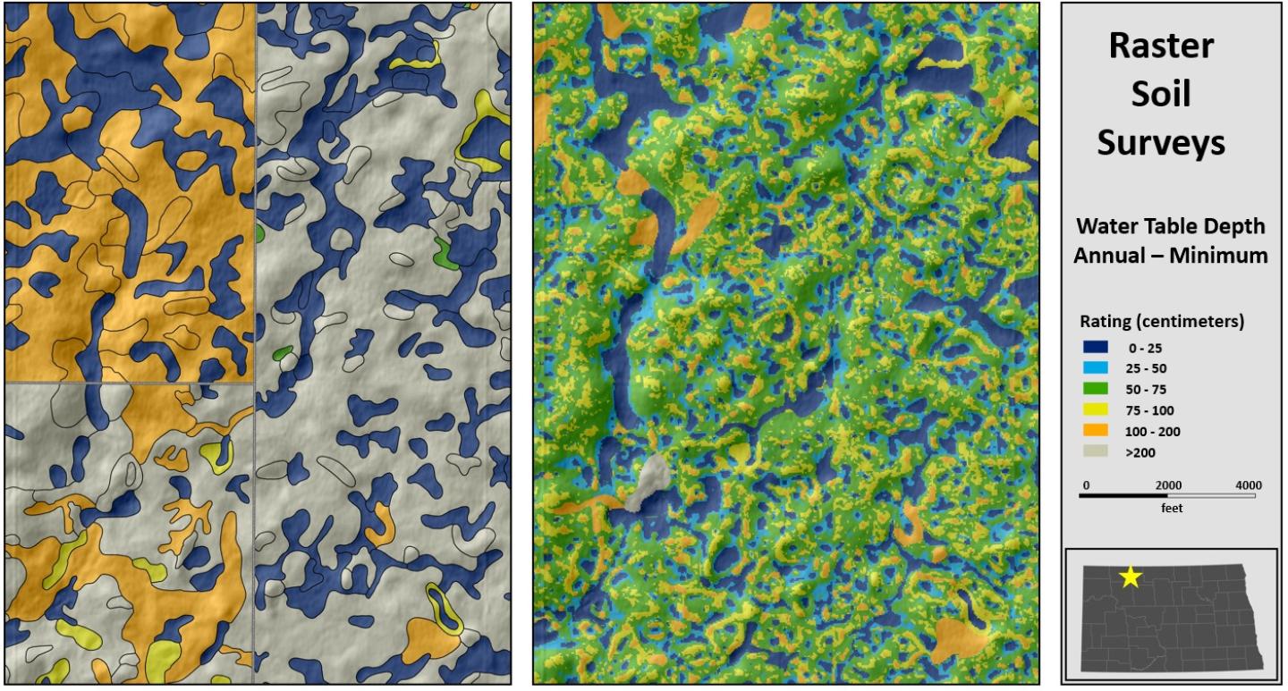
Raster Soil Survey is a reference to the products of soil survey work completed using digital soil mapping methodologies.
Download
State Extent Raster Soil Surveys
Description
Raster Soil Survey is a reference to the products of soil survey work completed using digital soil mapping methodologies. Digital soil mapping is the production of georeferenced soil databases based on the quantitative relationships between soil measurements made in the field or laboratory and environmental data and may be represented as either discrete classes or continuous soil properties. Both digital and traditional soil mapping use a conceptual soil-landscape model as a means for organizing environmental information into discrete divisions. The primary difference between these two approaches is that digital methods exploit quantitative relationships of the environmental information, while traditional methods utilize a more subjective approach and the approximate relationships of the environmental information to spatially represent where the divisions are represented.
Traditional soil mapping products are produced primarily through qualitative assessment of the landscape using aerial photography and other supporting digital environmental data and field sampling, and are delivered in a vector (SSURGO) or gridded (gSSURGO) data structure. Digital soil mapping exploits the quantitative relationships between soil observations and digital environmental data and products are delivered as raster data (i.e., rows and columns of pixels with geographic locations storing categorical or continuous data). Raster Soil Surveys are delivered here as stand-alone state extent databases at 10m spatial resolution and as part of the Gridded National Soil Survey Geographic Database (gNATSGO) in both 10m spatial resolution for states and 30m spatial resolution for CONUS.

Status Map
A map of available RSS databases is available here as part of the gNATSGO data source map.
Tools
ArcTools for working with RSS available here.
Digital Soil Mapping in NRCS
Visit the Digital Soil Mapping Focus Team for more information on digital soil mapping activities in soil survey.
Recommended Data Citations
Soil Survey Staff. Raster Soil Survey (RSS) Database for State name. United States Department of Agriculture, Natural Resources Conservation Service. Available online at https://nrcs.app.box.com/v/soils. Month, day, year (FYyear official release).
Citation Example
The following example is for the FY2023 RSS dataset for the State of Minnesota. Such citations should appear in the reference section of your document.
Soil Survey Staff. Raster Soil Survey Database for Minnesota. United States Department of Agriculture, Natural Resources Conservation Service. Available online at https://nrcs.app.box.com/v/soils. November 8, 2023 (FY2023 official release).
Contact Soils
Please contact us if you see something that needs to be updated, if you have any questions, or if you need accessibility assistance.

