

Private landowners across New Jersey are partnering with NRCS to conserve and improve soil. Learn more about this important natural resource and the technical soil services NRCS - NJ can provide to help you improve the health of your operation.
New Jersey Soil
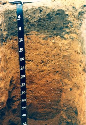
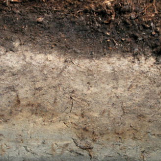
Just as New Jersey has a state bird, American Goldfinch, and a state flower, Violet, it also has a state soil, the Downer soil series.
The series was first recognized and established back in 1960 in Gloucester County, New Jersey. Since that time it has been identified in 11 of 21 counties in the Garden State, and approximately 349,294 acres of this series are now mapped in New Jersey, Maryland, and Delaware.
Downer soils are formed in loamy fluviomarine deposits in the Northern Atlantic Coastal Plain, located in broad interfluves, low hills, and ridges with slopes ranging from 0 to 30 percent. Downer soils are well drained with a seasonal high water table greater than 60 inches and permeability from moderate to moderately rapid.
Overall these soils are desirable for agricultural use since they do not present restrictions for use and management except in areas that are too sandy or too steep.
Most areas are used for growing field crops, vegetables, flowers, and some tree fruits.
Dominant vegetation in natural conditions includes white oak, red oak, scarlet oak, black oak, Virginia pine, pitch pine, hickory, sassafras, dogwood, greenbriar, and American Holly. Loblolly Pine occurs in the southern part of Downer soils distribution. The understory is dominantly low bush blueberry and mountain laurel.
TAXONOMIC CLASS: Coarse-loamy, siliceous, semiactive, mesic Typic Hapludults
New Jersey Soil Resources
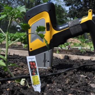
NEW: Soil Screening for Soil Science and Urban Agriculture Portable X-Ray Fluorescence (pXRF) User Guide
This manual provides regional guidance for conducting soil screening of trace metals or other targeted elements using a portable x-ray fluorescence (pXRF) equipment in support of technical assistance or conservation plan development. This guide is a reference document with a methodology and procedures for conducting pXRF screening analysis and provides currently available references and resources.
Guidance provided includes
• Evaluation methods for pre-site visit analysis
• Survey design strategies
• Onsite data collection methods
• Data evaluation
• Considerations for soil use and management
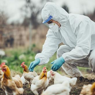
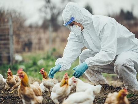
NEW: Soil Suitability for Animal Disposal
NRCS-NJ has developed an application that correlates eleven soil survey interpretations related to animal disposal suitability across New Jersey. This information should be considered as an additional source of information and not a replacement for any local or state requirement for animal disposal. It is highly encouraged to contact the local health department, state veterinarian, or NJ Department of Agriculture for further guidance.
Correlation Documents for New Jersey Soils
These documents correlate the historical published soil survey book symbols and soil names to the current soil series names and symbols.
New Jersey Hydric Soil Information
Important Farmland Soils Data for New Jersey
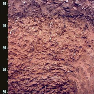
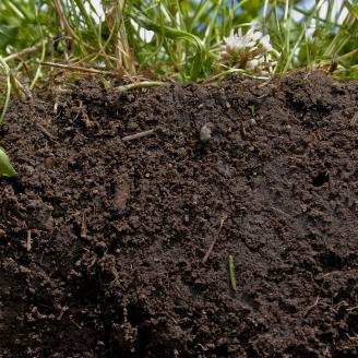
NJ Soil Profiles
Learn about New Jersey's soil profiles and see a picture of each.
Technical Services
Soil scientists offer technical capabilities and services across the state. With new technologies, NRCS can collect scientific information that will increase awareness for decision making or for targeting areas where more in depth investigation should be conducted.
Soil Screening for Soil Science and Urban Agriculture Portable X-Ray Fluorescence (pXRF) User Guide
This manual provides regional guidance for conducting soil screening of trace metals or other targeted elements using a portable x-ray fluorescence (pXRF) equipment in support of technical assistance or conservation plan development. This guide is a reference document with a methodology and procedures for conducting pXRF screening analysis and provides currently available references and resources.
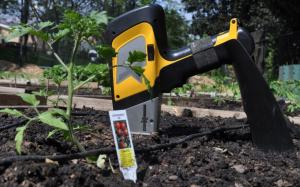
Assistance for Community Gardens
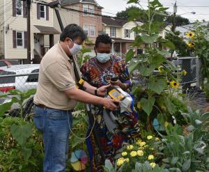
NRCS New Jersey is committed to helping communities ensure the safety of and improve the quality of locally produced fruits and vegetables. We work with landowners to help protect and conserve soil and water resources in urban and suburban areas, as well as the rural environment.
The Soils Staff provides free technical assistance to community gardens in New Jersey. Our soil assessment service can help you evaluate conditions in your gardens to achieve successful outcomes for yourself and
your community.
Ground Penetrating Radar (GPR)
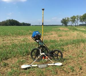
A favorable feature of GPR is its ability to noninvasively produce high-resolution images of the subsurface, and detect points or areas that have different reflection patterns than neighboring areas. An area or point having a
contrasting spatial reflection pattern is often referred to as an anomaly because of its uncertainty and/or non-uniqueness. An anomaly often indicates there is something different in the subsurface. In an archaeological context, an anomaly may indicate an area of disturbance or an artifact buried in the soil.
GPR Soil Suitability Maps
NRCS has prepared soil suitability maps based on soil attribute data and offer service providers an indication of the relative suitability of soils to GPR. Within any broadly defined area, the actual performance of GPR will depend on the local soil properties, the type of application, and the characteristics of the subsurface target. State GPR soil suitability maps provide a more detailed overview of the spatial distribution of soil properties that influence the depth of penetration and effectiveness of GPR. The spatial information contained on state GPR soil suitability maps can aid investigators who are unfamiliar with soils to assess the likely depth and relative effectiveness of GPR within project areas.
Designating Farmland of Local Importance

Farmland of Local Importance is land that is locally important for crop production, but not categorized as prime farmland, unique farmland, or farmland of statewide importance. Farmland classification is one of the tools utilized by government entities and private organizations to value the soil for farmland protection. The farmland classification classes found in New Jersey are prime farmland, farmland of statewide importance, farmland of statewide importance (if drained), farmland of unique importance, and farmland of local importance. This classification is based on optimal inherent physical and chemical soil properties for unique crop production or for ideal crop production at a local level. Some soils in New Jersey in current production do not fit these classes. The chart below details the designation process to request soils in agricultural production be classified as farmland of local importance.
Soil Screening Procedure Using pXRF
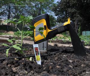
Soil screening using pXRF provides steps and a comprehensive method to conduct soil screening data collection of heavy metals or other targeted elements using a portable X-Ray Fluorescence (pXRF) device in urban areas. This method covers steps before and during on-site visits providing technical assistance to our clients and may be used for conservation planning development.
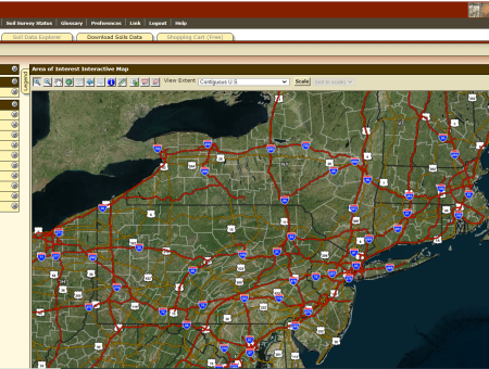
Web Soil Survey (WSS)
The Web Soil Survey (WSS) provides soil data and information produced by the National Cooperative Soil Survey. It is operated by the USDA Natural Resources Conservation Service (NRCS) and provides access to the largest natural resource information system in the world. NRCS has soil maps and data available online for more than 95 percent of the nation’s counties and anticipates having 100 percent in the near future. The site is updated and maintained online as the single authoritative source of soil survey information.
NEW: Soil Suitability for Animal Disposal
NRCS-NJ has developed an application that correlates eleven soil survey interpretations related to animal disposal suitability across New Jersey. This information should be considered as an additional source of information and not a replacement for any local or state requirement for animal disposal. It is highly encouraged to contact the local health department, state veterinarian, or NJ Department of Agriculture for further guidance.