Snow Survey | NRCS Montana
USDA Logo

Natural Resources Conservation Service

Montana


United States Department of Agriculture
  •  
  • Topics
    • Technical Resources
      • Conservation Planning
      • Data, Maps, & Analysis
      • Ecological Science
      • Engineering
      • Land Use
      • State Technical Committee
    • Soils
      • Soil Health
      • Soil Surveys
    • Water
      • Water Resources
    • Snow Survey
      • Snow Survey Products
    • Air
      • Air Quality
    • Plants & Animals
    • Energy
    • People
      • Partners
      • Teachers and Students
      • Volunteers
      • NRCS Employees
      • Community Agriculture
  • Programs
    • Farm Bill
    • Financial Assistance
    • Easements
    • Landscape Initiatives
    • Landscape Planning
    • Montana Focused Conservation
  • Newsroom
    • News Releases
    • Events & Deadlines
    • Photos and Videos
    • Public Notices
    • Publications & Fact Sheets
    • Success Stories
  • Contact Us
    • Local Service Centers
    • State Office
    • Feedback Forms
  •  
 
  • About Us
  •   |  
  • National Centers
  •   |  
  • State Websites
  • Browse By Audience
  •   |  
  • A-Z Index
  •   |  
  • Help

You are Here: 

Home / 

Snow Survey

Stay Connected USDA In Facebook NRCS In Twitter NRCS In Youtube NRCS In Mail USDA In Flicker
Z6_30DC1140N83C50ABLBMIOD10R1
{}
Z7_30DC1140N83C50ABLBMIOD1072

Web Content Viewer

Component Action Menu
  • ${title}
${loading}
Actions

Montana Snow Survey Homepage

  • Home
  • Daily Conditions
    • Daily Statewide Conditions
    • Daily River Basin Conditions
      • Kootenai
      • Flathead
      • Upper Clark Fork
      • Bitterroot
      • Lower Clark Fork
      • Jefferson
      • Madison
      • Gallatin
      • Helena Valley
      • Smith-Judith-Musselshell
      • Sun-Teton-Marias
      • St. Mary
      • Milk
      • Upper Yellowstone
      • Wyoming Basins
  • Water Supply
    • Monthly Statewide Overview
    • Monthly Basin Summaries
      • Kootenai
      • Flathead
      • Upper Clark Fork
      • Bitterroot
      • Lower Clark Fork
      • Jefferson
      • Madison
      • Gallatin
      • Helena Valley
      • Smith-Judith-Musselshell
      • Sun-Teton-Marias
      • St. Mary
      • Milk
      • Upper Yellowstone
      • Wyoming Basins
    • Official Streamflow Forecasts
    • Reservoir Storage
    • Daily Streamflow Forecasts
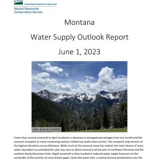
    • Water Supply Outlook Reports
  • Data Access
    • SNOTEL Site Data
    • Interactive Map
    • SNOTEL Update Report
    • Historical Data
    • Basin Plots
  • Recreation
  • Contact Us

The NRCS Montana Snow Survey Program provides mountain snowpack and precipitation data via manual snowpack measurements (Snow Courses) and the SNOwpack TELemetry (SNOTEL) network to forecast snowmelt-driven runoff during spring and summer. Individuals, organizations, and state and federal agencies use the information provided for decisions relating to agricultural production, fish and wildlife management, municipal and industrial water supply, urban development, flood control, recreation, power generation, and water quality management.


Product Highlights
Water Supply Daily Statewide Conditions Daily River Basin Conditions

Monthly summaries are available for statewide and river basin scale and webpages are developed for access to streamflow forecasts, reservoir contents and other water supply tools.

These tools can be found by clicking the links below, or using the navigation bar above. 

Monthly Overview

Monthly River Basin Summaries

Streamflow Forecasts (Official)

Streamflow Forecasts (Daily Guidance) 

Legacy Water Supply Outlook Reports

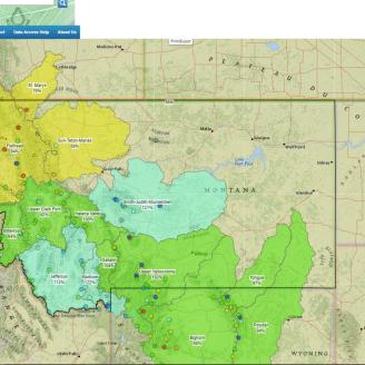
This web page displays  interactive  state-wide content which allows the water user to directly interact with the maps and products created by the NRCS and other cooperating agencies. 

***While useful for assessing periods between the official monthly reports, these tools should only be used to supplement the monthly products. Since they use a smaller selection of sites to create daily products, they offer a reasonable, but not comprehensive, overview of overall snowpack and precipitation.  


This web page allows water users in individual river basins to see interactive maps, plots and other information specific to their river basin, or sub-basin of interest. 

Click on the link to visit be directed to an example river basin, or use the Navigation Bar at the top view your river basin of interest. 

***While useful for assessing periods between the official monthly reports, these tools should only be used to supplement the monthly products. Since they use a smaller selection of sites to create daily products, they offer a reasonable, but not comprehensive, overview of overall snowpack and precipitation.  


Current Conditions
(Select A Map)


Snow survey resources for press and media

Our Snow Program staff is happy to help you with your story. Here you’ll find the latest media releases on Montana's snowpack and water supply outlook, including news releases, feature stories, downloadable media files and more.

 
Use one of the following links to download text

News releases

Use the following link to download photos

Download high-resolution photos

Contact us using one of the following links.

Sign up for e-mail updates


NRCS Home | USDA.gov | Site Map | Civil Rights | FOIA | Plain Writing | Accessibility Statement

Policy and Links | Non-Discrimination Statement | Information Quality | USA.gov | Whitehouse.gov

Complementary Content
  • ${title}${badge}
${loading}