
Overview
The NRCS Montana Snow Survey Program, in collaboration with other western state NRCS snow survey programs and the NRCS National Water and Climate Center, form the Snow Survey and Water Supply Forecasting (SSWSF) program. This cooperative effort is essential for understanding and managing water resources in the western United States.
The Vital Role of Mountain Snowpack
In the western United States, where arid conditions are common, it is estimated that upward of 80% of our water supply originates from the mountain snowpack. This snowpack acts as a natural reservoir, accumulating water during the winter and gradually releasing it during the spring and summer months. This delayed release of snowmelt into rivers and streams allows us to predict spring and summer streamflow.
Monitoring the Snowpack
The NRCS SSWSF program operates and utilizes two primary types of monitoring stations.
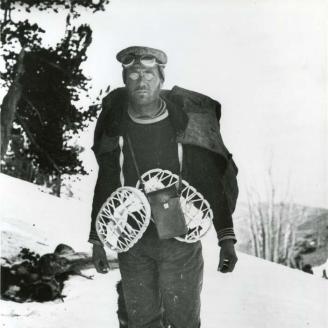
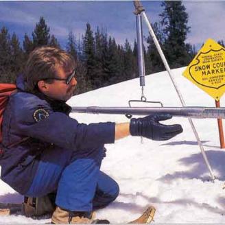
Snow Course: These historic monitoring sites, with data spanning over a century, consist of 5 or 10 sample points. At snow courses, specialized snow sampling equipment is used to manually measure snow depth and snow water equivalent or inches of water contained within the snowpack.
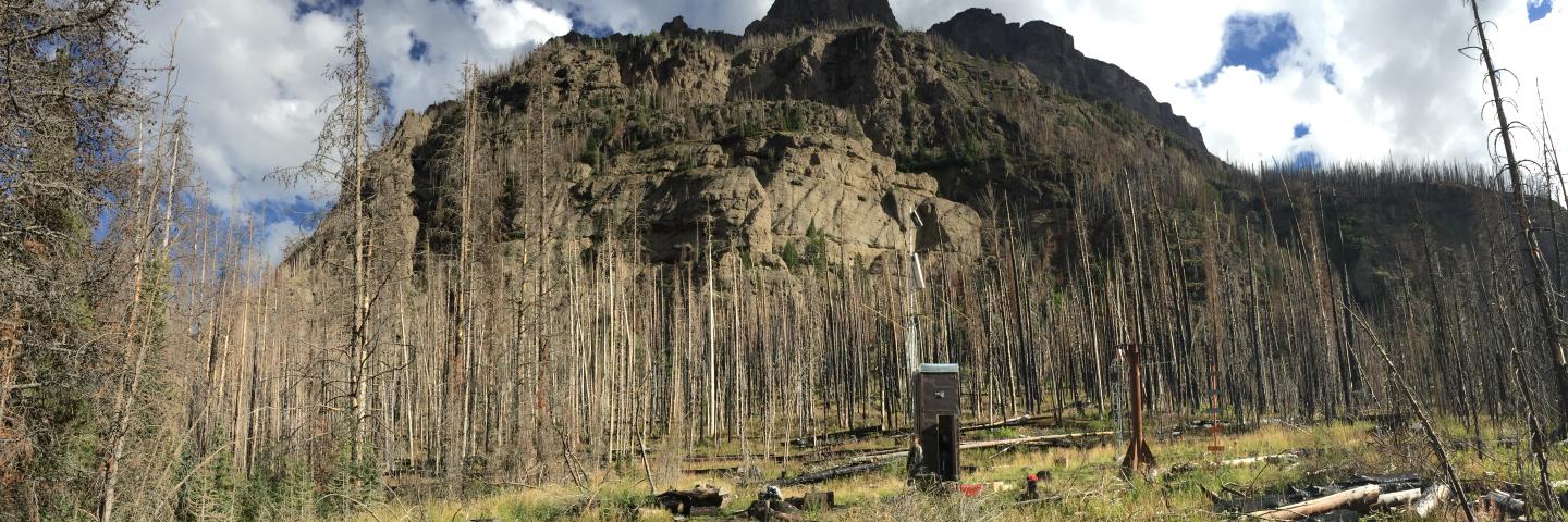
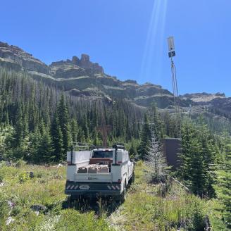
SNOTEL: In the mid-1970s, automated snow monitoring stations known as SNOTEL sites (Snow Telemetry) were introduced. Each SNOTEL site collects hydrologic and meteorological data, which at a minimum includes snow water equivalent, snow depth, precipitation, and air temperature. Some SNOTEL sites collect additional parameters including soil moisture, relative humidity, solar radiation, and wind speed. Data from SNOTEL sites are collected and transmitted hourly all year.
The NRCS SSWSF program has grown into a network comprising more than 900 manually measured snow courses and over 750 automated Snowpack Telemetry (SNOTEL) weather stations, spanning 12 western states, including Alaska.
Supporting Agriculture and More
NRCS SSWSF program hydrologists rely on snowpack data to estimate water supply. This information benefits various sectors during spring and the drier months of summer. Agriculture, which consumes a substantial portion of our total water resources, heavily relies on irrigation. Since the early 20th century, a network of reservoirs and canals has been established to store and distribute water for irrigation. The SSWSF program plays a vital role in forecasting water supply for the agricultural industry in the western United States. Other sectors the program supports are municipal water management, drought assessment, emergency preparedness, scientific research, and recreational activities.
A Cooperative Endeavor
The NRCS Snow Survey and Water Supply Forecasting program operates as a cooperative endeavor, collaborating with public and private entities that share an interest in ensuring consistent and reliable water supply forecasts. This cooperation ensures that water managers, cooperators, and the general public have access to the critical water supply information needed for effective decision-making and resource management.
A Brief History
1900-1930s
Early Beginnings
In the early 20th century Dr. Church, who was a professor at the University of Nevada, started systematic snow survey measurements in the Lake Tahoe region of California and Nevada. His work laid the foundation for modern snow survey programs in the western United States, which eventually became part of the USDA NRCS Snow Survey and Water Supply Forecasting program.
In 1935, Congress established the Snow Survey and Water Supply Forecasting program to address growing concerns over water supply reliability in the arid western United States. The program was originally a division of the Bureau of Agricultural Engineering but was shortly after moved to the Soil Conservation Service. In 1994, the Soil Conservation Service was renamed the Natural Resources Conservation Service to better reflect its expanded mission and broader scope of activities.
1930s-1970s
Network Establishment
From the 1930s to the 1970s, the USDA NRCS Snow Survey Program pioneered snow course establishment. These strategically placed sites, where snow depth and snow water equivalent are manually measured, formed the backbone of snowpack assessment. Over decades and continued today, these efforts collect water supply data, providing insights for water resource management in the western United States.

1970s
Technological Advancements
In the mid-1970s, the Snow Survey and Water Supply Forecasting program utilized technological advancements and introduced automated snow monitoring stations known as SNOTEL sites, significantly increasing data collection frequency. Lick Creek SNOTEL south of Bozeman, Montana, was among the earliest SNOTEL sites installed in the west wide network.
1990s-Present
Expansion and Modernization
The Snow Survey and Water Supply Forecasting program has evolved over the years, expanding its network of manually measured snow courses and SNOTEL sites while modernizing data collection methods. It now operates as the largest integrated and cooperative network across western states containing over 1,100 snow courses and over 850 SNOTEL stations. The program continues to expand both the network and data parameters collected in an effort to improve the accuracy of water supply forecasts.