


We all live in a watershed. Watersheds provide a vital resource for all living things to survive and thrive. All watersheds are interconnected, creating a land-water system that conveys water to its final destination such as a river, lake, wetland, or bay.
What is a Watershed?
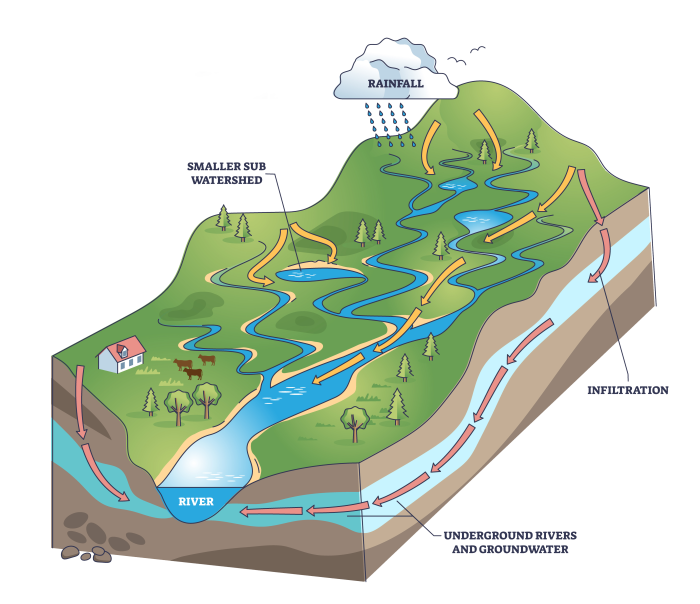
A watershed is the land that water flows across or under on its way to a stream, river, lake, or the sea.
How do watersheds work?
The landscape is made up of many interconnected basins, or watersheds. Within each watershed, all water runs to the lowest point - a stream, river, lake, or coastal area. On its way, water travels over the land surface and across farm fields, forest land, suburban lawns, and city streets, or it seeps into the soil and travels as ground water. Large watersheds like Narragansett Bay are made up of many smaller watersheds.
All watersheds are not the same. Watersheds come in many different shapes and sizes and have many different features. Watersheds can have hills or mountains or be nearly flat. They can have farmland, forestland, small towns, and big cities. Parts of your watershed may be so rough, rocky, or marshy that they’re suited only for certain trees, plants, and wildlife.
Your watershed community
Everyone lives in a watershed. You and everyone in your watershed are part of the watershed community. The animals, birds, and fish are, too. You influence what happens in your watershed, good or bad, by how you treat the natural resources—the soil, water, air, plants, and animals. What happens in your small watershed also affects the larger watershed downstream.
Watershed Management & Planning
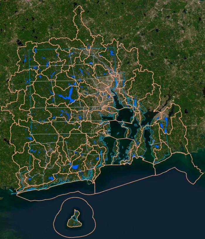
The Rhode Island Ecological Sciences Division and our partners are developing watershed management plans (or assessments) for HUC-12 watersheds across the Ocean State. (HUC-12 stands for "12-digit Hydrologic Unit Code", a watershed identification system developed by the USDA-NRCS.)
The Watershed as a Management Approach
Watershed management integrates and coordinates activities that affect a watershed's natural resources and water quality. The premise of this concept is that many water quality and ecosystem problems are best prioritized, addressed, and solved at the watershed level rather than at the individual waterbody level. The watershed management approach targets priority problems, promotes a high level of stakeholder involvement, develops integrated solutions that make use of the expertise and authority of multiple agencies and organizations, and measures success through monitoring and other data gathering.
The Watershed Planning Process
The watershed planning process works within a framework by using a series of cooperative, iterative steps to characterize existing conditions, identify and prioritize problems, define management objectives, develop protection or remediation strategies, and implement and adapt selected actions as necessary. The outcomes of this process are documented or referenced in a watershed plan. A watershed plan is a strategy that provides assessment and management information for a geographically defined watershed, including the analyses, actions, participants, and resources related to developing and implementing the plan. Watershed plan development requires a certain level of technical expertise and the participation of a variety of people with diverse skills and knowledge.
Steps of Watershed Planning
In general, all watershed planning efforts follow a similar path from identifying the problems to, ultimately, implementing actions to achieve the established goals.
- Build partnerships.
- Characterize the watershed to identify problems.
- Set goals and identify solutions.
- Design an implementation program.
- Implement the watershed plan.
- Measure progress and make adjustments.
Rhode Island Watershed Planning
Watershed plans are required to transition into the Implementation Phase for the National Water Quality Initiative (NWQI). Watershed plans are also useful tools to help communities and groups prioritize activities to improve water quality and resources in targeted areas. Watershed assessments that have been completed to date are listed and linked below.
Completed Watershed Plans
Sakonnet River
Learn about the Sakonnet River watershed
Tomaquag Brook-Pawcatuck River
Learn about the Tomaquag Brook-Pawcatuck River Watershed.
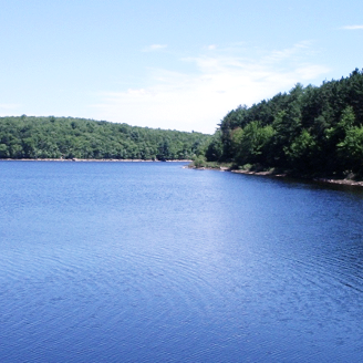
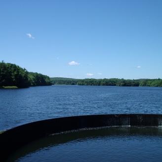
Scituate Reservoir
Learn about the Scituate Reservoir watershed
Moswansicut Pond-Huntinghouse Brook Watershed
Learn about the Moswansicut Pond-Huntinghouse Brook Watershed assessment.
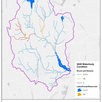
Barden Reservoir-Ponaganset River Watershed
Learn more about the Barden Reservoir-Ponaganset River watershed