
NRCS and the Northern Rhode Island Conservation District identified the Moswansicut-Huntinghouse Brook watershed as lacking a watershed assessment in place to address agriculture. This watershed plan assesses agriculture-related water quality conditions to determine voluntary conservation efforts.
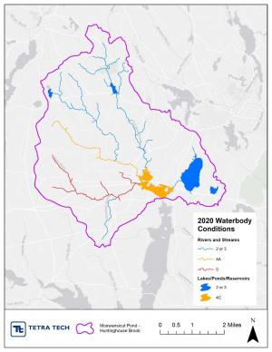
Rhode Island NRCS funded an NWQI watershed assessment for the 22 square mile Moswansicut Pond-Huntinghouse Brook watershed (HUC-12: 010900040604) in Providence County, north-central Rhode Island. This watershed assessment aims to fulfill requirements needed to enter the implementation phase of the National Water Quality Initiative (NWQI).
Background
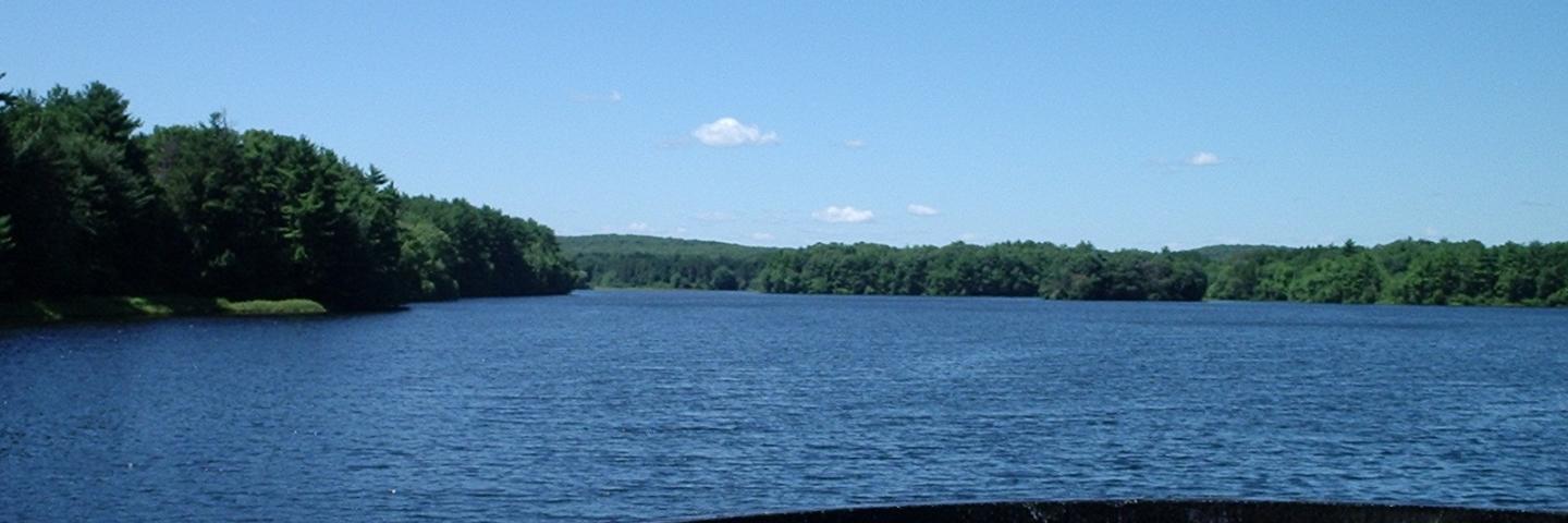
The Moswansicut Pond-Huntinghouse Brook watershed watershed lies within the broader Narraganset Bay Basin. Water flows into the watershed from three small tributaries (Peeptoad Brook, Huntinghouse Brook, and Rush Brook) and drains out to the Scituate Reservoir. Impoundments include Lake Aldersgate, Coomer Pond, Moswansicut Pond, and Kimball Reservoir.
The Scituate Reservoir is the largest freshwater body in Rhode Island and is the public drinking water source for the Providence metropolitan area. Providence Water works to conserve the entire Scituate Reservoir watershed, including the Moswansicut Pond-Huntinghouse Brook HUC-12. The Scituate Reservoir drainage area is located primarily within the rural towns of Scituate, Foster, and Glocester, and also includes parts of western Cranston and Johnston. The total drainage area covers 93 square miles.
The watershed area is approximately 78% forested. Agricultural land makes about 4% of the area and is distributed throughout the watershed. Most agricultural operations are small backyard farms, with agricultural land predominantly dedicated to forage (e.g., other hay/non-alfalfa, pasture). Developed land makes up about 13% of the area.
Water Quality Degradation Resource Concerns and Impairments
Occasional high levels of phosphorus and bacteria are the main water quality concerns for the Moswansicut Pond-Huntinghouse Brook watershed. Stream segments in Rush Brook and Huntinghouse Brook exceed recreational water quality standards for Enterococcus (indicating the potential presence of pathogenic organisms). Only Huntinghouse Brook has an approved Total Maximum Daily Load (TMDL). Previously, Moswansicut Stream was identified as impaired and was placed on the 303(d) list due to exceedances for Escherichia coli (E.coli); it was delisted in 2016. Recent U.S. Geological Survey (USGS) and PWSB water quality monitoring data also indicate high levels of phosphorus occurring episodically at stream sites throughout the watershed.
Contact
Additional Information
National Water Quality Initiative - Rhode Island
As USDA’s premiere water quality initiative, National Water Quality Initiative (NWQI) provides a way to accelerate voluntary, on-farm conservation investments and focused water quality monitoring and assessment resources where they can deliver the greatest benefits for clean water.
Learn MoreWatershed Planning in Rhode Island
We all live in a watershed. Watersheds provide a vital resource for all living things to survive and thrive. All watersheds are interconnected, creating a land-water system that conveys water to its final destination such as a river, lake, wetland, or bay.
Learn More