Caribbean soil survey interpretations predict soil behavior for specified soil uses and under specified soil management practices.

Soil survey interpretations use soil properties or qualities that directly influence a specified use or management of the soil. Soil properties and qualities that characterize the soil are criteria for interpretation models. They can be used to establish criteria for laws, programs, and regulations at local, State, and national levels. They are used to assist in planning broad categories of land use such as cropland, rangeland, pastureland, forestland, or urban development, and for preplanning and post planning activities for emergencies.
Soil survey interpretations also help plan specific management practices that are applied to soils like cropland irrigation or equipment use. Soil interpretations provide users of soil survey information with predictions of soil behavior to help in the development of reasonable and effective alternatives for the use and management of soil, water, air, plant, and animal resources. Prediction of soil behavior results from the observation and record of soil responses to specific uses and management practices.
As Charles E. Kellogg stated in his April, 1961 article about soil survey interpretations:
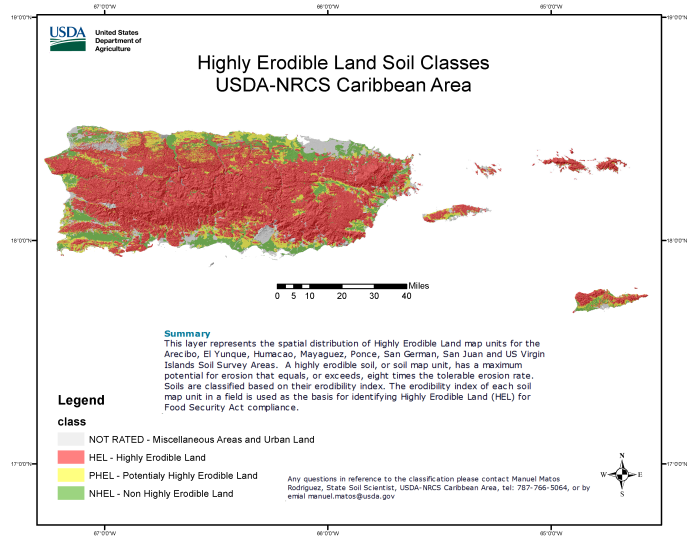
“Soil survey interpretations provide users of soil classification and soil maps with predictions about the behavior of each kind of soil under defined situations, especially systems of soil use and methods of manipulation. The interpretations range from such specific items as tile spacing, suitability of soils for highway subgrades, and erodibility to more broadly defined qualities, such as soil productivity for groups of crops, suitability of soils for wildlife, and so on. The more precisely we define alternative conditions of soil use or manipulation the more specific we can make predictions of the results. For most soils that can be cropped there are two or more alternative agricultural uses and several alternative combinations of management practices under each use.”
For more information about soil survey interpretations, refer to Title 430 – National Soil Survey Handbook, Part 617 – Soil Survey Interpretations (Exhibits).
Soil survey interpretations are generated within the National Soil Information System (NASIS) using the soil properties that are stored in the Soil Data Warehouse. Caribbean Area soil survey properties and interpretations are officially published under the Soil Survey Geographic Database (SSURGO) and can be accessed using the Web Soil Survey.
Find out more about Soils
Web Soil Survey
Web Soil Survey (WSS) provides soil data and information produced by the National Cooperative Soil Survey.
Learn MoreNational Soil Survey Center
The National Soil Survey Center manages the national soils, laboratory, ecological, and botanical databases—the world’s largest collection of natural resources data!
Learn MoreNational Cooperative Soil Survey
The National Cooperative Soil Survey (NCSS) is a nationwide partnership dedicated to soils since 1899!
Learn MoreContact
If you have any questions please contact Manuel Matos Rodríguez, Caribbean Area State Soil Scientist, at manuel.matos@usda.gov.
< back to Caribbean Soils page


