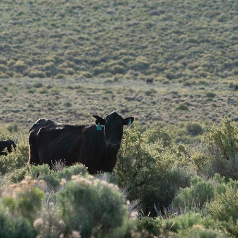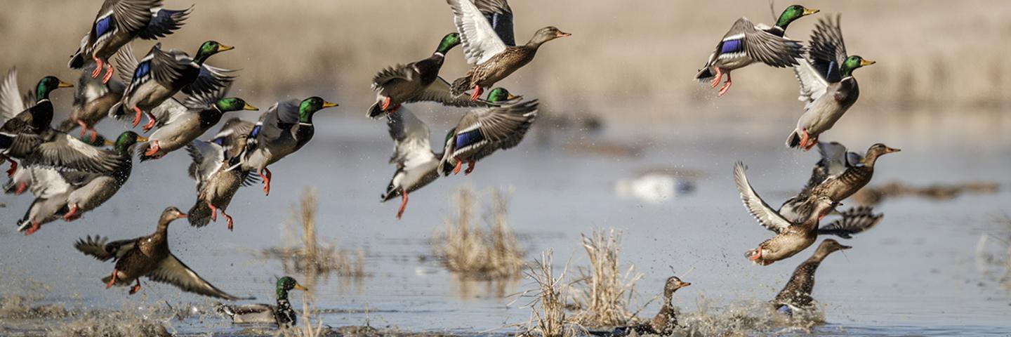
Conservation Effects Assessment Project (CEAP) wildlife assessments quantify the effects of voluntary conservation efforts on select fish and wildlife species across the nation’s agricultural lands.
About CEAP Wildlife Assessments
Approximately two-thirds of the land in the lower 48 states is privately owned. Farms, ranches, and private forests across the nation provide critical habitat for wildlife, and many species have rebounded and recovered largely thanks to the voluntary conservation efforts of agricultural producers. Through CEAP, the Natural Resources Conservation Service (NRCS) collaborates with fish and wildlife management and science communities to strengthen voluntary conservation for a range of at-risk species.
CEAP wildlife assessments deliver site-specific monitoring to inform on-the-ground conservation improvements and generate science support and tools for more effective delivery of conservation actions that benefit priority fish and wildlife species and communities. Details on the methods for wildlife assessments are available on the CEAP Frequently Asked Questions page.
CEAP Wildlife Publications and Relevant Tools
Reports, Articles, and Bibliographies
The below publications provide data and associated insights on the effects of voluntary conservation on wildlife. Categories include reports and articles and, separately, bibliographies. As applicable, publications within each category are organized by land use or conservation focus. Publications within a given category are organized in descending chronological order.
Reports and Articles
Conservation Reserve Program (CRP)
- Evaluating CRP-SAFE for Wildlife in Idaho, 2017 (0.7 MB)
- Effects of Haying on Breeding Birds in CRP Grasslands, 2016 (2.0 MB)
- Regional Assessment of the Effects of Conservation Practices on Priority Birds in the Shortgrass Prairie Bird Conservation Region, 2012 (0.7 MB)
- Bird Response to Conservation Reserve Program Land and Landscape Attributes in Maryland and Delaware, 2010 (0.2 MB)
- Linking Long-Term Pheasant Population Trends with the Conservation Reserve Program, 2010 (281.3 KB)
- Effects of the Conservation Reserve Program on Priority Shortgrass Prairie Birds, 2009 (5.3 MB)
- Estimated CRP Benefits to Priority Shortgrass Prairie Birds, 2009 (1.1 MB)
- Estimated CRP Benefits to Mixed-Grass Prairie Birds, 2008 (0.5 MB)
- Effects of the Conservation Reserve Program on Priority Mixed-grass Prairie Birds, 2007 (1.5 MB)
- Benefits of the Conservation Reserve Program to Grassland Bird Populations in the Prairie Pothole Region of North Dakota and South Dakota, 2007 (1.6 MB)
- Grassland Bird Response to Land Use Changes, 2007 (93.7 KB)
- Waterfowl Response to the Conservation Reserve Program and Swampbuster Provision in the Prairie Pothole Region, 1992-2004, 2007 (0.2 MB)
- Estimating Response of Ring-necked Pheasant to the Conservation Reserve Program, 2006 (691 KB)
- Estimating Wildlife Response to the Conservation Reserve Program: Bobwhite and Grassland Birds, 2006 (0.5 MB)
- Use of CRP Fields by Greater Sage-grouse and other Shrubsteppe Associated Wildlife in Washington, 2006 (4.0 MB)
Croplands
- Best Management Practices for Pollinator Habitat in the Southeast U.S., 2021 (3.2 MB)
- An Evaluation of Bird Conservation and Ecosystem Services on Northeastern Farms, 2020 (0.8 MB)
- Regional Assessment of the Relationships of Conservation Practices to Northern Bobwhite and Other Priority Grassland Bird Breeding Populations, 2014 (1.6 MB)
- Regional Assessment of the Effects of Conservation Practices on Northern Bobwhite and Other Priority Grassland Bird Breeding Populations and Their Habitats, 2011 (2.7 MB)
Forests, Eastern
- Assessing Eastern Whip-poor-will and Monarch Butterfly Responses to NRCS Conservation Programs Targeting Early-successional Habitats in the Eastern Forests, 2022 (2.6 MB)
- Assessing Wildlife Response to NRCS Conservation Programs Targeting Eastern Deciduous Forests: 2017-2021, 2022 (0.8 MB)
- Optimization Model for Forest and Shrubland Birds, 2021 (2.4 MB)
- A New Tool for Evaluating Outcomes of New England Cottontail Conservation Efforts, 2019 (2.3 MB)
- Assessing Wildlife Response to NRCS Conservation Programs Targeting Eastern Deciduous Forests: 2019 Annual Report, 2019 (3.8 MB)
- Habitat Ecology of Native Pollinators and Imperiled Migratory Songbirds within Early-successional Deciduous Forests, 2019 (1.9 MB)
- Assessing Avian Response to NRCS Conservation Programs Targeting Early-successional Habitats in the Appalachian Mountains and Western Great Lakes Regions, 2018 (4.6 MB)
- Habitat Evaluation and Monitoring of Working Lands for Wildlife: Assessment of Habitats Managed for New England Cottontails, 2018 (9.5 MB)
- Site-Specific and Landscape Features Associated with Shrubland Bird Occurrence in Anthropogenic Shrublands in the Northeastern United States, 2018 (0.8 MB)
- Assessing Wildlife Response to NRCS Conservation Programs Targeting Early Succession Habitats - 2016 Annual Report, 2017 (2.8 MB)
- Conservation Practices Benefit Golden-winged Warblers in Appalachia, 2016 (4.0 MB)
- Developing Guidelines for Promoting Pollinator Services and Shrubland Birds in the Northeast, 2016 (0.7 MB)
- Developing Regional and Landscape-Specific Management Guidelines for At Risk Shrubland Birds in the Northeast and Central Regions, 2016 (2.4 MB)
- Habitat Monitoring and Evaluation of Working Lands for Wildlife: New England Cottontails, 2016 (1.8 MB)
- Monitoring and Evaluating Golden-winged Warbler Use of Breeding Habitat Created by the Natural Resources Conservation Service Practices, 2015 (3.6 MB)
- Ecology and Management of Scrub-shrub Birds in New England: A Comprehensive Review, 2007 (4.5 MB)
Forests, Western
Grasslands, Great Plains
- Effects of northern bobwhite habitat management on avian species of conservation concern, 2025, Ecological Indicators
- Use of Species Distribution Models to Increase the Impacts of Woody Encroachment Control, 2023 (4.7 MB)
- An Assessment of Prescribed Grazing for Lesser Prairie-Chickens on Beef Herd Health and Productivity, 2022 (11.6 MB)
- Grazing Management and Prescribed Fire for Conservation of Lesser Prairie-Chickens, 2021 (12.7 MB)
- Influence of Human Policies on Lesser Prairie-chicken Ecology in a Fragmented Landscape, 2020 (3.2 MB)
- Effects of Working Grassland Management on Lesser Prairie-Chicken Resource Selection Within Home Ranges and During Dispersal Events, 2019 (2.9 MB)
- Lesser Prairie-Chicken Avoidance of Trees in a Grassland Landscape, 2017, Rangeland Ecology and Management
- Vegetation Characteristics and Lesser Prairie-Chicken Responses to Land Cover Types and Grazing Management in Western Kansas, 2017 (2.7 MB)
- Evaluation of Farm Bill Programs to Benefit Lesser Prairie-Chicken, 2013 (0.7 MB)
- Regional Assessment of the Effects of Conservation Practices on Priority Birds in the Shortgrass Prairie Bird Conservation Region (BCR 18), 2012 (762.4 KB)
Pasturelands, Eastern
- Wildlife Use of Livestock Troughs and Wildlife Escape Structure Study, 2018 (0.7 MB)
- Pilot Study to Investigate the Impacts of Emerging Warm-Season Grass Management Systems on Wildlife Habitat Components, 2010 (4.7 MB)
Rangelands, Sagebrush
- A Decade of Science Support in the Sagebrush Biome, 2021
- Reversing Tree Expansion in Sagebrush Steppe Yields Population-level Benefit for Imperiled Grouse, 2021, Ecosphere
- Sage Grouse Initiative Final Report, 2016 (0.8 MB)
- Evaluating Sage-Grouse and Habitat Responses to Sage-Grouse Friendly Livestock Grazing Strategies, 2014 (2.7 MB)
- Assessing the Effects of Conservation Practices on Priority Birds throughout the Intermountain West, 2013 (6.4 MB)
Rangelands, Southwestern
- New Mexico Meadow Jumping Mouse Project Report for 2018-2021, 2022 (2.9 MB)
- Thermal Ecology and Multi-scale Nest Site Selection of the Scaled Quail, 2020 (1.5 MB)
- Wildlife Habitat Evaluation Guides, 2020
- Yellow-billed Cuckoo (0.7 MB)
- Southwestern Willow Flycatcher (4.1 MB)
- Northern Mexican Gartersnake (2.0 MB)
- Arizona Bell's Vireo (1.2 MB)
- Southwestern Willow Flycatchers: Habitat Features and Effects of Livestock Grazing on their Habitat, 2019 (0.2 MB)
- New Mexico Meadow Jumping Mouse Project Report for 2015-2017, 2018 (4.3 MB)
- Identifying Key Habitat Features for Managing Breeding Southwestern Willow Flycatchers, 2017 (0.8 MB)
- Methods for Determining Biodiversity Metrics, Focal Species, and Conservation Practices for Multi-scale Analysis in Support of the Conservation Effects Assessment Project, 2016 (2.8 MB)
Stream Biota
- Quantifying the Potential Water Quality Benefits of Agricultural Conservation Practices for Stream Conservation in the Western Lake Erie Basin, 2016 (12.9 MB)
- Great Lakes Phase 2 Final Report: Assessing the Costs and Benefits of Conservation Practices to Restoring Biological Integrity in Agricultural Watersheds, 2013 (3.8 MB)
- Great Lakes Phase 1 Final Report: Assessing Benefits of Conservation Practices to the Biological Integrity of Agricultural Streams in Michigan and Wisconsin, 2012 (6.7 MB)
- Remediating Effects of Human Threats on Lotic Fish Assemblages Within the Missouri River Basin: How Effective are Conservation Practices, 2012 (7.3 MB)
- Establishing the Geomorphic Context for Wetland and Riverine Restoration of the San Rafael River, 2011 (7.6 MB)
- Evaluating Biological Effects of Dam Removals in Pennsylvania, 2011 (0.2 MB)
- Effects of Historic and Current Land Covers on Water Budget and Water Quality in Agricultural Regions of Michigan and Wisconsin, 2010
- SWAT Model Report 070900 (Rock River) (1.3 MB)
- SWAT Model Report 070700 (Wisconsin River) (1.5 MB)
- SWAT Model Report 040900 (Detroit Basin) (1.2 MB)
- SWAT Model Report 040802 (Saginaw Bay) (1.9 MB)
- SWAT Model Report 040801 (Lake Huron) (1.5 MB)
- SWAT Model Report 040500 (Grand Basin) (2.3 MB)
- SWAT Model Report 040303 (Lake Michigan) (1.2 MB)
- SWAT Model Report 040302 (Wolf/Fox Rivers) (1.6 MB)
- Wood River Valley Aquatic Habitat Study, 2010 (2.8 MB)
- Using NatureServe Information to Assess Farm Bill Practice Effects on At-risk Species and Habitats, Missouri Pilot Final Report, 2007 (3.2 MB)
Wetlands
- Agent-based Modeling of Movements and Habitat Selection by Mid-continent Mallards, 2022
- Avian Use of Wetland Reserve Easement Program Sites in Missouri, 2022 (3.6 MB)
- NRCS Working Lands for Wildlife Northeast Turtles Efforts, 2022 (4.2 MB)
- University of New Hampshire Final Report on Northeastern Turtles, 2019 (0.5 MB)
- Habitat Selection, Movements, and Home Range of Bog Turtles in Southeastern PA and Investigation of Grazing as a Management Tool, 2018 (2.1 MB)
- Winter Ecology of Radiomarked Female Mallards in Mississippi’s Alluvial Valley, 2018 (1.5 MB)
- Estimates of Waste Rice, Natural Seeds, and Wetland Birds in Gulf Coast Prairie Ricelands During Fall–Winter, 2017 (2.9 MB)
- Fall Migrant Waterbird Community Structure and Stable Isotope Ecology in the Mississippi Alluvial Valley and Northern Gulf of Mexico: Use of Migratory Bird Habitat Initiative Sites and Other Wetlands, 2016 (9.1 MB)
- An Assessment of Landscape Carrying Capacity for Waterfowl and Shorebirds in Nebraska's Rainwater Basin, 2015 (1.4 MB)
- USDA Programs Help Meet Migrating Waterfowl and Shorebird Feed Energy Needs on Rainwater Basin Wetlands in Nebraska, 2015 (2.7 MB)
- Application of Ground-truth for Classification and Quantification of Bird Movements on Migratory Bird Habitat Initiative Sites in Southwest Louisiana, 2014 (3.4 MB)
- Assessment of Bird Response to the NRCS Migratory Bird Habitat Initiative using Weather Surveillance Radar: Final Report, 2013 (1.5 MB)
- Amphibians as Wetland Restoration Indicators on Wetlands Reserve Program Sites in Lower Grand River Basin, Missouri, 2010 (3.1 MB)
- An Assessment of Wintering Waterfowl Use of Wetland Reserve Program Restored Wetlands in California Using NEXRAD Weather Radar, 2010 (3.2 MB)
- Effects of the Wetlands Reserve Program on Waterfowl Carrying Capacity in the Rainwater Basin Region of South-Central Nebraska, 2008 (1.2 MB)
Bibliographies
Fact Sheets: Conservation Insights and Science Notes
The below fact sheets include Conservation Insights and a Science Note on the effects of voluntary conservation on select wildlife species. Conservation Insights are organized by land use or conservation focus. As applicable, fact sheets within a given category are organized in descending chronological order.
Conservation Insights
Conservation Reserve Program (CRP)
- Conservation Reserve Program Benefits Lesser Prairie-Chickens, 2020 (1.2 MB)
- National Evaluation of Wildlife Benefits of CRP practice CP33, Habitat Buffers for Upland Birds, 2009 (3.2 MB)
- The CRP Enhances Landscape-level Grassland Bird Species Richness, 2009 (0.2 MB)
Croplands
- Can Cover Crops Help Grassland-breeding Birds? Corn Belt Insights from Iowa. 2024 (0.5 MB)
- Small, Diversified Farms in New England Provide Conservation Opportunities for Shrubland Birds, 2021
- Landscape Context Affects Bird Use of Conservation Practices in Delmarva, 2011 (1.5 MB)
- Bobwhite and Upland Songbird response to CCRP Practice CP33, Habitat Buffers for Upland Birds, 2009 (0.5 MB)
Forests, Eastern
- Private Landowner Response to NRCS Young Forest Programs, 2018 (1.6 MB)
- Small Forest Openings Support Shrubland Birds and Native Bees in the Northeast, 2017 (2.5 MB)
- Conservation Practices Benefit Shrubland Birds in New England, 2012 (0.5 MB)
Grasslands, Great Plains
- LPCI Practices Benefit Lesser Prairie-Chickens and Ranchers, 2019 (5.2 MB)
- Relationship of Lesser Prairie-Chicken Lek Presence and Density to Grassland Conservation Programs, 2014 (0.8 MB)
- USDA Conservation Program Contributions to Lesser Prairie-Chicken Conservation in the Context of Projected Climate Change, 2012 (1.1 MB)
Rangelands, Sagebrush
- Quantifying Outcomes of Working Lands for Wildlife (WLFW) for the Benefit of Landowners and At-Risk Wildlife, 2020 (1.5 MB)
- Conifer Removal Benefits Sage-Grouse, Other Sagebrush Birds, and Rangeland Productivity, 2019 (3.8 MB)
- Conservation Practices Benefit Priority Birds in the Intermountain West, 2017 (2.6 MB)
- Targeted Conifer Removal: A Proactive Solution to Conserving Sage-Grouse, 2014 (1.3 MB)
- Wetlands Provide Vital Sage-Grouse Summer Habitats on Private Lands, 2014 (1.3 MB)
- Wyoming's Core Area Policy and Conservation Easements Benefit Sage-Grouse, 2014 (2.0 MB)
- Applying the Sage-Grouse Fence Collision Risk Tool to Reduce Bird Strikes, 2012 (0.6 MB)
Stream Biota
Wetlands
- Wetland Easements Support Wintering Waterfowl in the Mississippi Alluvial Valley, 2023 (0.8 MB)
- Migrating and Wintering Waterfowl Select WRP Easements to Meet Annual Life-cycle Needs, 2015 (2.2 MB)
- Weather Surveillance Radar Reveals Bird Response to the Migratory Bird Habitat Initiative, 2015 (1.3 MB)
- Farm Bill Conservation Programs Can Help Meet the Needs of Spring-Migrating Waterfowl in Southern Oregon-Northeastern California, 2013 (1.1 MB)
- Wintering Waterfowl Respond to Wetlands Reserve Program Lands in the Central Valley of California, 2012 (2.3 MB)
- WRP Contributes to Amphibian Conservation in Missouri, 2012 (0.9 MB)
- Analysis of Missouri Wetlands Reserve Program Easement Monitoring Data, 2009 (2.5 MB)
- Factors Influencing Swamp Sparrow Reproductive Success at Restored and Natural Marshes, 2009 (1.0 MB)
- Ecological Monitoring Insights from the Wetlands Reserve Program in Missouri, 2008 (1.0 MB)
- WRP Supports Migrating Waterfowl in Nebraska's Rainwater Basin Region, 2008 (0.4 MB)
Science Note
Webinars and Blogs
The below Conservation Outcomes Webinar recordings feature scientists and other subject matter experts speaking on the effects of voluntary conservation on wildlife. Blogs related to CEAP wildlife assessments are also included. Webinar recordings are organized in descending chronological order. Visit the Conservation Outcomes Webinar Series webpage to access information on upcoming webinars.
Conservation Outcomes Webinars
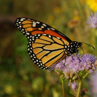
- June 20, 2024 – USDA Conservation Efforts Support Pollinators, Agricultural Production Nationwide: Webinar Recording (Captions Available), Presentation Slides, Additional Resources One-Pager, and Associated Virginia Tech Report
- April 25, 2024 – Emerging Findings on the Effects of Cover Crops on Grassland Birds: Webinar Recording (Captions Available), Presentation Slides, Additional Resources One-Pager, and Associated Conservation Insight
- November 16, 2023 – Outcomes of Spatial Targeting in Sagebrush Country via the Sage Grouse Initiative: Webinar Recording (Captions Available), Presentation Slides, and Additional Resources One-Pager
- August 24, 2023 – Informing Turtle Conservation in the Northeast by Thinking Bigger in Space and Time: Webinar Recording (Captions Available), Presentation Slides, and Additional Resources One-Pager
- December 8, 2022 – Reducing Woody Encroachment to Conserve Rangeland Production in the Great Plains: Webinar Recording (Captions Available), Presentation Slides, and Additional Resources One-Pager
- June 23, 2022 – Science Informs Managing Working Lands for Lesser Prairie-Chickens: Webinar Recording, Presentation Slides, and Transcript
- February 24, 2022 – What New Mexico Meadow Jumping Mice Tell Us About Functional Riparian Ecosystems: Webinar Recording and Presentation Slides
- November 18, 2021 – A Decade of Science Support in the Sagebrush Biome: Webinar Recording and Presentation Slides
- September 23, 2021 – CEAP Science Informs Shrubland Bird Conservation in Eastern Forests: Webinar Recording and Presentation Slides
- July 22, 2021 – Pollinator Response to NRCS Pollinator Practices: Webinar Recording and Presentation Slides
- February 25, 2021 – Rangeland Analysis Platform: Integrating Production and Economics into Area-Wide Planning: Webinar Recording
- August 27, 2020 – Conservation Outcomes of NRCS’s Working Lands for Wildlife in Eastern Forests: Webinar Recording
- April 23, 2020 – Conservation Outcomes on America’s Western Grazing Lands with NRCS’s Working Lands for Wildlife: Webinar Recording
Blogs
- Recent Report Reveals Native Bees’ Favorite Flowers
- Three Key Findings from First-of-its-Kind Study on NRCS Conservation Practices and U.S. Pollinators
- Three Key Ways NRCS Supports Double Wins for Wildlife and Working Lands Conservation
- Ask the Expert: A Q&A on Voluntary Conservation Outcomes for Wildlife with Charlie Rewa
Tools
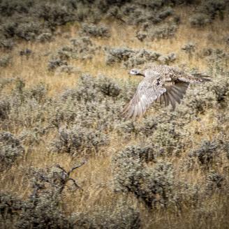
Through CEAP, USDA collaborates with partners from federal and state agencies, universities, and non-government organizations to deliver tools that support conservation assessment and planning across a range of landscapes and for a diversity of management goals. The below tools support wildlife-related conservation efforts for a range of habitats. Visit the Conservation Assessment and Planning Tools webpage to access additional CEAP-supported tools that may strengthen conservation assessment and planning efforts for your geographic area, land use, and management goals of interest.
Predictor of Avian Communities Tool
The Predictor of Avian Communities Tool (PACT) is a web-based tool that allows users to assess the potential effects of forest composition and management decisions on select bird communities. PACT was funded by the National Fish and Wildlife Foundation and NRCS, with additional support provided by the U.S. Forest Service and University of Massachusetts.
Users including conservationists, forest landowners and other land managers, and researchers may use PACT to assess the effects of openings in forests – including their size, proximity to other openings, and residual basal area – on mature forest and shrubland bird species. Project-specific outputs include the total number of species expected given a particular management scenario and the likelihood of individual species occurrence. Users may leverage this tool to consider the effects of various silvicultural treatments and associated predicted changes to bird communities in a user-specified area. PACT is intended for use in the temperate forests of the eastern United States and Canada.
Visit the PACT website to learn more and directly access this resource with supporting materials.
Rangeland Analysis Platform
The Rangeland Analysis Platform (RAP) is an online application that provides users direct access to geospatial vegetation data for rangeland in the United States. RAP was developed by the University of Montana in partnership with NRCS, USDA’s Agricultural Research Service, and the Bureau of Land Management.
RAP enables users including conservationists, ranchers and other land managers, resource managers, and researchers to visualize and analyze continuous vegetative cover, annual aboveground biomass, and 16-day aboveground biomass for specific locations and across geographic scales. Associated tools include a Production Explorer and Stocking Rate Calculator Tool. RAP is intended to support users in monitoring rangeland and evaluating current or past management strategies to ultimately strengthen land management planning.
Visit the RAP website to learn more and directly access this resource with supporting materials.
CEAP Wildlife Highlights
The below highlights represent recent resources and key findings on wildlife conservation efforts and outcomes. Visit this webpage frequently to see what's new, or browse the above publications to access hundreds of published resources from CEAP wildlife assessments.
Three Key Findings from First-of-its-Kind Study on NRCS Conservation Practices and U.S. Pollinators
CEAP and Virginia Tech collaborated on a first-of-its-kind study to evaluate the impacts of NRCS’s voluntary conservation practices on pollinator habitat nationwide. This blog shares three key findings to inform data-driven decision making for U.S. pollinator conservation.

Three Key Ways NRCS Supports Double Wins for Wildlife and Working Lands Conservation
This blog by Terry Cosby, Chief of USDA's Natural Resources Conservation Service (NRCS), highlights three key ways NRCS supports win-win voluntary conservation solutions that strengthen working lands and the species that call them home.
USDA Conservation Efforts Support Pollinators, Agricultural Production Nationwide
This Conservation Outcomes Webinar highlights findings from a study on the nationwide effectiveness of USDA's voluntary conservation programs in supporting pollinators and strategies to increase benefits. The presenter is Dr. Elissa Olimpi, a leader of the study conducted with Virginia Tech.

Can Cover Crops Help Grassland-breeding Birds? Corn Belt Insights from Iowa.
This Conservation Insight shares findings on grassland-breeding bird responses to the integration of cover crops in a corn-soybean cropping system in Iowa. Findings from this study may inform on-the-ground cropland management decisions in similar cropping systems across the Corn Belt.
Ask the Expert: A Q&A on Voluntary Conservation Outcomes for Wildlife with Charlie Rewa
This Ask the Expert features Charles (Charlie) Rewa, CEAP Wildlife Assessments Lead. Charlie answers questions about wildlife and voluntary conservation, the value of a data-driven approach to strengthen conservation for key species, and NRCS resources to support producers and other land managers.

Additional Resources
Conservation Effects Assessment Project (CEAP)
USDA’s Conservation Effects Assessment Project (CEAP) is a multi-agency effort led by the Natural Resources Conservation Service (NRCS) to quantify the effects of conservation practices across the nation’s working lands.
Learn MoreFrequently Asked Questions | Conservation Effects Assessment Project
This webpage provides answers to frequently asked questions about the Conservation Effects Assessment Project (CEAP).
Last Updated: June 9, 2023
Learn MorePublications | Conservation Effects Assessment Project
USDA’s Conservation Effects Assessment Project, CEAP, provides a suite of publications highlighting the effects of voluntary conservation across the nation’s working lands.
Learn MoreConservation Assessment and Planning Tools
USDA’s Conservation Effects Assessment Project (CEAP) collaborates with partners to deliver tools that support conservation assessment and planning for diverse land uses and management goals.
Learn More


