
This webpage provides answers to frequently asked questions about the Conservation Effects Assessment Project (CEAP).
Last Updated: June 9, 2023
About the Conservation Effects Assessment Project (CEAP)
Q: What is the Conservation Effects Assessment Project, or CEAP?
A: USDA’s Conservation Effects Assessment Project, CEAP, is a multi-agency effort led by the Natural Resources Conservation Service to quantify the effects of conservation practices across the nation’s working lands over time. CEAP findings are used to guide conservation program development and support conservationists, agricultural producers, and partners in choosing the most effective conservation actions and making informed management decisions backed by data and science.
CEAP assessments are carried out at national, regional, and watershed scales for conservation efforts related to cropland, grazing land, wetlands, and wildlife. These assessments empower a diversity of customers to evaluate conservation successes, identify potential improvements, and set targeted, measurable goals for the future.
Q: Why and when was CEAP initiated?
A: CEAP was initiated in 2003 by USDA’s Natural Resources Conservation Service, Agricultural Research Service, Cooperative State Research, Education, and Extension Service, and Farm Service Agency. The intent was to support strengthened accountability on reporting the effects of increased conservation program funding provided via the 2002 Farm Bill. The original goals of CEAP were to estimate conservation impacts and benefits for reporting at the national and regional levels and to establish the scientific understanding of the effects of conservation practices at the watershed scale.
Q: What agencies, organizations, and other entities contribute to CEAP?
A: CEAP is a joint effort led by USDA's Natural Resources Conservation Service in partnership with federal and state agencies, universities, non-government organizations, and agricultural producers. Key partners within USDA include the Agricultural Research Service, Farm Service Agency, National Agricultural Statistics Service, National Institute of Food and Agriculture, and U.S. Forest Service. Additional partners include the Bureau of Land Management, Bureau of Indian Affairs, U.S. Environmental Protection Agency, U.S. Geological Survey, and U.S. Fish and Wildlife Service.
Q: What is the vision of CEAP, and what is CEAP's primary goal?
A: CEAP's vision is enhanced natural resources and healthier ecosystems through improved conservation effectiveness and better management of agricultural landscapes. The primary goal of this effort is to improve efficacy of conservation practices and programs by quantifying conservation effects and providing the science and education base needed to enrich conservation planning, implementation, management decisions, and policy.
Conservation Effects Assessment Project Focus Areas
Cropland Assessments
Q: How do farmers and other land managers participate in CEAP cropland surveys?
A: USDA’s National Agricultural Statistics Service (NASS) leads efforts to survey thousands of farmers nationwide through CEAP cropland assessments. CEAP surveys gives farmers and other producers an opportunity to provide a complete and accurate picture of the conservation practices they use on their working lands. Approximately 19,000 farmers provided input on their conservation and management practices for the CEAP report published in March 2022, for instance.
USDA’s Natural Resources Conservation Service combines the data collected by NASS with information from hydrologic, climate, and soil databases to estimate environmental and management conditions for the areas surveyed. Additional details on modeling for CEAP cropland assessments are provided under the Data and Assessment Methods section, below.
Q: Is participant information collected during CEAP cropland surveys kept confidential?
A: Yes. USDA’s National Agricultural Statistics Service safeguards the privacy of all respondents, ensuring that no individual operation or producer can be identified, as required by Federal law. Participants’ responses cannot be used for the purposes of taxation, investigation, or regulation (Title 7, U.S. Code, and CIPSEA, Public Law 107-347).
Q: What are croplands, and why do CEAP cropland assessments matter?
A: There are more than 300 million acres of cultivated cropland across the United States. Farmers and other land managers grow a diversity of crops on these working lands to provide food, fuel, and livestock feed for our nation and beyond.
CEAP uses a sampling and modeling approach to quantify the impacts of voluntary conservation practices on cropland – such as no-till, cover crops, and nutrient management – over time. CEAP’s findings empower farmers and other land managers with data to evaluate national and regional conservation successes, identify potential improvements for their operations, and set targeted, measurable goals for the future. NRCS and conservation partners equally rely on CEAP assessments to evaluate conservation outcomes and to guide targeted, data-driven prioritization of future efforts and initiatives to conserve natural resources across the nation's cropland.
Visit the CEAP Cropland Assessment webpage for additional details and access to publications from the CEAP cropland assessments portfolio.
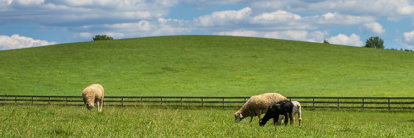
Grazing Land Assessments
Q: What are grazing lands, and why do CEAP grazing land assessments matter?
A: Grazing land is a collective term for rangeland, pastureland, grazed forestland, native and naturalized pasture, hayland, and grazed cropland. Approximately 978 million acres, 40 percent of all land across the United States, is designated as grazing land. That includes 584 million acres of private land and 394 million acres of land managed by agencies such as the U.S. Forest Service, Bureau of Land Management, and Bureau of Indian Affairs. Grazing lands are used to feed and raise livestock, providing food and essential byproducts for the United States and beyond while also offering potential ecosystem services such as cleaner water, fire and fuel hazard reduction, and improved wildlife habitat.
CEAP modeling across grazing lands informs management decisions for a diversity of land managers and partners. Findings highlight where conservation practices – such as brush management and prescribed grazing – have the greatest positive effects. Findings also highlight where targeted conservation efforts are most needed to positively affect factors such as plant productivity, soil erosion, and water quality.
Beyond modeling outcomes, CEAP also provides tools, interpreted data layers, and other products for conservation planners, ranchers, and partners to use when considering the best solutions for healthy, productive grazing land.
Visit the CEAP Grazing Land Assessments webpage for additional details and access to publications from the CEAP grazing land assessments portfolio.
Wetland Assessments
Q: What are wetlands, and why do CEAP wetland assessments matter?
A: Wetlands are areas where water covers the soil or is present at or near the soil surface for at least a portion of the year during the growing season. Wetlands provide many important benefits to society, including fish and wildlife habitat and biodiversity, nutrient and sediment capture, storage of surface and floodwaters, protection of shorelines, hunting and recreation opportunities, production of food and fiber, pollutant removal, greenhouse gas emissions management, regional water sustainability, and cultural and educational benefits.
CEAP assessments provide information to further understanding of wetland functions and the effects of conservation practices related to wetlands – particularly those in agricultural landscapes – at local and regional levels. Remote sensing and landscape-scale assessments document base-flow to streams, for instance, and water quality improvements that may be marginal at local scales but have significant impacts at broader landscape levels.
CEAP also supports remote sensing and modeling efforts to develop more effective tools for targeted wetland restoration and conservation efforts. These large-scale analyses provide insights into wetland contributions to water quality and quantity, best practice for wetland management, and accounting of economic benefits and tradeoffs that may help to incentivize the implementation of wetland-related conservation practices for farmers and other land managers.
Visit the CEAP Wetland Assessments webpage for additional details and access to publications from the CEAP wetland assessments portfolio.
Q: What are the benefits of NRCS investments in wetland restoration efforts?
A: Restoration of wetlands through opportunities like the Wetland Reserve Easements component of the Agricultural Conservation Easement Program and the Environmental Quality Incentive Program helps to mitigate some of the effects of sediment, nutrients, and other chemicals that may be associated with agricultural production. These wetlands often take marginally productive land out of active agriculture and increase flood water storage, wildlife habitat, and other benefits. CEAP assessments help to document the outcomes of these conservation practices and investments, and to guide future implementation. You may access CEAP reports focusing on wetlands on the CEAP Wetland Assessments webpage.
Q: Do NRCS conservation practices protect wetlands from degradation? If so, how?
A: Yes. Conservation practices implemented through the Environmental Quality Incentives Program and other conservation programs protect wetlands from degradation by removing sediment and nutrients before they reach the wetland, thereby increasing the life of the wetland by preventing filling or overgrowth of vegetation and algae. Multiple CEAP assessments and on-going studies show the benefits of these conservation practices for wetlands, streams, and other aquatic systems.
Wildlife Assessments
Q: What wildlife are included in CEAP assessments, and why do these assessments matter?
A: Working farms, ranches, and private forests across the United States provide critical habitat for wildlife. From the sage grouse to the Louisiana black bear, many species have rebounded and recovered largely thanks to the voluntary conservation efforts of agricultural producers and other land managers across private lands. CEAP wildlife assessments deliver site-specific monitoring to inform on-the-ground conservation improvements and generate science support and tools to inform more effective delivery of conservation actions that benefit priority fish and wildlife species and communities.
CEAP collaborates with fish and wildlife management and science communities to strengthen voluntary conservation for a range of at-risk birds, fish, insects, mammals, and reptiles. You may access species-specific reports and other resources on the CEAP Wildlife Assessments webpage.
Watershed Assessments
Q: What are watersheds, and why do CEAP watershed-level assessments matter?
A: A watershed is an area of land that collects and delivers water to one central location, such as a stream, river, lake, estuary, or the ocean. Everyone lives within a watershed, and good land management practices and conservation contribute to watershed health. NRCS supports farmers, ranchers, private forest landowners, and other landowners and land managers in implementing suites of conservation practices to help prevent erosion and build soil health, improve water and air quality, increase water filtration, enhance wildlife habitat, and provide other natural resource benefits within targeted watersheds.
Through CEAP, NRCS works with agricultural producers and partners including other agencies, universities, conservation districts, and watershed groups to quantify the effects of voluntary conservation on factors such as water quality, water availability, and soil health in select small watersheds across the nation. This provides data to measure the effects of both individual conservation practices and combinations of conservation practices to maximize environmental benefits, and to understand how field-level efforts impact broader ecosystems and communities.
There are currently 24 active watershed studies across the United States. Findings from these studies strengthen the science base for voluntary conservation, improve conservation planning, refine methods and tools for watershed scale and site-specific assessment, and ultimately help USDA deliver more focused, strategic conservation opportunities to support productive agricultural lands and environmental benefits nationwide.
Data and Assessment Methods
Cropland Assessments
Q: What are the data sources and associated assessment methods for CEAP cropland assessments?
A: CEAP cropland assessments are developed using confidential farmer surveys coupled with modeling to estimate the effects of conservation practices. Data sources for CEAP models include the National Resources Inventory (NRI) and records from both NRCS and Farm Service Agency offices at USDA Service Centers.
The approach consists of four basic steps or activities:
- A subset of NRI sample points are selected to serve as "representative fields." These NRI sample points, which are located on cultivated cropland and land in long-term conservation cover, provide the statistical framework for the model as well as information on soils, climate, and topography.
- USDA implements CEAP Cropland Farmer Surveys to collect the information needed at the selected NRI sample points to run field-level process models and assess the effects of conservation practices. The National Agricultural Statistics Service (NASS) interviews farmers to obtain current information on farming practices such as crops grown, tillage practices, nutrient and pesticide application, and conservation practices.
- USDA uses the physical process model called APEX (Agricultural Policy Environmental Extender) to estimate field-level benefits. APEX is a variant of the EPIC (Erosion Productivity Impact Calculator) model that allows USDA to estimate the effects of buffers, grassed waterways, and other erosion control practices. APEX allows estimation of the reductions in soil loss, reductions in nitrogen loss, reductions in phosphorus loss, and reductions in pesticide loss from farm fields reported as reductions in pesticide risk. APEX also allows USDA to evaluate soil quality enhancement as a result of practice implementation.
- USDA integrates the model output from APEX with another model called SWAT/HUMUS (Soil and Water Assessment Tool / Hydrologic Unit Model of the United States) to assess off-site benefits for water quality and availability. HUMUS includes databases on land use and sources of non-point and point source pollutants that are used with the SWAT model to simulate the transport of water and potential pollutants from the land to receiving streams and routes the flow downstream to the next watershed, ultimately to the estuaries and oceans. SWAT/HUMUS allows estimation of the reduction in in-stream concentrations of sediment, nutrients, and pesticides attributable to implementation of conservation practices.
Q: What specific data do you collect through CEAP cropland assessments?
A: Farmer survey documents are available on the CEAP Publications webpage, under the Cropland Assessments section. These survey documents provide the specific questions farmers answered for unique survey years and, as such, the specific data and information available for modeling, reporting, and additional analyses through CEAP cropland assessments.
Grazing Land Assessments
Q: What is the assessment approach for CEAP grazing land assessments?
A: CEAP grazing land assessments are comprised of several complementary facets to quantify environmental effects across non-federal grazing land and rangeland administered by the Bureau of Land Management (BLM). NRCS invests financial and technical assistance into conservation of federally-managed lands when there is a direct benefit to associated non-federal lands. Including those BLM lands in CEAP grazing land assessments provides a more holistic understanding of the unique diversity, needs, and solutions to resource conservation of grazing lands. The primary data sources for CEAP grazing land assessments are the USDA National Resources Inventory Grazing Land OnSite Data Study, which began on rangeland in 2004 and contains a vast suite of field data on both rangeland and pastureland since 2013, plus the Landscape Monitoring Framework data from the BLM.
Associated assets to guide the assessment process include a comprehensive literature review of what is currently known about the effects of the dominant conservation practices on pastureland and rangeland, ecological site group descriptions developed by CEAP and NRCS, terrain models developed to improve our ability to impute known data to areas lacking in data, and regional and sub-regional research studies on specific concerns related to water conservation, forage growth, fuels and wildfire risk, wildlife habitat quality in conjunction with CEAP wildlife assessments. The overall CEAP grazing land assessments effort provides tools for conservationists, ranchers, and researchers, with many aspects contributing values needed to populate process-based models including RHEM (Rangeland Hydrology and Erosion Model), AERO (Aeolian Erosion), KINEROS2 (Kinematic Runoff and Erosion), and APEX (Agricultural Policy/Environmental eXtender).
Wetland Assessments
Q: What is the assessment approach for CEAP wetland assessments?
A: There are five related objectives for CEAP wetland assessments.
- Conduct regional collaborative investigations. These provide data to:
- Develop conservation planning tools to target and improve wetland restoration and related practices.
- Quantify wetland ecosystem services – such as suitable fish and wildlife habitat, pollutant management, and surface water runoff and floodwater management – across an alteration gradient in agricultural landscapes.
- Interpret effects and effectiveness of conservation practices and programs on specific ecosystem services.
- Identify multiple-scale factors that influence the capacity for a wetland to provide an ecosystem service within a predicted range of estimates.
- Develop an integrated landscape model for simulation and forecasting capability as part of a National Wetlands Monitoring Process.
- Build science collaborations as the foundation of CEAP wetland assessments.
- Document the scientific knowledge base and gaps in knowledge to understand the effects of conservation practices and programs on wetland ecosystem services.
- Analyze Natural Resources Conservation Service (NRCS) conservation practice and program data to illustrate applications of data to support CEAP research and monitoring activities related to wetland assessments.
- Develop a national wetlands monitoring process in collaboration with the National Resources Inventory (NRI) to enhance decisions affecting the conservation of wetlands in agricultural landscapes.
Wildlife Assessments
Q: What is the assessment approach for CEAP wildlife assessments?
A: Fish and wildlife are affected by conservation actions taken on a variety of working lands. Because of this, elements of CEAP wildlife assessments link to and complement CEAP cropland, wetland, grazing land, and watershed assessments. The approach for CEAP wildlife assessments is to:
- Work collaboratively with science partners to conduct relevant assessments,
- Leverage the use of existing data to the extent possible,
- Identify critical data gaps and stimulate action to fill them,
- Base assessment activity on regional priorities, and
- Use assessment findings to inform and adapt conservation delivery to optimize fish and wildlife benefits.
Assessments are targeted to address priorities identified in collaboration with state, regional, and headquarters NRCS staff and through interaction with the broader fish and wildlife science and conservation community.
Watershed Assessments
Q: What is the assessment approach for CEAP watershed assessments?
A: There are currently three CEAP watershed categories:
- Agricultural Research Service (ARS) Benchmark Watersheds. The ARS watershed studies provide information needed to verify the accuracy of models used in national CEAP assessments. Fourteen watersheds are included and focus on water and soil quality, and water conservation, as primary resource concerns on rain-fed agricultural land.
- Special Emphasis Watersheds established by the Natural Resources Conservation Service (NRCS). Studies within these watersheds address specific resource concerns, such as manure management from animal feeding operation and water use and conservation on irrigated cropland. Ten special emphasis watersheds were initially established in 2004. Five have been added in recent years.
- Competitive Grants Watersheds, established by the National Institute of Food and Agriculture (NIFA). Studies within these watersheds focus on understanding on how best to locate and sequence conservation efforts within a watershed in order to achieve locally defined water quality goals. Projects also addressed the human dimensions of conservation adoption, implementation, and maintenance of practices as well as effective outreach techniques.