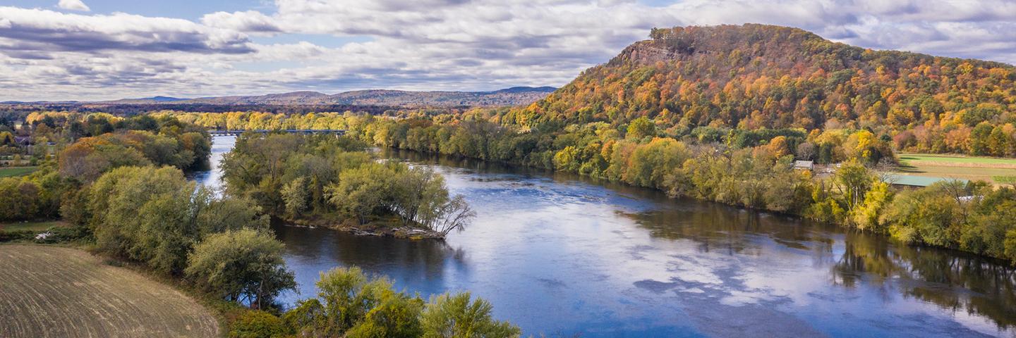
Conservation Effects Assessment Project (CEAP) watershed studies provide in-depth assessments of water quality, water availability, and soil concerns at a finer scale than national or regional assessments.
About CEAP Watershed Assessments
Water quality concerns related to agriculture affect private landowners, governments, and communities. Through CEAP, the Natural Resources Conservation Service (NRCS) works with agricultural producers and partners including other agencies, universities, conservation districts, and watershed groups to quantify the effects of voluntary conservation on factors such as water quality, water availability, and soil health in select small watersheds across the nation.
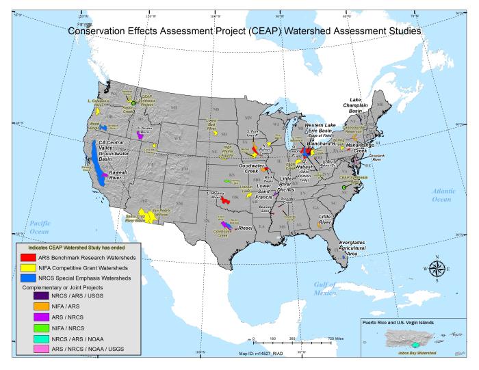
There are currently 24 active watershed studies. Findings from these studies strengthen the science base for voluntary conservation, improve conservation planning, refine methods and tools, and ultimately help USDA deliver more focused, strategic conservation opportunities to support productive agricultural lands and environmental benefits nationwide. Additional details on watershed studies are available on the CEAP Frequently Asked Questions page.
Download a copy of the CEAP Watershed Assessments Map as a .pdf or .jpg.
CEAP Watershed Publications and Relevant Tools
Reports, Articles, and Bibliographies
The below reports, journal articles, and bibliography provide data and associated insights on the effects of voluntary conservation in select watersheds. Within each category publications are organized in descending order by date.
Publications and Journal Special Issues
- The CEAP Watershed Assessment Studies Network, 2021 (23.7 MB)
- Special Issue: Measuring and Understanding the Effects of Conservation Within Watersheds, 2020, Journal of Soil and Water Conservation
- Journal of Soil and Water Conservation Volume 69, Issue 5, 2014 – Please note, this publication includes:
- Impact of the Agricultural Research Service Watershed Assessment Studies on the Conservation Effects Assessment Project Cropland National Assessment, 2014, Journal of Soil and Water Conservation
- A Decade of Conservation Effects Assessment Research by the USDA Agricultural Research Service: Progress Overview and Future Outlook, 2014, Journal of Soil and Water Conservation
- Impact of Weather and Climate Scenarios on Conservation Assessment Outcomes, 2014, Journal of Soil and Water Conservation
- Surface Soil Quality in Five Midwestern Cropland Conservation Effects Assessment Project Watersheds, 2014, Journal of Soil and Water Conservation
- Fine Sediment Sources in Conservation Effects Assessment Project Watersheds, 2014, Journal of Soil and Water Conservation
- NIFA-CEAP Watershed Synthesis Study, 2012
- Results from Cooperative State Research, Education, and Extension Service (CSREES) - Conservation Effects Assessment Project (CEAP) United States Watershed Projects, 2010, Journal of Soil and Water Conservation
- The Conservation Effects Assessment Project Special Issue, 2008, Journal of Soil and Water Conservation
- ARS Watershed Assessment Study Plan, 2004 (3.5 MB)
Individual Watershed Reports
- Twenty years of Conservation Effects Assessment in the St. Joseph River Watershed, Indiana, 2023, Journal of Soil and Water Conservation
- California Central Valley Groundwater Basin: Nitrate Leaching Field Scale Assessment Tools, 2021 (1.0 MB)
- California Central Valley Groundwater Basin: Nonpoint Source Pollution Assessment Tool, 2021 (0.9 MB)
- List of Published Papers for the South Fork Iowa River Watershed, 2021 (0.1 MB)
- Validating the Soil Vulnerability Index for a Claypan Watershed, 2016, Catena
- Science Note - Water Quality Effects and Placement of Pasture BMPs in the Spring Creek Watershed (Centre County, PA), 2014 (0.3 MB)
- Influence of Integrated Watershed-scale Agricultural Conservation Practices on Lake Water Quality, 2014, Journal of Soil and Water Conservation
- Locating Existing Best Management Practices Within a Watershed: The Value of Multiple Methods, 2013, Journal of the American Water Resources Association
- Spatial Considerations in Wet and Dry Periods for Phosphorus in Streams of the Fort Cobb Watershed, United States, 2013, Journal of the American Water Resources Association
- Hydrology and Water Quality of a Field and Riparian Buffer Adjacent to a Mangrove Wetland in Jobos Bay Watershed, Puerto Rico, 2012, Ecological Engineering
- Characterization of Land-Based Sources of Pollution in Jobos Bay, Puerto Rico: Status of Heavy Metal Concentration in Bed Sediment, 2012, Environmental Monitoring and Assessment
- A Baseline Assessment of the Ecological Resources of Jobos Bay, Puerto Rico, 2011, NOAA Technical Memorandum
- ARS Chesapeake Bay Research Intensifies, 2010, Agricultural Research
- Wood River Project Final Report, 2010 (2.9 MB)
- Choptank River Project Final Report, 2009 (3.8 MB)
- Federal-State Partnership Yields Success in Remote Sensing Analysis of Conservation Practice Effectiveness: Results from the Choptank River Conservation Effects Assessment Project, 2009, Journal of Soil and Water Conservation
- Sprague River CEAP Study Report, 2009 (5.2 MB)
- ARS's Quest To Improve the Chesapeake Bay, 2006, Agricultural Research
- Black Willow Cutting Survival in Streambank Plantings, Southeastern United States, 2006, Journal of the American Water Resources Association
- Cumulative Uncertainty in Measured Streamflow and Water Quality Data for Small Watersheds, 2006, Transactions of the American Society of Agricultural and Biological Engineers
- Long Term Water Quality Responses to Conservation Practices in Nested Coastal Plain Watersheds, 2006 (2.8 MB)
- The Costs and Benefits of Conservation Practices in Iowa, 2006, Iowa Ag Review Online
- St. Joseph River CEAP Watershed Update, 2005 (3.1 MB)
Individual Watershed Summaries
- Beasley Lake Watershed Summary, 2021 (1.5 MB)
- Blanchard River Watershed Summary, 2021 (1.2 MB)
- Choptank River Watershed Summary, 2021 (1.4 MB)
- Goodwin Creek Experimental Watershed Summary, 2021 (1.4 MB)
- Kaweah River Watershed Summary, 2021 (0.8 MB)
- Lake Champlain Basin Summary, 2021 (1.4 MB)
- Little River Watershed Summary, 2021 (1.8 MB)
- Little River Ditches & Lower St. Francis Watersheds Summary, 2021 (1.4 MB)
- Mahantango Creek Watershed Summary, 2021 (1.4 MB)
- Mark Twain/Salt River and Goodwater Creek Watersheds Summary, 2021 (1.3 MB)
- Riesel Watersheds/Grassland Research Summary, 2021 (0.8 MB)
- South Fork, Iowa River Watershed Summary, 2021 (1.3 MB)
- St. Joseph River Watershed Summary, 2021 (1.5 MB)
- Upper Snake/Rock Watershed Summary, 2021 (1.3 MB)
- Upper Washita River Watersheds Summary, 2021 (1.4 MB)
- Walnut Creek Watershed Summary, 2021 (1.2 MB)
- Western Lake Erie Basin, Upper Big Walnut Creek, and Upper Wabash River Summary, 2021 (1.0 MB)
Other Journal Articles
- Fighting Nitrate in the Trenches, 2012, Agricultural Research
- The Challenge of Documenting Water Quality Benefits of Conservation Practices: A Review of USDA-ARS's Conservation Effects Assessment Project Watershed Studies, 2011, Water Science and Technology
- Effects of Hydrology and Field Management on Phosphorus Transport in Surface Runoff, 2009, Journal of Environmental Quality
- Using Satellite Remote Sensing to Estimate Winter Cover Crop Nutrient Uptake Efficiency, 2009, Journal of Soil and Water Conservation
- Adapting Existing Models to Examine Effects of Agricultural Conservation Programs on Stream Habitat Quality, 2006, Journal of the American Water Resources Association
- Compilation of Measured Nutrient Load Data for Agricultural Land Uses in the United States, 2006, Journal of the American Water Resources Association
- Evaluation of the Importance of Channel Processes in CEAP-Watershed Suspended-Sediment Yields, 2006
- Practical Guidance for Discharge and Water Quality Data Collection on Small Watersheds, 2006, Transactions of the American Society of Agricultural and Biological Engineers
- STEWARDS—for Access to Vital Watershed Data, 2006, Agricultural Research
- Conservation: Are We Getting Our Money's Worth?, 2005, Agricultural Research
- Uncertainty in Measured Sediment and Nutrient Flux in Runoff from Small Agricultural Watersheds, 2005, Transactions of the American Society of Agricultural and Biological Engineers
- Comparison of Time-Based Sampling Strategies to Determine Nitrogen Loading in Plot-Scale Runoff, 2004, Transactions of the American Society of Agricultural and Biological Engineers
- Automated Storm Water Sampling on Small Watersheds, 2003, Applied Engineering in Agriculture
Fact Sheets: Science Notes
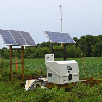
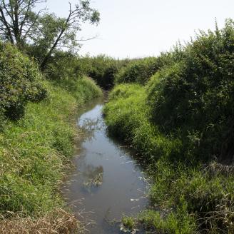
The below fact sheet provides insights on the effects of voluntary conservation within a specific watershed.
Webinars, Blogs, and Videos
The below Conservation Outcomes Webinar recordings feature scientists and other subject matter experts speaking on the effects of voluntary conservation for watersheds. Webinars are organized in descending order by date. Visit the Conservation Outcomes Webinar Series webpage to access information on upcoming webinars. Blogs and videos related to CEAP watershed assessments are also included below.
Conservation Outcomes Webinars
- October 24, 2024 - Lessons Learned for Water Quality Outcomes: Conservation Planning and Implementation for Healthy Watersheds: Webinar Recording (Captions Available), Presentation Slides, Additional Resources One-Pager
- August 22, 2024 – Yesterday's Phosphorus, Today's Water Quality: Conservation Insights from the USDA Legacy Phosphorus Assessment: Webinar Recording (Captions Available), Presentation Slides, Additional Resources One-Pager, Answers to Questions in Webinar Chat
- October 27, 2022 – Addressing Water Quality Outcomes Through Nutrient and Water Management: Webinar Recording, Presentation Slides, and Additional Resources One-Pager
- May 27, 2021 – When it Rains, it Pours: Conservation Considerations for Resiliency in a Changing Climate: Webinar Recording and Presentation Slides
- January 28, 2021 – Development of the Agricultural Conservation Planning Framework and Use by NRCS for Watershed Planning: Webinar Recording
- May 28, 2020 – Measuring and Understanding the Effects of Conservation within Watersheds: Webinar Recording
Blogs
- Can Agriculture Improve Water Quality? With Data-Driven Voluntary Conservation, the Answer is Yes.
- Ask the Expert: A Q&A on Water Quality Outcomes of Voluntary Conservation with Lisa Duriancik
Videos
USDA Legacy Phosphorus Assessment Project and Phosphorus Modeling Documents
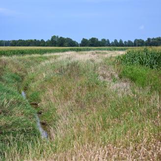
Water quality can be persistently degraded due to historical phosphorus sources, creating a challenge for watershed management. USDA's Legacy Phosphorus Assessment Project leverages watershed research to advance legacy phosphorus understanding and support water quality improvements.
USDA and partners are pursuing watershed modeling to extrapolate findings from field research and to assess effective legacy phosphorus mitigation strategies. To ensure that this modeling is broadly applicable, the USDA Legacy Phosphorus Assessment Project convened a workshop with partners to review how legacy phosphorus may be better represented in watershed models. The associated resources are the result of workshop presentations by model developers to describe how leading watershed models represent legacy phosphorus sources and, in some cases, processes, to account for these as part of watershed loads.
Learn more and access modeling resources by visiting the USDA Legacy Phosphorus Assessment Project webpage.
Tools
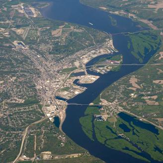
Through CEAP, USDA collaborates with partners from federal and state agencies, universities, and non-government organizations to deliver tools that support conservation assessment and planning across a range of landscapes and for a diversity of management goals. The below tool supports watershed-scale conservation planning for multiple states across the Midwest. Visit the Conservation Assessment and Planning Tools webpage to access additional CEAP-supported tools that may strengthen conservation assessment and planning efforts for your geographic area, land use, and management goals of interest.
Agricultural Conservation Planning Framework
The Agricultural Conservation Planning Framework (ACPF) is a web-based resource that supports targeted, strategic conservation planning at the small watershed scale. ACPF was developed by USDA’s Agricultural Resource Service in collaboration with NRCS.
ACPF consists of a framework of conservation priorities that may improve watershed health, databases for select hydrologic unit code (HUC)-12 watersheds across the upper Midwest, and a toolbox for use in ArcGIS. Users, including conservationists and other planners, may leverage this resource to identify high-risk areas for targeted conservation and to generate suites of site-specific conservation opportunities and associated output maps to inform future conservation efforts. ACPF data are currently available for Illinois, Iowa, Minnesota, and Wisconsin and parts of Indiana, Kansas, Missouri, Nebraska, North Dakota, and South Dakota.
Visit the ACPF website to learn more and directly access this resource with supporting materials.
CEAP Watershed Highlights
The below highlights represent recent resources and key findings released by CEAP on watershed-scale conservation efforts and outcomes. Visit this webpage frequently to see what's new, or browse the above publications to access hundreds of published resources from CEAP watershed assessments.
Lessons Learned for Water Quality Outcomes: Conservation Planning and Implementation for Healthy Watersheds
This Conservation Outcomes Webinar highlights lessons learned, synthesized from 13 watershed-scale studies of conservation effects conducted under CEAP by universities in partnership with NRCS and National Institute of Food and Agriculture (NIFA). Findings presented by Dr. Deanna Osmond.

Can Agriculture Improve Water Quality? With Data-Driven Voluntary Conservation, the Answer is Yes.
This blog by Chief Terry Cosby details some of the key ways USDA's Natural Resources Conservation Service supports producers and conservation partners in improving water quality and strengthening agricultural operations through voluntary conservation.

USDA Legacy Phosphorus Assessment Project
Water quality can be persistently degraded due to historical phosphorus sources. This new webpage features resources from USDA's Legacy Phosphorus Assessment Project, which leverages watershed research to advance legacy phosphorus understanding and support water quality improvements nationwide.
The Conservation Effects Assessment Project Watershed Assessment Studies Network
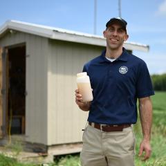
This 2021 publication details a network of watershed studies to quantify the effects of conservation practices on water quality, water availability, and soil health within small watersheds. Research findings to date are provided for 23 watershed studies at 18 locations.
Ask the Expert: A Q&A on Water Quality Outcomes of Voluntary Conservation with Lisa Duriancik
This Ask the Expert features Lisa Duriancik, CEAP Watersheds Lead. Lisa answers questions about efforts to quantify the effects of voluntary conservation on water quality in fields and selected watersheds and shares management recommendations to support both water quality and production goals.
Additional Resources
Conservation Effects Assessment Project (CEAP)
USDA’s Conservation Effects Assessment Project (CEAP) is a multi-agency effort led by the Natural Resources Conservation Service (NRCS) to quantify the effects of conservation practices across the nation’s working lands.
Learn MoreFrequently Asked Questions | Conservation Effects Assessment Project
This webpage provides answers to frequently asked questions about the Conservation Effects Assessment Project (CEAP).
Last Updated: June 9, 2023
Learn MorePublications | Conservation Effects Assessment Project
USDA’s Conservation Effects Assessment Project, CEAP, provides a suite of publications highlighting the effects of voluntary conservation across the nation’s working lands.
Learn MoreConservation Outcomes Webinar Series
The Conservation Outcomes Webinar Series provides key findings, data, and tools to support producers and partners in pursuing voluntary conservation efforts across the nation's working lands.
Learn More


