Reading and assessing the land is the first step in solving natural resource problems and sustaining our resources. In particular, soils provide the foundation for conservation work, and understanding the nature and properties of soils is critical to managing and conserving other natural resources.
On this page:
| NH's State Soil | Web Soil Survey | About Soil Surveys in NH | Soil Related Resources |
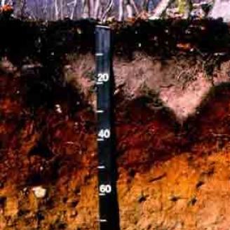
Marlow: The New Hampshire State Soil

What is Marlow?
The broad, gently sloping hillsides and summits of loamy drumlins provide some of the most productive soils for farmers and foresters in the harsh granite landscapes of New Hampshire. We call these important soils Marlow.
Marlow was established as a soil series in 1939 in the town of Marlow in Cheshire County, N.H.
It is a well-drained soil that has a very firm substratum of basal till that was deposited by the glacier during its last advances over the northeast about 15,000 years ago.

More about Marlow
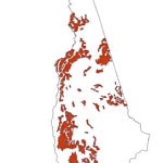
The Marlow series soil can be found throughout New Hampshire. This map shows the extent of Marlow Soil in New Hampshire.
From rock-lined rolling fields to the steep forested uplands of the White Mountains, Marlow soils underlie much of the picturesque backdrop of rural New Hampshire. Many of the State’s current farms are located on this same land that the early settlers cleared of trees and picked of stones. Marlow soils are also economically important soils for timber products, where the climax forest typically consists of shade-tolerant hardwoods such as sugar maple and beech.
Although not officially adopted as the State Soil by the Legislature, Marlow was chosen by a committee of New Hampshire Soil Scientists several years ago and is recognized as the State Soil nationally by the USDA's Natural Resources Conservation Service.

Where to Find Marlow
In a word "drumlins."
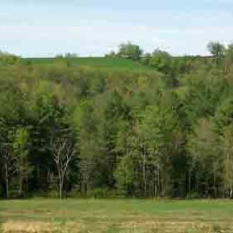
Marlow Soil is found on landscapes such as the one pictured above, on areas where the glacier left hills called "drumlins" (in background) and in the mountainous uplands of northern and western New Hampshire.
A drumlin, in the classical sense is an elongated hill in the shape of an inverted spoon or half-buried egg formed by glacial ice acting on underlying unconsolidated till or ground moraine.
Learn more about drumlins.
Web Soil Survey
Soil Survey data has been compiled nationally by the NRCS and is accessible online through the Web Soil Survey application. here you can find soil types that have been identified through Soil Surveys in your area.
Web Soil Survey
Web Soil Survey (WSS) provides soil data and information produced by the National Cooperative Soil Survey.
Learn MoreSoil Surveys in New Hampshire
Through its Soil Survey Program, the Natural Resources Conservation Service (NRCS) studies and inventories the soil resources of the Nation. In fact, it is a major responsibility of NRCS to conduct soil surveys on the private lands of the United States.
Soil Surveys contain information in the form of detailed soil maps, data tables, and text narratives that can be used in land-planning programs. Soil Surveys also contain predictions of soil behavior for selected land uses and highlights limitations and hazards inherent in the soil, improvements needed to overcome the limitations, and the impact of selected land uses on the environment.
Soil Surveys can help YOU!
The New Hampshire Soil Survey Program is a diverse and customer-sensitive program that strives to set a national example while serving the soil information needs of New Hampshire communities.
Who uses Soil Surveys?
- Farmers
- Foresters
- Planners from towns, regions, states
- Community officials
- Engineers
- Builders and developers
- Conservationists
- Teachers and students
Why Use Soil Surveys?
Sustaining soil resources for:
- Food production
- Forest products
- Land-use planning
- Water quality
- Wildlife habitat
Below you can find Soils resources for New Hampshire.

