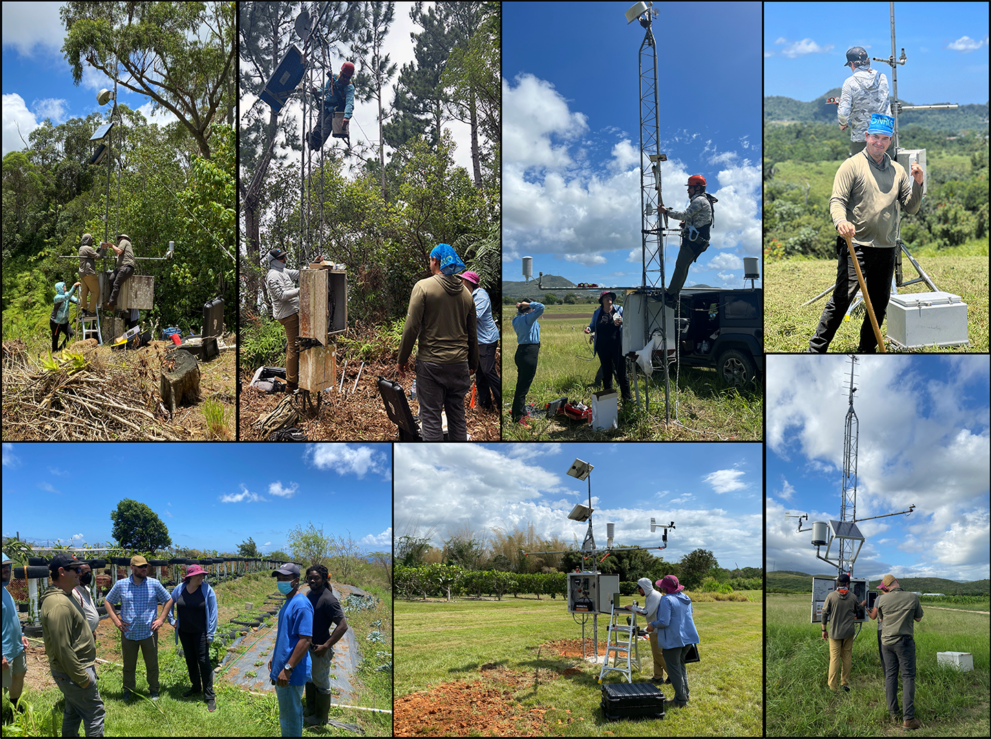
The Soil Climate Analysis Network (SCAN) soil climate monitoring program consisting of automated data collection sites across the U.S. The Caribbean Area Soils Division currently maintains 9 SCAN stations, 8 on Puerto Rico and one on St. Croix.
The system is designed to provide data to support natural resource assessments and conservation activities. The SCAN system focuses on agricultural areas of the U.S. and is composed of over 200 stations. A typical SCAN site monitors soil moisture content at several depths, air temperature, relative humidity, solar radiation, wind speed and direction, liquid precipitation, and barometric pressure. Data at SCAN sites are collected hourly and stored by a datalogger installed in an electronics enclosure.
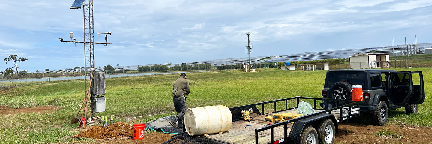
In April and May 2022, the Caribbean Area Soils team and scientists from the National Water and Climate Center repaired, upgraded and relocated our SCAN stations across Puerto Rico and the USVI. Hurricanes Irma and Maria in September 2017 caused severe damage to these stations and destroyed the St. John site. All were partially restored in 2018 (except for St. John and St. Croix, USVI).
During the recent update, the team replaced all sensors to the latest climate monitoring technology, beginning at the Isabela Agricultural Research Station (ARS), then moving to Combate in Cabo Rojo, Maricao State Forest, Mayagüez Tropical ARS, Guánica Dry Forest, Guilarte State Forest in Adjuntas, Juana Díaz UPR Agriculture Experiment State (AES), Corozal AES, and St. Croix, USVI, AES. The work included the removal of the St. John site at Cinnamon Bay, VI National Park, and the evaluation of areas for a new site in St. Thomas, USVI.
SCAN del Caribe
El programa de monitoreo del clima del suelo de la Red de Análisis del Clima del Suelo (SCAN, por sus siglas en inglés) consiste en sitios de recopilación de datos automatizados en los EE. UU. La División de Suelos del Área del Caribe actualmente mantiene 9 estaciones SCAN, 8 en Puerto Rico y una en St. Croix.
El sistema está diseñado para proporcionar datos para respaldar las evaluaciones de los recursos naturales y las actividades de conservación. El sistema SCAN se enfoca en áreas agrícolas de los EE. UU. y está compuesto por más de 200 estaciones. Un sitio típico de SCAN monitorea el contenido de humedad del suelo a varias profundidades, temperatura del aire, humedad relativa, radiación solar, velocidad y dirección del viento, precipitación líquida y presión barométrica. Los datos en los sitios de SCAN se recopilan cada hora y se almacenan en un registrador de datos instalado en un gabinete electrónico.
En abril y mayo de 2022, el equipo de Suelos del Área del Caribe y los científicos del Centro Nacional de Agua y Clima de NRCS repararon, actualizaron y reubicaron nuestras estaciones SCAN en Puerto Rico y las Islas Vírgenes Americanas. Los huracanes Irma y María en septiembre de 2017 causaron graves daños a estas estaciones y destruyeron el sitio de St. John. Todos fueron parcialmente restaurados en 2018 (excepto St. John y St. Croix, USVI).
Durante la actualización reciente, el equipo reemplazó todos los sensores con la última tecnología de monitoreo del clima, comenzando en la Estación de Investigación Agrícola (ARS) de Isabela y luego moviéndose a Combate en Cabo Rojo, Bosque Estatal de Maricao, Mayagüez ARS, Bosque Seco de Guánica, Estado de Guilarte Bosque en Adjuntas, Estado Experimental Agrícola (AES) de la UPR Juana Díaz, Corozal AES y St. Croix, USVI, AES. El trabajo incluyó la eliminación del sitio de St. John en Cinnamon Bay, Parque Nacional VI, y la evaluación de áreas para un nuevo sitio en St. Thomas, USVI.