
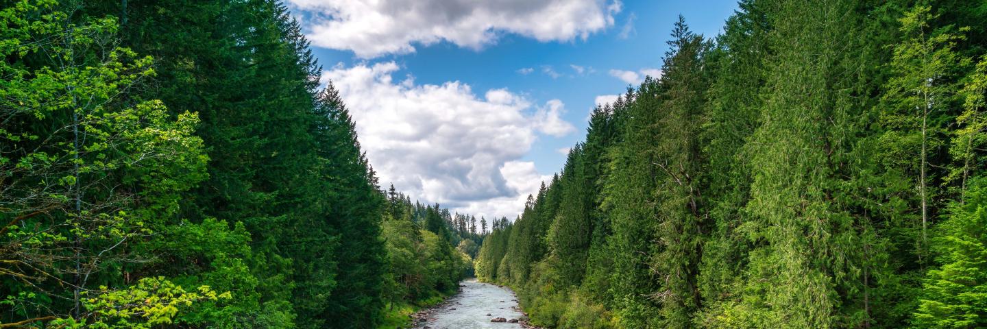
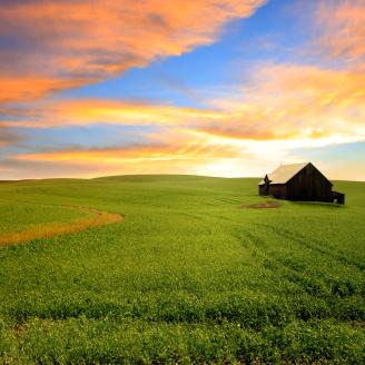
The Regional Conservation Partnership Program (RCPP) is a partner-driven approach to conservation that funds solutions to natural resource challenges on agricultural land.

By leveraging collective resources and collaborating on common goals, RCPP demonstrates the power of public-private partnerships in delivering results for agriculture and conservation.
RCPP projects fall under two different categories: RCPP Classic and RCPP Alternative Funding Arrangements (AFAs). RCPP Classic projects are implemented using NRCS contracts and easements with producers, landowners and communities, in collaboration with project partners. Through RCPP AFAs, NRCS provides funding to partners to support conservation activities with eligible producers and landowners on eligible land. RCPP AFA funding reimburses partners for conservation activities done for or on behalf of producers, landowners, or other entities.
Latest Information
RCPP Improvement Effort
USDA’s NRCS has identified ways to streamline and simplify RCPP, ease the burden on employees and partners, and help maximize flexibility for partners to leverage their investments with NRCS resources and capabilities.
RCPP Partners and Impact
1. Impact—RCPP applications must propose effective and compelling solutions that address one or more natural resource priorities to help solve natural resource challenges. Partners are responsible for evaluating a project’s impact and results.
2. Partner Contributions—Partners are responsible for identifying any combination of cash and in-kind value-added contributions to leverage NRCS’s RCPP investments. It is NRCS’s goal that partner contributions at least equal the NRCS investment in an RCPP project. Substantive partner contributions are given priority consideration as part of the RCPP application evaluation criteria.
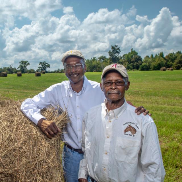
3. Partnerships and Management—Partners must have experience, expertise, and capacity to manage the partnership and project, provide outreach to producers, and quantify the environmental outcomes of an RCPP project. RCPP ranking criteria give preference to applicants that meaningfully engage historically underserved farmers and ranchers.
Interactive Map of Projects
See the 2020-2022 awarded projects
RCPP Conservation Activities
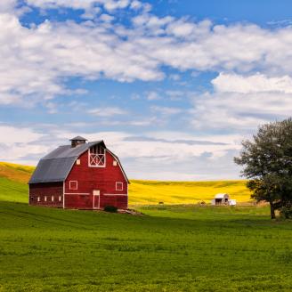
RCPP projects may include a range of on-the-ground conservation activities implemented by farmers, ranchers and forest landowners. These activities include:
- Land management/land improvement/restoration practices
- Land rentals
- Entity-held easements
- United States-held easements
- Public works/watersheds
A single RCPP project application can propose to employ any combination of these eligible activity types as part of an RCPP project.
For more information on RCPP easements, visit the RCPP easement page.
RCPP Funding Pools
RCPP funding is divided evenly among two funding pools:
Critical Conservation Areas
For projects in eight geographic areas chosen by the Secretary of Agriculture. These receive 50 percent of funding. Learn more about RCPP Critical Conservation Areas.

State/Multistate
For projects in a single state or across several states. These receive 50 percent of funding.
Who is Eligible
Partner Eligibility
Eligible organizations interested in partnering with NRCS on conservation projects can develop applications for the RCPP competition. The lead partner for an RCPP project is the entity that submits an application, and if selected for an award is ultimately responsible for collaborating with NRCS to successfully complete an RCPP project.
See here for details about what types of organizations are eligible to apply.
Producer and Landowner Eligibility
Once NRCS selects a project and executes an RCPP agreement with a lead partner, agricultural producers may participate in an RCPP project in one of two ways. First, producers may engage with project partners and delegate a willing partner to act as their representative in working with NRCS. Second, producers seeking to carry out conservation activities consistent with a RCPP project in the project’s geographic area can apply directly to NRCS.
Land Eligibility
RCPP projects must be carried out on agricultural or nonindustrial private forest land or associated land on which NRCS determines an eligible activity would help achieve conservation benefits (i.e., improved condition of natural resources resulting from implementation of conservation activities).
Eligible conservation activities may be implemented on public lands when those activities will benefit eligible lands as determined by NRCS and are included in the scope of an approved RCPP project.
More Information

How To Apply
Potential partners are invited to propose RCPP projects where NRCS and partners co-invest in impactful and innovative solutions to on-farm, watershed, and regional natural resource concerns.

Resources for Lead Partners
Resources to help awarded partners negotiate an RCPP Programmatic Partnership Agreement, Supplemental Agreements, and how to work with NRCS to implement conservation activities on the ground.

RCPP in Action
RCPP projects are making an impact across the country.

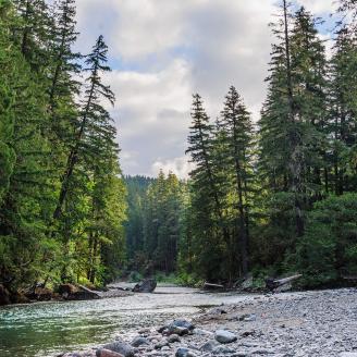
RCPP Easements
Conservation easements protect working agricultural lands, limit nonagricultural uses, and facilitate the restoration and enhancement of wetlands, grasslands, forestlands, and other natural resources.
Overview
The Regional Conservation Partnership Program (RCPP) promotes coordination of NRCS conservation activities with eligible partners that offer value-added contributions to expand our collective ability to address on-farm, watershed, and regional natural resource concerns. A Notice of funding Opportunity (NFO), calling for proposal submissions, is released approximately every year. Successful projects demonstrate innovative solutions to conservation challenges and provide measurable improvements and outcomes tied to the resource concerns they seek to address.
Please subscribe to Farmers.gov for NRCS program updates
RCPP Informational Webinar Series
An Introduction to RCPP
RCPP & Conservation Easements Brief
RCPP Public Works & Watershed Brief
Developing an RCPP Proposal Brief
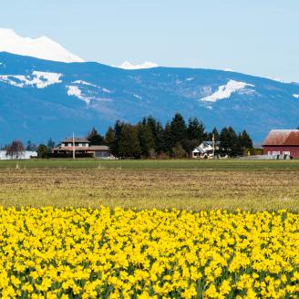
Washington RCPP Funded Projects

Below are the current Washington RCPP agreement projects:
1877 Poop Smart Clark
Lead Partner: Clark Conservation District
Project end date: Feb. 9, 2026
Cradled in the bend of the Columbia River, Clark County is full of contradictions: tidy small farms, exploding development, scenic recreational areas - and polluted waters. Clark CD has worked tirelessly to improve water quality and now, through a new partnership, proposes to target resource concerns in a fresh way.
The Poop Smart Clark RCPP is a Pollution Identification and Correction (PIC) program that utilizes expertise from local agencies and nonprofits to reduce sediment, nutrient, and bacteria runoff in Clark County. Through pollution source identification, targeted outreach, education, and implementation of on-the-ground practices, Poop Smart Clark connects landowners with the tools they need to correct pollution, drive social change and spur adoption of better management practices.
The East Fork Lewis River forms the hydrologic backbone of our county, reaching from the mountains to the Columbia River. This watershed is a vital link in the agricultural, standards for fecal coliform bacteria and temperature. This puts both Clark County residents and aquatic life at risk.
Clark CD will direct our highest priority efforts to this watershed. The goal of the Poop Smart Clark RCPP is to improve impaired water quality. Using technical and financial assistance to landowners, the five RCPP partners will reduce pathogen, nutrient, and sediment levels in area streams, as well as improve soil health and restore habitat on participating properties. Direct measurement of water quality will provide real time feedback on accomplishments. RCPP funds will be used in targeted, on the ground conservation projects that address the sources of the water quality resource concerns.
Additional Documents
2243 WRIA 1 Salmon Recovery and Water Quality 2.0
Lead Partner: Whatcom Conservation District
Project end date: July 10, 2026
Salmon and Orca recovery is the most critical conservation challenge in the Pacific Northwest. ESA listed species are critical to the economy of the region and to the culture, subsistence, and economic wellbeing of Native American Tribes. The Nooksack River is the northern most river in the Puget Sound Basin of Washington State. The upper watershed is largely intact and some of the most productive farmland in the world is found in the lower watershed.
A key group of partners have established a robust program to improve aquatic habitat and degraded plant conditions affecting ESA listed Salmon and Steelhead in the Pacific Northwest. Producers here face many economic challenges as well as conservation concerns. Water availability, flood control, urban growth, and water quality effects to downstream shellfish beds are just the beginning of what producers have to think about as they manage their farms. They are generally not opposed to conservation practices that benefit Salmon and Orca but have little time and even less money to put towards such work.
Recognizing this the partners have developed an innovative means to leverage local resources and expertise along with RCPP funding to make the implementation of habitat practices hands free and no cost to producers. The Salmon Recovery Plan for the Nooksack River watershed focuses on three practices: removing barriers to fish passage (396 Aquatic Organism Passage), placing large wood habitat structures in the stream channel (396 Stream Habitat Improvement and Management), and planting riparian buffers (391 Riparian Forest Buffer). These are the focus practices for this project. All provide not only benefits to fish but also to farms.
2382 Nooksack Watershed Restoration
Lead Partner: Lummi Nation
Project end date: Sept. 17, 2026
The goal of the Nooksack Watershed Restoration Project is to address the natural resource concerns of inadequate aquatic habitat for fish and water quality degradation.
The project will restore fluvial processes to improve ESA-listed salmonid spawning, rearing and holding habitat while increasing low flow and thermal refugia. Project objectives focus on root causes of habitat degradation, namely the lack of large, stable log jams that maintain habitat-forming processes. The project addresses habitat limiting factors identified in the WRIA 1 Salmonid Recovery Plan (lack of key habitats, low habitat diversity, high water temperature, high channel instability, and elevated fine sediment).
This project consists of five restoration projects split between two tribal partners - Lummi Natural Resources and Nooksack Natural Resources - working to recover two native chinook salmon populations essential to the recovery of ESA-listed Puget Sound chinook. Project objectives focus on the root causes of inadequate aquatic habitat for fish and water quality degradation, namely the lack of large, stable logjams that maintain habitat-forming processes. We will install 92 engineered logjams (ELJs), 55 feet of flood fencing, remove or lower 1,850 linear feet of riprap levee, and plant 38.05 acres of riparian trees.
1. Increase key habitat quality and diversity by creating pools with engineered logjams (ELJs).
2. Increase length of secondary channels (near-term) and side channels (longer-term).
3. Increase the availability of cold-water refuges (areas over 2C cooler than ambient).
4. Increase rearing habitat by re-connecting, creating and/or enhancing wetland and/or floodplain habitat.
5. Improve riparian forest conditions in and within 300 feet of the Historic Migration Zone. Over time, mature vegetation will reduce stream temperature.
Additional documents
2344 Fuel Break & forest Resilience Partnership
Lead Partner: Cascadia Conservation District
Project End Date: Nov. 26, 2026
The goal of this project is to improve and reduce risk to habitat in Eastern Washington’s Wenatchee Subbasin. The project will address priority resource concerns for the state including inadequate habitat for fish and wildlife, water quality degradation, and drought conditions. Through partner collaboration and implementing conservation practices in strategic locations, fish and wildlife habitat will become more resilient to wildfire, pest damage, drought and disease.
Cascadia will be project lead and partner with NRCS, state, local, and regional partners, to use RCPP flexibilities and innovative measures to incentivize landowner participation and increase environmental outcomes. The Wenatchee Valley is home to critical habitat for several endangered and sensitive species (ESA), as well as a thriving agricultural economy. Over 100 years of fire exclusion, past forest management, and development has resulted in an unhealthy forest landscape.
The Quantitative Wildfire Risk Assessment (QFRA), commissioned by USDA Forest Service, found the Wenatchee Valley is the highest risk community for catastrophic wildfire compared to all other communities in Washington and Oregon. Project partners have recently invested over 3 million dollars in planning efforts including, landscape evaluations, NEPA planning and risk modeling to determine where investments should occur to reduce risk to forest lands, ESA listed species and water resources.
These planning efforts are foundational to this proposal as they identified specific landscapes and projects where investment in forest restoration is strategic, adequately scaled, and urgently needed. Importantly, our existing collaboration has built strong working relationships and trust between our local, state, and federal partners to build landscapes and communities more resilient to wildfire and drought. We are prepared, technically competent, and passionate about providing resources to forest landowners to address an urgent need.
Additional Documents
2128 Palouse River Implementation
Partnership WRIA 34
Lead Partner: Palouse Conservation District
Project end date: Dec. 6, 2026
The Palouse River Watershed spans over five counties in Washington and Idaho and encompasses both fertile agriculture land and critical habitat for fish and wildlife. The goals of water quality work objectives will be integrated to compliment the three originally defined objectives:
1. Implement riparian buffers (continuation).
2. Implement conservation tillage and Farmed Smart certification (continuation).
3. Obtain conservation easements to protect prime farmland and Palouse Prairie vegetation communities (continuation).
4. Implement soil health management systems (expanded): Incentivize producers to move beyond conservation tillage by targeting practices such as precision nutrient management, cover crops, and no-till through the utilization of programs such as EQIP, CSP and CRP.
5. Mitigate flooding (expanded) – Implementing practices to mitigate flooding caused by straightening, incising, sedimentation, development, or poor upland management that affecting communities and landowners.
Partners and researchers are developing an innovative watershed planning tool to identify critical source areas of runoff and erosion that will be incorporated into the ranking criteria across both continued and expanded objectives to further optimize the effectiveness of Resources. Management Systems (RMS) level planning and practices for future RCPP applicants.
Additional Documents
2326 Middle Columbia Steelhead Partnership
Lead Partner: Yakama Nation
Project end date: April 2, 2027
This proposal addresses critical needs for integrated conservation and restoration of watersheds. The primary resource concerns are degradation of habitat, water quality and water quantity. This proposal will accelerate the recovery of Steelhead within the reservation and ceded lands of the Yakama Nation, including the Yakima, Klickitat, Rock and White Salmon River basins within the ESA designated Middle Columbia Steelhead ESU.
These actions will also benefit multiple other aquatic and riparian species, including coho, chinook, sockeye, Pacific lamprey, and important cultural plant species. Funds awarded under the RCPP will enable the Yakama Nation to coordinate actions from multiple resource management partners as much of the remaining aquifer as possible for the of the variability of water supplies and prepare for the uncertainties of climate change through operational and structural changes throughout the watershed. This includes large scale reservoir projects all the way down to individual producer projects. Kittitas County Conservation District (KCCD) is working within that framework assisting producers with on-farm and delivery irrigation practices and habitat practices to improve water use efficiency, water quality and fish habitat availability.
This proposal will replace six irrigation diversion structures with fish friendly structures opening up two miles of habitat, install three acres of riparian habitat; realize over 1000 acre/feet of annual water savings with four miles of piped/lined irrigation ditches and convert 1600 acres of cropland to sprinkler irrigation. Actions are grouped into three types: irrigation efficiency, habitat restoration, and water quality. Habitat actions will increase stream miles available for safe fish passage by removing barriers and screening irrigation diversions and restore riparian habitat. Irrigation efficiency actions include piping/lining open ditches, reducing/eliminating irrigation return flows and the installation of water measurement/management structures.
Water quality actions include eliminating irrigation return flows into steelhead waters and improving riparian habitat conditions. In summation, these actions will have a positive cumulative effect on ESA threatened species, Mid-Columbia steelhead, a critical species of cultural and ecological importance and will have a positive cumulative effect on irrigation water availability.
2725 Whatcom County Conservation Easement Program
Lead Partner: Whatcom County
Project end date: March 10, 2028
The Whatcom County Conservation Easement Program’s (CEP) purpose is to protect farmland, forestland, and important ecological areas to ensure economically viable natural resource industries that encourage environmental sustainability. Many of our valuable working and natural lands are zoned for rural development, placing increasing threats to our agricultural and forest industries.
These development threats also extend to our critical ecosystems and water resources. The CEP preserves these areas through the placement of permanent conservation easements. These easements not only protect the lands from development and other incompatible uses, but also incorporate conservation planning for sustainable farm and forest land management.
The CEP has also identified an equity issue in relation to beginning, minority and low-income farmers’ inability to afford the purchase of farmland in Whatcom County. As such, we aim to utilize conservation easements to make farmland more affordable for those who traditionally have not been able to gain and benefit from ownership access to productive farmland. The primary goal of this project is to protect farmland, forestland, and important ecological areas in Whatcom County. The secondary goal is to make farmland more affordable for beginning, minority, and low-income farmers.
This project identifies three objectives to complete these goals:
1. Purchase permanent conservation easements that restrict development and other incompatible uses on important agricultural lands, forestland, and ecological areas.
2. Develop conservation plans to help ensure the management of farms and forests is environmentally sustainable.
3. Develop and implement a buy-protect-sell strategy to acquire valuable farmland, purchase a conservation easement to reduce the price of the land, and sell to a beginning, minority, or low-income farmer.
Additional Documents
2843 Odessa Groundwater Replacement Program Lateral 80.6 and 84.7 On-Farm Project
Lead Partner: Columbia Basin Conservation District
Project end date: Mar. 25, 2028
This project is part of the Odessa Groundwater Replacement Program (OGWRP) located in the heart of the Columbia River Basin in Central Washington. The goal of this RCPP is to replace groundwater irrigation with Columbia River surface water for 11,180 acres of high-value irrigated farmland currently relying on the rapidly declining Odessa Subarea Aquifer, thereby helping to prevent source water depletion.
It is imperative that this new source of surface water is delivered as soon as possible in order to avoid an economic, social, and natural resource disaster. Without more reliable surface water, farmers will continue to be impacted by declining groundwater levels and will likely be forced to convert to dryland farming. Further, our goal is to conserve as much of the remaining aquifer as possible for the 12 communities that rely on it for their drinking water supply. As wells continue to fail, digging more and deeper wells is not a viable alternative. Both the water quantity and quality are compromised at current depths of the confined aquifer, with some wells now as deep as 2,400 feet.
To meet these goals, Grant County Conservation District’s (GCCD) objective is to leverage partner contributions, RCPP funds, and technical assistance to accelerate the construction of the on-farm projects on the EL 80.6 and 84.7 laterals. Once constructed, this project would deliver Columbia Basin Project (CBP) water from the East Columbia Basin Irrigation District’s (ECBID) canal to 13 farms totaling 11,180 acres, effectively removing 22 wells from pumping groundwater and conserving 33,540 acre-feet (10.9 billion gals) of water in the aquifer each year.
This proposal will build upon and leverage anticipated funding through the PL 83-566 program that is currently in development to construct ECBID laterals and pump stations. This proposal is requesting $6 million to specifically support the construction of the on-farm buildouts that will connect to the EL 80.6 and EL 84.7 system.
3149 Upper Yakima River Water Supply and Fish Habitat
Lead Partner: Kittitas Conservation District
Project end date: April 15, 2029
Plan (YBIP) is a 30-year water resiliency plan to protect and enhance fish and natural resources, improve water availability and reliability, establish more efficient water markets, manage the variability of water supplies, and prepare for the uncertainties of climate change through operational and structural changes throughout the watershed.
This includes large scale reservoir projects all the way down to individual producer projects. Kittitas County Conservation District (KCCD) is working within that framework assisting producers with onfarm and delivery irrigation practices and habitat practices to improve water use efficiency, water quality and fish habitat availability.
This proposal will replace six irrigation diversion structures with fish friendly structures opening up two miles of habitat, install three acres of riparian habitat; realize over 1000 acre/ feet of annual water savings with four miles of piped/lined irrigation ditches and convert 1600 acres of cropland to sprinkler irrigation. Actions are grouped into three types: irrigation efficiency, habitat restoration, and water quality.
Habitat actions will increase stream miles available for safe fish passage by removing barriers and screening irrigation diversions and restore riparian habitat. Irrigation efficiency actions include piping/ lining open ditches, reducing/eliminating irrigation return flows and the installation of water measurement/management structures.
Water quality actions include eliminating irrigation return flows into steelhead waters and improving riparian habitat conditions. In summation, these actions will have a positive cumulative effect on ESA threatened species, Mid- Columbia steelhead, a critical species of cultural and ecological importance and will have a positive cumulative effect on irrigation water availability.
Additional Documents:
2952 Odessa Groundwater Replacement Program EL 86.4 On-Farm Project
Lead Partner: Columbia Basin Conservation District
Project end date: July 25, 2029
This project is part of the Odessa Groundwater Replacement Program (OGWRP) located in the heart of the Columbia River Basin in Central Washington. The goal of this RCPP is to replace groundwater irrigation with Columbia River surface water for 5426 acres of high-value irrigated farmland currently relying on the rapidly declining Odessa Subarea Aquifer, thereby helping to prevent source water depletion.
It is imperative that this new source of surface water is delivered as soon as possible to avoid an economic, social, and natural resource disaster. Without more reliable surface water, farmers will continue to be impacted by declining groundwater levels and will likely be forced to convert to dryland farming. Further, our goal is to conserve as much of the remaining aquifer as possible for the 25 communities that rely on it for their drinking water supply. Both the water quantity and quality are compromised at current depths of the confined aquifer, with some wells now as deep as 2400 feet.
To meet these goals, Grant County Conservation District and the Columbia Basin Conservation District’s (CBCD) objective is to leverage partner contributions, RCPP funds, and technical assistance to accelerate the construction of the on-farm project on the EL 86.4 lateral. Once constructed, this project would deliver Columbia Basin Project (CBP) water from the East Columbia Basin Irrigation District’s (ECBID) canal to 12 farms totaling 5426 acres, effectively removing 16 wells from pumping groundwater and conserving 16,143 acre-feet (5.3 billion gals) of water in the aquifer each year.
This proposal will build upon funding through the Washington State Legislature to build the EL 86.4 mainline, utilizing RCPP to complete on-farm infrastructure. If this project is awarded, the EL 86.4 will be fully funded and begin implementation next year. This proposal requests $7.2 million to specifically support the construction of the on-farm build-out that will 2843 Odessa Groundwater more reliable surface water, farmers will continue to be impacted by declining groundwater levels and will likely be forced to convert to dryland farming. Further, our goal is to conserve as much of the remaining aquifer as possible for the 12 communities that rely on it for their drinking water supply.
As wells continue to fail, digging more and deeper wells is not a viable alternative. Both the water quantity and quality are compromised at current depths of the confined aquifer, with some wells now as deep as 2,400 feet. To meet these goals, Grant County Conservation District’s (GCCD) objective is to leverage partner contributions, RCPP funds, and technical assistance to accelerate the construction of the on-farm projects on the EL 80.6 and 84.7 laterals.
Once constructed, this project would deliver Columbia Basin Project (CBP) water from the East Columbia Basin Irrigation District’s (ECBID) canal to 13 farms totaling 11,180 acres, effectively removing 22 wells from pumping groundwater and conserving 33,540 acre-feet (10.9 billion gals) of water in the aquifer each year. This proposal will build upon and leverage anticipated funding through the PL 83-566 program that is currently in development to construct ECBID laterals and pump stations. This proposal is requesting $6 million to specifically support the construction of the on-farm buildouts that will connect to the EL 80.6 and EL 84.7 system.
3084 Odessa Groundwater Replacement Program EL 80.6 Landowner - Extension Mainline
Lead Partner: Columbia Basin Conservation District
Project end date: July 25, 2029
This project seeks funding to complete one of the nine lateral systems in the Odessa Groundwater Replacement Program (OGWRP) located in Central Washington. The finished EL 84.7 lateral will replace groundwater irrigation with Columbia River surface water for a total of 7138 acres currently relying on rapidly declining groundwater wells, thereby helping to prevent source water depletion.
Drilling deeper wells or converting to dryland crops are economic risks and won’t sequester as much carbon as irrigated production can through biomass accumulation. By reducing the extraction from deep groundwater wells, the aquifer can recharge naturally over time, maintaining its long-term viability.
This benefits the local communities who rely on it for their drinking water supply by ensuring a stable and reliable water supply for future generations. To meet these goals, Grant County Conservation District and the Columbia Basin Conservation District’s (CBCD) objective is to leverage partner contributions, RCPP funds, and technical assistance to accelerate the construction of the landowner extension mainline on the EL 84.7 lateral. Once constructed, this project would deliver Columbia Basin Project (CBP) water from the East Columbia Basin Irrigation District’s (ECBID) canal to an estimated 15 farms totaling 6773 acres, effectively removing at least 11 wells from pumping groundwater and conserving 17,190 acre-feet (5.6 billion gals) of water in the aquifer each year.
This proposal will build upon funding through the Washington State Legislature and CBCD’s already awarded RCPP project, to fund the remaining public system portion necessary for on-farm conservation benefits and additional on-farm infrastructure. If this project is awarded, EL 84.7 will be fully funded and begin implementation next year. This proposal requests $19.66 million to specifically support the construction of the landowner mainline extension and the associated on-farm buildouts for the EL 84.7 delivery system.
3136 Odessa Groundwater Replacement Program EL 84.7 Landowner - Extension Mainline
Lead Partner: Columbia Basin Conservation District
Project end date: July 25, 2029
This project seeks funding to complete one of the nine lateral systems in the Odessa Groundwater Replacement Program (OGWRP) located in Central Washington. The finished EL 84.7 lateral will replace groundwater irrigation with Columbia River surface water for a total of 7138 acres currently relying on rapidly declining groundwater wells, thereby helping to prevent source water depletion. Drilling deeper wells or converting to dryland crops are economic risks and won’t sequester as much carbon as irrigated production can through biomass accumulation. By reducing the extraction from deep groundwater wells, the aquifer can recharge naturally over time, maintaining its long-term viability.
This benefits the local communities who rely on it for their drinking water supply by ensuring a stable and reliable water supply for future generations. To meet these goals, Grant County Conservation District and the Columbia Basin Conservation District’s (CBCD) objective is to leverage partner contributions, RCPP funds, and technical assistance to accelerate the construction of the landowner extension mainline on the EL 84.7 lateral. Once constructed, this project would deliver Columbia Basin Project (CBP) water from the East Columbia Basin Irrigation District’s (ECBID) canal to an estimated 15 farms totaling 6773 acres, effectively removing at least 11 wells from pumping groundwater and conserving 17,190 acre-feet (5.6 billion gals) of water in the aquifer in order to enact a holistic, watershed based approach to addressing natural resource degradation.
This proposal will restore habitat to benefit 22.5 miles of main and side channels, reconnect 111 acres of floodplain, restore 80 acres of riparian habitat, install 9621 feet of fence, thin 10 acres of forest, plant 149 acres of native upland vegetation and treat 172 acres of weeds. The project will realize over 4602 acre/feet of annual water savings with 15.5 miles of piped/lined irrigation canals, 1170 acres of cropland converted to sprinklers, and replace 8 obsolete diversion dams/screens with fish friendly structures, opening up 2.4 miles of habit. Actions are grouped into 3 types: habitat restoration, irrigation efficiency, and water quality.
Habitat actions will restore aquatic/floodplain and upland habitat and increase fish passage. Irrigation efficiency actions include piping lining open ditches, reducing/eliminating irrigation return flows and the installation of water measurement. Water quality actions include eliminating irrigation spills into steelhead waters. In summation, these actions will have a positive cumulative effect on Mid-Columbia Steelhead, a critical species of cultural and ecological importance to the Yakama Nation.
3686 Adapting Stream Crossings in a Changing Climate for Fish and Farms
Lead Partner: Whatcom Conservation District
Project end date: Dec. 20, 2029
To improve fish habitat and access to fish habitat in the Nooksack watershed in northwest Washington State. Inadequate habitat in freshwater natal streams used by anadromous salmon species limits species recovery. The project will remedy barriers to fish passage by replacing barrier culverts with fish passable structures and will improve stream habitat by adding large wood to create cover and resting pools for fish.
Additional Documents:
Partner's Corner
Washington State Contact
Laura Williams, State RCPP Coordinator
laura.williams@usda.gov
509-323-2988 [Call: 509-323-2988]
Ready to get started?
Contact your local service center to start your application.
How to Get Assistance
Do you farm or ranch and want to make improvements to the land that you own or lease?
Natural Resources Conservation Service offers technical and financial assistance to help farmers, ranchers and forest landowners.
To get started with NRCS, we recommend you stop by your local NRCS field office. We’ll discuss your vision for your land.
NRCS provides landowners with free technical assistance, or advice, for their land. Common technical assistance includes: resource assessment, practice design and resource monitoring. Your conservation planner will help you determine if financial assistance is right for you.
We’ll walk you through the application process. To get started on applying for financial assistance, we’ll work with you:
- To fill out an AD 1026, which ensures a conservation plan is in place before lands with highly erodible soils are farmed. It also ensures that identified wetland areas are protected.
- To meet other eligibility certifications.
Once complete, we’ll work with you on the application, or CPA 1200.
Applications for most programs are accepted on a continuous basis, but they’re considered for funding in different ranking periods. Be sure to ask your local NRCS district conservationist about the deadline for the ranking period to ensure you turn in your application in time.
As part of the application process, we’ll check to see if you are eligible. To do this, you’ll need to bring:
- An official tax ID (Social Security number or an employer ID)
- A property deed or lease agreement to show you have control of the property; and
- A farm number.
If you don’t have a farm number, you can get one from USDA’s Farm Service Agency. Typically, the local FSA office is located in the same building as the local NRCS office. You only need a farm number if you’re interested in financial assistance.
NRCS will take a look at the applications and rank them according to local resource concerns, the amount of conservation benefits the work will provide and the needs of applicants. View Application Ranking Dates by State.
If you’re selected, you can choose whether to sign the contract for the work to be done.
Once you sign the contract, you’ll be provided standards and specifications for completing the practice or practices, and then you will have a specified amount of time to implement. Once the work is implemented and inspected, you’ll be paid the rate of compensation for the work if it meets NRCS standards and specifications.