
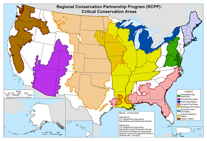
Critical Conservation Areas
Critical Conservation Areas (CCAs) are designated by the Secretary of Agriculture and represent an opportunity for many stakeholders to come together at a regional level to address common natural resource goals while maintaining or improving agricultural productivity.
Partners, working closely with NRCS producers and communities, define and propose projects that will achieve regional natural resource goals while also meeting complementary local conservation priorities.
CCA Priority Resource Concerns
Proposals within the CCA funding pool must address at least one of the priority resource concerns and must be limited to areas within counties that are within, or transected by, the published boundaries of the CCA. A table of priority resource concerns and link to CCA maps can be found below.
Chesapeake Bay Watershed
- Inadequate habitat
- Water quality degradation
Colorado River Basin
- Inadequate habitat
- Insufficient water/drought
- Soil quality degradation
- Water quality degradation
Great Lakes Region
- Inadequate habitat
- Water quality degradation
Longleaf Pine Range
- Degraded plant condition
- Inadequate habitat
- Water quality degradation
Mississippi River Basin
- Inadequate habitat
- Insufficient water/drought
- Water quality degradation
Northeast Forests and Waters
- Degraded plant condition
- Inadequate habitat
- Water quality degradation
Prairie Grasslands Region
- Degraded plant condition
- Excess water/flooding
- Inadequate habitat
- Insufficient water/drought
Western Waters
- Inadequate habitat
- Insufficient water/drought
- Water quality degradation