
10 Mile Lake Preliminary Investigative Findings Report
Sponsor: Barnes County Water Resource Board
Preliminary Investigation Findings Report
The purposes of the project are agricultural water management and flood prevention.
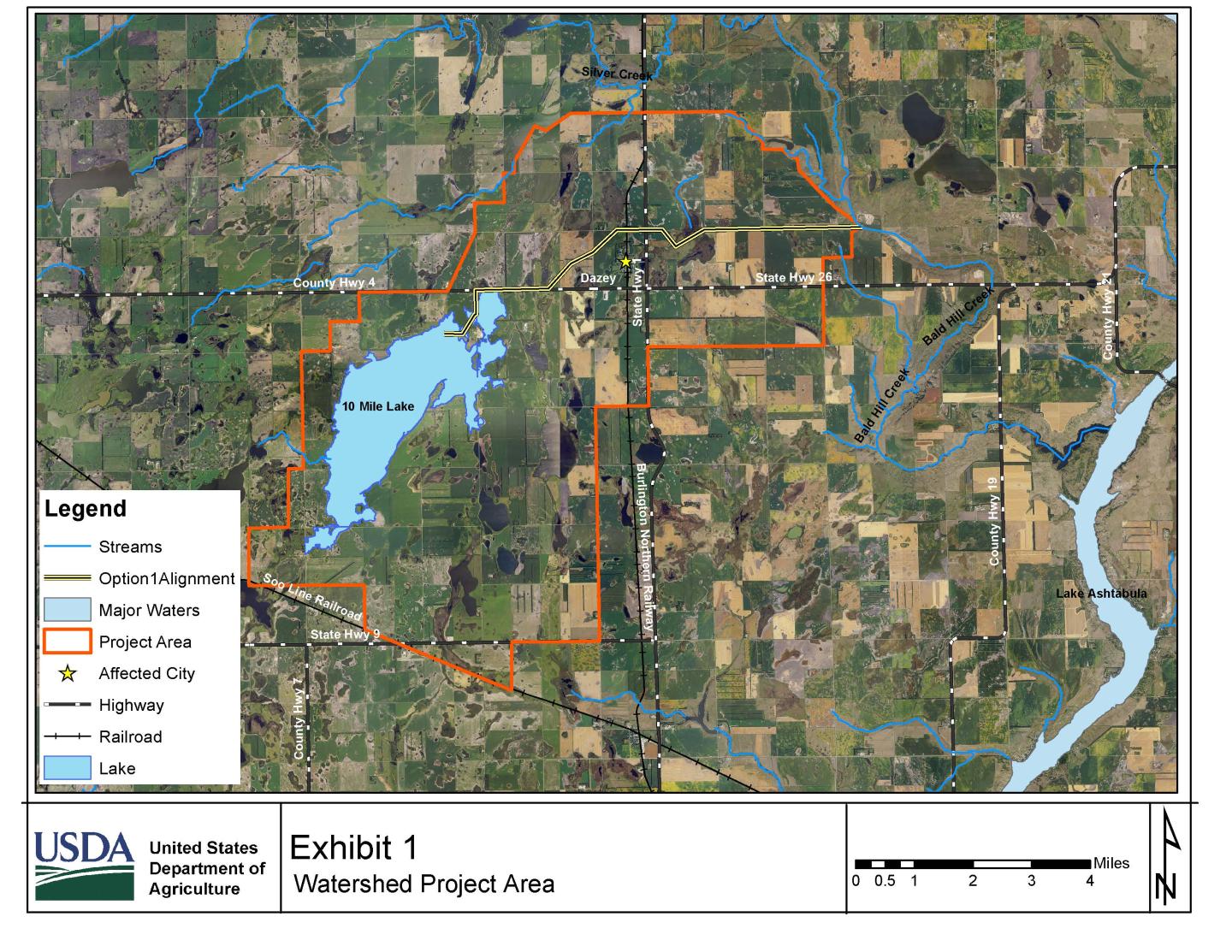
Due to a 30-year wet period, in addition to changes in farming practices, 10 Mile Lake has expanded in size from zero acres in 1957-62 to 3,000 acres currently, negatively impacting agricultural production. Groundwater flooding impacts approximately 26 farmsteads and 55 homes in the community of Dazey, including damages to septic systems
and/or water in basements due to the raised water table. High ground and surface water levels generates the PIFR – ND, the need for continual raising township roads, as well as re-surfacing and armoring road fills adjacent to new open water areas. Alternate routes taken because unsafe, or impassible roads have caused response times by
emergency services to increase.
Current Status
The Preliminary Investigation Findings Report was completed by NRCS in September 2024. The project was determined to be infeasible due to an insufficient Benefits to Costs ratio.