
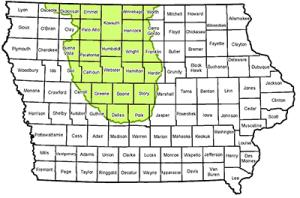
The Prairie Pothole Water Quality and Wildlife Program is a conservation funding opportunity for farmers in the Prairie Pothole Region, available through the Environmental Quality Incentives Program (EQIP).
When enrolled, producers are eligible for payment on cropped wetlands. NRCS offices accept program applications on a continuous basis. Occasionally, we set application cutoff dates as funding allows. The next application cutoff date for the Prairie Pothole Water Quality and Wildlife Program is Oct. 10, 2025. To apply or learn more, contact your local NRCS field office.
Background
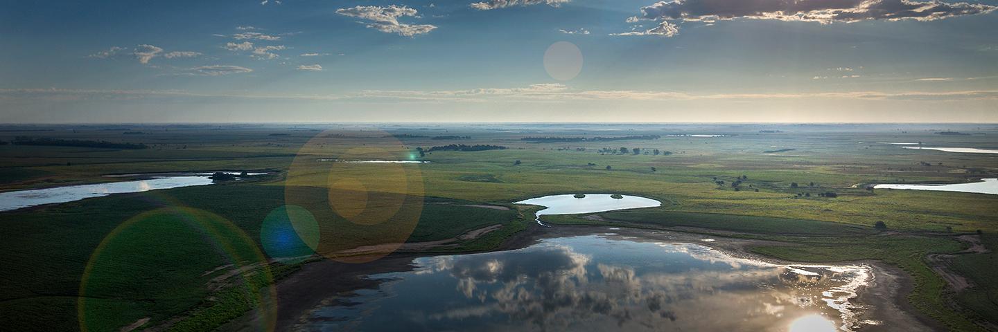
Water-saturated portions of cropland fields can cause environmental issues and financial losses for Iowa farmers in the Prairie Pothole Region. To help overcome these issues, USDA’s Natural Resources Conservation Service (NRCS) is offering the Prairie Pothole Water Quality and Wildlife Program to farmers in this area. The new program provides farmers an opportunity to implement conservation practices on wet areas.
How the Program Works
In Iowa, farmers may choose from three levels. Participants sign 5-year EQIP contracts and begin at a Level 1, 2 or 3 option, depending on whether their potholes are drained.
Where potholes have been drained, farmers will only have the Level 1 option. This involves implementing Conservation Cover the first year and maintaining wetland habitat the remaining years.
In areas where potholes remain, eligible producers will received five-year wetland wildlife habitat management payments at a Level 2 or 3. In Level 2, the producer ceases cropping a two-acre area or smaller and maintains the hydrology. In Level 3, the producer refrains from harvesting crops in a two-acre or smaller area during the primary nesting season.
Eligibility
To be eligible for the Prairie Pothole Water Quality and Wildlife Program, wetlands must be:
- Cropped Wetlands (Levels 1, 2 and 3)
- Two acres in size or less as identified on the National Wetlands Inventory (Levels 2 and 3)
- Intact Hydrology (Levels 2 and 3)
Monitoring
Examples of monitoring include but are not limited to: photo points with comparisons to surrounding wetlands, regeneration or breeding success, completing an annual management records log, documenting wildlife sightings, documenting location and species of invasive plants and condition of vegetative and structural treatments.
Practice Descriptions
Conservation Cover
Conservation cover is permanent vegetation, including a mix of introduced cool season grasses and legumes or native grasses and forbs, established on cropped wetland areas that need permanent vegetative cover to help improve water quality and provide wetland wildlife habitat.
The wetlands must be wholly or partially in cropland, typically two acres in size. Wetland hydrology has or could be diverted from the wetland.
Wetland Wildlife Habitat Management
Wetland Wildlife Habitat Management means retaining, developing or managing wetland habitat and communities for wetland wildlife. The purpose is to maintain habitat for waterfowl, shorebirds, fur-bearers, reptiles and amphibians, or other wetland-dependent flora or fauna.
The practice addresses wildlife habitat for wetter or water-saturated portions of cropland fields. The wetlands must be wholly or partially in cropland. Wetland hydrology has or could be diverted from the wetland through tiling, field or road ditching, diking or any other feature that removes wetland hydrology.
The planned area must be adequately covered with permanent and/or annual (non-persistent) vegetation. The cession of cropping and maintenance of hydrology provides adequate forage and cover in areas where normal cropland production restricts the growth of cover and forage sources. Monitoring assures hydrology is intact and provides wildlife water and habitat. Acres will be assessed and score 0.5 or greater as both Wetlands and Cropland on the Wildlife Habitat Evaluation Guide. Monitoring will be used to determine if the hydrology remains intact and cover is adequate and free of invasive weed species.