
What is a SNOTEL station?
The Natural Resources Conservation Service (NRCS) installs, operates, and maintains an extensive, automated system called SNOTEL (Snow Telemetry). SNOTEL is designed to collect snowpack data in the Western U.S. and Alaska.
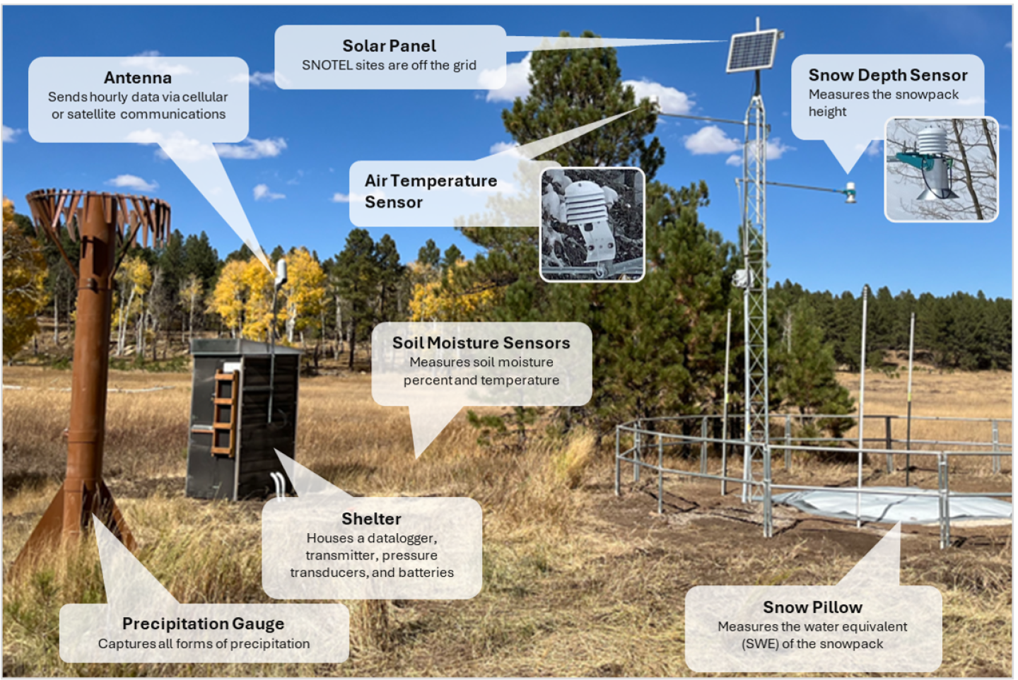
SNOTEL Sensors
Uses and Benefits
SNOTEL provides a reliable, cost-effective way to collect snowpack data needed to produce water supply forecasts and support resource management across the West. Whether used during normal conditions, to mitigate droughts, or to predict flooding, SNOTEL is essential to water management. A standard SNOTEL site measures and records hourly data on snow depth, snow water equivalent, precipitation, air temperature, soil moisture, and soil temperature. These data are free and available to the public.
Data collected and transmitted by SNOTEL stations and from manual collection sites are processed for quality control and are available on the Utah Snow Survey web site. These data and products are used by water managers, farmers, ranchers, recreationists, emergency management, government, researchers, dam operators, private entities, and others to efficiently manage and use Utah’s water resources.
Learn More
Utah Snow Survey Program
Utah’s Snow Survey Program Team works to provide mountain snowpack data and streamflow forecasts from across the state. This information can be a valuable tool for conservation planning, water supply management, flood control, drought and avalanche prediction, and recreation.
Utah Individual Site and Basin Time-Series Graphs
The following location-specific data provides snow water equivalent, precipitation, air temperature, and soil moisture for individual sites and basins in Utah.