
AR Land Use/Land Cover
Land Use/Land Cover
These maps were generated using the Natural Resources Conservation Service State Soil Geographic Database (STATSGO) using soils of capability class of III, IV, and V as the criteria for marginal lands. Soil capability Classes VI, VII, and VII are economically prohibitive due to steepness of slope, depth to bedrock, or other limitation and have been excluded. The dataset was overlaid and clipped using Gap Analysis Program (GAP)/Land Use Land Cover (LULC) data to produce marginal lands presently in forest, pasture, and crop. The visual map displays the approximate locations of these land covers. Acreage data for land use was generated through the 1997 National Resources Inventory (NRI). This acreage does not include federal agency managed lands or lands enrolled in federal conservation programs.
Land capability classification shows, in a general way, the suitability of soils for most kinds of field crops. Crops that require special management are excluded. The soils are grouped according to their limitations for field crops, the risk of damage if they are used for crops, and the way they respond to management. The criteria used in grouping the soils do not include major and generally expensive land forming that would change slope, depth, or other characteristics of the soils, nor do they include possible but unlikely major reclamation projects. Capability classes are designated by the numbers I through VIII. The numbers indicate progressively greater limitations and narrower choices for practical use. Capability classification is not a substitute for interpretations that show suitability and limitations of groups of soils for rangeland, for woodland, and for engineering purposes.
Land Use
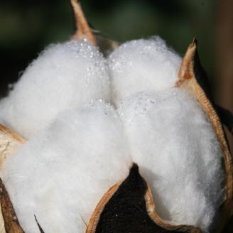
Cropland
Cropland includes areas used for the production of adapted crops for harvest. Two subcategories of cropland are recognized: cultivated and non-cultivated. Cultivated cropland comprises land in row crops or close-grown crops and also other cultivated cropland, for example, hay land or pastureland that is in a rotation with row or close-grown crops. Non-cultivated cropland includes permanent hay land and horticultural cropland.
Per the 2007 National Resources Inventory there are 357,023,500 acres of cropland in the United States (25.5 million in Iowa). The cropland acres produce most of the food and fiber production for the US and exports to other countries.
It is the NRCS role to provide national leadership and technical assistance for the conservation of our natural resources to ensure the continued production of food and fiber.
Major natural resource concerns facing cropland include: (1) erosion by wind and water, (2) maintaining and enhancing soil quality, (3) water quality from nutrient and pesticides runoff and leaching, and (4) managing the quantity of water available for irrigation.
Range & Pasture
Grazing Lands
Pasture lands are diverse types of land where the primary vegetation produced is herbaceous plants and shrubs. These lands provide forage for beef cattle, dairy cattle, sheep, goats, horses and other types of domestic livestock. Also many species of wildlife, ranging from big game such as elk to nesting song birds such as meadowlarks, depend on these lands for food and cover.
Primary economic outputs include livestock production, but wildlife values are also a major economic consideration for these lands, especially range lands. Environmental values of these lands are extensive and provide many essential ecosystem services, such as clean water, wildlife and fish habitat, and recreation opportunities. Scenic, cultural, and historic values of these lands provide not only economic benefits, but also quality of life values cherished by many.
Other Grazing Lands
Most grazing lands are considered either range or pasture, but grazing lands also include grazed forest lands, grazed croplands, haylands, and native/naturalized pasture. These other land use types make up an additional 106 million acres of privately owned grazing lands, or about 17% of the total U. S. grazing lands. These other types of grazing lands provide a significant forage resource for U. S. livestock production.
Grazing Lands Conservation Initiative
Healthy pasturelands provide livestock products, flood protection, wildlife habitat, purification of air and carbon sequestration. These lands also provide aesthetic value, open space and vital links in the enhancement of rural social stability and economic vigor.
Arkansas has 34,434 farms with more than 3.6 million acres of pastureland, excluding woodland pasture, according to the 2002 Census of Agriculture.
The Natural Resources Conservation Service (NRCS) offers several programs to help landowners address natural resource concerns related to pasture management.
NRCS grassland specialists and conservation planners work with farmers on resource assessments of pastures to help design effective grazing systems.
Assistance available includes:
Maintaining and improving private grazing land and its management;
Implementing grazing land management technologies;
Protecting and improving the quality and quantity of water;
Maintaining and improving wildlife habitat;
Enhancing recreational opportunities;
Maintaining and improving the aesthetic character of private grazing land;
Identifying opportunities and encouraging diversification; and
Encouraging the use of sustainable grazing systems.
All owners and managers of private grazing land are eligible to receive technical assistance from NRCS.
Grazing lands technical assistance addresses one of Arkansas' important resources. NRCS has four full-time grazing land specialists on staff and another 56 employees who spend more than half of their time providing assistance to grazing operations.
The following practices are a few of the key tools used by NRCS to improve pastureland in Arkansas
- Prescribed Grazing
- Filter Strips
- Alternative Livestock Watering
- Heavy Use Areas
- Nutrient Management
- Electric Fencing
Forestry
Forestry
The Natural Resources Conservation Service (NRCS) and its partners, such as State forestry agencies and other Technical Service Providers (TSPs), provide forestry-related assistance to private landowners and Tribes to plan and implement conservation practices and address resource concerns on their forest, woodland, farm, or ranch.
The Environmental Quality Incentives Program (EQIP) is available to help participants address a wide range of resource concerns on forest land and other land uses. Click here to see forestry practices available through EQIP and the application/implementation process.
For example:
Thin dense stands of trees;
Control invasive and noxious weeds/brush/trees;
Develop, protect, or enhance wildlife habitat;
Reduce the threat of wildfire by treating slash and installing fire breaks;
Plant trees and other grasses/shrubs to restore forest ecosystems;
Improve water quality by installing riparian forest buffers; and
Reduce soil erosion and energy usage by establishing windbreaks/shelterbelts on cropland and building sites.
Before applying for financial assistance through EQIP for your forest or woodland, you should develop a forest management plan. To get started, contact your Arkansas Forestry Commission county forester, Arkansas Game and Fish Commission private lands biologist or local USDA service center to find a forester near you. Your State forestry agency may be able to help you develop a Forest Stewardship Plan (a type of forest management plan).
The Conservation Stewardship Program (CSP) and Agricultural Conservation Easement Program (ACEP) may also be helpful for private forest landowners. The USDA Farm Service Agency's Conservation Reserve Program may also be helpful.
Additional Information
Memorandum of Understanding between the Arkansas Forestry Commission and the USDA Natural Resources Conservation Service and the Arkansas Forestry Assocation, American Tree Farm System
Arkansas Department of Agriculture Forestry Division (formerly Arkansas Forestry Commission)
Arkansas Game and Fish Commission
Arkansas Forestry Association