
Definitions of soil and soil survey, information on careers, some basics on soil formation and classification, and a soil science glossary.

Quick Links
What is Soil?
What is Soil Survey?
Careers in Soil Science
Soil Formation and Classification
Soil Science Glossary (from the Soil Science Society of America)
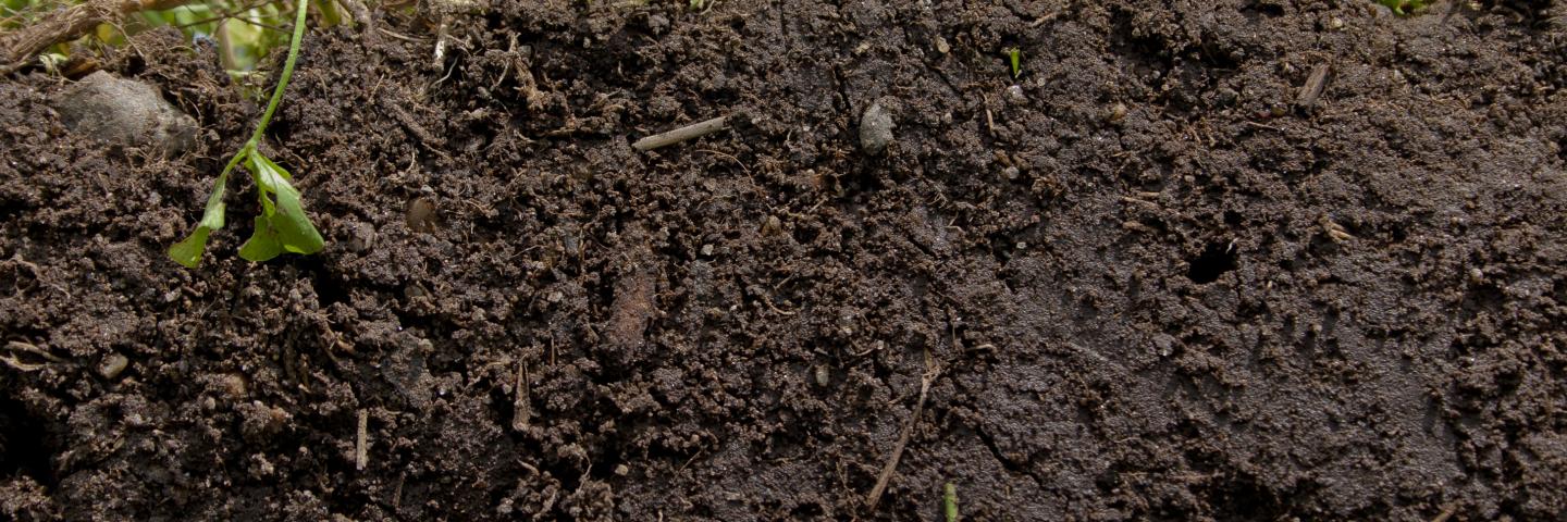
What is Soil?
This definition is from the Soil Science Society of America.
soil - (i) The unconsolidated mineral or organic material on the immediate surface of the Earth that serves as a natural medium for the growth of land plants. (ii) The unconsolidated mineral or organic matter on the surface of the Earth that has been subjected to and shows effects of genetic and environmental factors of: climate (including water and temperature effects), and macro- and microorganisms, conditioned by relief, acting on parent material over a period of time. A product-soil differs from the material from which it is derived in many physical, chemical, biological, and morphological properties and characteristics.
This definition is from Soil Taxonomy, second edition.
soil - Soil is a natural body comprised of solids (minerals and organic matter), liquid, and gases that occurs on the land surface, occupies space, and is characterized by one or both of the following: horizons, or layers, that are distinguishable from the initial material as a result of additions, losses, transfers, and transformations of energy and matter or the ability to support rooted plants in a natural environment.
The upper limit of soil is the boundary between soil and air, shallow water, live plants, or plant materials that have not begun to decompose. Areas are not considered to have soil if the surface is permanently covered by water too deep (typically more than 2.5 meters) for the growth of rooted plants.
The lower boundary that separates soil from the nonsoil underneath is most difficult to define. Soil consists of horizons near the Earth's surface that, in contrast to the underlying parent material, have been altered by the interactions of climate, relief, and living organisms over time. Commonly, soil grades at its lower boundary to hard rock or to earthy materials virtually devoid of animals, roots, or other marks of biological activity. For purposes of classification, the lower boundary of soil is arbitrarily set at 200 cm.
What is Soil Survey?
This definition is from the Soil Science Society of America:
soil survey - (i) The systematic examination, description, classification, and mapping of soils in an area. Soil surveys are classified according to the kind and intensity of field examination. (ii) The program of the National Cooperative Soil Survey that includes developing and implementing standards for describing, classifying, mapping, writing, and publishing information about soils of a specific area.
Expanded Definition and Uses
Soil survey, or soil mapping, is the process of classifying soil types and other soil properties in a given area and geo-encoding such information. It applies the principles of soil science, and draws heavily from geomorphology, theories of soil formation, physical geography, and analysis of vegetation and land use patterns. Primary data for the soil survey are acquired by field sampling and by remote sensing. Remote sensing principally uses aerial photography but LiDAR and other digital techniques steadily gaining in popularity. In the past, a soil scientist would take hard-copies of aerial photography, topo-sheets, and mapping keys into the field with them. Today, a growing number of soil scientists bring a rugidized tablet computer and GPS into the field with them. The tablet may be loaded with digital aerial photos, LiDAR, topography, soil geo-data-bases, mapping keys, and more.
The information in a soil survey can be used by the public as well as the scientific community. For example, farmers and ranchers can use it to help determine whether a particular soil type is suited for crops or livestock and what type of soil management might be required. An architect or engineer might use the engineering properties of a soil to determine whether or not it was suitable for a certain type of construction. A homeowner may even use the information for maintaining or constructing their garden, yard, or home.
Soil Survey Components
Typical information in a county soil survey includes:
- A brief overview of the county’s geography.
- A general soil map with a brief description of each of the major soil types found in the county along with their characteristics.
- Detailed aerial photographs with specific soil types outlined and indexed.
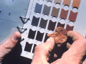
- Photographs of some of the typical soils found in the area.
- Tables containing general information about the various soils such as total area, comparisons of production of typical crops and common range plants. They also include extensive interpretations for land use planning such as limitations for dwellings with and without basements, shallow excavations, small commercial buildings, septic tank adsorptions, suitability for development, construction, and water management.
- Tables containing specific physical, chemical, and engineering properties such as soil depth, soil texture, particle size and distribution, plasticity, permeability, available water capacity, shrink-swell potential, corrosion properties, and erodibility.
The term soil survey may also be used to describe the published results. In the United States, these surveys were once published in book form for individual counties by the National Cooperative Soil Survey. Today, soil surveys are no longer published in book form; they are published to the web and can be freely accessed by the public on NRCS’ Web Soil Survey (WSS), where a person can create a custom soil survey. By making the data and information available online, it allows for the rapid flow of the latest soil information to the user. In the past, it could take years to publish a paper soil survey sometime making the published information almost obsolete. Many of the published manuscripts have been scanned for historical purposes.
Understanding the Value
Soil lies beneath each activity.
Soil surveys commonly identify the more important soil characteristics that determine the limitations and qualities of the soil. These interpretations are designed to warn of possible soil related hazards in an area. Knowledge of soil landscapes, soil formation, and the various soil properties and function has expanded with a classification system oriented to the interpretations of the soil survey. Various divisions and subdivisions of the basic system of classification called soil taxonomy provide a basis for application of the information to engineering and agricultural uses of the soil. Information about soil properties provides a basis for assessing risks and hazards when making land use decisions. Additionally, during the soil inventory process, we learn the relationship of various landscapes features to soil geography. Identifying and mapping soil landscape relationships strengthen soil interpretations and the associated interpretations involving hydrology and landscape stability. The separation of geology and soils is not a clear division, but rather the interpretations enhance the delivery of information through the connection of soils to the landscape and the corresponding geology.
Careers in Soil Science

What is a soil scientist?
A soil scientist studies the upper few meters of the Earth’s crust in terms of its physical and chemical properties; distribution, genesis and morphology; and biological components. A soil scientist needs a strong background in the physical and biological sciences and mathematics.
What is soil science?
Soil science is the science dealing with soils as a natural resource on the surface of the Earth including soil formation, classification, and mapping; physical, chemical, biological, and fertility properties of soils; and these properties in relation to the use and management of the soils.
Soils play multiple roles in the quality of life throughout the world. Soils are not only the resource for food production, but they are the support for our structures, the medium for waste disposal, they maintain our playgrounds, distribute and store water and nutrients, and support our environment. They support more life beneath their surface than exists above. They facilitate the life cycle of growth, sustenance and decay. They influence the worldwide distribution of plants, animals, and people.
What does a soil scientist do?
Soil scientists work for federal and state governments, universities, and the private sector. The job of a soil scientist includes collection of soil data, consultation, investigation, evaluation, interpretation, planning or inspection relating to soil science. This career includes many different assignments and involves making recommendations about many resource areas.
A soil scientist needs good observation skills to be able to analyze and determine the characteristics of different types of soils. Soil types are complex and the geographical areas a soil scientist may survey are varied. Aerial photos or various satellite images are often used to research the areas. Computer skills and geographic information systems help the scientist to analyze the multiple facets of geomorphology, topography, vegetation, and climate to discover the patterns left on the landscape.
Soil scientists work in both the office and field. The work may require walking over rough and uneven land and using shovels and spades to gather samples or examine a soil pit exposure.
Soil scientists work in a variety of activities that apply soil science knowledge. This work is often done with non-soil science professionals. A soil scientist's job may involve:
- conducting general and detailed soil surveys
- determining the hydric (wetness) characteristics of the soil
- recommending soil management programs
- helping to design hydrologic plans in suburban areas
- monitoring the effects of farm, ranch, or forest activities on soil productivity
- giving technical advice used to help plan land management programs
- predicting the effect of land management options on natural resources
- preparing reports describing land and soil characteristics
- advising land managers of capabilities and limitations of soils (e.g., timber sales, watershed rehabilitation projects, transportation planning, soil productivity, military maneuvers, recreation development)
- training other personnel
- preparing technical papers and attending professional soil science meetings
- conducting research in public and private research institutions
- managing soils for crop production, forest products and erosion control management.
- evaluating nutrient and water availability to crops
- managing soils for landscape design, mine reclamation, and site restoration
- investigating forest soils, wetlands, environmental endangerment, ecological status, and archeological sites
- assessing application of wastes including non-hazardous process wastes (residue and sludge management)
- conducting studies on soil stability, moisture retention or drainage, sustainability, and environmental impact
- assessing environmental hazards, including hazardous waste sites that involve soil investigation techniques, evaluation of chemical fate and transport phenomena, and remediation alternatives
- regulating the use of land and soil resources by private and public interests (government agencies)
These are some of the activities which soil scientists regularly practice. This work is most often conducted in coordination with other professionals with lesser training and knowledge of soil systems.
Well-trained soil scientists are in high demand for a wide array of professional positions with public agencies or private firms. Here are some specific examples of positions currently held by soil science graduates from just one university over the past 10 years.
-
Wetland specialist

- Watershed technician
- Hydrologist with Board of Health
- Environmental technician
- State soil and water quality specialist
- Soil Conservationist
- County Agricultural Agent
- Landscaping business
- Farming
- On-site evaluation
- Crop consultant
- Soil scientist, mapping and interpretation, U.S. Department of Agriculture
- Research technician
- Conservation planner
- District marketing manager for an agricultural firm
- County conservationist
- Crop production specialist
- Research scientist
What kind of people become soil scientists?
People that become soil scientists usually have one or more of the following characteristics:
- love of science
- enjoy working outdoors
- enthusiasm for maps and relationships in nature
- desire to be an integral in environmental decisions related to soil conservation, land use, water quality, or waste management
- willingness to communicate their knowledge about soils and the environment to all aspects of society
- hunger for answers to questions and solutions to problems in agricultural and environmental settings
- desire to contribute to the success of others
How do people become soil scientists?
Most soil scientists have earned at least a bachelor degree from a major agricultural university. At many universities, two choices are available for specialized training in soils. The Soil Science option prepares students to enter the agricultural sector as farm advisors, crop consultants, soil and water conservationists, or as representatives of agricultural companies. The Environmental Soil Science option prepares soil scientists for careers in environmental positions dealing with water quality concerns, remediation of contaminants or for on-site evaluation of soil properties in construction, waste disposal, or recreational facilities.
How do people become soil scientists with USDA?
The minimum requirement for a soil scientist position at USDA–NRCS or USDA Forest Service is a 4-year Bachelor of Science degree that includes 30 semester hours in the natural sciences (e.g., biological, physical, and earth science) and 15 semester hours in soil science (e.g., soil genesis and morphology, soil chemistry, soil physics, and soil fertility). Most of the major universities that still have a soil science program now offer soils courses only at the graduate level.
Where do you find career opportunities?
Soil Science Society of America
Office of Personnel Management - Openings for Federal soil scientist positions. Specific qualifications are listed for each vacancy. Search for the 0470 job series to find all soil scientist eligible vacancies.
Soil Formation and Classification
The National Cooperative Soil Survey identifies and maps over 20,000 different kinds of soil in the United States. Most soils are given a name, which generally comes from the locale where the soil was first mapped. Named soils are referred to as soil series.
Soil survey reports include the soil survey maps and the names and descriptions of the soils in a report area. These soil survey reports are published by the National Cooperative Soil Survey and are available to everyone.
Soils are named and classified on the basis of physical and chemical properties in their horizons (layers). “Soil Taxonomy” uses color, texture, structure, and other properties of the surface two meters deep to key the soil into a classification system to help people use soil information. This system also provides a common language for scientists.
Soils and their horizons differ from one another, depending on how and when they formed. Soil scientists use five soil factors to explain how soils form and to help them predict where different soils may occur. The scientists also allow for additions and removal of soil material and for activities and changes within the soil that continue each day.
Soil Forming Factors
Parent material. Few soils weather directly from the underlying rocks. These “residual” soils have the same general chemistry as the original rocks. More commonly, soils form in materials that have moved in from elsewhere. Materials may have moved many miles or only a few feet. Windblown “loess” is common in the Midwest. It buries “glacial till” in many areas. Glacial till is material ground up and moved by a glacier. The material in which soils form is called “parent material.” In the lower part of the soils, these materials may be relatively unchanged from when they were deposited by moving water, ice, or wind.
Sediments along rivers have different textures, depending on whether the stream moves quickly or slowly. Fast-moving water leaves gravel, rocks, and sand. Slow-moving water and lakes leave fine textured material (clay and silt) when sediments in the water settle out.
Climate. Soils vary, depending on the climate. Temperature and moisture amounts cause different patterns of weathering and leaching. Wind redistributes sand and other particles especially in arid regions. The amount, intensity, timing, and kind of precipitation influence soil formation. Seasonal and daily changes in temperature affect moisture effectiveness, biological activity, rates of chemical reactions, and kinds of vegetation.
Topography. Slope and aspect affect the moisture and temperature of soil. Steep slopes facing the sun are warmer, just like the south-facing side of a house. Steep soils may be eroded and lose their topsoil as they form. Thus, they may be thinner than the more nearly level soils that receive deposits from areas upslope. Deeper, darker colored soils may be expected on the bottom land.
Biological factors. Plants, animals, micro-organisms, and humans affect soil formation. Animals and micro-organisms mix soils and form burrows and pores. Plant roots open channels in the soils. Different types of roots have different effects on soils. Grass roots are “fibrous” near the soil surface and easily decompose, adding organic matter. Taproots open pathways through dense layers. Micro-organisms affect chemical exchanges between roots and soil. Humans can mix the soil so extensively that the soil material is again considered parent material.
The native vegetation depends on climate, topography, and biological factors plus many soil factors such as soil density, depth, chemistry, temperature, and moisture. Leaves from plants fall to the surface and decompose on the soil. Organisms decompose these leaves and mix them with the upper part of the soil. Trees and shrubs have large roots that may grow to considerable depths.
Time. Time for all these factors to interact with the soil is also a factor. Over time, soils exhibit features that reflect the other forming factors. Soil formation processes are continuous. Recently deposited material, such as the deposition from a flood, exhibits no features from soil development activities. The previous soil surface and underlying horizons become buried. The time clock resets for these soils. Terraces above the active floodplain, while genetically similar to the floodplain, are older land surfaces and exhibit more development features.
These soil forming factors continue to affect soils even on “stable” landscapes. Materials are deposited on their surface, and materials are blown or washed away from the surface. Additions, removals, and alterations are slow or rapid, depending on climate, landscape position, and biological activity.
When mapping soils, a soil scientist looks for areas with similar soil-forming factors to find similar soils. The colors, texture, structure, and other properties are described. Soils with the same kind of properties are given taxonomic names. A common soil in the Midwest reflects the temperate, humid climate and native prairie vegetation with a thick, nearly black surface layer. This layer is high in organic matter from decomposing grass. It is called a “mollic epipedon.” It is one of several types of surface horizons that we call “epipedons.” Soils in the desert commonly have an “ochric” epipedon that is light colored and low in organic matter. Subsurface horizons also are used in soil classification. Many forested areas have a subsurface horizon with an accumulation of clay called an “argillic” horizon.
Soil Orders
Soil taxonomy at the highest hierarchical level identifies 12 soil orders. The names for the orders and taxonomic soil properties relate to Greek, Latin, or other root words that reveal something about the soil. Sixty-four suborders are recognized at the next level of classification. There are about 300 great groups and more than 2,400 subgroups. Soils within a subgroup that have similar physical and chemical properties that affect their responses to management and manipulation are families. The soil series is the lowest category in the soil classification system.
Maps
The distribution of these soil orders in the United States corresponds with the general patterns of the soil forming factors across the country. A map of soil orders is useful in understanding broad areas of soils. Detailed soil maps found in soil survey reports, however, should be used for local decision making. Soil maps are like road maps, for very general overview, a small scale map in an atlas is helpful, but for finding a location of a house in a city, a large scale detailed map should be used.
Contact Soils
Please contact us if you see something that needs to be updated, if you have any questions, or if you need accessibility assistance.