
A Soil Profile
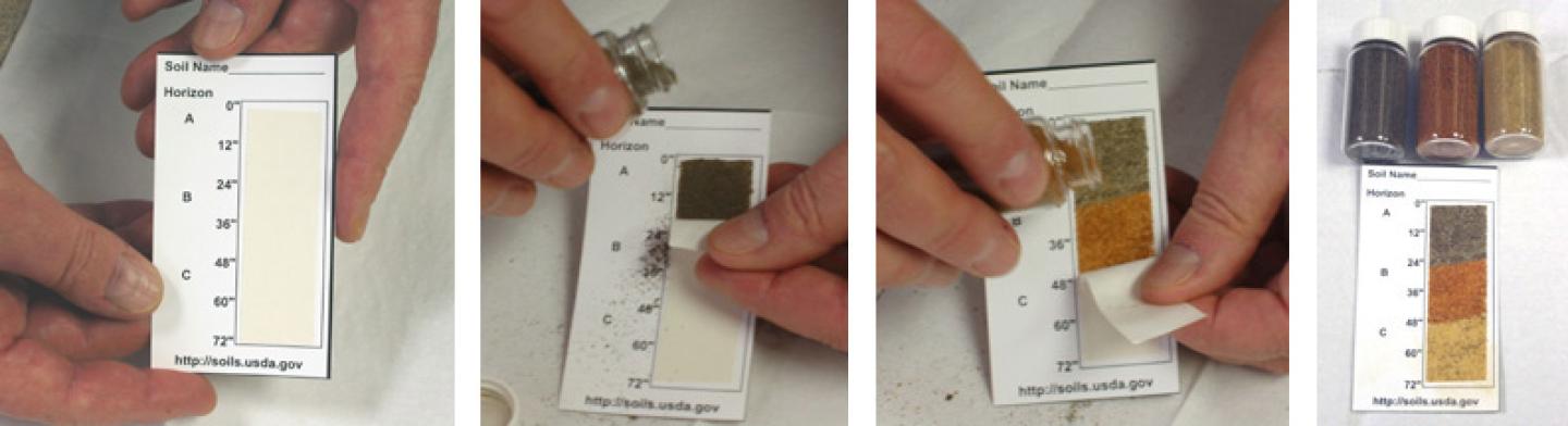
Create a card showing soil horizons.
Background
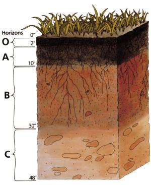
If you look in a soil pit or on a roadside cut, you will see various layers in the soil. These layers are called soil horizons. The arrangement of these horizons in a soil is known as a soil profile. Soil scientists, who are also called pedologists, observe and describe soil profiles and soil horizons to classify and interpret the soil for various uses.
Soil horizons differ in a number of easily seen soil properties such as color, texture, structure, and thickness. Other properties are less visible. Properties, such as chemical and mineral content, consistence, and reaction require special laboratory tests. All these properties are used to define types of soil horizons.
Soil scientists use the capital letters O, A, B, C, and E to identify the master horizons, and lowercase letters for distinctions of these horizons. Most soils have three major horizons -- the surface horizon (A), the subsoil (B), and the substratum (C). Some soils have an organic horizon (O) on the surface, but this horizon can also be buried. The master horizon, E, is used for subsurface horizons that have a significant loss of minerals (eluviation). Hard bedrock, which is not soil, uses the letter R.
Project
- Print the soil profile cards (above) onto cardstock paper or draw your own design on a 3" x 5" note card.
- Cut the cards apart.
- Attach a short strip of carpet tape to the card. Rolls of double-sided tape come in various widths. One-inch tape is adequate.
- Pull back the tape at the top to expose some of the sticky tape and place soil from the surface horizon to represent the depth of this soil.
- Pull back the tape for each additional layer one at a time following the same procedure.
- You might also collect a little surface vegetation to keep with your soil type for learning about plant-soil relations.
You can demonstrate erosion severity by altering the depth of the A horizon or display various types for soils found in different locations.
Displays can be made of several soils on a drawing of a hill slope or other landscape by using the tape on a larger card or poster.