
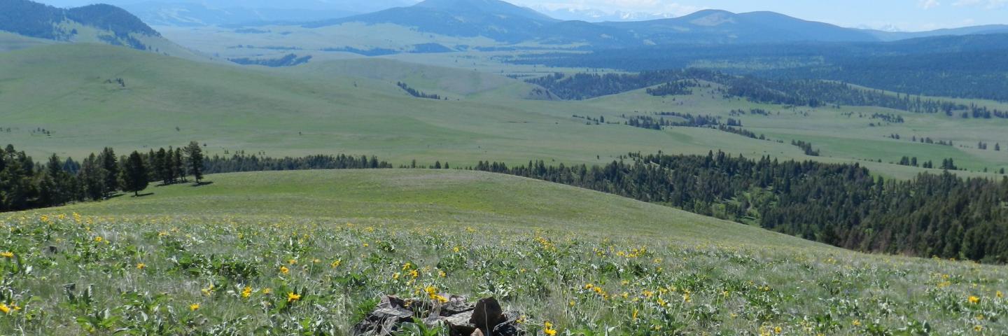
The Flint Creek Valley Conservation Regional Conservation Partnership (RCPP) Project will help sustain the agricultural economy and rural heritage of the Flint Creek Valley, one of the last naturally intact valleys in western Montana.

Flint Creek Valley Conservation Project partners aim to conserve a critical wildlife migration corridor between the Northern Continental Divide Ecosystem and the Greater Yellowstone Ecosystem and strengthen the valley’s agricultural economy by providing conservation easement services and support to the area’s producers.
Project Duration: 2021 -2026
Who Can Participate?
Granite County landowners in the project area.
Benefits to the Land
- Conserving a critical wildlife migration corridor between the Northern Continental Divide Ecosystem (NCDE) and the Greater Yellowstone Ecosystem (GYE)
- Strengthening the valley’s agricultural economy
Partners
- Five Valleys Land Trust (lead partner)
- Montana Natural Resource Damage Program
- Montana Fish Wildlife and Parks
- Trout Unlimited
- Five Valleys Audubon Society
- Climate Trust
- Montana Association of Land Trusts
Local Ranking Questions
- Number of forest, shrubland, and grassland habitat types to be conserved by the proposed easement.
- None of the listed habitat types
- One of the listed habitat types
- Two of the listed habitat types
- Three of the listed habitat types
- Number of riparian, wetland, and aquatic habitat types to be conserved by the proposed easement.
- None of the listed habitat types
- One of the listed habitat types
- Two of the listed habitat types
- Three of the listed habitat types
- Acres of offered land to be protected by the proposed easement.
- Zero to less than 50 acres
- 50 to less than 500 acres
- 500 to less than 1000 acres
- 1000 to less than 1500 acres
- 1500 acres or greater
- Proximity of the offered land to other conserved lands.
- Contiguous to other conserved lands
- Within 1 mile of other conserved lands
- Greater than 1 mile and less than 2 miles from other conserved lands
- Greater than 2 mile and less than 3 miles from other conserved lands
- Greater than 3 mile from other conserved lands
- Percent of the proposed easements offered land which is categorized as prime soils
- Prime Soils 0 to 10 percent
- Prime soils greater than 10 percent to 20 percent
- Prime soils greater than 20 percent to 30 percent
- Prime soils greater than 30 percent to 40 percent
- Prime soils 40 percent or greater
Ready to get started?
Contact your local service center to start your application.
How to Get Assistance
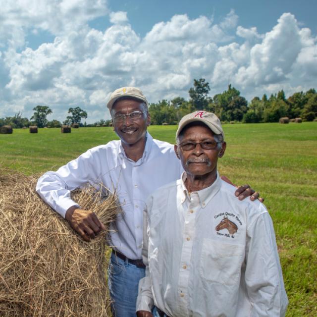
Do you farm or ranch and want to make improvements to the land that you own or lease?
Natural Resources Conservation Service offers technical and financial assistance to help farmers, ranchers and forest landowners.
To get started with NRCS, we recommend you stop by your local NRCS field office. We’ll discuss your vision for your land.
NRCS provides landowners with free technical assistance, or advice, for their land. Common technical assistance includes: resource assessment, practice design and resource monitoring. Your conservation planner will help you determine if financial assistance is right for you.
We’ll walk you through the application process. To get started on applying for financial assistance, we’ll work with you:
- To fill out an AD 1026, which ensures a conservation plan is in place before lands with highly erodible soils are farmed. It also ensures that identified wetland areas are protected.
- To meet other eligibility certifications.
Once complete, we’ll work with you on the application, or CPA 1200.
Applications for most programs are accepted on a continuous basis, but they’re considered for funding in different ranking periods. Be sure to ask your local NRCS district conservationist about the deadline for the ranking period to ensure you turn in your application in time.
As part of the application process, we’ll check to see if you are eligible. To do this, you’ll need to bring:
- An official tax ID (Social Security number or an employer ID)
- A property deed or lease agreement to show you have control of the property; and
- A farm number.
If you don’t have a farm number, you can get one from USDA’s Farm Service Agency. Typically, the local FSA office is located in the same building as the local NRCS office. You only need a farm number if you’re interested in financial assistance.
NRCS will take a look at the applications and rank them according to local resource concerns, the amount of conservation benefits the work will provide and the needs of applicants. View Application Ranking Dates by State.
If you’re selected, you can choose whether to sign the contract for the work to be done.
Once you sign the contract, you’ll be provided standards and specifications for completing the practice or practices, and then you will have a specified amount of time to implement. Once the work is implemented and inspected, you’ll be paid the rate of compensation for the work if it meets NRCS standards and specifications.