
Notice

The Regional Conservation Partnership Program (RCPP) is a partner-driven approach to conservation that funds solutions to natural resource challenges on agricultural land.
Project Summary
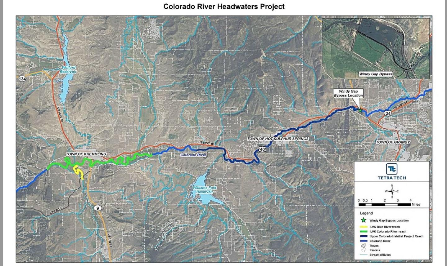
Trans-mountain diversions that supply agricultural and municipal water to Northern Colorado and the Front Range have had a significant impact on agriculture and aquatic resources in the headwaters of the Colorado River. After years of dispute, an array of partners representing local agriculture, local government, water providers, and conservation groups have come together to implement the Colorado River Headwaters Project. The Project consists of three parts: (1) a bypass channel to reconnect the Colorado River (Connectivity Channel); (2) channel and habitat improvement downstream of the Connectivity Channel (Habitat Project); and (3) projects to improve irrigation, soil and water quality, and aquatic habitat downstream of the Habitat Project (ILVK projects). When fully implemented, the Project will directly benefit 30 miles of the Colorado River and 4,500 acres of irrigated lands that provide sage grouse habitat. Up to 11,000 acre-feet of water will be available to improve the river during low flow conditions. The benefits of the Project will extend from the headwaters to the state line and beyond. Communities, farms and ranches in Northern Colorado will also benefit as implementation of the Project will enable additional trans-mountain diversions to firm up their water supplies. The Project will help local communities, demonstrate innovative solutions benefiting working lands and rivers, and leverage funding to restore the headwaters of America’s hardest working river. In an era of divisive water battles in the arid West, the Colorado River Headwaters Project stands as a shining example of what can be achieved with cooperation and some creativity among water users.
Colorado River Connectivity Channel (a.k.a. Windy Gap Reservoir Bypass)
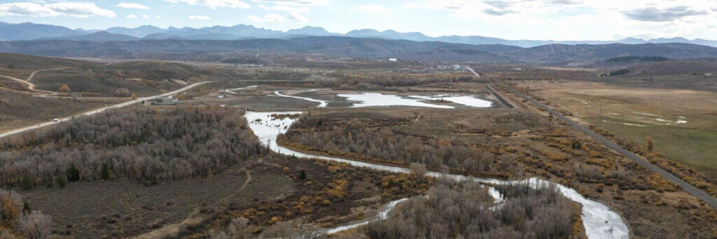
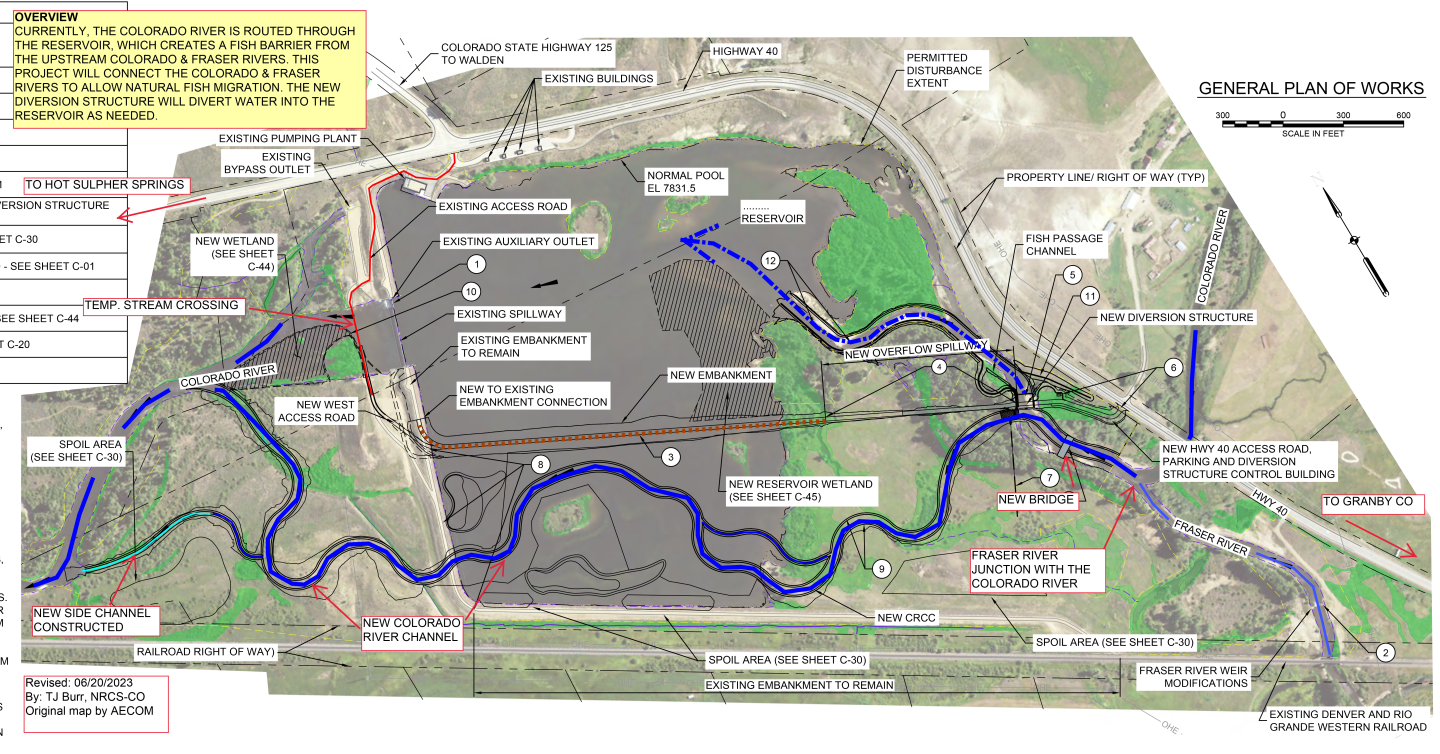
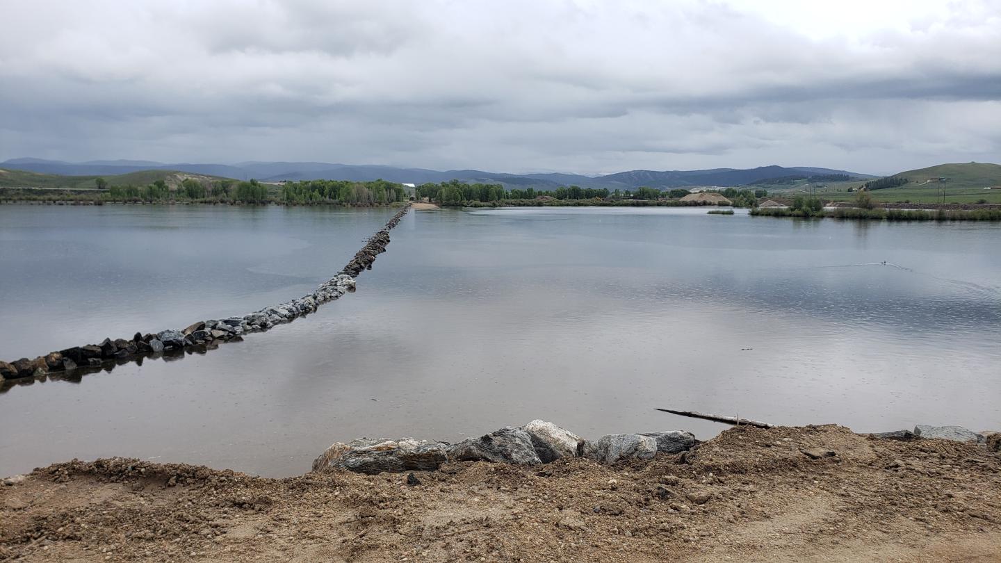
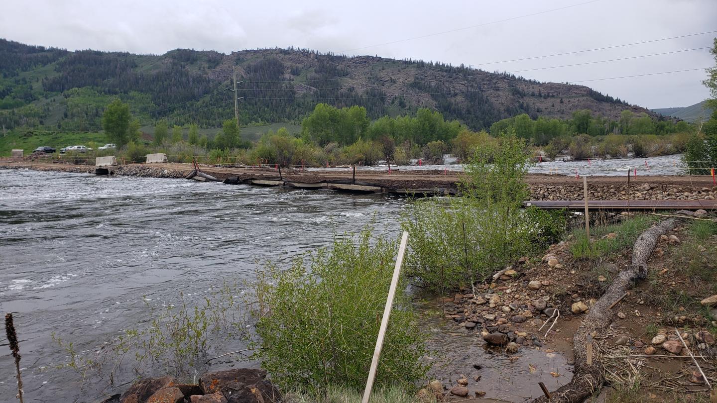
Windy Gap Reservoir is a shallow reservoir that blocks fish passage, increases stream temperature, and interferes with other natural stream processes. Stream health and the aquatic environment in this state-designated Gold Medal Trout fishery has significantly declined since the reservoir came online in the mid-1980s. The goal of the Connectivity Channel project is to create a channel around Windy Gap Reservoir to eliminate the reservoir’s negative impacts. Following years of heated dispute, the project Partners have come together with the common goal of improving conditions in the Colorado River downstream of the reservoir. After extensive study, the Connectivity Channel was unanimously selected as the best alternative to restore these valuable fisheries and the health of the Colorado River. The total cost of the project is estimated at $33 million. NRCS has committed approximately $15 million in PL566 funds, with the remaining funding to be provided by a combination of state, regional and local government grants, corporate contributions, and local landowner donations.
Colorado River Habitat Restoration
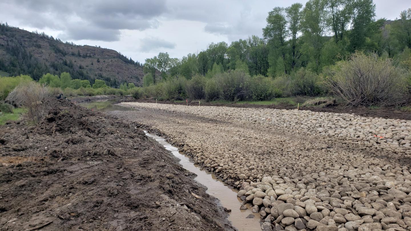
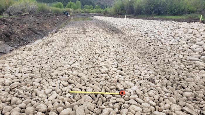
Currently, over 65% of the native flows of the Colorado River (as measured downstream of Windy Gap Reservoir) are transported across the Continental Divide for use in the Front Range and Northern Colorado. This dramatic flow reduction has left the river channel overly wide and shallow, creating poor aquatic habitat conditions. The Colorado River Habitat Restoration project aims at improving over a mile of the Colorado River channel downstream of Windy Gap Reservoir to improve aquatic habitat and restore river health. Led by Colorado Parks and Wildlife, the Habitat Project was completed in 2022, at a cost of approximately $1.2 million. The Habitat Project was entirely funded by partners as part of the Headwaters Project match.
Irrigators of Lands in the Vicinity of Kremmling (ILVK) Project
The Irrigators of the Lands in the Vicinity of Kremmling (ILVK) consist of 12 ranches and BLM land spanning over 12 miles of the Colorado River and 1.5 miles of the Blue River. Impacts to these ranches, formerly irrigated by natural flooding of the Colorado River, was specifically recognized in Senate Document 80, the document that created the Colorado-Big Thompson Project, and provision was made for the installation of irrigation pumps to enable irrigation in light of the anticipated reduction of Colorado River flows. As flows in the Colorado River dwindle due to transmountain diversions, the ranchers have been experiencing unsustainable problems with the elevation of the intakes and pump operations. As is the case in the upstream section of the Colorado River where the Habitat Project has been implemented, this section of the Colorado River has also become overly wide, leading to poor aquatic habitat. The ILVK Project involves the construction of natural river structures that elevate river levels allowing irrigators to divert their water and, at the same time, improving aquatic habitat and stream health. Approximately $2 million of EQIP funding was included as part of the Colorado River Headwaters RCPP. Over 12 individual projects have been completed so far, with only two projects remaining to be completed in 2023.
PROJECT ACTIVITY
Partner Participation
Project Overview Map_June 30, 2023
Line of riprap is at top of north edge of new embankment_June 13, 2023

Colorado River flowing over Windy Gap Reservoir spillway_June 13, 2023
Temporary construction crossing of river_June 13, 2023
Riffle structure in side channel of new river - joins existing at bend downstream_June 13, 2023
Riffle structure in side channel of new Colorado River_June 13, 2023
Ready to get started?
Contact your local service center to start your application.
How to Get Assistance
Do you farm or ranch and want to make improvements to the land that you own or lease?
Natural Resources Conservation Service offers technical and financial assistance to help farmers, ranchers and forest landowners.
To get started with NRCS, we recommend you stop by your local NRCS field office. We’ll discuss your vision for your land.
NRCS provides landowners with free technical assistance, or advice, for their land. Common technical assistance includes: resource assessment, practice design and resource monitoring. Your conservation planner will help you determine if financial assistance is right for you.
We’ll walk you through the application process. To get started on applying for financial assistance, we’ll work with you:
- To fill out an AD 1026, which ensures a conservation plan is in place before lands with highly erodible soils are farmed. It also ensures that identified wetland areas are protected.
- To meet other eligibility certifications.
Once complete, we’ll work with you on the application, or CPA 1200.
Applications for most programs are accepted on a continuous basis, but they’re considered for funding in different ranking periods. Be sure to ask your local NRCS district conservationist about the deadline for the ranking period to ensure you turn in your application in time.
As part of the application process, we’ll check to see if you are eligible. To do this, you’ll need to bring:
- An official tax ID (Social Security number or an employer ID)
- A property deed or lease agreement to show you have control of the property; and
- A farm number.
If you don’t have a farm number, you can get one from USDA’s Farm Service Agency. Typically, the local FSA office is located in the same building as the local NRCS office. You only need a farm number if you’re interested in financial assistance.
NRCS will take a look at the applications and rank them according to local resource concerns, the amount of conservation benefits the work will provide and the needs of applicants. View Application Ranking Dates by State.
If you’re selected, you can choose whether to sign the contract for the work to be done.
Once you sign the contract, you’ll be provided standards and specifications for completing the practice or practices, and then you will have a specified amount of time to implement. Once the work is implemented and inspected, you’ll be paid the rate of compensation for the work if it meets NRCS standards and specifications.