
NRCS offers financial and technical assistance through the National Water Quality Initiative (NWQI), to farmers, ranchers and private forest landowners interested in improving water quality and aquatic habitats in priority watersheds with impaired streams.
(en Español)
NRCS will help producers implement conservation and management practices through a systems approach to control and trap sediment, nutrients and organic runoff. Qualified producers will receive assistance for installing conservation practices such as cover crops, reduced tillage, riparian buffers and rotational grazing.
Conservation Funding and Practices
NRCS conservation professionals will provide technical assistance and planning tools to determine which conservation actions will provide the best results to improve water quality on your land. Nutrient management systems, erosion control, conservation tillage, pest management, and buffer systems are just some of the practices being offered as part of the National Water Quality Initiative. To help install these conservation practices, financial assistance to share in the cost of these conservation practices is available though the Environmental Quality Incentives Program (EQIP).
Partnerships
NRCS identified priority watersheds through the help of local partnerships and state water quality agencies. Partners sometimes offer financial assistance in addition to NRCS programs. NRCS will continue to coordinate with local and state agencies, conservation districts, nongovernmental organizations and others to implement this initiative. This strategic approach will leverage funds and provide streamlined assistance to help individual agricultural producers take needed actions to reduce the flow of sediment, nutrients and other runoff into impaired waterways.
Producer Benefits
Water quality conservation practices benefit agricultural producers by lowering input costs and enhancing the productivity of working lands. Conservation investments are good for all Americans because well managed farms limit pollution from runoff, produce food and fiber, sustain rural economies, and provide food security to the Nation. All across the country— farmers, ranchers and forest landowners are voluntarily taking action and putting conservation on the ground to improve water quality on millions of acres!
Public Benefits
NRCS is proud to be involved in a nationwide effort with landowners and communities to improve and protect our water resources. The landowners and farmers participating in the initiative will receive conservation payments to work on the land in a sustainable way which provides cleaner water. In addition to the financial assistance, the land will remain productive into the future. Communities benefit by having clean waterways, safer drinking water and healthy habitat for fish and wildlife.
How to Apply
To get started, make an appointment at your local NRCS field office (See list below to determine which office serves each selected watershed). You will need to establish eligibility and farm records for your land. NRCS will help you complete an application while explaining which conservation practices are available in your watershed. Remember to check with your local NRCS field office to see if you are located in a selected watershed.
Caribbean NWQI
For Fiscal Year 2022, NRCS, EPA and the Natural Resources Departments for PR (DNER) and the USVI (DPNR) identified two priorities for watershed assessments to be completed in Puerto Rico and the U.S. Virgin Islands based on HUC12 (HUC14 for USVI).
Additional watershed proposals were accepted and evaluated, but priority was given to the watersheds below:
- Rio Gurabo (210100050407); or
- Rio Grande de Añasco (210100030212), Rio La Plata (210100050707), and Rio Gurabo (210100050407) in Puerto Rico, and Northwest St. Thomas (21020001010010) in the U.S. Virgin Islands.
Opportunity Number USDA-NRCS-PR-EQIP-22-NOFO00012068 was posted to Grants.gov and the application deadline was May 25, 2022. The funding announcement is a key component of our strategy to leverage resources with partners to create watershed management plans to help us apply conservation in the Caribbean Area. Our goal is to obtain measurable outcomes that not only impact farmers but also have considerable impact on the communities around them.
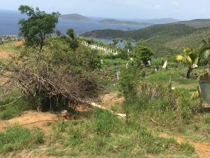
Caribbean Area Priority Watershed - Implementation: Río Fajardo
The Rio Fajardo Watershed covers around 16,309 acres in northeastern Puerto Rico, including portions of the municipalities of Fajardo and Ceiba and sections of El Yunque National Forest and Ceiba State Forest. The area also has one of the island’s 11 major public water supply reservoirs that serves 31,514 households. However, because of the water collection method from the river, sedimentation has reduced the reservoir’s capacity. NWQI efforts will focus on the agricultural area located in the watershed’s flood plain. Pasture covers 21% of the watershed and has been identified as high priority area with 2,374 acres, with resource concerns of overgrazing and a lack of riparian buffers adjoining the river. NRCS planners will work with producers and partners in the watershed to voluntarily implement conservation practices through EQIP to avoid, control, and trap sediment and nutrient runoff, and to improve wildlife habitat while maintaining agricultural productivity. The objective is to improved land-based management to protect stream and coastal water quality, while improving wildlife habitat for threatened and endangered species, and enhancing near shore coastal and coral reef health. The goal is to reduce sediment loads by 30% by increasing rotational grazing and applying riparian buffers. Project partners include PR DNER, US Forest Service & US Fish & Wildlife Service. Contact the Caguas Field Office at 787-743-2743 for information on the special NWQI EQIP signup.
Caribbean Area Priority Watershed - Planning: Río Gurabo
The Río Gurabo watershed is the second largest subwatershed contributing to Carraizo Lake, one of the most important public water sources in Puerto Rico serving approximately 179,000 households. Río Gurabo’s headwaters originate within El Yunque National Forest (YNF) on El Toro Peak hillside, drain south from Río Espiritu Santo (one of the primary YNF watersheds) and flow west to the confluence with Río Grande de Loiza. The Río Gurabo watershed covers approximately 32,513 acres and includes portions of Canovanas, Carolina, Gurabo, Humacao, Juncos, Las Piedras, Naguabo, Río Grande, and San Lorenzo counties. The total maximum daily load (of pollutants, TMDL) developed for the Río Gurabo watershed identified confined animal operations as the main source of fecal coliforms. Nitrogen, phosphorus and turbidity were also identified as causes of water quality impairment on Puerto Rico’s 303(d) list. A watershed management plan can substantially reduce and potentially delist this waterbody from the 303(d) list. This is and has been a high priority watershed for the PR Department of Natural and Environmental Resources (DNER) and the U.S. EPA, as well as YNF due to the watershed’s connection to Espiritu Santo priority watershed on YNF’s western boundary. Four percent (4%) of the selected HUC12 land cover lies within El Yunque National Forest (Northeast headwaters) and 16% of the watershed is devoted to agricultural land uses. Contact the Caguas Field Office at 787-743-2743 for more information.
Caribbean Area Priority Watershed - Planning: Río Grande de Añasco
The Rio Grande de Añasco is one of the primary rivers discharging into Mayagüez Bay and drains one of the largest watersheds in Puerto Rico. The Añasco watershed covers an area of 164,480 acres and includes portions of Añasco, Mayagüez, Las Marías, Maricao, San Sebastián, Lares, Yauco, and Adjuntas municipalities. The watershed is ranked # 5 on the list of impaired watersheds in the Puerto Rico Unified Watershed Assessment, due primarily to sediment, bacterial and chemical contamination (low dissolved oxygen, high arsenic and turbidity). Some of these pollutants are directly related to agricultural sources such as fertilizers, pesticides and manure from crop and pasture lands. NRCS has identified Concentrated erosion, Degraded plant condition, Field sediment, nutrient and pathogen loss, and Aquatic and Terrestrial habitat loss as the primary resource concerns in the Añasco watershed that will be addressed through this initiative. Contact the Mayagüez Field Office at 787-831-3454 for more information.
Caribbean Area Priority Watershed - Planning: Río la Plata
Rio La Plata drains north into the Atlantic Ocean and the headwaters are located 22 miles inland towards the south. The watershed covers approximately 139,520 acres and includes portions of Dorado, Toa Baja, Toa Alta, Bayamon, Naranjito, Comerio, Barranquitas, Aibonito, Cidra, and Cayey. It also includes one of the main water reservoirs for potable water in Puerto Rico serving 130,828 households. The TMDL developed for the watershed identified agriculture and confined animal operations as the main source of fecal coliforms. Nitrogen, phosphorus and turbidity were also identified as causes of impairment in the 303(d) list. A watershed management plan can substantially reduce and potentially delist this waterbody from the 303(d) list. This is and has been a high priority watershed for the PR Department of Natural and Environmental Resources (DNER) and the EPA. The selected HUC12 watershed covers 29.4% of the total watershed and has 41.5 % coverage by agricultural land uses. Contact the Caguas Field Office at 787-743-2743 or the Corozal Field Office at 787-859-2880 for more information.
Caribbean Area Priority Watershed - Planning: Northwest St. Thomas
Northwest St Thomas Watershed covers 4,883 acres and is composed of six bays: Botany Bay, Stumpy Bay, Santa Maria Bay, Dorothea Bay, Hull Bay and Magens Bay. These areas have the second largest concentration of livestock in the USVI and twice the number of livestock than the rest of the watersheds in St. Thomas. Although most water quality issues in the USVI are related to urban pollution, the Northwest St Thomas watershed has most of the island’s agriculture-related water quality issues. All the bays have turbidity issues and Magens Bay has enterococcus and pH issues identified on the 303d list. Dissolved oxygen is also identified as a source of impairment in Dorothea Bay. Contact the St. Croix Field Office at 340-692-9662 x3 for more information.
Iniciativa Nacional de Calidad de Aguas
Visión General
Por más de 85 años el Servicio de Conservación de Recursos Naturales (NRCS por sus siglas en Inglés) ha provisto asistencia a agricultores para implementar voluntariamente prácticas de conservación, para proteger los recursos naturales, manteniendo a su vez la producción y ganancias agrícolas. NRCS continúa ofreciendo asistencia financiera y técnica a través del La Iniciativa Nacional de Calidad de Aguas (NWQI por sus siglas en Ingles), a agricultores, ganaderos y dueños de tierras forestales que estén interesados en mejorar la calidad del agua y hábitats acuáticos en deterioro en cuencas hidrográficas. NRCS ayudará a los productores a implementar prácticas de conservación y manejo a través de un sistema enfocado en controlar y atrapar nutrientes y material fecal en las escorrentías. Productores elegibles recibirán asistencia para instalar prácticas de conservación tales como: cultivos de cobertura, labranza reducida, amortiguadores ribereños y pastoreo rotacional, entre otras.
Prácticas de Conservación con Ayuda Financiera
Profesionales de NRCS proveerán asistencia y herramientas para determinar cuáles prácticas de conservación son las más adecuadas para mejorar la calidad de las aguas en las fincas. Algunas de las practicas que se ofrecen incluyen: sistemas de manejo de nutrientes, control de erosión, labranza de conservación, manejo de plagas y franjas amortiguadoras. Para ayudar a instalar estas prácticas, se proveerá ayuda financiera compartida a través del Programa de Incentivos para la Calidad Ambiental (EQIP por sus siglas en Ingles).
Colaboradores
Las cuencas hidrográficas en potencial deterioro son identificadas por NRCS y socios estatales y locales interesados en la conservación de las aguas. En ocasiones, algunos socios podrían ofrecer ayuda financiera además de los programas de NRCS. NRCS a su vez continuará coordinando con agencias estatales y locales, los Distritos de Conservación y grupos no gubernamentales para establecer esta iniciativa. Este enfoque busca parear fondos y proveer asistencia de excelencia para ayudar a agricultores a tomar acción para reducir los flujos de sedimentos, nutrientes y otras escorrentías que potencialmente afecten de forma negativa los cuerpos de agua.
Beneficios para los Agricultores
Las prácticas de conservación de calidad de aguas benefician a los productores agrícolas al reducir los costos de mantenimiento y aumentar la producción. Las inversiones en la conservación son buenas para todos los ciudadanos ya que fincas bien manejadas reducen la contaminación en escorrentías, mantienen la producción y economía rural, y proveen seguridad alimentaria a la Nación.
Beneficios Públicos
NRCS está orgulloso de compartir en este esfuerzo nacional con dueños de tierras y comunidades para mejorar y proteger nuestros recursos de agua. Dueños de tierras y agricultores que participen de esta iniciativa recibirán pagos por conservar sus tierras de forma sustentable lo qual protege los recursos de aguas. Además de asistencia financiera, la tierra se mantendrá en producción para futuras generaciones. Las comunidades se beneficiaran de aguas limpias, potables y un hábitat saludable para la pesca y vida silvestre.
Cómo Solicitar
Comuníquese y haga una cita con las Oficinas de USDA o NRCS más cercanas a usted. Usted deberá cumplir con unos requisitos de elegibilidad. NRCS le ayudará a cumplimentar los formularios necesarios y explicará las prácticas de conservación que están disponibles en su cuenca. Asegúrese de que su finca está dentro de la cuenca seleccionada.
NWQI en el Área del Caribe
Para año fiscal de 2022, NRCS, EPA y los Departamentos de Recursos Naturales de PR (DNER) y USVI (DPNR) han identificado dos (2) prioridades para que se completen las evaluaciones de cuencas hidrográficas en Puerto Rico y las Islas Vírgenes Americanas (USVI) basadas en HUC12 (HUC14 para USVI). Se aceptarán y evaluarán propuestas de cuencas adicionales, pero se dará prioridad a las siguientes cuencas:
- Río Gurabo (210100050407); o
- Cualquier HUC12 que complemente los proyectos existentes en Río Grande de Añasco (210100030212), Río la Plata (210100050707) y Río Gurabo (210100050407), o cualquier HUC14 para las Islas Vírgenes Americanas que complemente la cuenca del noroeste de St. Thomas (21020001010010).
Cuenca de Prioridad en el Área del Caribe- Implementación: Río Fajardo
La Cuenca del Río Fajardo cubre alrededor de 16,309 acres en el noreste de Puerto Rico, incluyendo partes de los municipios de Fajardo y Ceiba y secciones del Bosque Nacional El Yunque y el Bosque Estatal de Ceiba. El área también tiene uno de los 11 principales reservas públicas de suministro de agua de la isla que atiende a 31,514 hogares. Sin embargo, debido al método de recolección de agua del río, la sedimentación no ha reducido la capacidad del embalse, sin embargo, esta sedimentación llega directamente al mar. Los esfuerzos de NWQI se centrarán en el área agrícola ubicada en la llanura de inundación de la cuenca. Los pastos cubren el 21% de la cuenca hidrográfica y se ha identificado como un área de alta prioridad con 2,374 acres, con preocupaciones sobre los recursos de pastoreo excesivo y la falta de zonas de amortiguadores ribereños contiguos al río. Los planificadores de NRCS trabajarán con los productores y socios en la cuenca para implementar voluntariamente prácticas de conservación a través del Programa de Incentivos para la Caldidad Ambiental (EQIP por sus siglas en inglés) para evitar, controlar y atrapar la escorrentía de sedimentos y nutrientes, y para mejorar el hábitat de la vida silvestre mientras se mantiene la productividad agrícola. El objetivo es mejorar el manejo del suelo para proteger la calidad del agua de los arroyos y las costas, al mismo tiempo que se mejora el hábitat de la vida silvestre para las especies amenazadas y/o en peligro de extinción y se mejora la salud de los arrecifes de coral y las zonas costeras. El objetivo es reducir la carga de sedimentos en un 30% aumentando el pastoreo rotacional y aplicando amortiguadores ribereños. Los socios del proyecto incluyen PR DRNA, el Servicio Forestal de los Estados Unidos (USFS), y Vida Silvestre de los Estados Unidos (USFWS). Comuníquese con la oficina de campo de Caguas al 787-743-2743 para obtener más información.
Cuenca de Prioridad en el Área del Caribe - Planificación: Río Gurabo
La Cuenca del Río de Gurabo es la segunda subcuenca más grande que contribuye al Lago Carraízo, una de las fuentes públicas de agua más importantes de Puerto Rico que atiende aproximadamente 179,000 hogares. El Río Gurabo se origina dentro del Bosque Nacional El Yunque (YNF) en la ladera del Pico El Toro, drenando hacia el sur desde el Río Espíritu Santo (una de las principales cuencas del YNF) y fluyen hacia el oeste a la confluencia con el Río Grande de Loíza. La cuenca del Río Gurabo cubre aproximadamente 32,513 acres e incluye parte de los municipios de Canóvanas, Carolina, Gurabo, Humacao, Juncos, Las Piedras, Naguabo, Río Grande y San Lorenzo. La carga diaria máxima total (de contaminantes, TMDL) desarrollada para la cuenca del río Gurabo identificó las operaciones con animales confinados como una de las principales fuente de coliformes fecales. El nitrógeno, el fósforo y la turbidez también se identificaron como causas del deterioro de la calidad del agua en la lista 303(d) de Puerto Rico. Un plan de manejo de cuencas hidrográficas puede reducir sustancial y potencialmente eliminar este cuerpo de agua de la lista 303(d). Esta es y ha sido una cuenca de alta prioridad para el Departamento de Recursos Naturales y Ambientales (DNER) de PR y la EPA de Estados Unidos, así como para YNF debido a la conexión de la cuenca con la cuenca prioritaria de Espíritu Santo en el límite occidental de YNF. El cuatro por ciento (4 por ciento) de la cobertura terrestre HUC12 seleccionada se encuentra dentro del Bosque Nacional El Yunque (cabeceras del noreste) y el 16 por ciento de la cuenca está dedicada a usos agrícolas de la tierra. Comuníquese con la oficina de campo de Caguas al 787-743-2743 para obtener más información.
Cuenca de Prioridad en el Área del Caribe - Planificación: Río Grande de Añasco
El Río Grande de Añasco es uno de los principales ríos que descargan en la Bahía de Mayagüez y drena una de las mayores cuencas hidrográficas de Puerto Rico. La cuenca de Añasco cubre un área de 257 millas cuadradas (164,480 acres) e incluye partes de los municipios de Añasco, Mayagüez, Las Marías, Maricao, San Sebastián, Lares, Yauco y Adjuntas. La cuenca ocupa el puesto #5 en la lista de las cuencas hidrográficas con deficiencias en la "Unified Watershed Assessment" debido principalmente a los sedimentos, contaminación bacteriana y química (bajo nivel de oxígeno disuelto y la alta turbidez). Muchos de estos contaminantes están directamente relacionados con la agricultura, como fertilizantes y productos químicos. La preocupación por los recursos en la cuenca Añasco que se trabajarán a través de esta iniciativa son la erosión laminar y en surcos, la calidad y cantidad del agua, la sanidad vegetal, las inundaciones y las especies invasoras. Comuníquese con la oficina de campo de Mayagüez al 787-831-3454 para obtener más información.
Cuenca de Prioridad en el Área del Caribe - Planificación: Río la Plata
El Río La Plata desemboca al norte en el Océano Atlántico y las cabeceras están ubicadas a 22 millas tierra adentro hacia el sur. La cuenca cubre aproximadamente 139,520 acres e incluye porciones de los municipios de Dorado, Toa Baja, Toa Alta, Bayamon, Naranjito, Comerio, Barranquitas, Aibonito, Cidra y Cayey. También incluye uno de los principales reservorios de agua potable en Puerto Rico que atiende a 130,828 hogares. La carga diaria máxima total (TMDL por sus siglas en inglés) identifican fuentes agrícolas y operaciones de animales en confinamiento como las principales fuentes de coliformes fecales. Exceso en nitrógeno, el fósforo y turbidez también han sido identificados como causantes de contaminación en la lista 303 (d) de aguas deterioradas y amenazadas. Un plan de manejo de cuencas puede ayudar a reducir substancialmente las causas de contaminación y potencialmente remover este cuenca de la lista 303 (d). La restauración de la cuenca del Río la Plata ha sido indentificada de alta prioridad por el DRNA y la EPA. La cuenca seleccionada (HUC12) comprende un 29.4% del área total de la cuenca una cobertura del 41.5% para usos de tierras agrícolas. Comuníquese con la oficina de campo de Caguas al 787-743-2743 o la oficina de campo de Corozal al 787-859-2880 para obtener más información.
Cuenca de Prioridad en el Área del Caribe – Planificación: Noroeste St. Thomas
La cuenca Noroeste St Thomas comprende 4,883 acres y está compuesta de seis (6) bahías: Botany Bay, Stumpy Bay, Santa Maria Bay, Dorothea Bay, Hull Bay y Magens Bay. Esta área posee la segunda concentración más alta de animales de fincas en las Islas Vírgenes Americanas y el doble de todos los animales de fincas contenidos en otras cuencas en St. Thomas combinadas. A pesar de que la mayoría de los problemas en calidad de agua en la isla están atados a la contaminación urbana, la Cuenca de Noroeste St. Thomas posee la mayor cantidad de terrenos agrícolas y problemas de calidad de agua relacionados. Todas las bahías tienen problemas de turbidez y Magens Bay tiene altas concentraciones de enterococos y problemas con el pH. Bajo contenido de oxígeno disuelto también ha sido identificado en Dorothea Bay. Comuníquese con la oficina de campo de St. Croix al 340-692-9662 x3 para obtener más información.
Ready to get started?
Contact your local service center to start your application.
How to Get Assistance
Do you farm or ranch and want to make improvements to the land that you own or lease?
Natural Resources Conservation Service offers technical and financial assistance to help farmers, ranchers and forest landowners.
To get started with NRCS, we recommend you stop by your local NRCS field office. We’ll discuss your vision for your land.
NRCS provides landowners with free technical assistance, or advice, for their land. Common technical assistance includes: resource assessment, practice design and resource monitoring. Your conservation planner will help you determine if financial assistance is right for you.
We’ll walk you through the application process. To get started on applying for financial assistance, we’ll work with you:
- To fill out an AD 1026, which ensures a conservation plan is in place before lands with highly erodible soils are farmed. It also ensures that identified wetland areas are protected.
- To meet other eligibility certifications.
Once complete, we’ll work with you on the application, or CPA 1200.
Applications for most programs are accepted on a continuous basis, but they’re considered for funding in different ranking periods. Be sure to ask your local NRCS district conservationist about the deadline for the ranking period to ensure you turn in your application in time.
As part of the application process, we’ll check to see if you are eligible. To do this, you’ll need to bring:
- An official tax ID (Social Security number or an employer ID)
- A property deed or lease agreement to show you have control of the property; and
- A farm number.
If you don’t have a farm number, you can get one from USDA’s Farm Service Agency. Typically, the local FSA office is located in the same building as the local NRCS office. You only need a farm number if you’re interested in financial assistance.
NRCS will take a look at the applications and rank them according to local resource concerns, the amount of conservation benefits the work will provide and the needs of applicants. View Application Ranking Dates by State.
If you’re selected, you can choose whether to sign the contract for the work to be done.
Once you sign the contract, you’ll be provided standards and specifications for completing the practice or practices, and then you will have a specified amount of time to implement. Once the work is implemented and inspected, you’ll be paid the rate of compensation for the work if it meets NRCS standards and specifications.