

The Mississippi River Basin Healthy Watershed Initiative (MRBI) is accelerating voluntary, on-farm conservation investments and focused water quality monitoring and assessment resources in the Mississippi River watershed.
Known as “America’s River,” the Mississippi River is North America’s largest river, flowing over 2,300 miles through America’s heartland to the Gulf of America. The Mississippi River watershed not only provides drinking water, food, industry and recreation for millions of people, it also hosts the migratory flyway and home for more than 325 bird species.
Elevated nutrient levels in the Mississippi River flow downstream and are contributing to the Gulf of America hypoxic (low-oxygen) zone. To address these water quality concerns and agricultural sources of nutrients and sediment, NRCS is working with farmers and conservation partners to implement conservation practices proven to improve the overall health of the Mississippi River.
How It Works
Launched in 2009, the 12-state MRBI uses several Farm Bill programs, including the Environmental Quality Incentives Program (EQIP), to help landowners conserve America’s natural resources through voluntary conservation. The overall goals of MRBI are to improve water quality, restore wetlands and enhance wildlife habitat while ensuring economic viability of agricultural lands.
States within the Mississippi River Basin have developed nutrient reduction strategies to minimize the contributions of nitrogen and phosphorus to surface waters within the basin, and ultimately to the Gulf of America. MRBI uses a small watershed approach to support the states’ reduction strategies. Avoiding, controlling and trapping practices are implemented to reduce the amount of nutrients flowing from agricultural land into waterways and to improve the resiliency of working lands.
Results
To date, segments of the Cache River and St. Francis River in Arkansas, and Flowers Creek in Indiana, have been scheduled for de-listing from the state impaired waters lists due to improved water quality conditions.
MRBI has shown that focused water quality efforts in high priority areas can be effective in building strong partnerships, increasing trust and collaboration with landowners and farmers, and getting more conservation systems on the ground. In fact, the initiative has helped increase the adoption of critical water quality conservation practices, such as cover crops, no-till, residue management, grassed waterways and nutrient management by more than 30 percent (based on practice obligations) compared to focus area watersheds with general EQIP alone.
Over the past ten years, MRBI has helped farmers and ranchers:
- Implement conservation on nearly 1.5 million acres.
- Reduce sediment loss by more than 2.4 million tons.
- Reduce phosphorous loss by more than 5.5 million pounds.
- Reduce nitrogen loss by more than 20.2 million pounds.
Fiscal Year 2025 Watersheds

Contact
John Bullough, Conservation Initiatives Coordinator for Water Quality
Ohio Projects
Upper Ohio Brush Creek Watershed Water Quality Improvement Project will provide Environmental Quality Incentive Program (EQIP) funds for producers in the focus area to complete conservation practices that improve overall soil health, reduce erosion, and curb nutrient leaching.
The project focus area encompasses five 40 square mile sub-watersheds of the Upper Ohio Brush Creek Watershed which extend throughout northwestern Adams and adjoining areas of Brown and Highland Counties. These sub-watersheds include: Little West Fork Ohio Brush Creek, Headwaters West Fork Ohio Brush Creek, Cherry Fork, Georges Creek-West Fork Ohio Brush Creek, and Little East Fork-Ohio Brush Creek. This area of focus was selected due to the high density of livestock producers and crop fields, as well as its designation as “impaired” due to excessive sediment and nutrients.
Cover crops and inter-seeding pastures are the two primary practices used to protect water quality and reduce soil erosion. Other available practices will include crop rotation with perennials, grass waterways, forage and biomass plantings, pipelines, watering facilities, subsurface drains, access roads, heavy use areas, stream crossings, spring development, nutrient management and prescribed grazing.
Ohio Partnership Opportunities
NRCS is building a foundation of partners from non-profit and private organizations, local, state, and federal governments and individuals across the Nation. Whether these partnerships augment funding sources, increase return on investment, or provide boots-on-the-ground support, NRCS and its partners are committed to helping people help the land.
In addition to providing input for priority watershed selection criteria and the processes used to implement MRBI, partners will have a crucial role in encouraging and supporting producer participation. Partners’ involvement will be instrumental in a variety of ways, including:
- Providing information and conducting education and outreach activities.
- Forming agreements to provide staffing for technical assistance and education activities.
- Joining the State Technical Committee to provide input for future focus areas and watershed selection.
- Submitting proposals for CIG and ACEP or partnering with a group submitting a proposal.
- Targeting their organization’s programs toward the Initiative’s watersheds.
- Assisting with monitoring, evaluation, and assessment.
MRBI Success Stories
Learn more about the impact of MRBI through our success stories.
A Recipe for Success: Improving Water Quality in the Indian Creek Watershed
Voluntary conservation efforts focused in small watersheds can yield big results for locally important waters. See how NRCS, landowners, and partners are working together to improve water quality in Illinois.
Learn MoreStepping Up for a Cleaner Mississippi River
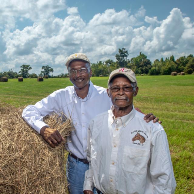
Meet Iowa's 2015 Soil Conservation Farmer of the Year Award recipient, Tim Smith, one of the many conservation farmers participating in a USDA program designed to reduce nutrient and sediment loading in the Mississippi River Basin.
Learn MoreReady to get started?
Contact your local service center to start your application.
How to Get Assistance
Do you farm or ranch and want to make improvements to the land that you own or lease?
Natural Resources Conservation Service offers technical and financial assistance to help farmers, ranchers and forest landowners.
To get started with NRCS, we recommend you stop by your local NRCS field office. We’ll discuss your vision for your land.
NRCS provides landowners with free technical assistance, or advice, for their land. Common technical assistance includes: resource assessment, practice design and resource monitoring. Your conservation planner will help you determine if financial assistance is right for you.
We’ll walk you through the application process. To get started on applying for financial assistance, we’ll work with you:
- To fill out an AD 1026, which ensures a conservation plan is in place before lands with highly erodible soils are farmed. It also ensures that identified wetland areas are protected.
- To meet other eligibility certifications.
Once complete, we’ll work with you on the application, or CPA 1200.
Applications for most programs are accepted on a continuous basis, but they’re considered for funding in different ranking periods. Be sure to ask your local NRCS district conservationist about the deadline for the ranking period to ensure you turn in your application in time.
As part of the application process, we’ll check to see if you are eligible. To do this, you’ll need to bring:
- An official tax ID (Social Security number or an employer ID)
- A property deed or lease agreement to show you have control of the property; and
- A farm number.
If you don’t have a farm number, you can get one from USDA’s Farm Service Agency. Typically, the local FSA office is located in the same building as the local NRCS office. You only need a farm number if you’re interested in financial assistance.
NRCS will take a look at the applications and rank them according to local resource concerns, the amount of conservation benefits the work will provide and the needs of applicants. View Application Ranking Dates by State.
If you’re selected, you can choose whether to sign the contract for the work to be done.
Once you sign the contract, you’ll be provided standards and specifications for completing the practice or practices, and then you will have a specified amount of time to implement. Once the work is implemented and inspected, you’ll be paid the rate of compensation for the work if it meets NRCS standards and specifications.