

Protect Your Investments in the Soil: USDA’s Modernized Lab Data Mart Provides User-Friendly, State-of-the-Art Data
Understanding your soil and its dynamic properties that can change over time can be invaluable. The USDA’s Natural Resources Conservation Service (NRCS), through the National Cooperative Soil Survey (NCSS), has a team of soil and data scientists who bring customers the best soil information using the newest technology. The Lab Data Mart website, also known as the National Cooperative Lab Characterization Database, offers a variety of soil information sampled by soil scientists nationwide, including Puerto Rico and the Virgin Islands, and analyzed at the NRCS’ Kellogg Soil Survey Laboratory (KSSL). Through the newly updated website, architects, educators, engineers, farmers, landowners, scientists, and anyone looking to learn more about their soil can access the latest data to make more informed decisions and reduce potential soil risks and hazards.
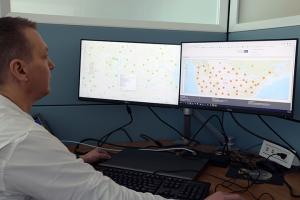
“The modernized website is more user-friendly, with a helpful, interactive map that’s easy to navigate,” said Dave Hoover, director of the USDA-NRCS National Soil Survey Center. “Whether you’re a hydrogeologist, municipal water-utility operator, or water-quality regulator looking to understand the subsurface, or an architect looking at a site’s soil to build a baseball field, you can search by location and have soil data available at your fingertips.”
The new map includes mid-infrared (MIR) soil spectroscopy data gathered during soil analysis at the KSSL, one of the largest libraries of MIR spectral data in the world. MIR soil spectroscopy uses the interactions between soil matter and infrared radiation to estimate soil properties, such as organic carbon, clay content, calcium carbonate equivalent, and pH, which is beneficial in soil health assessments.
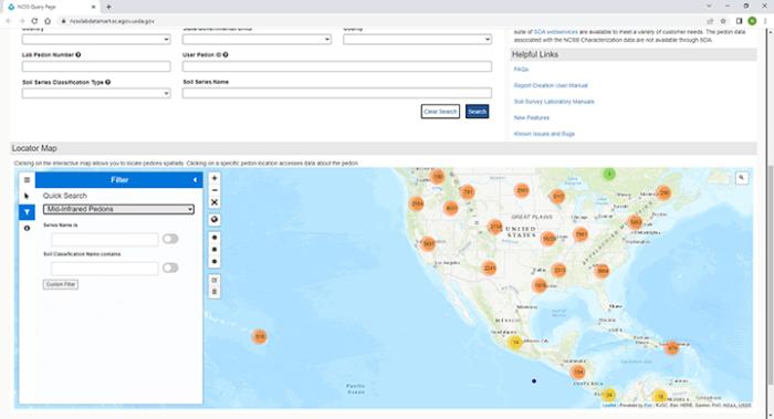
The interactive map links to a national database of soil characterization data allowing users to locate soil samples and “pedons” analyzed in the lab. A pedon is the smallest unit of soil containing all the soil horizons of a particular soil type. The customized data in the Lab Data Mart is downloadable to multiple web services and applications, such as SQLite, Access, GeoPackage, and ESRI File Geodatabase, and is continuously updated as more sampled soil sites are added or re-visited. The MIR spectroscopy data displayed on the map are available for download.
For the benefit of developers and data scientists, the lab tables are available through the Soil Data Access (SDA) application and SDA web services. Custom Structured Query Language (SQL) queries can be used to receive instant or emailed tabular results in xml, html, or text format. A suite of SDA web services is available to meet a variety of customer needs. The pedon data associated with the NCSS characterization data are not available through SDA.
What Else is New with Lab Data Mart?
- A new process has been implemented for updating the lab data on a more regular basis.
- Open-source databases and companion morphological data are now available.
- The update uses a new, simplified, database model schema.
- New data tables and columns are available.
- Interactive metadata documentation is available for the new tables.
- The previous web map has been replaced with an open-source, leaflet map that uses automated data.
- The map now allows you to select custom areas and to download the data in a database format of choice.
How Can Lab Data Mart Help You?
- Helps with carbon credits or improving carbon sequestration: The data can determine how much carbon is currently in the top 12 inches of soil to help you determine whether you want to sequester more carbon and consider methods and management practices to do so.
- Supplies valuable information to consider when leasing or buying land: The data may help determine if your planned management practices will work, and if not, what could be the added cost to do things differently? Understanding the mineralogy of your soil can help you determine if it requires soil amendments, a new tool or piece of equipment to accomplish your goals, or a change to what you farm or your tillage operation.
- Provides the foundational information for a more holistic view of your land: Whether working with an NRCS conservation planner or on your own, the data helps you know more about your soil and ties into how you look at the whole ecological site, as well as ecosystem state and transition models.
Who Can Help You Use Lab Data Mart and Help You Understand Your Data?
NRCS State Soil Scientists and their staff, as well as technical service providers, can assist with obtaining the data in Lab Data Mart and understanding it.
Visit the Lab Data Mart. Learn more about NRCS’ Soil Science. To get started with NRCS, visit your local USDA Service Center.