
2024 Refresh of Soil Survey Data
Details on the 2024 refresh of soil survey data.
The USDA NRCS, Soil and Plant Science Division refreshes the publicly available soil survey database once a year. This Annual Soils Refresh (ASR) provides new soils data, updates to existing soils data, and new soil interpretations. The ASR also ensures all official soils data adhere to the same standards.
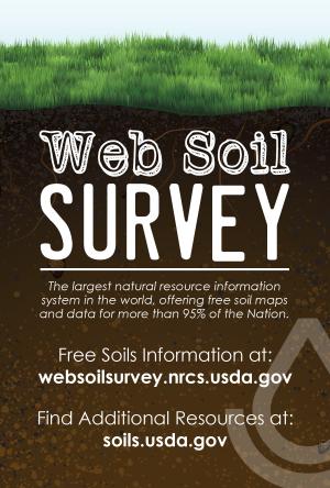
The official soil survey database was refreshed on October 1, 2024. This data is now available to the public through Web Soil Survey (WSS) or Soil Data Access (SDA). Additionally, a new SQLite SSURGO database containing the updated data is available for download, delivering all SSURGO data in a single, downloadable file. This product contains all tabular SSURGO data, a vector version of the polygons, and a rasterized version of the polygons. Please contact the Soils Hotline with any questions or requests for assistance.
The list below highlights some of the major additions to the official soil survey database.
- 270 million acres of new soils data added
- 3,379 soil survey areas published*
- Tabular data refreshed for all soil survey areas
- Spatial data refreshed for 834 soil survey areas
- 120 National soils interpretations published
- 99.275 new soil polygons added
- 5,492 new map units added
- 25,545 new soil components added
- The following soil survey areas were completed:
- AK621 - Kodiak Archipelago Area, Alaska**
- AK623 - Seward Area, Alaska**
- AK644 - Ketchikan Area, Alaska**
- AK646 - Chatham Area, Alaska**
- AK650 - Fort Wainwright Area, Alaska**
- AK659 - North Copper River Area, Alaska**
- AK693 - Yakutat Area, Alaska**
- AK700 - Yukon Delta National Wildlife Refuge - Nunivak Island Refuge Area, Alaska**
- AK701 - St. Mathew Island Area, Alaska**
- AK702 - St. Lawrence Island Area, Alaska**
- AK703 - Yukon Delta National Wildlife Refuge - Western Part Area, Alaska**
- AK704 - Yukon Delta National Wildlife Refuge - Yukon River Area, Alaska**
- AK705 - Yukon Delta National Wildlife Refuge - Kuskoskwim River Area, Alaska**
- AK706 - Chugach National Forest - Kenai Peninsula West Area, Alaska**
- AK707 - Chugach National Forest - Kenai Peninsula East Area, Alaska**
- AK708 - Chugach National Forest - Prince William Sound Area, Alaska**
- AK709 - Robinson Mountains and Gulf of Alaska Coast Area, Alaska**
- AK710 - Togiak National Wildlife Refuge - Southwestern Part and Bordering Area, Alaska**
- AK711 - Southern Nulato Hills Area, Alaska**
- AK712 - Reindeer and Iditarod Rivers Area, Alaska**
- AK713 - Western Ahklun Mountains Area, Alaska**
- AK714 - Aleutian Mountains - Lake Clark Area, Alaska**
- AK715 - Alaska Peninsula - Iliamna and Bristol Bay Lowlands Area, Alaska**
- AK717 - Katmai National Park and Preserve Area, Alaska**
- AK718 - Alaska Peninsula - Aniakchak and Unimak Area, Alaska**
- AK719 - Alaska Range - Tordrillo Mountains and Happy River Area, Alaska**
- AK720 - Alaska Range - Revelation Mountains and Stink River Area, Alaska**
- AK721 - Interior Rivers - Lime Hills and Kuskokwim Mountains Area, Alaska**
- AK722 - Kuskokwim - Kaiyuh Mountains Area, Alaska**
- AK723 - Tanana - Kuskokwim Lowlands - Snohomish and Trimokish Hills Area, Alaska**
- AK724 - Tatlanika and Wood River Area, Alaska**
- AK725 - Alaska Range - Clearwater Mountains and Susitna River Area, Alaska**
- AK726 - Kuskokwim Mountains and Bordering Area, Alaska**
- AK727 - Yukon River Lowlands and Innoko National Wildlife Refuge South Area, Alaska**
- AK728 - Nulato Hills - Continental Divide and Blackburn Hills Area, Alaska**
- AK729 - Yukon River Lowlands and Innoko National Wildlife Refuge, North Area, Alaska**
- AK730 - Ray Mountains - Kokrines Hills and Yukon River Area, Alaska**
- AK731 - Yukon River Lowlands - Koyukuk National Wildlife Refuge Area, Alaska**
- AK732 - Nowitna National Wildlife Refuge Area, Alaska**
- AK733 - Seward Peninsula and Nulato Hills Area, Alaska**
- AK734 - Southern Baird Mountains and Kiana Hills Area, Alaska**
- AK735 - De Long Mountains West and Noatak River Area, Alaska**
- AK736 - Seward Peninsula - Kotzebue Sound and Kivalik River Area, Alaska**
- AK737 - Alaska Range - Brushkana Area, Alaska**
- AK738 - Selawik National Wildlife Refuge Area, Alaska**
- AK739 - Brooks Range and Ray Mountains Area, Alaska**
- AK740 - Ray Mountains and Bordering Area, Alaska**
- AK741 - Purcell Mountains, Pah River Flats and Koyukuk River Area, Alaska**
- AK742 - Brooks Range and Kobuk River - Nana Area, Alaska**
- AK743 - Kobuk Ridges and Valleys - Alatna Hills and Bordering Area, Alaska**
- AK744 - Kanuti National Wildlife Refuge Area, Alaska**
- AK745 - Ray Mountains - Yukon Flats National Wildlife Refuge Northwest Area, Alaska**
- AK751 - Brooks Range and Davidson Mountains Area, Alaska**
- AK752 - Brooks Range - Gates Of The Arctic National Park and Preserve Area, Alaska**
- AK754 - Bering Land Bridge National Preserve and Shishmarev Area, Alaska**
- AK755 - Cape Krusenstern National Monument and Bordering Area, Alaska**
- AK756 - Brooks Range - Brooks Foothills Area, Alaska**
- AK757 - Brooks Range - Brooks Foothills - Lisburne Peninsula Area, Alaska**
- AK764 - Brooks Foothills - Toolik River Area, Alaska**
- AK765 - Ray Mountains and Yukon River Lowlands Area, Alaska**
- AK766 - Alaska Range - Granite Mountains Area, Alaska**
- AK767 - Yukon Tanana Uplands West and Bordering Area, Alaska**
- AK768 - Yukon Tanana Uplands East and Bordering Area, Alaska**
- AK769 - Alaska Range - Nelchina Public Use Area, Alaska**
- AK770 - Talkeetna and Chugach Mountains - Cook Inlet Area, Alaska**
- AK771 - Chugach Mountains - Eagle River Area, Alaska**
- AK772 - Kenai National Wildlife Refuge Area, Alaska**
- AK773 - Kenai Peninsula - Kenai Fjords National Park and Bordering Area, Alaska**
- AK774 - Kenai Mountains and Kachemak Bay State Park Area, Alaska**
- AK775 - Parts Of Wrangell - St. Elias National Park and Preserve Area, Alaska**
- AK776 - Boundary Range - Chilkat River Area, Alaska**
- AK777 - Chugach St. Elias and Boundary Ranges - Coastal Rainforest Area, Alaska**
- AK778 - St. George Island Area, Alaska**
- AK779 - Kuskokwim - Kilbuck Mountains Area, Alaska**
- AK781 - Aleutian Islands - Sanak Islands Area, Alaska**
- AK782 - Aleutian Islands - Unalaska and Andreanof Islands Area, Alaska**
- AK789 - Tetlin National Wildlife Refuge - Tanana Kuskokwim Lowlands Area, Alaska**
- AK790 - Tongass National Forest - Klukwah and Takshanuk Mountains Area, Alaska**
- AK791 - Alaska Range - Parts Of Mentasta Mountains Area, Alaska**
- AK793 - Tanana and Chatanika River Area, Alaska**
- AK794 - Kachemak Bay State Wilderness Park Area, Alaska**
- AK795 - Barren Islands Area, Alaska**
- AK796 - Middleton Island Area, Alaska**
- AK797 - Lower Kenai Peninsula - Northern Chugach Islands Area, Alaska**
- AZ695 - Kaibab National Forests, Arizona, Parts of Coconino, Mohave and Yavapai Counties
- CA673 - Santa Barbara County, California, South Coastal Part
- CA732 - Inyo National Forest, Western Part, California
- MT606 - Flathead Indian Reservation Wilderness Area, Montana
- MT633 - Bob Marshall, Scapegoat, Great Bear, and Mission Mtn. Wilderness Area, Montana
- OR618 - Crook County Area, Oregon*
- OR626 - Malheur National Forest, Oregon**
- OR627 - Grant County Area, Oregon
- OR677 - Wheeler County Area, Oregon
- UT651 - Fishlake National Forest, Utah, East Part - Parts of Sevier, Piute, Wayne and Sanpete Counties
- WA730 - Olympic National Park, Washington
- WI015 - Calumet County, Wisconsin*
- WI059 - Kenosha County, Wisconsin*
- WI071 - Manitowoc County, Wisconsin*
- WI079 - Milwaukee County, Wisconsin*
- WI101 - Racine County, Wisconsin*
- WI133 - Waukesha County, Wisconsin*
* Soil survey area OR654 - Prineville Area, Oregon, was removed and replaced by OR618 - Crook County Area, Oregon; WI600 - Calumet and Manitowoc Counties, Wisconsin, was removed and replaced by WI015 - Calumet County, Wisconsin, and WI071 - Manitowoc County, Wisconsin; WI601 - Kenosha and Racine Counties, Wisconsin, was removed and replaced by WI059 - Kenosha County, Wisconsin, and WI101 - Racine County, Wisconsin; and WI602 - Milwaukee and Waukesha Counties, Wisconsin, was removed and replaced by WI079 - Milwaukee County, Wisconsin, and WI133 - Waukesha County, Wisconsin.
** Soil survey area contains generalized order 5 soil mapping, published at a 1:250,000 scale. For comparison, most soil surveys contain detailed order 2 or order 3 soil mapping at the 1:24,000 scale. Please refer to pages 269-275 in Chapter 4 of the Soil Survey Manual for details about order of mapping and how it defines level of detail, accuracy, and scale. Some of these soil survey areas are entirely order 5 and others partially consist of order 5.

Stay Informed
- To stay updated about various soil-related issues, subscribe to GovDelivery, which is a free service.
- For assistance with WSS, send inquiries to SoilsHotline@usda.gov.
- For assistance with SDA, send inquiries to soildataaccess@usda.gov.
- For assistance from the Soils Hotline, a State soil scientist, or a local NRCS service center, click the “Contact Us” link in WSS or visit the contact information page for State soil scientists.
- For questions about soils data in a specific State, contact the State soil scientist.
- For more information on WSS, see “I Want Help With…” on WSS Home Page or visit the NRCS Soils web page.