

Utah Individual Site and Basin Time-Series Graphs
The following location-specific data provides snow water equivalent, precipitation, air temperature, and soil moisture for individual sites and basins in Utah.
Individual Site Products and Data
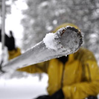
Snow Water Equivalent
Time-series charts detailing snow water equivalent data by point of record (POR) or projection at Utah SNOTEL sites.
- Agua Canyon: POR, projection
- Atwater: POR, projection
- Bear River RS: POR, projection
- Beaver Dams: POR, projection
- Beaver Divide: POR, projection
- Ben Lomond Peak: POR, projection
- Ben Lomond Trail: POR, projection
- Bevans Cabin: POR, projection
- Big Flat: POR, projection
- Black-Flat-U.M. Ck: POR, projection
- Blacks Fork Jct.: POR, projection
- Bobs Hollow: POR, projection
- Box Creek: POR, projection
- Box Springs: POR, projection
- Brian Head: POR, projection
- Brighton: POR, projection
- Brown Duck: POR, projection
- Buck Flat: POR, projection
- Buck Pasture: POR, projection
- Buckboard Flat: POR, projection
- Bug Lake: POR, projection
- Burts Miller Ranch: POR, projection
- Camp Jackson: POR, projection
- Cascade Mountain: POR, projection
- Castle Valley: POR, projection
- Chalk Creek #1: POR, projection
- Chalk Creek #2: POR, projection
- Chepeta: POR, projection
- Clayton Springs: POR, projection
- Clear Creek #1: POR, projection
- Clear Creek #2: POR, projection
- Corral: POR, projection
- Currant Creek: POR, projection
- Daniels-Strawberry: POR, projection
- Dills Camp: POR, projection
- Donkey Reservoir: POR, projection
- Dry Bread Pond: POR, projection
- Dry Fork: POR, projection
- East Willow Creek: POR, projection
- EF Blacks Fork GS: POR, projection
- Farmington: POR, projection
- Farmington Lower: POR, projection
- Farnsworth Lake: POR, projection
- Fish Lake Utah: POR, projection
- Five Points Lake: POR, projection
- Franklin Basin: POR, projection
- Garden City Summit: POR, projection
- Gardner Peak: POR, projection
- GBRC HQ: POR, projection
- GBRC Meadows: POR, projection
- George Creek: POR, projection
- Gooseberry RS: POR, projection
- Gooseberry RS Up: POR, projection
- Gutz Peak: POR, projection
- Hardscrabble: POR, projection
- Harris Flat: POR, projection
- Hayden Fork: POR, projection
- Hewinta: POR, projection
- Hickerson Park: POR, projection
- Hobble Creek: POR, projection
- Hole-in-Rock: POR, projection
- Horse Ridge: POR, projection
- Huntington Horse: POR, projection
- Jones Corral: POR, projection
- Kilfoil Creek: POR, projection
- Kimberly Mine: POR, projection
- Kings Cabin: POR, projection
- Klondike Narrows: POR, projection
- Kolob: POR, projection
- Lakefork #1: POR, projection
- Lakefork #3: POR, projection
- Lakefork Basin: POR, projection
- Lasal Mountain: POR, projection
- Lasal Mountain-Lower: POR, projection
- Lightning Ridge: POR, projection
- Lily Lake: POR, projection
- Little Bear: POR, projection
- Little Grassy: POR, projection
- Lonesome Beaver: POR, projection
- Long Flat: POR, projection
- Long Valley Jct.: POR, projection
- Lookout Peak: POR, projection
- Lost Creek Resv.: POR, projection
- Louis Meadow: POR, projection
- Mammoth-Cottonwood: POR, projection
- Merchant Valley: POR, projection
- Midway Valley: POR, projection
- Mill Creek Canyon: POR, projection
- Mill-D North: POR, projection
- Mining Fork: POR, projection
- Monte Cristo: POR, projection
- Mosby Mtn.: POR, projection
- Mt Baldy: POR, projection
- Mt Pennell: POR, projection
- Oak Creek: POR, projection
- Panguitch Lake RS: POR, projection
- Parleys Summit: POR, projection
- Parleys Upper: POR, projection
- Parrish Creek: POR, projection
- Payson R.S.: POR, projection
- Pickle Keg: POR, projection
- Pine Creek: POR, projection
- Red Pine Ridge: POR, projection
- Redden Mine Lwr: POR, projection
- Rees Flat: POR, projection
- Rock Creek: POR, projection
- Rockwood GS: POR, projection
- Rocky Basin-Settleme: POR, projection
- Santaquin Meadows: POR, projection
- Seeley Creek: POR, projection
- Smith & Morehouse: POR, projection
- Snowbird: POR, projection
- Spirit Lk: POR, projection
- Steel Creek Park: POR, projection
- Strawberry Divide: POR, projection
- Sunflower Flat: POR, projection
- Suu Ranch: POR, projection
- Takka Wiiya: POR, projection
- Temple Fork: POR, projection
- Thaynes Canyon: POR, projection
- Thistle Flat: POR, projection
- Timberline: POR, projection
- Timpanogos Divide: POR, projection
- Tony Grove Lake: POR, projection
- Tony Grove RS: POR, projection
- Trial Lake: POR, projection
- Trout Creek: POR, projection
- Upper Jones Valley: POR, projection
- Usu Doc Daniel: POR, projection
- Vernon Creek: POR, projection
- Webster Flat: POR, projection
- White River #1: POR, projection
- Widstoe #3: POR, projection
- Wilbur Bench: POR, projection
- Wolf Creek Peak: POR, projection
- Wrigley Creek: POR, projection
- Yankee Reservoir: POR, projection
Precipitation
The below charts detail precipitation data by point of record (POR) or projection at Utah SNOTEL sites.
- Agua Canyon: POR, projection
- Atwater: POR, projection
- Bear River RS: POR, projection
- Beaver Dams: POR, projection
- Beaver Divide: POR, projection
- Ben Lomond Peak: POR, projection
- Ben Lomond Trail: POR, projection
- Bevans Cabin: POR, projection
- Big Flat: POR, projection
- Black-Flat-U.M. Ck: POR, projection
- Blacks Fork Jct.: POR, projection
- Bobs Hollow: POR, projection
- Box Creek: POR, projection
- Box Springs: POR, projection
- Brian Head: POR, projection
- Brighton: POR, projection
- Brown Duck: POR, projection
- Buck Flat: POR, projection
- Buck Pasture: POR, projection
- Buckboard Flat: POR, projection
- Bug Lake: POR, projection
- Burts Miller Ranch: POR, projection
- Camp Jackson: POR, projection
- Cascade Mountain: POR, projection
- Castle Valley: POR, projection
- Chalk Creek #1: POR, projection
- Chalk Creek #2: POR, projection
- Chepeta: POR, projection
- Clayton Springs: POR, projection
- Clear Creek #1: POR, projection
- Clear Creek #2: POR, projection
- Corral: POR, projection
- Currant Creek: POR, projection
- Daniels-Strawberry: POR, projection
- Dills Camp: POR, projection
- Donkey Reservoir: POR, projection
- Dry Bread Pond: POR, projection
- Dry Fork: POR, projection
- East Willow Creek: POR, projection
- EF Blacks Fork GS: POR, projection
- Farmington: POR, projection
- Farmington Lower: POR, projection
- Farnsworth Lake: POR, projection
- Fish Lake Utah: POR, projection
- Five Points Lake: POR, projection
- Franklin Basin: POR, projection
- Garden City Summit: POR, projection
- Gardner Peak: POR, projection
- GBRC HQ: POR, projection
- GBRC Meadows: POR, projection
- George Creek: POR, projection
- Gooseberry RS: POR, projection
- Gooseberry RS Up: POR, projection
- Gutz Peak: POR, projection
- Hardscrabble: POR, projection
- Harris Flat: POR, projection
- Hayden Fork: POR, projection
- Hewinta: POR, projection
- Hickerson Park: POR, projection
- Hobble Creek: POR, projection
- Hole-in-Rock: POR, projection
- Horse Ridge: POR, projection
- Huntington Horse: POR, projection
- Jones Corral: POR, projection
- Kilfoil Creek: POR, projection
- Kimberly Mine: POR, projection
- Kings Cabin: POR, projection
- Klondike Narrows: POR, projection
- Kolob: POR, projection
- Lakefork #1: POR, projection
- Lakefork #3: POR, projection
- Lakefork Basin: POR, projection
- Lasal Mountain: POR, projection
- Lasal Mountain-Lower: POR, projection
- Lightning Ridge: POR, projection
- Lily Lake: POR, projection
- Little Bear: POR, projection
- Little Grassy: POR, projection
- Lonesome Beaver: POR, projection
- Long Flat: POR, projection
- Long Valley Jct.: POR, projection
- Lookout Peak: POR, projection
- Lost Creek Resv.: POR, projection
- Louis Meadow: POR, projection
- Mammoth-Cottonwood: POR, projection
- Merchant Valley: POR, projection
- Midway Valley: POR, projection
- Mill Creek Canyon: POR, projection
- Mill-D North: POR, projection
- Mining Fork: POR, projection
- Monte Cristo: POR, projection
- Mosby Mtn.: POR, projection
- Mt Baldy: POR, projection
- Mt Pennell: POR, projection
- Oak Creek: POR, projection
- Panguitch Lake RS: POR, projection
- Parleys Summit: POR, projection
- Parleys Upper: POR, projection
- Parrish Creek: POR, projection
- Payson R.S.: POR, projection
- Pickle Keg: POR, projection
- Pine Creek: POR, projection
- Red Pine Ridge: POR, projection
- Redden Mine Lwr: POR, projection
- Rees Flat: POR, projection
- Rock Creek: POR, projection
- Rockwood GS: POR, projection
- Rocky Basin-Settleme: POR, projection
- Santaquin Meadows: POR, projection
- Seeley Creek: POR, projection
- Smith & Morehouse: POR, projection
- Snowbird: POR, projection
- Spirit Lk: POR, projection
- Steel Creek Park: POR, projection
- Strawberry Divide: POR, projection
- Sunflower Flat: POR, projection
- Suu Ranch: POR, projection
- Takka Wiiya: POR, projection
- Temple Fork: POR, projection
- Thaynes Canyon: POR, projection
- Thistle Flat: POR, projection
- Timberline: POR, projection
- Timpanogos Divide: POR, projection
- Tony Grove Lake: POR, projection
- Tony Grove RS: POR, projection
- Trial Lake: POR, projection
- Trout Creek: POR, projection
- Upper Jones Valley: POR, projection
- Usu Doc Daniel: POR, projection
- Vernon Creek: POR, projection
- Webster Flat: POR, projection
- White River #1: POR, projection
- Widstoe #3: POR, projection
- Wilbur Bench: POR, projection
- Wolf Creek Peak: POR, projection
- Wrigley Creek: POR, projection
- Yankee Reservoir: POR, projection
Soil Moisture
The below graphs detail the period of record and average of current soil moisture.
- Agua Canyon: POR
- Atwater: POR
- Bear River RS: POR
- Beaver Dams: POR
- Beaver Divide: POR
- Ben Lomond Peak: POR
- Ben Lomond Trail: POR
- Bevans Cabin: POR
- Big Flat: POR
- Black-Flat-U.M. Ck: POR
- Blacks Fork Jct.: POR
- Bobs Hollow: POR
- Box Creek: POR
- Box Springs: POR
- Brian Head: POR
- Brighton: POR
- Brown Duck: POR
- Buck Flat: POR
- Buck Pasture: POR
- Buckboard Flat: POR
- Bug Lake: POR
- Burts Miller Ranch: POR
- Camp Jackson: POR
- Cascade Mountain: POR
- Castle Valley: POR
- Chalk Creek #1: POR
- Chalk Creek #2: POR
- Chepeta: POR
- Clayton Springs: POR
- Clear Creek #1: POR
- Clear Creek #2: POR
- Corral: POR
- Currant Creek: POR
- Daniels-Strawberry: POR
- Dills Camp: POR
- Donkey Reservoir: POR
- Dry Bread Pond: POR
- Dry Fork: POR
- East Willow Creek: POR
- EF Blacks Fork GS: POR
- Farmington: POR
- Farmington Lower: POR
- Farnsworth Lake: POR
- Fish Lake Utah: POR
- Five Points Lake: POR
- Franklin Basin: POR
- Garden City Summit: POR
- Gardner Peak: POR
- GBRC HQ: POR
- GBRC Meadows: POR
- George Creek: POR
- Gooseberry RS: POR
- Gooseberry RS Up: POR
- Gutz Peak: POR
- Hardscrabble: POR
- Harris Flat: POR
- Hayden Fork: POR
- Hewinta: POR
- Hickerson Park: POR
- Hobble Creek: POR
- Hole-in-Rock: POR
- Horse Ridge: POR
- Huntington Horse: POR
- Jones Corral: POR
- Kilfoil Creek: POR
- Kimberly Mine: POR
- Kings Cabin: POR
- Klondike Narrows: POR
- Kolob: POR
- Lakefork #1: POR
- Lakefork #3: POR
- Lakefork Basin: POR
- Lasal Mountain: POR
- Lasal Mountain-Lower: POR
- Lightning Ridge: POR
- Lily Lake: POR
- Little Bear: POR
- Little Grassy: POR
- Lonesome Beaver: POR
- Long Flat: POR
- Long Valley Jct.: POR
- Lookout Peak: POR
- Lost Creek Resv.: POR
- Louis Meadow: POR
- Mammoth-Cottonwood: POR
- Merchant Valley: POR
- Midway Valley: POR
- Mill Creek Canyon: POR
- Mill-D North: POR
- Mining Fork: POR
- Monte Cristo: POR
- Mosby Mtn.: POR
- Mt Baldy: POR
- Mt Pennell: POR
- Oak Creek: POR
- Panguitch Lake RS: POR
- Parleys Summit: POR
- Parleys Upper: POR
- Parrish Creek: POR
- Payson R.S.: POR
- Pickle Keg: POR
- Pine Creek: POR
- Red Pine Ridge: POR
- Redden Mine Lwr: POR
- Rees Flat: POR
- Rock Creek: POR
- Rockwood GS: POR
- Rocky Basin-Settleme: POR
- Santaquin Meadows: POR
- Seeley Creek: POR
- Smith & Morehouse: POR
- Snowbird: POR
- Spirit Lk: POR
- Steel Creek Park: POR
- Strawberry Divide: POR
- Sunflower Flat: POR
- Suu Ranch: POR
- Takka Wiiya: POR
- Temple Fork: POR
- Thaynes Canyon: POR
- Thistle Flat: POR
- Timberline: POR
- Timpanogos Divide: POR
- Tony Grove Lake: POR
- Tony Grove RS: POR
- Trial Lake: POR
- Trout Creek: POR
- Upper Jones Valley: POR
- Usu Doc Daniel: POR
- Vernon Creek: POR
- Webster Flat: POR
- White River #1: POR
- Widstoe #3: POR
- Wilbur Bench: POR
- Wolf Creek Peak: POR
- Wrigley Creek: POR
- Yankee Reservoir: POR
Air Temperature
The below period of records graphs detail average daily air temperatures.
- Agua Canyon
- Atwater
- Bear River RS
- Beaver Dams
- Beaver Divide
- Ben Lomond Peak
- Ben Lomond Trail
- Bevans Cabin
- Big Flat
- Black-Flat-U.M. Ck
- Blacks Fork Jct.
- Bobs Hollow
- Box Creek
- Box Springs
- Brian Head
- Brighton
- Brown Duck
- Buck Flat
- Buck Pasture
- Buckboard Flat
- Bug Lake
- Burts Miller Ranch
- Camp Jackson
- Cascade Mountain
- Castle Valley
- Chalk Creek #1
- Chalk Creek #2
- Chepeta
- Clayton Springs
- Clear Creek #1
- Clear Creek #2
- Corral
- Currant Creek
- Daniels-Strawberry
- Dills Camp
- Donkey Reservoir
- Dry Bread Pond
- Dry Fork
- East Willow Creek
- EF Blacks Fork GS
- Farmington
- Farmington Lower
- Farnsworth Lake
- Fish Lake Utah
- Five Points Lake
- Franklin Basin
- Garden City Summit
- Gardner Peak
- GBRC HQ
- GBRC Meadows
- George Creek
- Gooseberry RS
- Gooseberry RS Up
- Gutz Peak
- Hardscrabble
- Harris Flat
- Hayden Fork
- Hewinta
- Hickerson Park
- Hobble Creek
- Hole-in-Rock
- Horse Ridge
- Huntington Horse
- Jones Corral
- Kilfoil Creek
- Kimberly Mine
- Kings Cabin
- Klondike Narrows
- Kolob
- Lakefork #1
- Lakefork #3
- Lakefork Basin
- Lasal Mountain
- Lasal Mountain-Lower
- Lightning Ridge
- Lily Lake
- Little Bear
- Little Grassy
- Lonesome Beaver
- Long Flat
- Long Valley Jct.
- Lookout Peak
- Lost Creek Resv.
- Louis Meadow
- Mammoth-Cottonwood
- Merchant Valley
- Midway Valley
- Mill Creek Canyon
- Mill-D North
- Mining Fork
- Monte Cristo
- Mosby Mtn.
- Mt Baldy
- Mt Pennell
- Oak Creek
- Panguitch Lake RS
- Parleys Summit
- Parleys Upper
- Parrish Creek
- Payson R.S.
- Pickle Keg
- Pine Creek
- Red Pine Ridge
- Redden Mine Lwr
- Rees Flat
- Rock Creek
- Rockwood GS
- Rocky Basin-Settleme
- Santaquin Meadows
- Seeley Creek
- Smith & Morehouse
- Snowbird
- Spirit Lk
- Steel Creek Park
- Strawberry Divide
- Sunflower Flat
- Suu Ranch
- Takka Wiiya
- Temple Fork
- Thaynes Canyon
- Thistle Flat
- Timberline
- Timpanogos Divide
- Tony Grove Lake
- Tony Grove RS
- Trial Lake
- Trout Creek
- Upper Jones Valley
- Usu Doc Daniel
- Vernon Creek
- Webster Flat
- White River #1
- Widstoe #3
- Wilbur Bench
- Wolf Creek Peak
- Wrigley Creek
- Yankee Reservoir
Soil Temperature
The below period of records graphs detail average daily soil temperatures.
- Agua Canyon
- Atwater
- Bear River RS
- Beaver Dams
- Beaver Divide
- Ben Lomond Peak
- Ben Lomond Trail
- Bevans Cabin
- Big Flat
- Black-Flat-U.M. Ck
- Blacks Fork Jct.
- Bobs Hollow
- Box Creek
- Box Springs
- Brian Head
- Brighton
- Brown Duck
- Buck Flat
- Buck Pasture
- Buckboard Flat
- Bug Lake
- Burts Miller Ranch
- Camp Jackson
- Cascade Mountain
- Castle Valley
- Chalk Creek #1
- Chalk Creek #2
- Chepeta
- Clayton Springs
- Clear Creek #1
- Clear Creek #2
- Corral
- Currant Creek
- Daniels-Strawberry
- Dills Camp
- Donkey Reservoir
- Dry Bread Pond
- Dry Fork
- East Willow Creek
- EF Blacks Fork GS
- Farmington
- Farmington Lower
- Farnsworth Lake
- Fish Lake Utah
- Five Points Lake
- Franklin Basin
- Garden City Summit
- Gardner Peak
- GBRC HQ
- GBRC Meadows
- George Creek
- Gooseberry RS
- Gooseberry RS Up
- Gutz Peak
- Hardscrabble
- Harris Flat
- Hayden Fork
- Hewinta
- Hickerson Park
- Hobble Creek
- Hole-in-Rock
- Horse Ridge
- Huntington Horse
- Jones Corral
- Kilfoil Creek
- Kimberly Mine
- Kings Cabin
- Klondike Narrows
- Kolob
- Lakefork #1
- Lakefork #3
- Lakefork Basin
- Lasal Mountain
- Lasal Mountain-Lower
- Lightning Ridge
- Lily Lake
- Little Bear
- Little Grassy
- Lonesome Beaver
- Long Flat
- Long Valley Jct.
- Lookout Peak
- Lost Creek Resv.
- Louis Meadow
- Mammoth-Cottonwood
- Merchant Valley
- Midway Valley
- Mill Creek Canyon
- Mill-D North
- Mining Fork
- Monte Cristo
- Mosby Mtn.
- Mt Baldy
- Mt Pennell
- Oak Creek
- Panguitch Lake RS
- Parleys Summit
- Parleys Upper
- Parrish Creek
- Payson R.S.
- Pickle Keg
- Pine Creek
- Red Pine Ridge
- Redden Mine Lwr
- Rees Flat
- Rock Creek
- Rockwood GS
- Rocky Basin-Settleme
- Santaquin Meadows
- Seeley Creek
- Smith & Morehouse
- Snowbird
- Spirit Lk
- Steel Creek Park
- Strawberry Divide
- Sunflower Flat
- Suu Ranch
- Takka Wiiya
- Temple Fork
- Thaynes Canyon
- Thistle Flat
- Timberline
- Timpanogos Divide
- Tony Grove Lake
- Tony Grove RS
- Trial Lake
- Trout Creek
- Upper Jones Valley
- Usu Doc Daniel
- Vernon Creek
- Webster Flat
- White River #1
- Widstoe #3
- Wilbur Bench
- Wolf Creek Peak
- Wrigley Creek
- Yankee Reservoir
Snow Depth
- Agua Canyon
- Atwater
- Bear River RS
- Beaver Dams
- Beaver Divide
- Ben Lomond Peak
- Ben Lomond Trail
- Bevans Cabin
- Big Flat
- Black-Flat-U.M. Ck
- Blacks Fork Jct.
- Bobs Hollow
- Box Creek
- Box Springs
- Brian Head
- Brighton
- Brown Duck
- Buck Flat
- Buck Pasture
- Buckboard Flat
- Bug Lake
- Burts Miller Ranch
- Camp Jackson
- Cascade Mountain
- Castle Valley
- Chalk Creek #1
- Chalk Creek #2
- Chepeta
- Clayton Springs
- Clear Creek #1
- Clear Creek #2
- Corral
- Currant Creek
- Daniels-Strawberry
- Dills Camp
- Donkey Reservoir
- Dry Bread Pond
- Dry Fork
- East Willow Creek
- EF Blacks Fork GS
- Farmington
- Farmington Lower
- Farnsworth Lake
- Fish Lake Utah
- Five Points Lake
- Franklin Basin
- Garden City Summit
- Gardner Peak
- GBRC HQ
- GBRC Meadows
- George Creek
- Gooseberry RS
- Gooseberry RS Up
- Gutz Peak
- Hardscrabble
- Harris Flat
- Hayden Fork
- Hewinta
- Hickerson Park
- Hobble Creek
- Hole-in-Rock
- Horse Ridge
- Huntington Horse
- Jones Corral
- Kilfoil Creek
- Kimberly Mine
- Kings Cabin
- Klondike Narrows
- Kolob
- Lakefork #1
- Lakefork #3
- Lakefork Basin
- Lasal Mountain
- Lasal Mountain-Lower
- Lightning Ridge
- Lily Lake
- Little Bear
- Little Grassy
- Lonesome Beaver
- Long Flat
- Long Valley Jct.
- Lookout Peak
- Lost Creek Resv.
- Louis Meadow
- Mammoth-Cottonwood
- Merchant Valley
- Midway Valley
- Mill Creek Canyon
- Mill-D North
- Mining Fork
- Monte Cristo
- Mosby Mtn.
- Mt Baldy
- Mt Pennell
- Oak Creek
- Panguitch Lake RS
- Parleys Summit
- Parleys Upper
- Parrish Creek
- Payson R.S.
- Pickle Keg
- Pine Creek
- Red Pine Ridge
- Redden Mine Lwr
- Rees Flat
- Rock Creek
- Rockwood GS
- Rocky Basin-Settleme
- Santaquin Meadows
- Seeley Creek
- Smith & Morehouse
- Snowbird
- Spirit Lk
- Steel Creek Park
- Strawberry Divide
- Sunflower Flat
- Suu Ranch
- Takka Wiiya
- Temple Fork
- Thaynes Canyon
- Thistle Flat
- Timberline
- Timpanogos Divide
- Tony Grove Lake
- Tony Grove RS
- Trial Lake
- Trout Creek
- Upper Jones Valley
- Usu Doc Daniel
- Vernon Creek
- Webster Flat
- White River #1
- Widstoe #3
- Wilbur Bench
- Wolf Creek Peak
- Wrigley Creek
- Yankee Reservoir
Basin Products and Data
Snow Water Equivalent
Time-series charts detailing snow water equivalent data by point of record (POR) or projection at Utah SNOTEL sites.
- Abajo Mountains: POR, projection
- American Fork: POR, projection
- Ashley: POR, projection
- Bear: POR, projection
- Bear Lake: POR, projection
- Beaver: POR, projection
- Big Cottonwood: POR, projection
- Bingham: POR, projection
- Blacks Fork: POR, projection
- Blacksmith Fork: POR, projection
- Chalk: POR, projection
- City: POR, projection
- Coal-Parowan: POR, projection
- Cottonwood: POR, projection
- Cub: POR, projection
- Deep Creek Mountains: POR, projection
- Dirty Devil: POR, projection
- Duchesne: POR, projection
- East Canyon: POR, projection
- East Fork Sevier: POR, projection
- Emigration: POR, projection
- Ephraim: POR, projection
- Escalante: POR, projection
- Escalante-Paria: POR, projection
- Farmington: POR, projection
- Ferron: POR, projection
- Fremont: POR, projection
- Great Salt Lake: POR, projection
- Headwaters Duchesne: POR, projection
- Headwaters Weber: POR, projection
- Henry Mountains: POR, projection
- Henrys Fork: POR, projection
- Huntington: POR, projection
- Kanab: POR, projection
- Lake Fork: POR, projection
- Little Bear: POR, projection
- Little Cottonwood: POR, projection
- Logan: POR, projection
- Lost: POR, projection
- Lower Sevier: POR, projection
- Manti: POR, projection
- Middle Sevier: POR, projection
- Mill: POR, projection
- Mill Creek: POR, projection
- Muddy: POR, projection
- Northeastern Uintas: POR, projection
- Ogden: POR, projection
- Paria: POR, projection
- Parleys: POR, projection
- Price: POR, projection
- Price-San Rafael: POR, projection
- Provo: POR, projection
- Provo-Utah Lake-Jordan: POR, projection
- Raft: POR, projection
- Raft Mountains: POR, projection
- Rock: POR, projection
- Rush-Tooele Valleys: POR, projection
- San Pitch: POR, projection
- Santa Clara: POR, projection
- Sevier Headwaters: POR, projection
- Sheep: POR, projection
- Smiths Fork: POR, projection
- Southeastern Utah: POR, projection
- Southwestern Utah: POR, projection
- Spanish Fork: POR, projection
- Strawberry: POR, projection
- Tooele Valley-Vernon Creek: POR, projection
- Twelvemile: POR, projection
- Uinta: POR, projection
- Upper Bear: POR, projection
- Upper Beaver: POR, projection
- Upper Sevier: POR, projection
- Upper Virgin: POR, projection
- Weber-Ogden: POR, projection
- Willow: POR, projection
- Yellowstone: POR, projection
Precipitation
The below graphs detail period of record and projected precipitation of all sites within and adjacent to the selected watershed.
- Abajo Mountains: POR, projection
- American Fork: POR, projection
- Ashley: POR, projection
- Bear: POR, projection
- Bear Lake: POR, projection
- Beaver: POR, projection
- Big Cottonwood: POR, projection
- Bingham: POR, projection
- Blacks Fork: POR, projection
- Blacksmith Fork: POR, projection
- Chalk: POR, projection
- City: POR, projection
- Coal-Parowan: POR, projection
- Cottonwood: POR, projection
- Cub: POR, projection
- Deep Creek Mountains: POR, projection
- Dirty Devil: POR, projection
- Duchesne: POR, projection
- East Canyon: POR, projection
- East Fork Sevier: POR, projection
- Emigration: POR, projection
- Ephraim: POR, projection
- Escalante: POR, projection
- Escalante-Paria: POR, projection
- Farmington: POR, projection
- Ferron: POR, projection
- Fremont: POR, projection
- Great Salt Lake: POR, projection
- Headwaters Duchesne: POR, projection
- Headwaters Weber: POR, projection
- Henry Mountains: POR, projection
- Henrys Fork: POR, projection
- Huntington: POR, projection
- Kanab: POR, projection
- Lake Fork: POR, projection
- Little Bear: POR, projection
- Little Cottonwood: POR, projection
- Logan: POR, projection
- Lost: POR, projection
- Lower Sevier: POR, projection
- Manti: POR, projection
- Middle Sevier: POR, projection
- Mill: POR, projection
- Mill Creek: POR, projection
- Muddy: POR, projection
- Northeastern Uintas: POR, projection
- Ogden: POR, projection
- Paria: POR, projection
- Parleys: POR, projection
- Price: POR, projection
- Price-San Rafael: POR, projection
- Provo: POR, projection
- Provo-Utah Lake-Jordan: POR, projection
- Raft: POR, projection
- Raft Mountains: POR, projection
- Rock: POR, projection
- Rush-Tooele Valleys: POR, projection
- San Pitch: POR, projection
- Santa Clara: POR, projection
- Sevier Headwaters: POR, projection
- Sheep: POR, projection
- Smiths Fork: POR, projection
- Southeastern Utah: POR, projection
- Southwestern Utah: POR, projection
- Spanish Fork: POR, projection
- Strawberry: POR, projection
- Tooele Valley-Vernon Creek: POR, projection
- Twelvemile: POR, projection
- Uinta: POR, projection
- Upper Bear: POR, projection
- Upper Beaver: POR, projection
- Upper Sevier: POR, projection
- Upper Virgin: POR, projection
- Weber-Ogden: POR, projection
- Willow: POR, projection
- Yellowstone: POR, projection
Soil Moisture
Graphs comparing the average of current soil moisture (in % saturation) of all sites within and adjacent to the watershed with all other years from the historical record. Graphs also include statistical background data, such as the maximum, normal, and minimum water years, as well as shading based on the 10th, 30th, 50th, 70th, and 90th percentiles. The user can select and compare any year(s)
- Statewide
- Abajo Mountains
- American Fork
- Ashley
- Bear
- Bear Lake
- Beaver
- Big Cottonwood
- Bingham
- Blacks Fork
- Blacksmith Fork
- Chalk
- City
- Coal-Parowan
- Cottonwood
- Cub
- Deep Creek Mountains
- Dirty Devil
- Duchesne
- East Canyon
- East Fork Sevier
- Emigration
- Ephraim
- Escalante
- Escalante-Paria
- Farmington
- Ferron
- Fremont
- Great Salt Lake
- Headwaters Duchesne
- Headwaters Weber
- Henry Mountains
- Henrys Fork
- Huntington
- Kanab
- Lake Fork
- Little Bear
- Little Cottonwood
- Logan
- Lost
- Lower Sevier
- Manti
- Middle Sevier
- Mill
- Mill Creek
- Muddy
- Northeastern Uintas
- Ogden
- Paria
- Parleys
- Price
- Price-San Rafael
- Provo
- Provo-Utah Lake-Jordan
- Raft
- Raft Mountains
- Rock
- Rush-Tooele Valleys
- San Pitch
- Santa Clara
- Sevier Headwaters
- Southeastern Utah
- Southwestern Utah
- Spanish Fork
- Strawberry
- Tooele Valley-Vernon Creek
- Twelvemile
- Uinta
- Upper Bear
- Upper Beaver
- Upper Sevier
- Upper Virgin
- Weber-Ogden
- Willow
- Yellowstone
Air Temperature
Graphs comparing the average of current average daily temperature (in °F) of all sites within and adjacent to the watershed with all other years from the historical record. Graphs also include statistical background data, such as the maximum, normal, and minimum water years, as well as shading based on the 10th, 30th, 50th, 70th, and 90th percentiles. The user can select and compare any year(s).
- Abajo Mountains
- American Fork
- Ashley
- Bear
- Bear Lake
- Beaver
- Big Cottonwood
- Bingham
- Blacks Fork
- Blacksmith Fork
- Chalk
- City
- Coal-Parowan
- Cottonwood
- Cub
- Deep Creek Mountains
- Dirty Devil
- Duchesne
- East Canyon
- East Fork Sevier
- Emigration
- Ephraim
- Escalante
- Escalante-Paria
- Farmington
- Ferron
- Fremont
- Headwaters Duchesne
- Headwaters Weber
- Henry Mountains
- Henrys Fork
- Huntington
- Kanab
- Lake Fork
- Little Bear
- Little Cottonwood
- Logan
- Lost
- Lower Sevier
- Manti
- Middle Sevier
- Mill
- Mill Creek
- Muddy
- Northeastern Uintas
- Ogden
- Paria
- Parleys
- Price
- Price-San Rafael
- Provo
- Provo-Utah Lake-Jordan
- Raft
- Raft Mountains
- Rock
- Rush-Tooele Valleys
- San Pitch
- Santa Clara
- Sevier Headwaters
- Sheep
- Smiths Fork
- Southeastern Utah
- Southwestern Utah
- Spanish Fork
- Strawberry
- Tooele Valley-Vernon Creek
- Twelvemile
- Uinta
- Upper Bear
- Upper Beaver
- Upper Sevier
- Upper Virgin
- Weber-Ogden
- Willow
- Yellowstone