
USACE Visit to Clear Lake SNOTEL

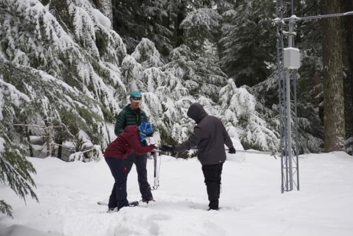
Staff from the U.S. Army Corps of Engineers join staff from the NRCS Oregon Snow Survey on a trip to Clear Lake SNOTEL
Staff from the U.S. Army Corps of Engineers (USACE), including commanders for the Northwestern Division and Portland District, joined staff from the NRCS Oregon Snow Survey on a visit to Clear Lake SNOTEL site (south of Mt. Hood) to discuss the importance of data collected at sites across the region and the history of the Snow Survey and Water Supply Forecasting Program. The USACE is one of many partners the NRCS Oregon Snow Survey collaborates with to better serve the needs of water users and resource managers in the state of Oregon.
The USACE operates several projects in the Willamette and Rogue River Basins for flood control, water supply, and power generation. These reservoirs include Lost Creek Lake and Applegate in the Rogue Basin, and 13 in the Willamette Basin including Detroit and Cougar. Hydroclimatic data from SNOTEL stations upstream of these reservoirs are essential to dam operations. These data are used in models for streamflow forecasts that assist dam operators in properly managing reservoir storage volumes, thus outflow from reservoirs, throughout the spring and summer when streamflow runoff is primarily driven by melting of snowpack.
In fact, the first water supply forecast was driven by the need to properly manage reservoir operations at the Tahoe Dam on the Truckee River. This dam, managed by the Truckee River General Electric Company, was primarily used for hydroelectric power in the late 1800s. By 1903, the federal government assumed the right to control water stored in Lake Tahoe and started diversions to the downstream farmland. However, the reliability of water supply from Lake Tahoe was affected by the high variability in winter weather conditions, thus leading to difficulties managing outflow from the dam. Dr. James E. Church, the first to survey snow and perform regular snowpack measurements on top of Mt. Rose, correlated snowpack measurements in the Tahoe Basin with spring lake levels. Thus, he produced the first water supply forecasts for the Tahoe dam operators in 1910. Ever since, reservoir managers have been one of the primary users of data provided by the NRCS Snow Survey and Water Supply Forecasting Program (SSWSF).
Want to learn more? Visit the links below!
USACE Portland District
USACE Northwestern Division
NRCS Oregon Snow Survey "About Us"
NRCS SSWSF History