
Sustaining the Land: Tribal Land Management and Conservation at Fort Belknap
Fort Belknap Indian Reservation in north-central Montana is the homeland of the Assiniboine and Gros Ventre Tribes. The fourth largest reservation in the state, Fort Belknap spans 675,147 acres with a beautiful landscape of rolling plains.
Fort Belknap Indian Reservation in north-central Montana is the homeland of the Assiniboine and Gros Ventre Tribes. The fourth largest reservation in the state, Fort Belknap spans 675,147 acres with a beautiful landscape of rolling plains. The land is home to livestock and a variety of wildlife, such as bison, deer, antelope, waterfowl, eagles, and many upland birds. The property is different because the range is tribally owned, with Bureau of Land Management (BLM) land incorporated.
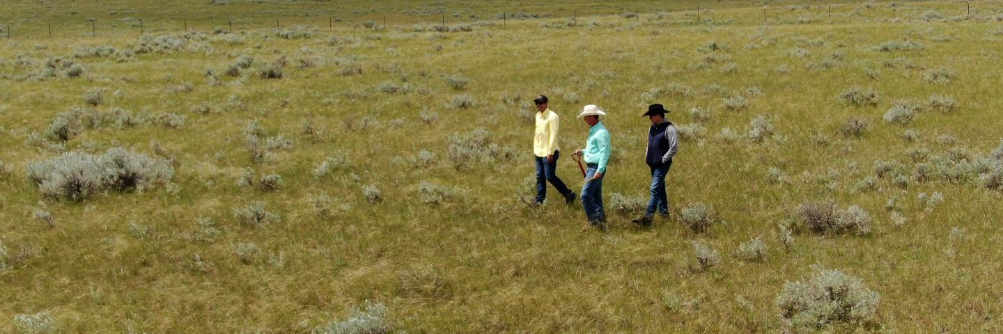
Trying to find an effective land management system can be challenging on such a unique property. When concerns arose about the declining state of the rangeland, USDA Agricultural Ambassador Kyle Stiffarm approached the USDA Natural Resources Conservation Service (NRCS) looking for technical assistance on how best to improve grazing management.
A major problem on rangeland across the west is lack of rest and recovery for plants that have been grazed. “Having a good grazing system is very important and we have to understand what it is we are managing and what we are managing for, so getting out to inventory the species of plants, forage production, and overall health of the rangeland is key,” says NRCS State Rangeland Specialist Kevin Derzapf who has worked with Stiffarm for nearly three years both on prescribed grazing and range inventory.
Over many years, grasslands at Fort Belknap had become degraded due to a variety of factors from overgrazing to increasing drought. To change this trajectory, Stiffarm not only hoped to identify resource concerns and better grazing management, but also to create opportunities for tribal members to participate in NRCS conservation programs with future generations in mind.
With a long history of working in cooperation with NRCS to establish best management practices for grazing bison and cattle, Stiffarm brought the agency on to get some good on-the-ground information about the condition of the rangeland and the plants growing there. Noticeable resource concerns included lack of water, under-grazed areas too far from water sources, and overgrazed areas, particularly near those few water sources.

A Holistic Approach Range Management
Seventy percent of Montana is rangelands, according to Derzapf. “Range inventory is an important measurement. We can look at where we came from, where we’re at, and in the future, we can monitor if the rangeland management we’re imparting is improving the land or degrading it.”
Derzapf describes this data as being critical to rangeland management success. “We try to key in on specific plants or groups of plants in specific areas and focus on what we want on the rangeland, not necessarily on what we don’t want. We want to increase the palatable and productive forages and to increase the plant diversity.”
At Fort Belknap, this work has included NRCS helping with range inventory on 30,000 acres. Add in the work done through their BLM partnership and that number reaches more than 50,000 acres of rangeland management.
Range and Forage Inventory
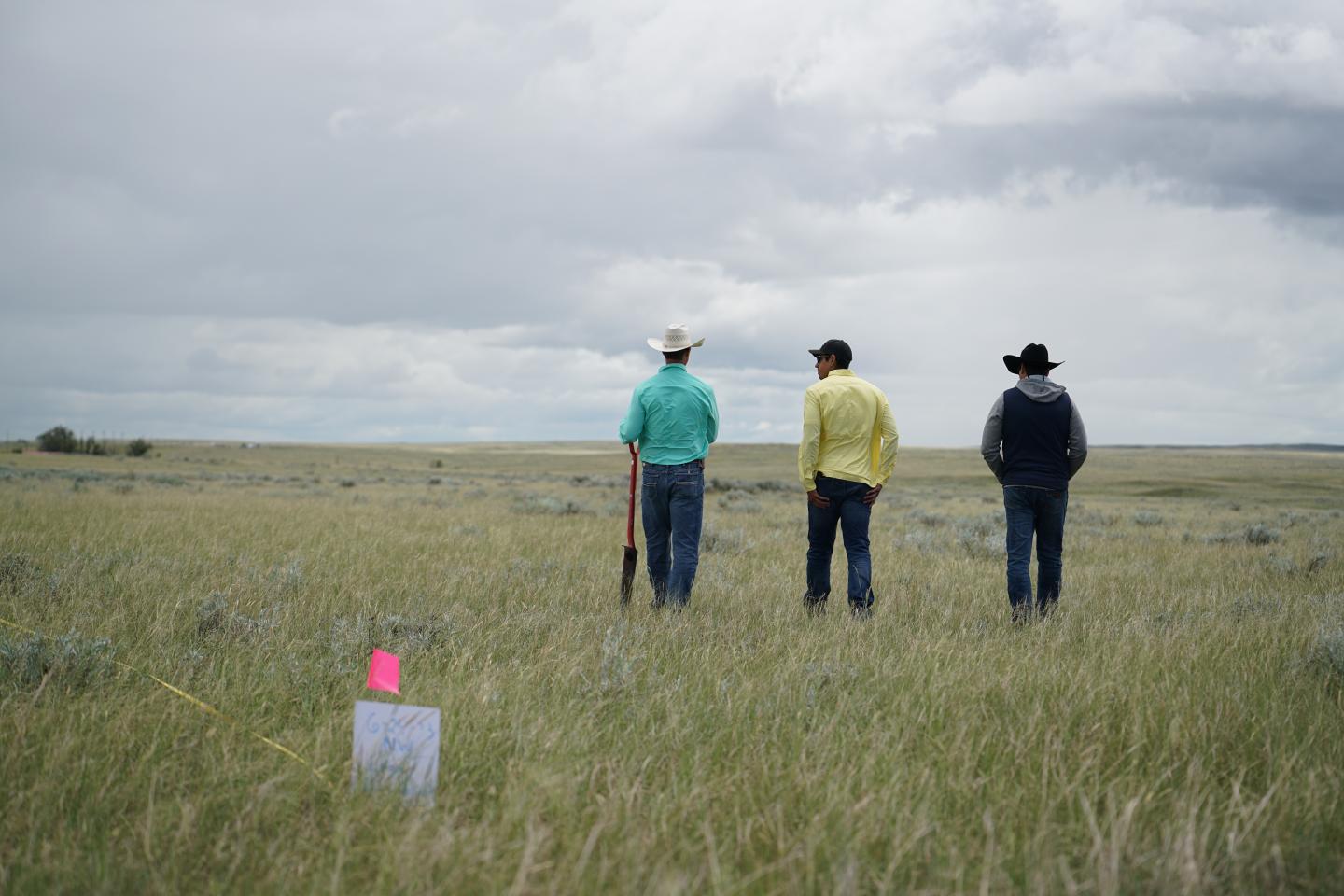
In addition to NRCS involvement, the range and forage inventory project involved a partnership with BLM, the Bureau of Indian Affairs (BIA), and the Fort Belknap Indian Community to collect inventory data needed to assess the identified critical resource concerns.
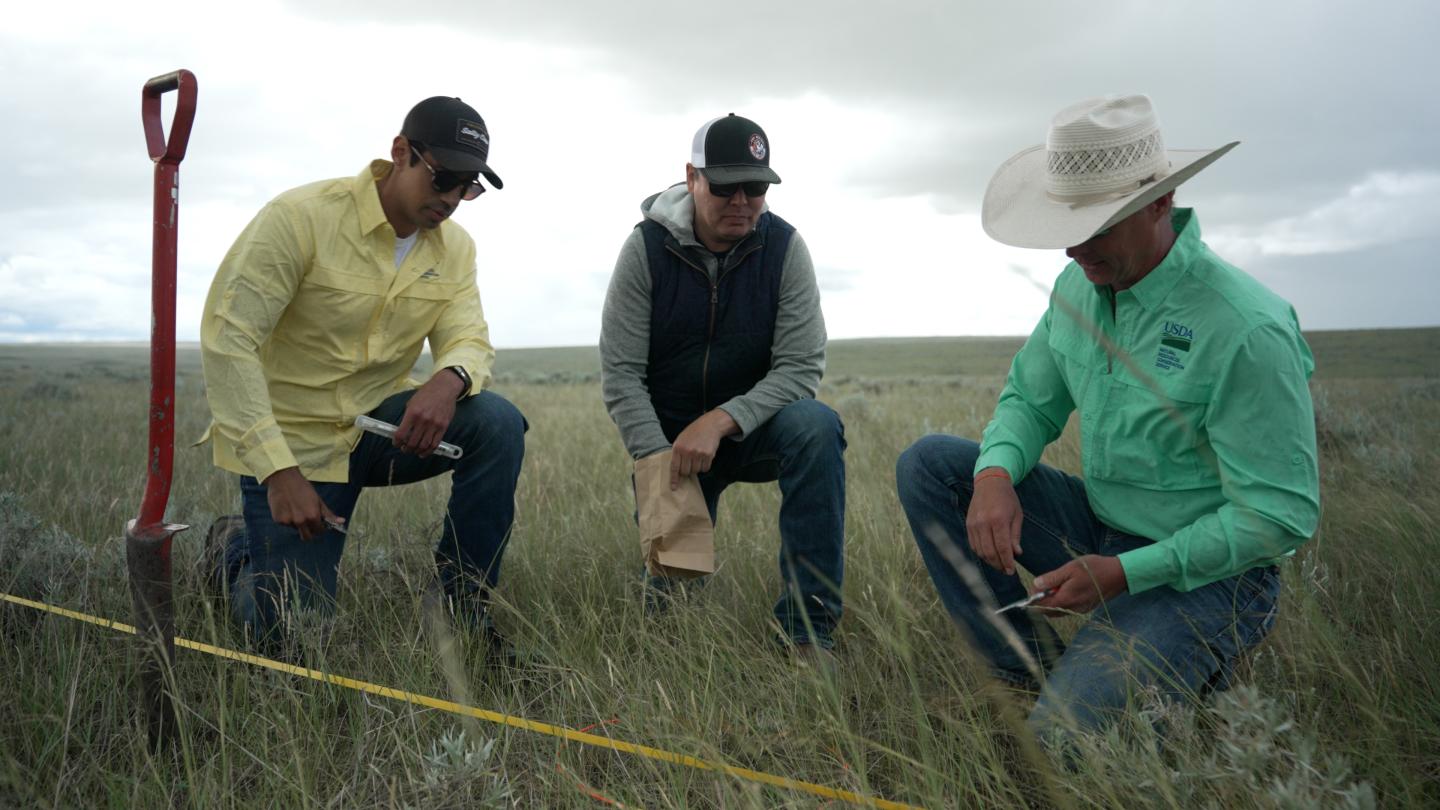
Under Derzapf’s leadership, the team revisited areas that had been inventoried years earlier to conduct range inventories gathering data on production, plant species, bare ground, and other metrics. During the inventory, Derzapf provided hands-on training to field crews in preparation for the weeklong project. The NRCS team showed participants how to identify ecological sites and how to evaluate each site using indicators of rangeland health. They also instructed the team on using the line-point intercept method for foliar cover and the total harvest by species method for production.
“What we’ve seen from this inventory, and the inventory conducted 10 years ago, are similar species composition,” Derzapf says. “We saw greater productivity but that is a result of the tribes management of the land. They removed the cattle from the pasture for two years and let the range recover. And then we had an excellent spring with abundant rainfall, so the range was in excellent condition when we conducted this inventory 10 years later.”
Field data gathered was then used by NRCS, who worked with tribal managers, to develop a Targeted Implementation Plan (TIP) to address critical resource concerns.
NRCS Tribal Conservationist, Michael Kinsey, was not involved in the range inventory, but came on shortly afterwards and is supporting Fort Belknap’s TIP on its submarginal lands.
Kinsey plans to address concerns noted last year by conducting additional inventory of livestock water quality, quantity, and how it’s distributed within the TIP. The goal is to improve water availability for livestock. His efforts will also continue to address grazing challenges, with a focus on improving infrastructure, like adding cross fencing.
“It’s been good working with the different partners,” Kinsey says. “Going through the BIA and the tribe itself, it’s been bringing everyone to the table, so everyone is in the know.”
A Conservation Reserve Enhancement Program (CREP) will begin after the TIP. Under this agreement, the community will enroll land located within the reservation’s boundaries or owned by individual tribe members to conserve resources, improve environmental quality, and enhance wildlife habitats. For this effort, NRCS is developing tribal-specific grazing plans to help implement these conservation practices on tribal lands.
Extending Opportunities to Tribal Communities
“We’ve completed one large water development and are in the process of completing a second. We have a conservation reserve enhancement program that’s probably going to be the driver to how we approach some of these larger projects,” Stiffarm says. He adds the enhancement program has sparked community wide interest in not just the work they’re doing, but the work that they’ll be able to do in the future.
“Fort Belknap is kind of a blank canvas at the moment. A lot of programs are available inside NRCS. Some of the projects we’ve completed are becoming a catalyst for others to take advantage of some of the EQIP programs,” Stiffarm says.
The hope is that the work they’ve accomplished so far will not only create more opportunities for tribal members to apply for financial assistance programs, but to benefit from educational opportunities as well.
“We’re also hoping to create more educational opportunities like field days and group training and one-on-one training opportunities,” Derzapf says, explaining they are partnering with organizations like Montana Grazing Lands Coalition and Western Landowners Alliance.
So far, people have been receptive. It’s not just tribal members who are on the learning end, but agency representatives as well. “It was a huge opportunity for us to train new employees through the forage inventory process, plant identification, how to conduct a forage inventory, how to come up with stocking rates—all the things that move towards generating interest in grazing management,” says Derzapf.

The Role of Partnerships in Overcoming Challenges
Stiffarm says what they’ve accomplished so far is the result of a team effort. He’s enjoyed working with and creating good relationships over the past few years with NRCS staff, who are trying to do everything they can to help tribal producers move forward.
“I was fortunate to be able to work with former NRCS employees Blake Stiffarm and Leon Lasalle. They nudged me in the right direction. But at some point, I had to step up to the plate, take the bull by the horns, and get us headed in the right direction the best I could,” Stiffarm states.
Working with Derzapf has proven to be equally as helpful. “Kevin’s been amazing. He’s very knowledgeable and he’s been helpful in organizing the range inventory and doing some really solid evaluation and giving us that science-based analysis we were looking for,” Stiffarm says.
Having a tribal conservationist on hand also has been a plus. “Michael—he’s a community member and his knowledge and educational background is contributing to our success in exploring new programs through NRCS,” Stiffarm says.
Beyond NRCS, BLM has been a heavy hitter in making progress with range management across the expanse of Fort Belknap.
“We were very fortunate we had Tracy Stone Manning from BLM. BLM listened to us last summer. We gave an idea of what we were trying to accomplish and how we were going to need to find partnerships within the BLM, considering the tribal land within the submarginals that is owned and managed by the tribe also borders about 30,000 acres of BLM land,” Stiffarm says. “Finding a way for the two to coexist under a conservation plan is a very unique challenge. It’s also a very opportunistic challenge at the same time.”
Submarginal lands are lands that lie to the west of the reservation boundaries. This area is bordered by BLM and state lands and has a distinctive management strategy. Nestled between the Bears Paw and Rocky Mountains, it features expansive, open views, wide grassy prairies, and abundant wildlife. For this reason, according to Stiffarm, “It's important to create a management plan to sustain the land far into the future.”