

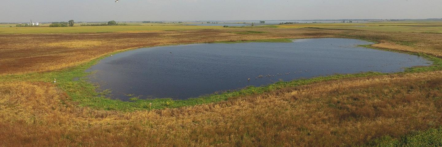
This tool provides guidance on lateral effect distances for prospective drainage projects within the Prairie Pothole Region (PPR) states of Iowa, Minnesota, North Dakota and South Dakota.
Prairie Pothole Region Lateral Effect Database
This tool provides guidance on lateral effect distances for prospective drainage projects within the Prairie Pothole Region (PPR) states of Iowa, Minnesota, North Dakota and South Dakota. It requires an internet connection and Microsoft Excel software. Please Contact local NRCS staff for further assistance if you don't have access to Microsoft Excel. Please see below for more details on how to use this tool to determine an appropriate lateral effect distance for your project and location. Download the tool here.
National Engineering Handbook Chapter 19 Prairie Pothole Region Supplement
This document provides additional documentation on the methodology and datasets utilized in producing lateral effect distances that are provided in the Prairie Pothole Region Lateral Effect Database. Download the supplement here
Additional Wetlands and Drainage Resources
Wetlands - USDA Wetland Conservation Provisions and Wetland Conservation Programs.
Water Management - NRCS' Drainage and Water Management Conservation Practices.
NRCS EFH Ch 19 - NRCS Engineering Field Handbook on Wetland Hydrology and Assessment
PPR Ch 19 Supplement - Regional Supplement to EFH Ch 19 - Wetland Hydrology and Assessment
Preparation for determining Lateral Effect Distances for a Project
Please have the following information on hand prior to determining the appropriate lateral effect distance(s) for a drainage project.
- Map of proposed drainage project with depths and diameters of drains/ditches.
- Certified Wetland Determination with a map of wetland boundaries.
- Map of soils within and adjacent to the wetland area. You may produce one through the Web Soil Survey Application.
If you require further assistance acquiring a wetland determination or a map of soils within the project area, please contact the local NRCS Field Office.
Instructions for using the Prairie Pothole Region Lateral Effect Database tool
The following instructions describe how to use the Lateral Effect Database tool to determine the appropriate lateral effect distance(s) for a project. If you require assistance or have questions on how to interpret and implement this guidance, please contact the local NRCS Field Office.
- Download the Lateral Effect Database tool here or from the link above.
- Open the tool using Microsoft Excel. Select "Enable macros" and designate the "Level of Trust" as "Public", if prompted.
- Select the "Database" tab
- Enter the User, Producer and Location information in the appropriate fields.
- Select the State and Soil Survey Area of interest. The tool will retrieve lateral effect information for the selected Soil Survey Area. This may require some time and is dependent on the bandwidth of the internet connection.
- Select the predominant Wetland Soil Map Unit within the wetland area from the dropdown selection. This is the soil map unit that occupies most of the wetland area and is typically coincident with the central portion of the wetland area.
- Select the Field Soil Map Unit from the dropdown selection at the preferred location of the planned drain or ditch. This must be at least 50 feet outside of the wetland area.
- Select the appropriate drain depth and diameter from the dropdown selections.
- A lateral effect distance for this soil and drain configuration will be provided upon selecting all of the required criteria.
- If the lateral effect distance places the drain/ditch in a new soil map unit, obtain the lateral effect for the new map unit. Repeat this step until no greater lateral effect is found.
- The lateral effect for a location along a wetland boundary is the maximum lateral effect distance for the soil map units between the drain and the wetland boundary.
- Print or save the lateral effect determination for this location, soil and drain combination, for your records.
- Repeat steps 6-10 for every combination of field soil and drain configuration along the wetland boundary within the project area.
- Use the lateral effect distances generated in the previous steps to produce an exclusion zone along the wetland boundary for the project area. This zone may become wider or narrower depending on the drain configuration and the soils present between the proposed drain and the wetland boundary.
NOTE: The methods employed to determine the lateral effect distances contained within the database are not appropriate for all locations and/or soil types. In these instances you will be prompted to seek further assistance from NRCS staff in determining an appropriate lateral effect distance for the site specific circumstances to ensure compliance with the wetland conservation provisions and your continued USDA program eligibility.
Information on wetland compliance and USDA program eligibility
The Food Security Act’s wetland conservation provisions were enacted to assist in protecting the values, acreage, and functions of the Nation's wetlands. To participate in most United States Department of Agriculture (USDA) programs, agricultural producers agree to comply with the wetland conservation provisions, which means producers will not farm converted wetlands or convert wetlands to enable agricultural production.
Program participants who know or believe wetlands subject to the conservation provisions exist on their property may farm these areas when conditions permit but may not convert the wetland through draining, filling low spots, or clearing woody vegetation.
In situations where drainage was constructed in or near a wetland before December 23, 1985, the drainage may be maintained to the scope and effect of the drainage as originally constructed. Any additional drainage which would increase production or allow the wetland to be farmed in additional years would be a potential violation of the provisions.
To avoid impacting wetlands, USDA program participants should not install ditches or tile within such proximity to wetland areas that the hydrology of those areas may be impacted. As a courtesy, and to assist you in maintaining USDA program eligibility, NRCS has calculated lateral effect distances for most soils in with the Prairie Pothole Region (parts of IA, MN, ND, and SD). The lateral effect distance is the distance on either side of a ditch or tile line within which wetland hydrology would be impacted by the installation of the ditch or tile line such that it may cause a wetland conversion and potential loss of eligibility for USDA program benefits. You may ensure your continued eligibility by installing drains or ditches at a distance from the wetland equal or greater to the distance provided in the lateral effect database tool. The distance is measured from the ditch or drain to the edge of the wetland boundary indicated on your Certified Wetland Determination (CWD), or to the edge of any potential wetland area on adjacent lands or lands for which a CWD has not been completed.
This information has been provided for the purpose of implementing the wetland conservation provisions of the Food Security Act of 1985, as amended. This information may not be valid for compliance with the Clean Water Act, state or local laws or regulations, or various easement restrictions. If you intend to conduct any activity that constitutes a discharge of dredged or fill material into wetlands or other waters, you should contact the local district office of the U.S. Army Corps of Engineers prior to starting work. If any state or local laws or regulations apply, it is your responsibility to contact those offices for any needed permits or approvals prior to initiating wetland drainage activities. Likewise, it is your responsibility to ensure your actions do not impact wetlands protected by an easement. For any questions regarding an easement on your property or adjacent land, please contact the local, state, federal, or private easement holder. For any USDA NRCS wetland easements, please contact the local NRCS office.