

WYNOOSE SERIES
LOCATION IL
Established Series
Rev. SEW-WMM-AAC
08/2009
The Wynoose series consists of very deep, slowly or very slowly permeable, poorly drained soils on broad till plains. They formed in loess, the underlying silty or loamy pedisediment or coarser loess (locally known as Roxana silts), and underlying Sangamon age paleosol. Slope ranges from 0 to 2 percent. Mean annual air temperature is about 13 degrees C (55 degrees F), and mean annual precipitation is about 1067 mm (42 inches).
TAXONOMIC CLASS: Fine, smectitic, mesic Typic Albaqualfs
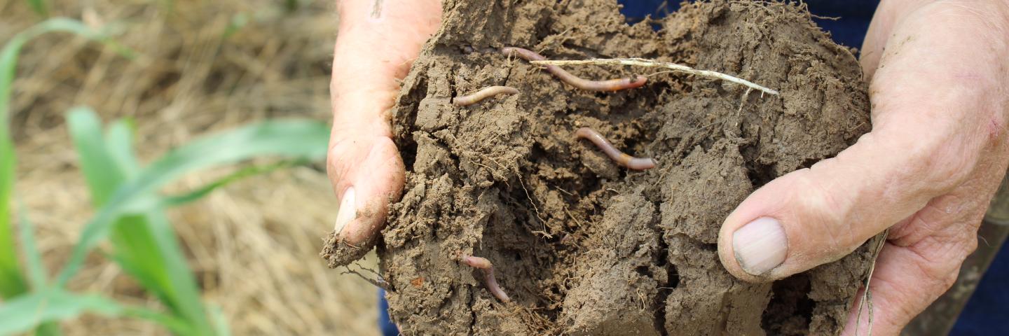
TYPICAL PEDON: Wynoose silt loam - on a nearly level slope in a cultivated field at an elevation of 455 feet above mean sea level. (Colors are for moist soil unless otherwise stated.)
Ap--0 to 18 cm (0 to 7 inches); dark grayish brown (10YR 4/2) silt loam, light brownish gray (10YR 6/2) dry; moderate fine granular structure; friable; common very fine roots throughout; common fine distinct brown (7.5YR 4/4) masses of oxidized iron-manganese in the matrix; few fine spherical masses of oxidized iron-manganese throughout; neutral; abrupt smooth boundary. [ 15 to 31 cm (6 to 12 inches) thick]
Eg1--18 to 36 cm (7 to 14 inches); light brownish gray (10YR 6/2) silt loam, white (2.5Y 8/1) dry; moderate medium platy structure; friable; few very fine roots throughout; common distinct light gray (10YR 7/2) (dry) clay depletions on faces of peds; common fine prominent strong brown (7.5YR 5/6) and yellowish brown (10YR 5/6) masses of oxidized iron in the matrix; few fine spherical masses of oxidized iron-manganese throughout; strongly acid; clear smooth boundary.
Eg2--36 to 51 cm (14 to 20 inches); light brownish gray (10YR 6/2) silt loam, white (2.5Y 8/1) dry; moderate medium platy structure; friable; few very fine roots throughout; common distinct light gray (10YR 7/2) (dry) clay depletions on faces of peds; many fine prominent strong brown (7.5YR 5/6) masses of iron in the matrix; few fine spherical masses of oxidized iron-manganese throughout; few fine irregular iron-manganese concretions throughout; very strongly acid; abrupt smooth boundary.[Combined thickness of the Eg horizon(s) is 18 to 46 cm (7 to 18 inches).]
Btg1--51 to 74 cm (20 to 29 inches); light brownish gray (10YR 6/2) silty clay; strong medium prismatic structure parting to strong medium angular blocky; firm; few very fine roots along faces of peds; many distinct gray (10YR 5/1) clay films and common distinct light gray (10YR 7/2) (dry) clay depletions on faces of peds; many fine and medium prominent strong brown (7.5YR 5/6) masses of oxidized iron in the matrix; common fine spherical masses of oxidized iron-manganese throughout; common fine and medium irregular iron-manganese concretions throughout; very strongly acid; clear smooth boundary.
Btg2--74 to 91 cm (29 to 36 inches); light brownish gray (10YR 6/2) silty clay; strong medium prismatic structure parting to strong medium angular blocky; firm; few very fine roots along faces of peds; common distinct gray (10YR 5/1) clay films and few distinct light gray (10YR 7/2) (dry) clay depletions on faces of peds; many fine and medium prominent strong brown (7.5YR 5/6) masses of iron in the matrix; few fine spherical masses of oxidized iron-manganese throughout; few fine irregular iron-manganese concretions throughout; very strongly acid; clear smooth boundary. [Combined thickness of the Btg horizon(s) is 25 to 107 cm (10 to 42 inches)].
2Btg3--91 to 122 cm (36 to 48 inches); light brownish gray (10YR 6/2) silty clay loam; moderate medium prismatic structure parting to moderate medium subangular blocky; firm; few very fine roots along faces of peds; few distinct grayish brown (10YR 5/2) clay films and few distinct light gray (10YR 7/2) (dry) clay depletions on faces of peds. common fine and medium prominent strong brown (7.5YR 5/6) masses of oxidized iron in the matrix; few fine spherical masses of oxidized iron-manganese throughout; few fine irregular iron-manganese concretions throughout; about 2 percent angular gravel by volume; strongly acid; clear smooth boundary.
2Btg4--122 to 168 cm (48 to 66 inches); gray (10YR 6/1) silty clay loam; moderate medium prismatic structure parting to moderate medium subangular blocky; firm; few very fine roots along faces of peds; few distinct gray (10YR 5/1) clay films on faces of peds and few distinct dark grayish brown (10YR 4/2) clay films in root channels and pores; common fine and medium prominent strong brown (7.5YR 5/8) masses of oxidized iron in the matrix; few fine irregular iron-manganese concretions throughout; about 2 percent angular gravel by volume; strongly acid; clear smooth boundary. [Combined thickness of the 2Btg and, if present, 2BCg horizon(s) is 38 to 127 cm (15 to 50 inches)].
3Btgb--168 to 203 cm (66 to 80 inches); gray (10YR 6/1) silty clay loam; moderate medium prismatic structure parting to moderate medium subangular blocky; very firm; common distinct gray (10YR 5/1) clay films on faces of peds and common prominent black (N 2.5/) manganese coatings on faces of peds; common fine and medium prominent strong brown (7.5YR 5/8) and strong brown (7.5YR 5/6) masses of oxidized iron in the matrix; common medium irregular iron-manganese concretions throughout; about 5 percent angular gravel by volume; moderately acid.
TYPE LOCATION: Wayne County, Illinois; about 3.6 miles northwest of Mt. Erie; 967 feet west and 2458 feet north of the southeast corner of sec. 10, T. 1 N., R. 8 E. USGS Enterprise, Illinois topographic quadrangle; lat. 38 degrees 31 minutes 57.4 seconds N. and long. 88 degrees 17 minutes 50.3 seconds W.; UTM Zone 16S 0386926 easting and 4265710 northing; NAD 83.
RANGE IN CHARACTERISTICS: The depth to the top of the argillic horizon is less than 61 cm (24 inches). The depth to the base of the argillic horizon is greater than 102 cm (40 inches). Loess thickness ranges from 76 to 140 cm (30 to 55 inches). The particle-size control section averages between 35 and 42 percent clay and less than 15 percent sand.
The Ap or A horizon has hue of 10YR or 2.5Y; value of 4 to 6; and chroma of 1 or 2. Texture is silt loam. Reaction is very strongly acid or strongly acid but ranges to neutral in pedons that have been limed.
The Eg horizon has hue of 10YR or 2.5Y; value of 5 to 7; chroma of 1 or 2. Texture is silt loam. Reaction ranges from extremely acid to neutral. Redoximorphic features are typically present.
Some pedons have a B/E horizon.
The Btg horizon has hue of 10YR, 2.5Y, or 5Y; value of 4 to 6; and chroma of 1 or 2. Redoximorphic features are typically present. It is silty clay loam or silty clay. Reaction ranges from extremely acid to moderately acid.
The 2Btg or 2BCg horizon has hue of 10YR, 2.5Y, or 5Y; value of 4 to 6; and chroma of 1 or 2. Redoximorphic features are typically present. It is silty clay loam, clay loam, loam, or silt loam. Sand content ranges from 15 to 30 percent. Reaction ranges from extremely acid to moderately acid.
The 3Agb or 3Btgb horizon, where present within 80 inches, has hue of 7.5YR, 10YR, 2.5Y, or 5Y; value of 4 to 6; chroma of 1 or 2. It is silty clay loam, clay loam, silt loam, or loam. Sand content ranges from 15 to 40 percent. Reaction ranges from moderately acid to slightly alkaline.
COMPETING SERIES:
These are the Ames, Leaksville, Pierron, Rushville, Watchung,and Zwingle series. Ames soils average more than 20 percent sand in the particle size control section. Leaksville soils have a paralithic and lithic contact, both within 60 inches. Pierron and Rushville average less 15 percent sand throughout the series control section. Watchung soils formed in residuum, have rock fragments throughout the particle size control section, and are in a cool mesic temperature regime. Zwingle soils average more than 42 percent clay in the particle size control section and are in a cool mesic temperature regime.
GEOGRAPHIC SETTING: Wynoose soils are on broad areas of till plains. Slopes range from 0 to 2 percent. Wynoose soils formed in 30 to 55 inches of loess and the underlying silty or loamy pedisediment or coarser loess (Roxana silts). They are underlain by a Sangamon age paleosol formed in diamicton or accretion gley. The paleosol may or may not have been truncated by erosion prior to loess deposition. The mean annual air temperature ranges from 53 to 57 degrees F., mean annual precipitation ranges from 38 to 46 inches, frost free days range from 180 to 200, and elevation ranges from 350 to 700 feet above sea level.
GEOGRAPHICALLY ASSOCIATED SOILS:
These are the Ava, Blair, Bluford, Hickory, Passport, and Racoon soils. The moderately well drained Ava and Bluford soils are in a drainage sequence with Wynoose soils. They all have brittleness in the subsoil and are on ridges and knolls higher on the landform. The somewhat poorly drained Blair and Passport soils formed primarily in silty or loamy pedisediment, respectively, and are on back slopes or near the heads of drainageways below Wynoose soils. The well drained Hickory soils formed in diamicton on back slopes below Wynoose soils. Racoon soils are on foot slopes or on the stream terraces below the Wynoose soils.
DRAINAGE AND SATURATED HYDRAULIC CONDUCTIVITY: Poorly drained. The potential for surface runoff is low or medium. Periods of brief ponding can occur after heavy rains, generally during the period from January through May. Saturated hydraulic conductivity is low to moderately high 0.01 to 1.41 micrometer per second). Permeability is slow or very slow If un-drained, these soils have a water table within 15 cm (0.5 foot) of the surface between November and June in most years. Where drained,
the water table is within 31 cm (1 foot) of the surface between January and May in most years.
USE AND VEGETATION: Most areas of Wynoose soils are used to grow soybeans,corn, milo, and wheat. Native vegetation is deciduous forest consisting mainly of post oak, black oak, and hickory.
DISTRIBUTION AND EXTENT: Southern Illinois. These soils are extensive (more than 140,000 acres correlated) in MLRA 113.
MLRA SOIL SURVEY REGIONAL OFFICE (MO) RESPONSIBLE: Indianapolis, Indiana
SERIES ESTABLISHED: Washington County, Illinois, 1924.
REMARKS: Diagnostic horizons and features recognized in this pedon are:
ochric epipedon - the zone from the surface to a depth of 20 inches (Ap and Eg horizon);
albic horizon - the zone from 7 to 20 inches (Eg horizons);
argillic horizon - the zone from approximately 20 to 88 inches (Btg1, Btg2, 2Btg3, 2Btg4, and 3Btgb horizons);
abrupt textural change from the Eg2 to the Btg1 horizon;
aquic conditions - chroma of 2 and redox concentrations between a depth of 16 and 20 inches and in the upper 5 inches of the argillic horizon; a positive reaction to alpha-alpha dipyridyl is assumed.
With this update (8/2003), a new typical pedon is selected. Data from the former OSD site in Effingham County indicated that the pedon did not represent the Wynoose series because it did not have an abrupt textural change.
ADDITIONAL DATA: Data for several pedons of Wynoose soils are on file at the Illinois State Office.
National Cooperative Soil Survey
U.S.A.