

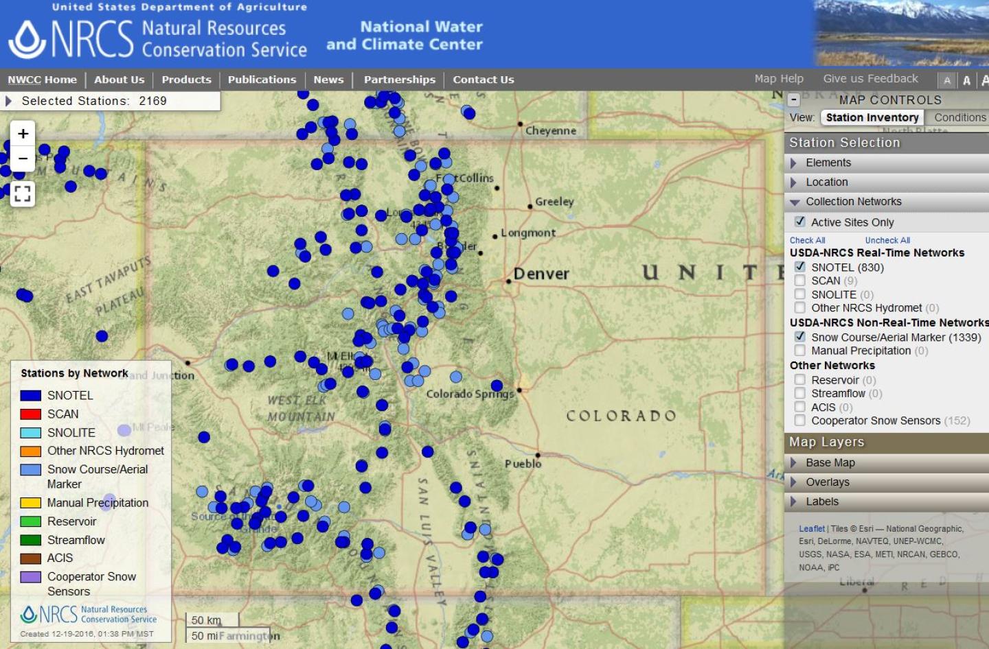
Explore Colorado in the Interactive Map
Explore Colorado in the Interactive Map
The Interactive Map Conditions interface allows users to display current and historical snow water equivalent, snow depth, precipitation, reservoir storage, and streamflow data collected by the Natural Resources Conservation Service and other monitoring agencies. Capabilities include options to display observations or statistical metrics for specific dates and durations of interest. Use the links below to view pre-defined maps for Colorado.
Map Links
Snow Water Equivalent
Snow Water Equivalent
Snow Depth

Snow Depth
Year to Date Precipitation

Year to Date Precipitation
Month to Date Precipitation
Month to Date Precipitation
Monthly Reservoir Storage
Monthly Reservoir Storage
Monthly Reservoir Storage end of month storage data.
Monthly Streamflow Volume
Monthly Streamflow Volume
Monthly Streamflow Volume expressed as an adjusted volume.