
Here you will find information on local soils including Vermont's state soil, Tunbridge.
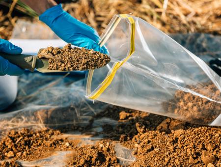
Soil Screening 2024
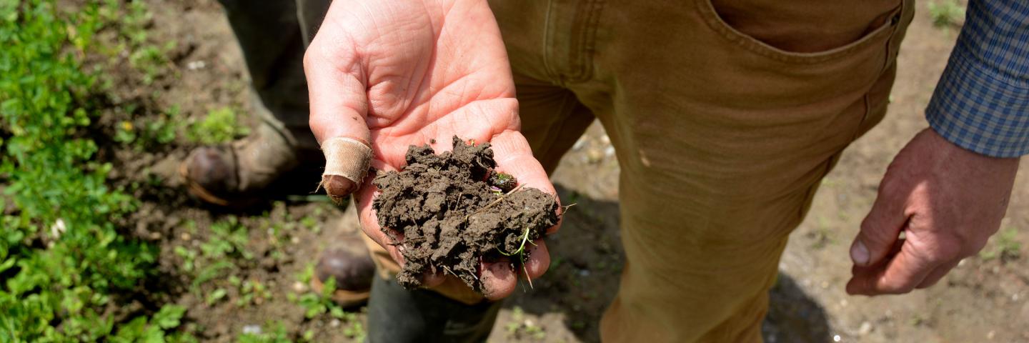
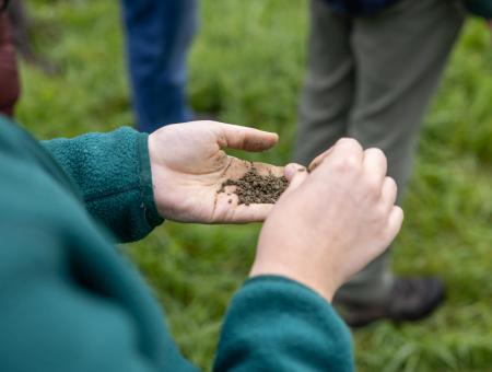
NRCS is offering free soil screening for lead, in conjunction with the UVM Extension. Bring 2 cups of your soil in a sealed, plastic bag and NRCS will perform analysis and give you the results on the spot!
Vermont Soils
Vermont's State Soil - Tunbridge
Botanists look at plant features, such as leaf shape and number of flower petals, to describe and classify plants. Whereas, soil scientists look at things like soil horizons (layers) and depth to bedrock to describe and classify soils. There is even a soil key (taxonomy) that allows one to key out a particular soil classification. A soil is defined as: a vertical section of the soil through all its horizons.
Surface layer: very dark brown, partially decomposed organic material
Subsurface layer: gray fine sandy loam
Subsoil - upper: dark brown fine sandy loam
Subsoil - lower: brown channery fine sandy loam
Bedrock: schist
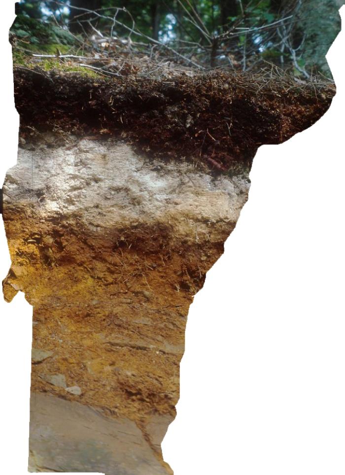
General Description of Tunbridge Soil
The Tunbridge series consists of loamy, well-drained soils that formed in Wisconsin-age glacial till. These soils are 20 to 40 inches deep over schist, gneiss, phyllite, or granite bedrock. They occur extensively in mountainous areas of Vermont, in all but one county.
Tunbridge soils are used mainly for woodland. White ash, American beech, white birch, yellow birch, hemlock, white pine, red spruce, red maple, and sugar maple are typical species. Sugar maple is especially important; Vermont produces the largest amount of maple syrup in the U.S. Some areas have been cleared and are used for hay and pasture. Recreational uses are common on these soils. They include trails for hiking, mountain biking, snowmobiling, and skiing.
In addition to having certain soil characteristics and typical land usage, a image of a "typical landscape" where the soil is found helps to complete the description.
Vermont Surveys Past and Present
NRCS soil survey began with the recognition during the Dust Bowl that we needed to take better care of our soil resource. A national soil mapping effort resulted as a reaction to this terrible man-made ecological disaster in the 1930's. Soil Survey mapping is the starting point for much of the current day technical assistance that NRCS provides. All 14 counties in Vermont have completed soil mapping. Soil survey data is available in digital format for the whole state.
Numerous interpretations are included along with the soil maps. The interpretive data includes a wide range of data - such as, ratings for highly erodible land and prime farmland. Today, the soil survey program continues to evolve, using the latest technology to improve the quality and consistency of soil maps. The original county-centric mapping of the past will be transformed by a physiographic region approach that will harmonize the data across the county.
Updating Soil Maps in the Lake Champlain Basin: NRCS is updating the soil mapping within selected areas of the Basin. The goal is to use new information and technologies to bring the soil survey for the Basin up to a consistent common standard. Currently, the soil survey in the area is made up of many different vintages and is in need of updating to improve accuracy, and therefore land use decisions. See the factsheet below to learn more.
University of Vermont Extension Survey Data
The University of Vermont Extension recently released a presentation on soil carbon stocks in Vermont and the state of soil health in the state. The project was a collaborative effort UVM Extension, The Nature Conservancy of Vermont, the Gund Institute for Environment, and more. The project set out to establish a baseline of soil health indicators, carbon stocks, and associated ecosystem services in Vermont's agricultural landscapes, create standards for soil sampling across management types, give farmers contextualized information about soil health on their farms, support collaboration among the many organizations that work with producers towards soil health, and build skills and capacity for soil carbon assessments and measuring soil health. Below you will find the presentation in addition to the data from the project that has been graciously shared with Vermont NRCS.
SSURGO - Soil Survey Geographic Database
Vermont SSURGO (Soil Survey Geographic Database) information includes the digital soil maps and the accompanying soil properties and interpretations database. This data is primarily used in GIS applications.
The SSURGO user should be knowledgeable of the structure of the soil database and familiar with GIS technology.
There are three levels of digital soils data:
- SSURGO - is the most detailed county level data
- STATSGO - is less detailed state-wide map
- NATSGO - is a very general soil map of the entire U.S.
The majority of counties in Vermont use 1:20,000 mapping scale for SSURGO data. The minimum area mapped is, in general, about 3 acres. This level of mapping is designed for use by farmers, landowners, watershed groups, towns, and county/regional/state natural resource planning agencies. The data is available for download from the sites listed below.
Two options for downloading SSURGO data:
1. USDA / Web Soil Survey site
USDA NRCS Web Soil Survey
-Click on 'Start Web Soil Survey (WSS), then click on the 'Download Soils Data' Tab
This data is available at 1:24,000 scale. In Vermont the data were developed with the intended publication scale of 1:20,000. A "scale waiver" was permitted for many Vermont counties, to allow this non-standard scale and make soil data compatible across Vermont.
A complete SSURGO data set consists of:
- map data (as ESRI ArcGIS shapefiles)
- attribute data (a multitude of separate text tables)
- database template (MS Access format - this helps with understanding the structure and linkages of the various tables)
- metadata
2. Vermont Center for Geographic Information:
Vermont Center for Geographic Information - State GIS Warehouse
To find all types of spatial data to download from VCGI, go to http://geodata.vermont.gov/
For soils data options from this page, scroll down and find the icon called Geologic + Soils, and click on it. On the resulting Vermont Open Geodata Portal web page, click in the Search window and type “soils”.
A direct link to Soils data specifically, from VCGI: http://geodata.vermont.gov/datasets?q=soils
These data layers are synchronized annually with the official Web Soil Survey data source, and include some common attributes such as map unit name, Prime Soil characteristics, and bedrock depth. There are several download options – if you want the soils data for a particular county, click on that county in the map and follow instructions that pop up.
*Note: The "Top Twenty Table" included in the SSURGO attribute data. This is a condensed and easy to use single table, containing the most frequently used data attributes. On the VCGI site it can be found in http://geodata.vermont.gov/datasets?q=soils – scroll down to find VT Data – NRCS TOP20 soils attributes and documentation. Click that title to download info.
Highly Erodible Land Conservation Provisions
In order to maintain eligibility for most USDA programs, producers must comply with the Highly Erodible Land Conservation (HELC), agreeing they will not:
- Produce an agricultural commodity on highly erodible land without an adequate conservation system
The Natural Resources Conservation Service (NRCS) is responsible for providing program participants technical assistance and determinations to assist them in complying with the provisions.
The HELC Provision Contact is State Agronomist Thomas Akin
- Phone: (802) 951-6796, ext. 240
- email: thomas.akin@usda.gov
Highly Erodible HEL Soils Lists
(Lists the soils that can erode at an excessive rate from either water or wind because of soil properties)
- Addison
- Bennington
- Caledonia
- Chittenden
- Essex
- Franklin
- Grand Isle
- Lamoille
- Orange
- Orleans
- Rutland
- Washington
- Windham
- Windsor
Climatic Data for Normal Circumstances
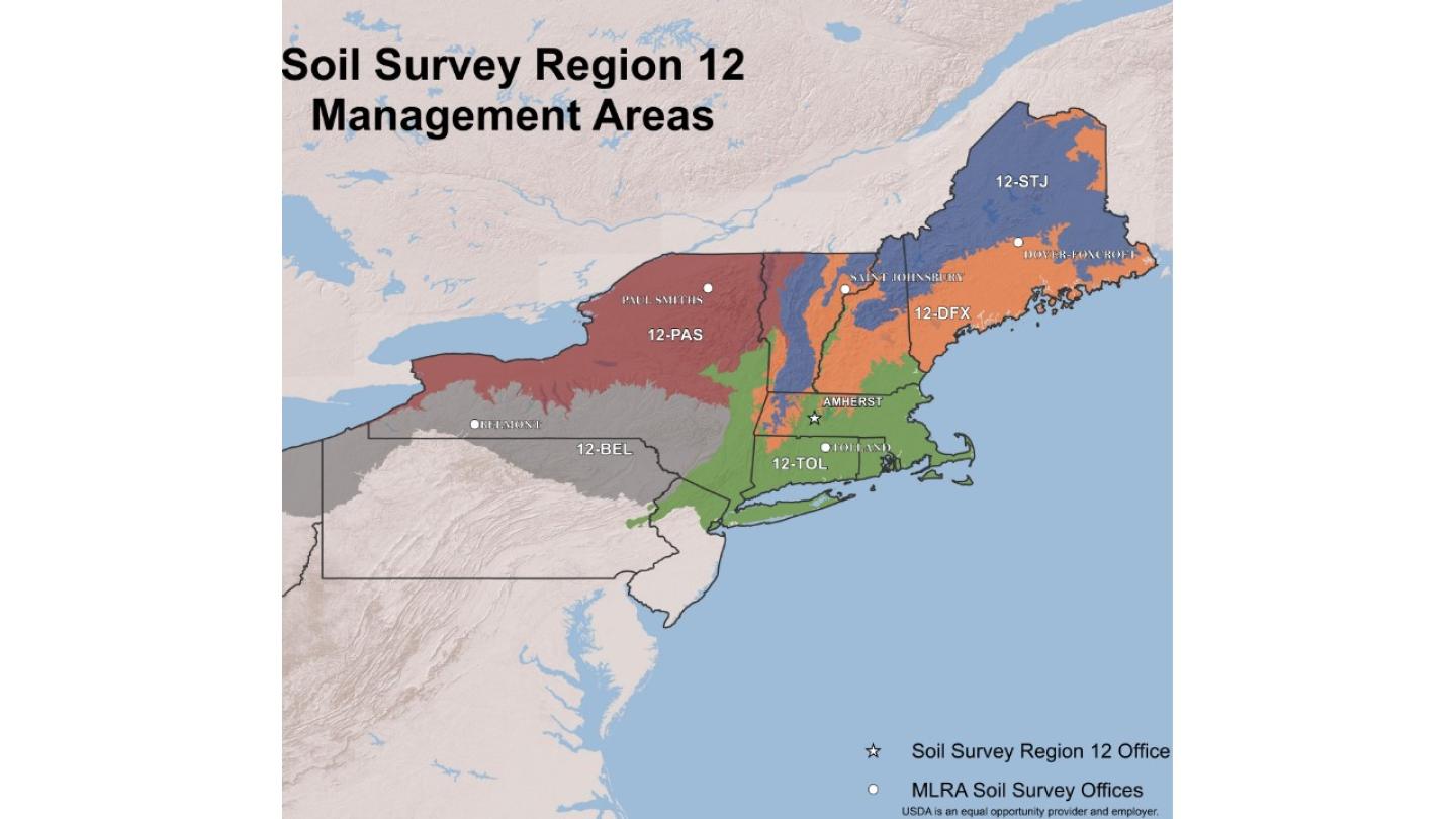
MLRA Soil Survey Offices
What is an MLRA?
Major Land Resource Areas (MLRAs) are geographic areas, usually several thousand acres in extent, that are characterized by a particular pattern of soils, climate, water resources, land uses, and type of farming.
Soil surveys are an inventory of the soil resources that includes soil maps, data about soil properties and characteristics, and interpretations about soil suitability and limitations for land use and management. They were historically conducted on a county basis. Soil map units often extended to political boundaries rather than natural features. To harmonize the soil survey data within physiographic regions, soil survey offices are now organized by MLRA.
Vermont is within 4 MLRAs
- The northern part of the northeastern uplands comprising portions of Maine, Massachusetts, New Hampshire, New York, and Vermont is covered by the Dover-Foxcroft office in Maine.
- The Champlain Valley in Vermont and New York as well as other portions of New York are covered by the Paul Smiths soil survey office in New York.
- The mountainous region encompassing Maine, Massachusetts, New Hampshire, and Vermont is covered by the St Johnsbury office in Vermont.
- The Connecticut River Valley including the portion that extends into Vermont, and the southern part of the northeastern uplands comprising portions of Connecticut, Massachusetts, New Jersey, New Hampshire, New York, Pennsylvania, and all Rhode Island are covered by the Tolland office in Connecticut.
Location address and Contact information for MLRA offices:
Dover-Foxcroft MLRA Soil Survey Office
USDA-Natural Resources Conservation Service
42 Engdahl Drive
Dover-Foxcroft, ME 04426
Dover-Foxcroft MLRA Soil Survey Office
| Name | Position | Phone Number | |
|---|---|---|---|
|
Joshua Dera
|
Soil Scientist
|
||
|
Jasmine Gregory
|
Soil Scientist
|
||
|
Christopher Mann
|
Soil Survey Office Leader
|
Paul Smiths MLRA Soil Survey Office
USDA-Natural Resources Conservation Service
8023 State Route 30
Paul Smiths, NY 12970
Paul Smiths MLRA Soil Survey Office
| Name | Position | Phone Number | |
|---|---|---|---|
|
Alaina Kresovic
|
Soil Scientist
|
St. Johnsbury MLRA Soil Survey Office
USDA-Natural Resources Conservation Service
481 Summer Street
Suite 202
St. Johnsbury, VT 05819
St. Johnsbury MLRA Soil Survey Office
| Name | Position | Phone Number | |
|---|---|---|---|
|
Paul Gadecki
|
Soil Scientist
|
||
|
Lucille Zendzian
|
Soil Scientist
|
Tolland MLRA Soil Survey Office
USDA-Natural Resources Conservation Service
344 Merrow Road
Suite A
Tolland, CT 06084
Tolland MLRA Soil Survey Office
| Name | Position | Phone Number | |
|---|---|---|---|
|
Braden Fleming
|
Soil Scientist
|
||
|
Donald Parizek
|
Soil Survey Office Leader
|
||
|
Geraldine Vega Pizarro
|
Soil Scientist
|
||
|
Milton Vega
|
Soil Scientist
|
Vermont Soils Resources
- NRCS Soil Science Contacts
- Across the Fence - Across the Fence is the longest running daily farm and home television program in the country. Across the Fence is a 15 minute program produced by University of Vermont Extension. The program airs weekdays at 12:10 pm on WCAX TV, Channel 3. The program covers a wide variety of topics including dairy, stewardship, natural resources, and sustainable agriculture. Find at more on the UVM Extension website.
- Rainfall Simulator Demonstration
- University of Vermont Department of Plant and Soil Science - the mission of the department is to expand, integrate, and extend the knowledge of crops and environmental quality in plant/soil ecosystems affecting the people of Vermont, the region, and the world
- Soil and Water Conservation Society - fosters the science and the art of soil, water and related natural resource management to achieve sustainability
- Soil Science Society of America - advances the discipline and practice of soil science by acquiring and disseminating information about soils in relation to crop production, environmental quality, ecosystem sustainability, bioremediation, waste management and recycling, and wise land use
World Soils Day 2023
Soil and water provide the foundation for food production, ecosystems, and human well-being. Recognizing their invaluable roles, we can take proactive measures to safeguard these resources for future generations.