
Snowmelt Runoff Season Has Begun Across Colorado
In addition to above normal snowpack across much of the state, primarily in Western Colorado, lower elevation snowpack were particularly plentiful leading to substantial early season runoff in some basins.
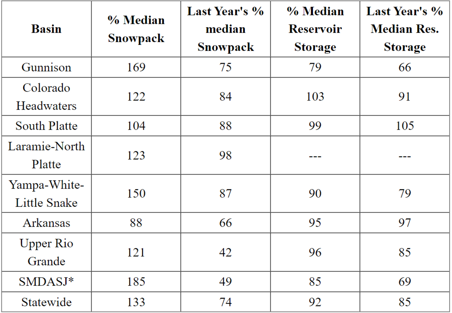
Denver, CO – May 4th, 2023 – In addition to above normal snowpack across much of the state, primarily in Western Colorado, lower elevation snowpack were particularly plentiful leading to substantial early season runoff in some basins. Along with this low elevation snowmelt, significant flooding has already been observed in the Yampa and Dolores basins with still much more snowmelt to come. While much of Western Colorado experienced above normal April streamflow volumes this was not the case across the entire state. NRCS Hydrologist Karl Wetlaufer commented “Peak snowpack and streamflow forecasts for the full April-July runoff period vary widely across the state this year. While much of Western Colorado should expect a continuing trend of above normal streamflow, much of the Arkansas and South Platte basins are forecasted for well below normal seasonal runoff volumes.” Portions of the Colorado River headwaters and portions of the Rio Grande River basins are also anticipated to have below normal streamflow over the coming month.
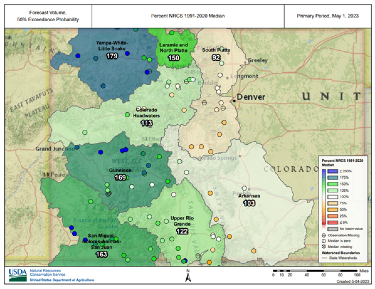
Reservoir storage has begun to improve in the basins with the biggest deficits, namely the Gunnison and the combined San Miguel-Dolores-Animas-San Juan River basins, with most other basins holding near normal storage values. With several months of snowmelt runoff still to come, it is anticipated that reservoir storages will be changing considerably as the season progresses. Given the high degree of variability in streamflow forecasts across the state it is recommended to pay close attention to forecasts and changing conditions in your local area throughout the spring and summer.
Statewide snowpack, as measured at SNOTEL sites, peaked on April 8th prompting the start of the primary snowmelt runoff season. As days get longer and the sun gets higher in the sky, snowmelt rates have the potential to continue to accelerate. Hydrologist Wetlaufer notes “This is an incredibly important time of year for water resources. Conditions can change quickly and is important to monitor changing conditions closely over the coming months depending on the needs of water resource management in a given basin.” Wetlaufer continued “In a year like this, some areas may need to be planning activities such as reservoir management with flood potential in mind while in areas with lesser streamflow forecasts conservation may need to be the focus.” While plentiful streamflow are certainly good news from a strictly water supply standpoint in the greater Colorado River Basin (above Lake Powell) it is important for everyone in Colorado to be mindful of flood potential and those associated hazards.
* combined San Miguel-Dolores-Animas-San Juan River basin
For more details see the May 1st Water Supply Outlook Report.