Resources
Tech Tools
WinTR-20 System Controller/Editor Version 3.30.1
WinTR-20 is a single event, watershed-scale runoff and routing model. Like WinTR-55, this model applies to both urban and agricultural areas - allowing users to develop runoff hydrographs for multilpe sub-areas and at selected points along the stream system.
Topics
Tech Tools
WinTR-55 Small Watershed Hydrology Version 2.00.00
WinTR-55 is a single event, small watershed rainfall-runoff model.
Topics
Guides and Instructions
Wisconsin Engineering Resources
Wisconsin Field Office Technical Guide (FOTG) Engineering Specifications and Conservation Practice Standards.
Topics
Data and Reports
Wisconsin Soil Data Mart
The following links to data are not static; these links pull information and hits from the official soils database live. Interactive maps and dynamic reports are available below.
Education and Teaching Materials
Wisconsin State Soil - Antigo Silt Loam
Many states have a designated state bird, flower, fish, tree, rock, etc. And, many states also have a state soil – one that has significance or is important to the state.
Topics
Guides and Instructions
Woody Residue Treatment (Ac.) (384) Conservation Practice Standard
Download the national conservation practice standard document and supporting documents for Woody Residue Treatment (Ac.) (384).
Data and Reports
Working for Montana Agriculture
The NRCS, Montana Association of Land Trusts, and the Heart of the Rockies Initiative have partnered to produce a report of the economic impact of ALE easements in Montana as well as stories from families that have realized economic benefits on their farm or ranch.
Data and Reports
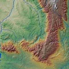
Wyoming GIS
GIS stands for Geographic Information Systems. GIS software automates databases and maps to reveal the spatial patterns of data.
Topics
Data and Reports
Wyoming Snow Survey & Water Supply Program
The NRCS Snow Survey Program provides mountain snowpack data and streamflow forecasts for the western United States. Common applications of snow survey products include water supply management, flood control, climate modeling, recreation, and conservation planning.
Topics