Guides and Instructions
Pumping Plant (No.) (533) Conservation Practice Standard
Download the national conservation practice standard document and supporting documents for Pumping Plant (No.) (533).
Topics

The .gov means it’s official.
Federal government websites often end in .gov or .mil. Before sharing sensitive information, make sure you’re on a federal government site.
The site is secure.
The https:// ensures that you are connecting to the official website and that any information you provide is encrypted and transmitted securely.
Download the national conservation practice standard document and supporting documents for Pumping Plant (No.) (533).
Montana guides, publications, videos and related resources for range and pasture management

Download the national conservation practice standard document and supporting documents for Range Planting (Ac.) (550).
The Rapid Carbon Assessment (RaCA) was initiated by the USDA-NRCS Soil and Plant Science Division in 2010.
Raster Soil Survey is a reference to the products of soil survey work completed using digital soil mapping methodologies.
New data visualization tools are now available. Users can graph, map, and download customized datasets based on practices applied through NRCS programs and survey data on land use, soil erosion, and prime farmland from the National Resources Inventory (NRI).

NRCS is required to report on the progress of RCPP projects.
A convenient resource for soil conservation professionals and students of the history of conservation.
Download the national conservation practice standard document and supporting documents for Recreation Land Improvement and Protection (Ac.) (566).
Report Generator is a web application developed by the Natural Resources Conservation Service (NRCS) National Water and Climate Center (NWCC). It uses long-term snowpack, precipitation, reservoir, streamflow, and soils data from a variety of quality-controlled sources to create reports.
Download the national conservation practice standard document and supporting documents for Residue and Tillage Management, No-Till (Ac.) (329).
Download the national conservation practice standard document and supporting documents for Residue and Tillage Management, Reduced Till (Ac.) (345).
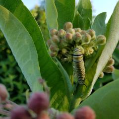
NRCS and our conservation partners provide technical and financial assistance to create and improve pollinator habitat.
Download the national conservation practice standard document and supporting documents for Restoration of Rare or Declining Natural Communities (Ac.) (643).
Rhode Island NRCS partners with the Ocean State's three conservation districts – Eastern, Northern & Southern – to help communities, farmers, forest landowners, oyster growers, ranchers and urban growers to conserve and protect natural resources.
Download the national conservation practice standard document and supporting documents for Riparian Forest Buffer (Ac.) (391).
Download the national conservation practice standard document and supporting documents for Riparian Herbaceous Cover (Ac.) (390).
Download the national conservation practice standard document and supporting documents for Road/Trail/Landing Closure and Treatment (Ft.) (654).