 Web Content Viewer
Colorado Snow Survey

The NRCS Snow Survey Program provides mountain snowpack data and streamflow forecasts for the western United States. Common applications of snow survey products include water supply management, flood control, climate modeling, recreation, and conservation planning.
More About Snow Surveys
Colorado News and Announcements
-
Interim Issue Resolution: Air Temperature Data Bias
The extended range air temperature sensors used at SNOTEL sites in the continental U.S. calculate temperature from sensor output voltage using a linear least-squares regression algorithm. It has been determined that use of the linear least-squares regression algorithm has resulted in a data bias.
The Snow Survey and Water Supply Forecasting Program is actively working on a correction technique for this issue.
More Information: Air Temperature Bias Correction Metadata and Resources -
Website Under Construction
Please be advised that our website is going through a transition period due to changes in IT infrastructure. As we transition, many of our old products have been replaced with new products that will update more reliably and are interactive. During this process links will change. Lists of all of our current products can be found at the following links: Snow, Precipitation, Water Supply.
For additional news and reports please see our News Releases and Water Supply Outlook Reports.
Snow Survey Data, Products, and Reports
Snow
Current and historic snowpack data, reports, maps, and graphs
Precipitation
Current and historic snowpack data, reports, maps, and graphs
Water Supply
Current and historic snowpack data, reports, maps, and graphs
Site Information
Current and historic snowpack data, reports, maps, and graphs
Other Popular Products
Interactive Map

-
Pre-defined map links for Colorado A page of predefined interactive map links for the variety of data Colorado by the Colorado Snow Survey.
-
Active Colorado SNOTEL Stations An interactive map of all active SNOTEL stations in Colorado and the greater western United States.
-
Active Colorado Snow Courses An interactive map of all active manual measurement sites, called Snow Courses, in Colorado and the greater western United States.
Data Query Tools

-
Report Generator Create custom data search, output csv data, view charts
-
Daily Update Reports Create precipitation and snowpack reports for dates and areas of interest
-
Monthly Basin Data Reports View monthly reports for snowpack, precipitation, and reservoir data
Interactive Plots

-
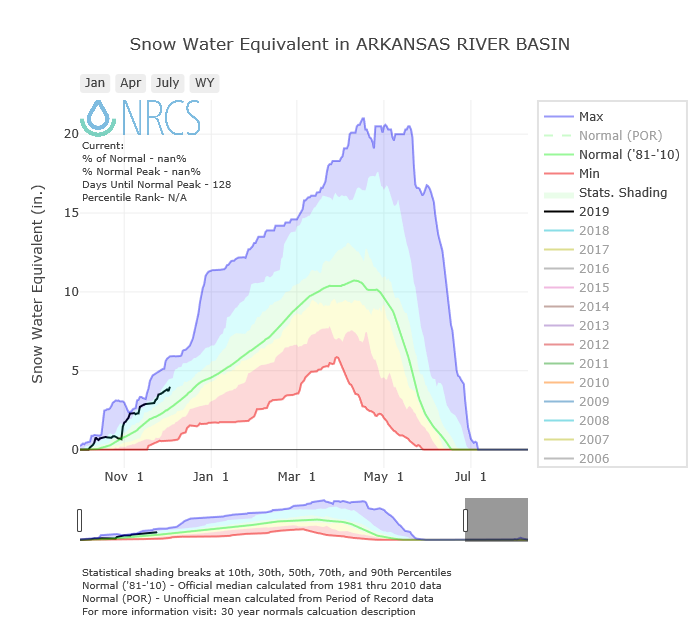
Basin-wide daily snow water equivalent and precipitation charts Interactive graphs of Colorado Basins summarizing precipitation and snow water equivalent recorded by SNOTEL Stations in those basins.
-
Individual site daily snow water equivalent and precipitation charts Interactive graphs of Colorado SNOTEL stations observations of precipitation and snow water equivelant.
Additional Snow Survey Information and Cooperator Resources
-
Frequently Asked Questions and Additional Snow Survey Resources A list of frequently asked questions and additional resources.
-
Cloud Seeding Threshold Map An interactive map showing whether cloud seeding is allowed based of off the current snowpack at Colorado SNOTEL sites.
-
Contact Colorado Snow Survey A list of employees and ways to contact the Colorado Snow Survey.
-
Colorado Snow Course Survey Schedule A sampling schedule for all snow courses in Colorado, Arizona, New Mexico, and southern Wyoming.


