Water and Climate Information System
The Water and Climate Information System (WCIS) is comprised of the database, applications, and tools which support the extensive data collection network of the Snow Survey and Water Supply Forecasting (SSWSF) Program.
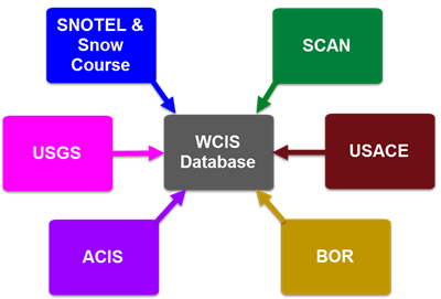
Snow data are collected at automated Snow Telemetry (SNOTEL) sites or manually-measured snow courses in the West. Soil climate data are collected at automated Soil Climate Analysis Network (SCAN) sites throughout the U.S. Data are transmitted either to intermediate Master Stations or directly back to the centralized database servers, which are located in a secure, fail-safe environment.
The WCIS database also ingests precipitation, streamflow, and reservoir data from the U.S. Army Corps of Engineers (USACE), the U.S. Bureau of Reclamation (BOR), the Applied Climate Information System (ACIS), the U.S. Geological Survey (USGS), various water districts and other entities.

Depending on the type of information, data are processed both an hourly and a daily basis and made available to WCIS applications, such as the Charting Tool, Report Generator, Update Report, and displayed on the Interactive Map.

