Data and Reports
Digital Soil Mapping (DSM)
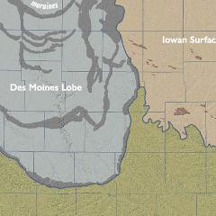
The use of geospatial techniques for mapping soils is broadly covered by the term “digital soil mapping” (DSM).
Topics

The .gov means it’s official.
Federal government websites often end in .gov or .mil. Before sharing sensitive information, make sure you’re on a federal government site.
The site is secure.
The https:// ensures that you are connecting to the official website and that any information you provide is encrypted and transmitted securely.
The use of geospatial techniques for mapping soils is broadly covered by the term “digital soil mapping” (DSM).
Engineering has played an essential part in meeting NRCS' mission objectives.
The U.S. Department of Agriculture (USDA) invested $50 million in 118 partnerships to expand access to conservation assistance for climate-smart agriculture and forestry in fiscal year 2022.
USDA is investing up to $70 million in cooperative agreements to support outreach to underserved producers and communities about opportunities with NRCS for natural resource conservation, climate-smart agriculture and forestry.
NRCS works with partners to set aside a certain pool of funding for an awarded project. Producers, landowners, and partners then enter into producer contracts and supplemental agreements with NRCS to carry out agreed-to conservation activities.
Information to support NRCS geographic information systems (GIS), global positioning systems (GPS), mobile computers, and associated geospatial technologies.

USDA awarded $12 million in cooperative agreements in 2023 for projects that expand access to conservation technical assistance for livestock producers and increase the use of conservation practices on grazing lands. The funding is provided through the Grazing Lands Conservation Initiative (GLCI).
The gridded National Soil Survey Geographic Database (gNATSGO) is a USDA-NRCS Soil & Plant Science Division (SPSD) composite database that provides complete coverage of the best available soils information for all areas of the United States and Island Territories.
Gridded SSURGO (gSSURGO) is similar to the standard USDA-NRCS Soil Survey Geographic (SSURGO) Database product but in the format of an Environmental Systems Research Institute, Inc. (ESRI®) file geodatabase.
Using a case study of changes in soil erosion in the "Driftless Area" of the Coon Creek watershed, this publication illustrates a methodology for determining long term changes in erosion conditions.
This paper discusses how Bennett’s USDA career made him the logical candidate to lead the Federal soil conservation effort.
This article discusses the establishment of Soil Erosion Service demonstration projects by Hugh Hammond Bennett and colleagues between 1933 and 1935.
The SCS developed principles that aided the soil and water conservation program and made pioneering contributions to science and technology.
This tool provides state-by-state data showing investments for Farm Bill and Inflation Reduction Act funding. Final data are available for fiscal year 2023, with year-to-date data available for fiscal year 2024.
The story of the Soil Conservation Service, told by the four men who ran the agency over a period of some thirty years.
This page has links to documents, maps and other graphics that are helpful in understanding the role of geology and geologic assessment in NRCS conservation planning and engineering.
The policy of NRCS is that economics is an essential consideration in all agency decision making. Economic principles must be applied in the planning, implementation, and evaluation of agency policies and program activities to provide the most cost effective assistance.

Data by land type (e.g., cropland, pasture, forest) for 1982-2017, at 5-year intervals, by state, based on the National Resources Inventory (NRI). Data can be filtered, graphed, mapped, and downloaded by state, year, and land type (e.g., cropland), and irrigation.
This paper provides analysis of why an environment favorable for passage of the 1985 Farm Bill came to be, and it draws a few lessons from the experience.
Application period July 1st - August 31st, 2023
Applications must be submitted to: agwaste@ldaf.state.la.us