
Data and Reports
Plant Materials Technical Documents Search
Plant Materials Technical Documents
Plants Database
The PLANTS Database provides standardized information about the vascular plants, mosses, liverworts, hornworts, and lichens of the U.S. and its territories.
Prime Farmland
Trends in prime farmland for 1982-2017, at 5-year intervals, by land type and state based on the National Resources Inventory (NRI). Data can be filtered, graphed, mapped, and downloaded by state, year, land type (e.g., cropland).
Publications of the National Water and Climate Center
Articles, reports, and help files published by the National Water and Climate Center and the Snow Survey and Water Supply Forecasting Program.
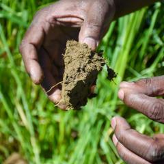
Rapid Carbon Assessment (RaCA)
The Rapid Carbon Assessment (RaCA) was initiated by the USDA-NRCS Soil and Plant Science Division in 2010.
Raster Soil Surveys (RSS)
Raster Soil Survey is a reference to the products of soil survey work completed using digital soil mapping methodologies.
RCA Data Viewer
New data visualization tools are now available. Users can graph, map, and download customized datasets based on practices applied through NRCS programs and survey data on land use, soil erosion, and prime farmland from the National Resources Inventory (NRI).
RCPP Congressional Report—December 2019
NRCS is required to report on the progress of RCPP projects.
Readings in the History of the Soil Conservation Service
A convenient resource for soil conservation professionals and students of the history of conservation.
Report Generator
Report Generator is a web application developed by the Natural Resources Conservation Service (NRCS) National Water and Climate Center (NWCC). It uses long-term snowpack, precipitation, reservoir, streamflow, and soils data from a variety of quality-controlled sources to create reports.
Snow and Climate Monitoring Predefined Reports and Maps
The National Water and Climate Center provides a number of predefined reports, using the online tools it administers for the Snow Survey and Water Supply Forecasting Program.
Snow and Water Interactive Map
Welcome to the National Water and Climate Center's Snow and Water Interactive Map, a groundbreaking tool designed to provide farmers, researchers, policymakers, and water management professionals with up-to-the-minute snow survey data and water supply forecasting.
Soil and Water Conservation Expenditures by USDA Agencies, 1935-2010
This report examines historical expenditures on 32 conservation programs administered by the NRCS, Farm Service Agency (FSA), and their predecessor agencies.
Soil Carbon Monitoring Agreements - Fiscal Year 2023
The U.S. Department of Agriculture (USDA) is investing $8 million in four partnerships to support and expand measurement and monitoring of carbon in soil on working agricultural lands and to assess how climate-smart practices are affecting carbon sequestration.
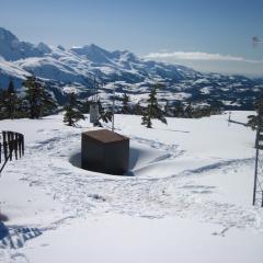
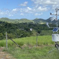
Soil Climate Analysis Network
The Soil Climate Analysis Network, also known as SCAN, supports natural resource assessments and conservation activities through its comprehensive, nationwide soil moisture and climate information network.
Soil Climate Research Stations
Links to data from soil climate research stations in Alaska and Antarctica.
Soil Conservation in New Zealand and the United States
This paper explores former SCS director Donald A. Williams' review of and suggestions for improving New Zealand's soil conservation institutions in 1964.