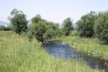
National Water Quality Initiative Successes
Learn how the National Water Quality Initiative is working across the country.

The .gov means it’s official.
Federal government websites often end in .gov or .mil. Before sharing sensitive information, make sure you’re on a federal government site.
The site is secure.
The https:// ensures that you are connecting to the official website and that any information you provide is encrypted and transmitted securely.
As USDA’s premiere water quality initiative, National Water Quality Initiative (NWQI) provides a way to accelerate voluntary, on-farm conservation investments and focused water quality monitoring and assessment resources where they can deliver the greatest benefits for clean water.
NRCS recently published a Federal Register notice to seek feedback on how best to target program benefits, quantify impact, and improve program delivery and outreach in the future. Information gathered through the Federal Register notice will help inform NRCS efforts to identify and prioritize improvements to this initiative starting in fiscal year 2024. This is a 30-day public comment period. Public comments should be submitted through the Federal Register notice by April 7, 2023. Questions should be sent to SM.NRCS.LandscapeConservationInitiatives@usda.gov.
Read the press release for more information.
NWQI has been extended through Fiscal Year 2023, with updates to strengthen program delivery. Updates include a focus on watershed assessment and planning and use of multi-year budgets to demonstrate long-term commitment in assisting water quality efforts.
Now in its eleventh year, the National Water Quality Initiative is a partnership among NRCS, state water quality agencies and the U.S. Environmental Protection Agency to identify and address impaired water bodies through voluntary conservation. NRCS provides targeted funding for financial and technical assistance in small watersheds most in need and where farmers can use conservation practices to make a difference.
Conservation systems include practices that promote soil health, reduce erosion and lessen nutrient runoff, such as filter strips, cover crops, reduced tillage and manure management. These practices not only benefit natural resources but enhance agricultural productivity and profitability by improving soil health and optimizing the use of agricultural inputs.
State water quality agencies and other partners contribute additional resources for watershed planning, implementation and outreach. They also provide resources for monitoring efforts that help track water quality improvements over time.
In FY19, NRCS expanded the scope of NWQI to include source water protection, including both surface and ground water public water systems, and is now a special component of NWQI. There are 9 implementation projects and 15 readiness projects in FY22. NWQI assists partners in adapting and expanding source water protection plans to identify critical source areas needing further treatment related to agricultural land uses.
Since 2012, NRCS has worked with more than 5,600 producers to adopt conservation practices on more than 1,190,000 acres in priority watersheds through NWQI. To date, at least 16 impaired water bodies have been improved and subsequently scheduled for de-listing or otherwise removed from NWQI due to successful water quality improvements.
Water quality is improving in NWQI watersheds. State water quality agency partners report that 36% of NWQI monitoring watersheds show an improvement in water quality in at least one of the NWQI-monitored pollutants (based on 2017-2020 data). Further, 73% of these improvements can be attributed to or associated with agricultural conservation practices implemented by farmers and ranchers.
State water quality agencies are a key partner in the success of NWQI efforts. This includes providing analysis of long-term water quality trends in NWQI watersheds through in-stream monitoring. State water quality agencies are assessing in-stream water quality progress by monitoring in at least one NWQI watershed per state using EPA Clean Water Act Section 319 or other funds. The objective is to assess whether water quality and/or biological condition related to nutrients, sediments, or livestock-related pathogens have changed since the start of the NWQI in the watershed, and if so, whether this can be associated with voluntary conservation implemented on agricultural lands.
Contact: John Bullough, Conservation Initiatives Coordinator: Water Quality
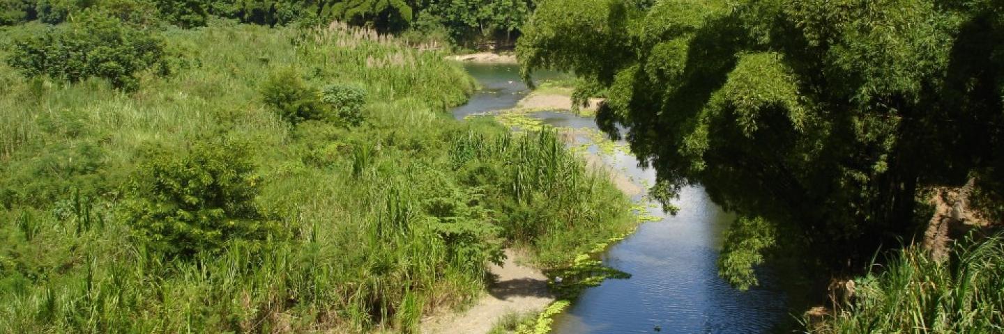
Learn how the National Water Quality Initiative is working across the country.
The National Water Quality Initiative is a partnership among NRCS, state water quality agencies and the U.S. Environmental Protection Agency to identify and address impaired water bodies through voluntary conservation. NRCS provides targeted funding for financial and technical assistance in small watersheds most in need and where farmers can use conservation practices to make a difference.

Learn more about the Baker Source Water Protection project.
Contact your local service center to start your application.
Do you farm or ranch and want to make improvements to the land that you own or lease?
Natural Resources Conservation Service offers technical and financial assistance to help farmers, ranchers and forest landowners.

To get started with NRCS, we recommend you stop by your local NRCS field office. We’ll discuss your vision for your land.
NRCS provides landowners with free technical assistance, or advice, for their land. Common technical assistance includes: resource assessment, practice design and resource monitoring. Your conservation planner will help you determine if financial assistance is right for you.
We’ll walk you through the application process. To get started on applying for financial assistance, we’ll work with you:
Once complete, we’ll work with you on the application, or CPA 1200.
Applications for most programs are accepted on a continuous basis, but they’re considered for funding in different ranking periods. Be sure to ask your local NRCS district conservationist about the deadline for the ranking period to ensure you turn in your application in time.
As part of the application process, we’ll check to see if you are eligible. To do this, you’ll need to bring:
If you don’t have a farm number, you can get one from USDA’s Farm Service Agency. Typically, the local FSA office is located in the same building as the local NRCS office. You only need a farm number if you’re interested in financial assistance.
NRCS will take a look at the applications and rank them according to local resource concerns, the amount of conservation benefits the work will provide and the needs of applicants. View Application Ranking Dates by State.
If you’re selected, you can choose whether to sign the contract for the work to be done.
Once you sign the contract, you’ll be provided standards and specifications for completing the practice or practices, and then you will have a specified amount of time to implement. Once the work is implemented and inspected, you’ll be paid the rate of compensation for the work if it meets NRCS standards and specifications.