
Gallatin Valley Forest Resiliency and Watershed Health is a Joint Chiefs' Landscape Restoration Partnership project aimed at reducing the risk of wildfire, maintaining high-quality water supply, and increasing forest health and resiliency in Gallatin County, Montana.
On This Page
Project Description
Project duration: 2022-2024
Project area: Portions of Gallatin County, Montana

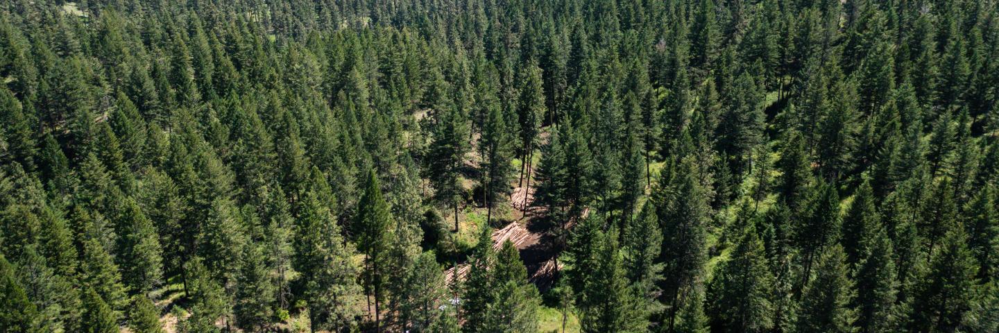
The Gallatin Valley Forest Resiliency and Watershed Health Project is a cross-boundary collaboration effort between the U.S. Forest Service, Custer Gallatin National Forest, and the Natural Resources Conservation Service (NRCS), Bozeman Field Office, aimed at reducing the risk of wildfire, maintaining high-quality water supply, and increasing forest health and resiliency. This project will treat a total of 4,961 acres, which includes 3,336 acres on National Forest System lands and 1,625 acres on private lands. Prescribed fire, timber harvest, shaded fuel breaks, small diameter understory thinning, and weed treatments have been prioritized to meet the goals and objectives of the project. The project area is all within Gallatin County, MT with treatments planned in the Gallatin Mountains; specifically the Bozeman Creek and Hyalite Creek municipal watersheds and the Bridger and Bangtail Mountains. Treatments are located within the wildland urban interface (WUI) of the City of Bozeman and Gallatin County. Bozeman and Hyalite watersheds provide 80% of the water supply to the Bozeman community. Baseline studies have indicated the greatest risk to the local water supply is a high severity wildland fire, which could generate significant amounts of sediment and ash runoff into streams. These rainfall or snowmelt runoff events would likely generate heavy sediment loading that would exceed current treatment capacity, resulting in a shutdown of the City's water treatment plant, in turn, having significant negative impacts to the drinking supply. As a result of fire suppression, much of the forest is functioning outside the range of natural variability and has experienced a significant decline in forest health due to presence of insect infestation and disease, with high likelihood of additional severe outbreaks and spread. Project treatments will achieve goals and objectives across jurisdictional boundaries to reduce hazardous fuels and improve forest health, protect water supply, reduce wildfire risk, increase public and firefighter safety, and generate economic benefits to the local communities. Planned treatments will lower potential fire severity and increase forest resiliency by reducing hazardous fuels, reducing competition for resources, and returning fire to fire adapted communities. Lower intensity fire and reduced crown fire probability will enhance firefighter safety and the effectiveness of suppression actions. Conifer removal around whitebark pine and aspen will enhance regeneration to improve health and productivity. Reduction of fuel loading will aid in protection of water quality by reducing potential sediment impacts to streams. While not the primary objective of the project, secondary benefits to wildlife will occur through improved habitat and foraging opportunities. Private land treatments of brush management, forest stand improvement, and fuel breaks will occur mostly down gradient of the USFS focus areas. This will expand the protection offered to the municipal water supply drainages and natural resource benefits. Private land treatments will primarily occur along major roads with limited ingress-egress and in or adjacent to subdivisions located throughout the project.
Project Partners
The USDA Natural Resources Conservation Service and the U.S. Forest Service as well as other Federal, state, county, and local entities:
- City of Bozeman
- Montana Department of Natural Resources and Conservation (DNRC)
- Gallatin County
- Custer Gallatin Working Group
Applicable Conservation Practices
- 314 Brush Management
- 315 Herbaceous Weed Treatment
- 383 Fuel Break
- 384 Woody Residue Treatment
- 512 Pasture and Hay Planting
- 550 Range Planting
- 660 Tree/Shrub Pruning
- 666 Forest Stand Improvement
Detailed descriptions of these conservation practices can be found in the Field Office Technical Guide, Section 4 - Practice Standards and Supporting Documents.
When to Apply
Program applications are accepted on a continual basis. However, NRCS establishes application ranking dates for evaluation, ranking and approval of eligible applications. Applications received after the ranking date will be automatically deferred to the next funding period. See Montana Programs and Application Dates.
Local Ranking Questions
NRCS uses these questions to evaluate eligible applications for this project and to prioritize applications for potential funding.
- Does the EQIP contract leverage the management of natural resources across land ownership (public-private) boundaries?
- EQIP project is located in an area that is adjacent to high priority projects on public land as identified in the selected Joint Chiefs’ Landscape Restoration Project proposal.
- EQIP project is located in an area that is within the same 12-digit hydrologic unit as high priority projects on public land as identified in the selected Joint Chiefs’ Landscape Restoration Project proposal.
- Is the project located adjacent to a high wildfire hazard zone (see Fire risk map at local USDA Service Center)?
- Yes
- No
- Is the project located adjacent to a medium wildfire hazard zone (see Fire risk map at local USDA Service Center)?
- Yes
- No
- Is all or part of the proposed project area located directly adjacent to a public road?
- Yes
- No
- Is the project within a half mile of additional private residences?
- Yes
- No
- Is the project adjacent to an existing fuel reduction project that meets NRCS standards and specifications for fuel break or forest stand improvement?
- Yes
- No
Contact
Bozeman Service Center in Gallatin County
Additional Montana Information
NRCS contributions to Joint Chiefs' Landscape Restoration Partnership projects in Montana are managed through the Montana Environmental Quality Incentives Program (EQIP).
Ready to get started?
Contact your local service center to start your application.
How to Get Assistance
Do you farm or ranch and want to make improvements to the land that you own or lease?
Natural Resources Conservation Service offers technical and financial assistance to help farmers, ranchers and forest landowners.
To get started with NRCS, we recommend you stop by your local NRCS field office. We’ll discuss your vision for your land.
NRCS provides landowners with free technical assistance, or advice, for their land. Common technical assistance includes: resource assessment, practice design and resource monitoring. Your conservation planner will help you determine if financial assistance is right for you.
We’ll walk you through the application process. To get started on applying for financial assistance, we’ll work with you:
- To fill out an AD 1026, which ensures a conservation plan is in place before lands with highly erodible soils are farmed. It also ensures that identified wetland areas are protected.
- To meet other eligibility certifications.
Once complete, we’ll work with you on the application, or CPA 1200.
Applications for most programs are accepted on a continuous basis, but they’re considered for funding in different ranking periods. Be sure to ask your local NRCS district conservationist about the deadline for the ranking period to ensure you turn in your application in time.
As part of the application process, we’ll check to see if you are eligible. To do this, you’ll need to bring:
- An official tax ID (Social Security number or an employer ID)
- A property deed or lease agreement to show you have control of the property; and
- A farm number.
If you don’t have a farm number, you can get one from USDA’s Farm Service Agency. Typically, the local FSA office is located in the same building as the local NRCS office. You only need a farm number if you’re interested in financial assistance.
NRCS will take a look at the applications and rank them according to local resource concerns, the amount of conservation benefits the work will provide and the needs of applicants. View Application Ranking Dates by State.
If you’re selected, you can choose whether to sign the contract for the work to be done.
Once you sign the contract, you’ll be provided standards and specifications for completing the practice or practices, and then you will have a specified amount of time to implement. Once the work is implemented and inspected, you’ll be paid the rate of compensation for the work if it meets NRCS standards and specifications.