
Wisconsin Local Working Group Resources
Find your Local Working Group using the state map and access workload prioritization tools by Area.
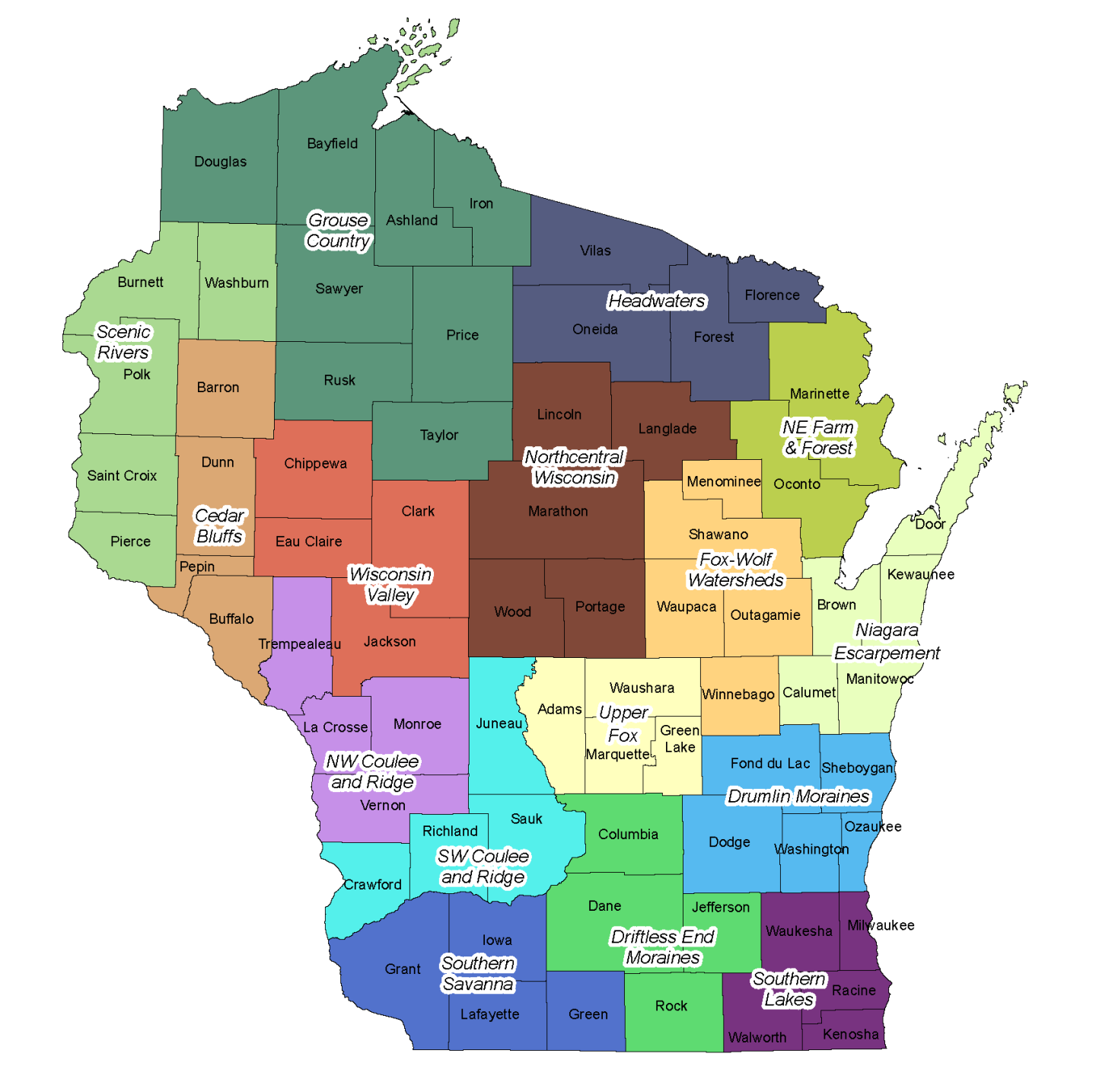
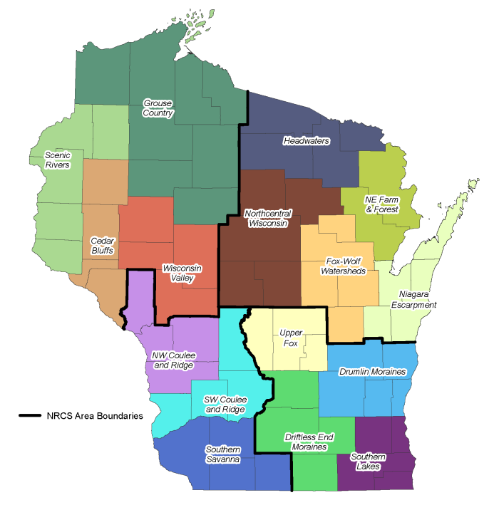
Local Working Group Area Boundaries
Counties grouped by LWG and Area are also listed below
The workload prioritization tools available below apply to applications being submitted for fiscal year 2024 funding consideration.
Northwest Wisconsin - Area 1
Local work groups have a workload prioritization tool for cropland and pasture in FY2024. All local work groups in this area will use the same tool. There is not a workload prioritization tool for forestry & wildlife.
Northeast Wisconsin - Area 2
Local work groups do not have a workload prioritization tool for cropland, pasture, and forestry & wildlife in FY2024.
Southwest Wisconsin - Area 3
Local work groups have a workload prioritization tool for cropland, pasture, and forestry & wildlife in FY2024. All local work groups in this Area will use the same tool.
Southeast Wisconsin - Area 4
Local work groups do not have a workload prioritization tool for cropland, pasture, and forestry & wildlife in FY2024.
Local Working Groups
Navigate to our other Wisconsin NRCS LWG resources.
Local Working Groups - Wisconsin
The Local Working Group (LWG) is a diverse group of people with agricultural and natural resource interests. LWGs provide recommendations on local natural resource priorities and criteria for conservation activities and programs.
Learn MoreWisconsin Local Working Group Meetings
Details for Wisconsin NRCS Local Working Group Meetings.
Learn More