
Data and Reports
2017 Sage Grouse Initiative Report Montana
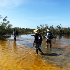
The 2017 Sage Grouse Report summarizes challenges and successes of the Sage Grouse Initiative in Montana.
Official websites use .gov
A .gov website belongs to an official government organization in the United States.
Secure .gov websites use HTTPS
A lock (
) or https:// means you’ve safely connected to the .gov website. Share sensitive information only on official, secure websites.
The 2017 Sage Grouse Report summarizes challenges and successes of the Sage Grouse Initiative in Montana.
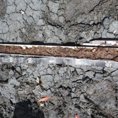
This technical note provides information on the potential of coastal and subaqueous soils to form acid sulfate soils. It provides a definition of acid sulfate soils and describes the impacts, treatment and management, and testing of these soils.
All Colorado Basin Charts hosted by the National Water and Climate Center. Includes snow water equivalent, precipitation, temperature, soil moisture, soil temperature, SWE vs Elevation, stacked SWE accumulation, and reservoir charts.
All Colorado Station Charts hosted by the National Water and Climate Center. Includes snow water equivalent, precipitation, temperature, soil moisture, and soil temperature.
This paper provides a brief overview of the Soil Bank program and its long term value for conservation.
The NRCS Snow Survey Program provides mountain snowpack data and streamflow forecasts for the western United States. Common applications of snow survey products include water supply management, flood control, climate modeling, recreation, and conservation planning.
Our Caribbean Area accomplishments reports provide annual summaries of programs impacts in PR & USVI. Nuestros informes de logros del Área del Caribe brindan resúmenes anuales de los impactos de los programas en Puerto Rico y las Islas Vírgenes Americanas.
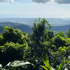
Technical Notes, Posters, Reports and other scientific publications about the soils of Puerto Rico and the U.S. Virgin Islands.
This page reviews the NRCS normals, describes how normals are calculated, and provides access to current and historic normals.
The Colorado Water Supply Outlook Report is a publication that the Colorado Snow Survey publishes monthly from January through June. The report contains information on the current water supply conditions across the state of Colorado and includes summaries of the end-of-month conditions.
Conservation and Culture: The Soil Conservation Service, Social Science, and Conservation on Tribal Lands in the Southwest features USDA's efforts to address soil erosion on Navajo and Hopi reservations in the 1930s.
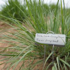
Discontinued Conservation Plant Releases
NRCS utilizes has several technical resources and publications to assist growers plan and apply conservation on their land to address their unique natural resources concerns.
Estimated wind and sheet and rill erosion on cropland for 1982-2017, at 5-year intervals, for highly erodible and non-highly erodible land, by state based on the National Resources Inventory (NRI).
The Digital General Soil Map of the United States or STATSGO2 is a broad-based inventory of soils and non-soil areas that occur in a repeatable pattern on the landscape and that can be cartographically shown at the scale mapped of 1:250,000 for most of U.S and territories and 1:1M for Alaska.